ORH_wxman
-
Posts
93,095 -
Joined
-
Last visited
Content Type
Profiles
Blogs
Forums
American Weather
Media Demo
Store
Gallery
Everything posted by ORH_wxman
-
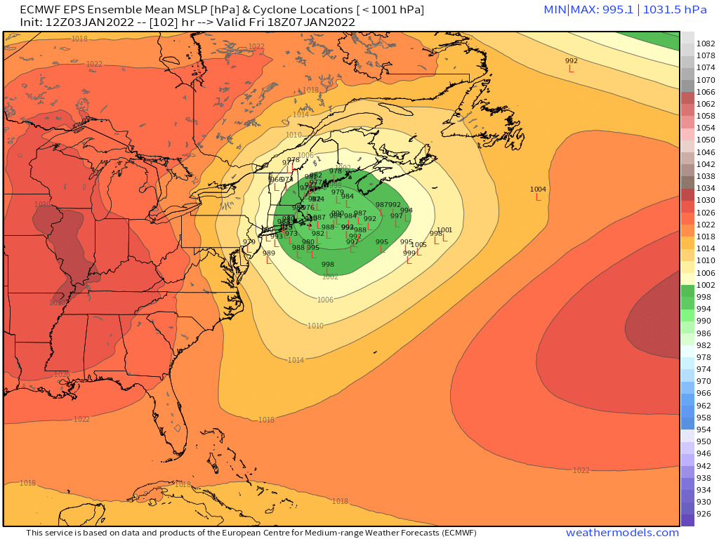
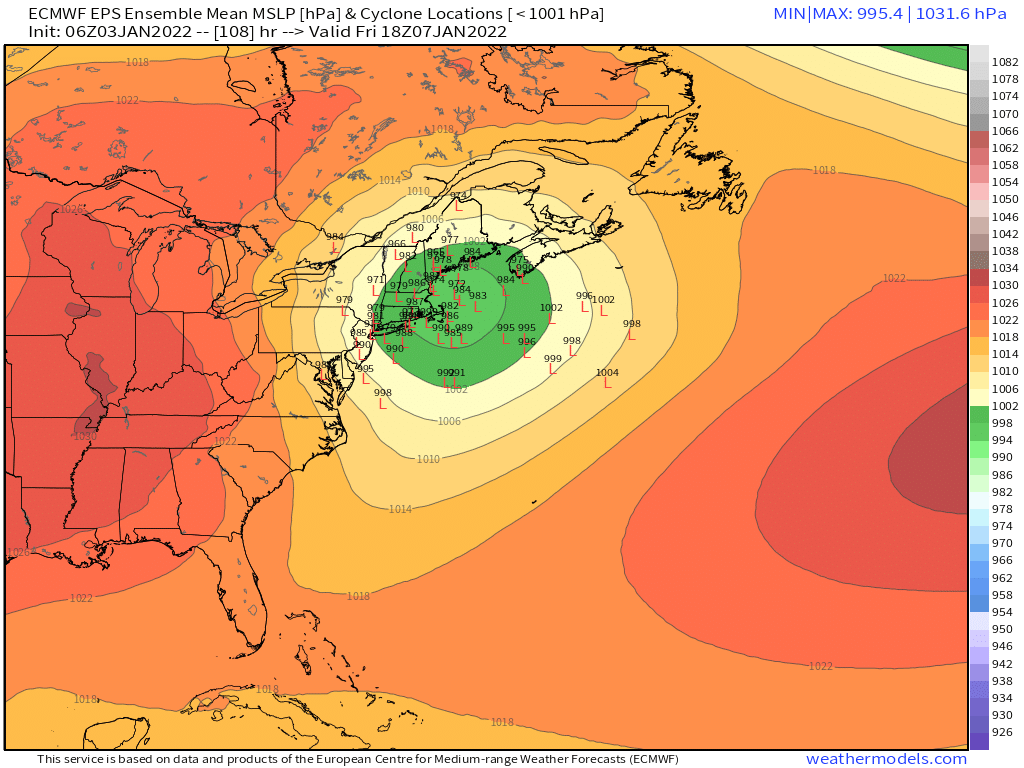
Theres also still a lot of spread. When you see this type of spread, you really shouldn't be living and dying with each OP run....the OP run is basically another ensemble member...maybe a slightly more skilled one, but just one member nonetheless.


-
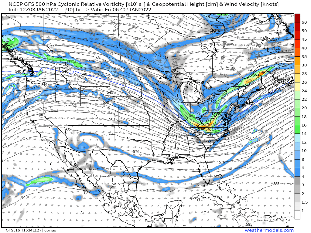
84h RGEM looked pretty similar too.
-
The 00z OP Euro was actually on the western half of the ensemble envelope, so it wasn't likely to hold serve regardless of the other models.
-
It's gonna be SE of 00z, but it is not going to be a whiff by any stretch.
-
Not a single model shows it starting on Thursday. Maybe flurries near midnight at the earliest.
-
WST hasn't reported snow all day. IT looks like it's trying to make a push though in the next hour or two.
-
We became unbearable at some point in the 2010s....nobody in here ever canceled winter in December or early January....only Ji did that in the M.A. forum. Now we get it multiple times per winter in here.
-
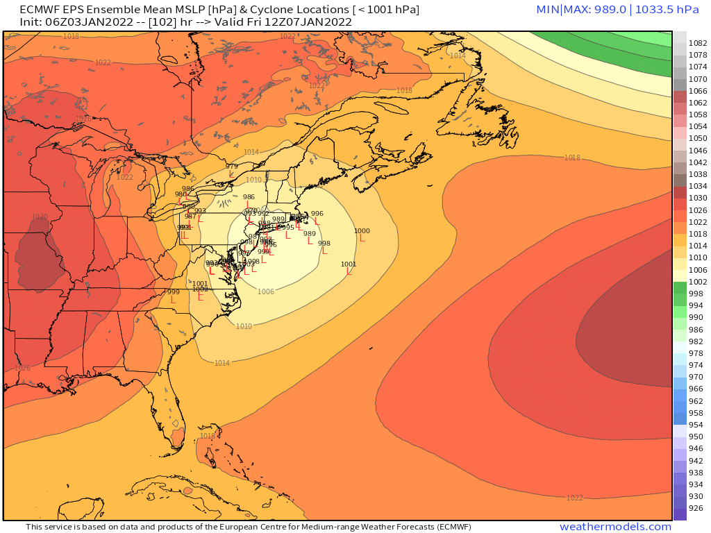
Yeah 950mb on the benchmark will probably verify.
-
The ensemble guidance being pretty far west still is a solid red flag for assuming a whiff SE.
-
2nd best model!!!
-
Even aloft on GFS this doesn't really scream wide right to me

-
Yeah it's prob good right now...lol....considering where other guidance is. I don't see this whiffing.
-
Yeah a whiff is the least likely IMHO. Almost all the ensemble spread is to the left of most OP tracks.
-
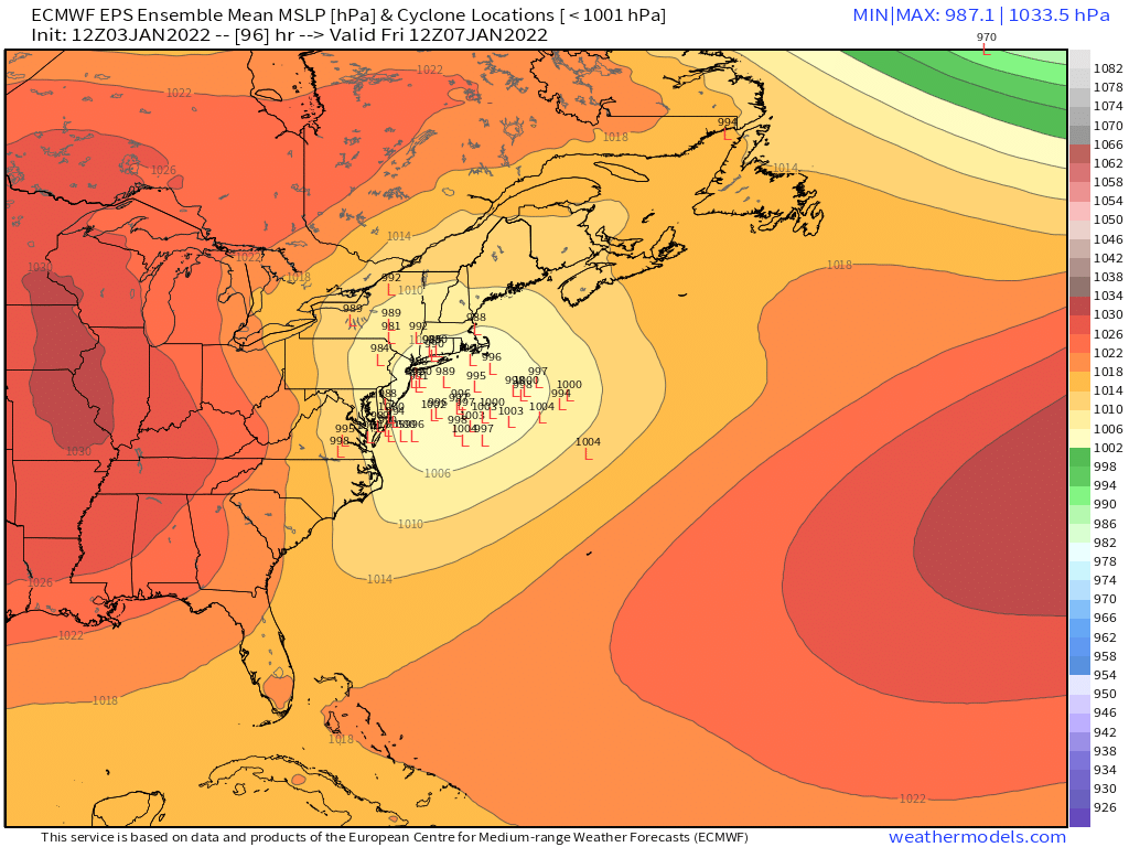
The mean looks pretty close to ACK. But still pretty good spread at this point.
-
I actually like where this one is right now. You have pretty much all non-GFS guidance with a significant storm and the OP euro is on the western side of the EPS envelope. The classic 70/30 or 80/20 compromise would be ideal. Too bad it’s not 3 days out instead of 4 though.
-
With omega that high in the sounding that dendrite posted, you also get garbage snow growth. Prob putrid bullets and plates which sublimate much faster too when they are trying to overcome dry layers.
-
Hallucinations are going to be epic tomorrow.
-
Yeah this is why I was laughing at the microanalysis of the 12z EPS. It took 6 hours to look different.
-
Yeah it’s amazing how many people immediately canceled winter after that post. Although many of them already canceled in December so not sure why the need to do it again…
-
Yeah it’s not even that bad of a look anyway, I just found the change funny. The ridge retrogrades back quickly into a pants tent pattern. But I’d obviously be cautious still.
-
It’s prob a red flag in the sense that something super amped up the Hudson valley is pretty unlikely. EPS are pretty far west compared to other ensemble suites too. So while I’d weight the EPS the highest, I would still add a little bit of weight to the others.
-
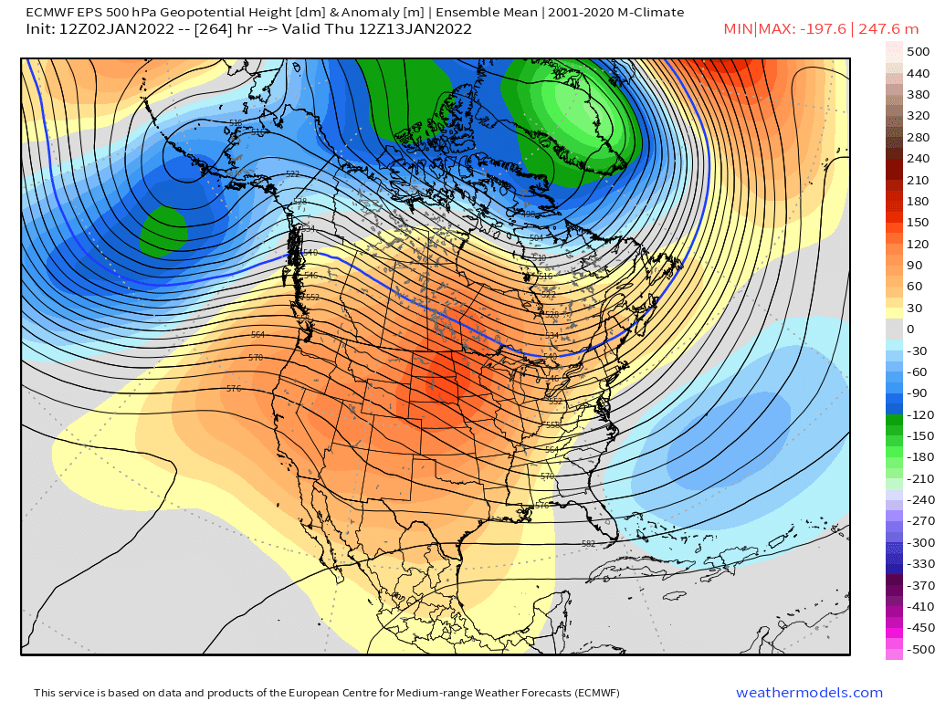
Lol EPS went right back to the low AK heights this run and then torches the country for several days before it reverts back to the good pattern.

-
It’s kind of weird that most OP runs don’t really have a primary up there but several ensemble members do. I’m not super worried about it at this point though. I can tell people are losing their minds when we’re analyzing the EPS individual members this much at 5 days out when it will probably look vastly different in a couple cycles.