ORH_wxman
-
Posts
93,095 -
Joined
-
Last visited
Content Type
Profiles
Blogs
Forums
American Weather
Media Demo
Store
Gallery
Everything posted by ORH_wxman
-
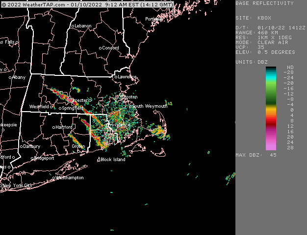
Not even close for Sunday on Ukie...drops a PV lobe down into NE. GGEM did this too on the 12z run.
-
Ukie has a light event for Friday.
-
GFS decides to go with shortwave #3 for a good storm on 1/18. I feel like one of these will work out, but I'd rather get Friday out of the way. There isn't enough room to amplify that unless it goes totally nuclear aloft.
-
That streamer goes all the way through S ORH county and to near UUU.
-
Beast must have gotten several inches? That streamer seemed to be near them oscillating all night.
-
LL lapse rates are like 9C/km tonight....watch for windex squalls up in NNE/CNE...they may get down to the pike region in SNE, but I'd def favor further north toward Ray if anything was gonna happen in SNE. Too bad we didn't have a little more moisture pooling or it would have a chance to be higher end.
-
That is a very realistic possibility.
-
Agreed. There are going to be plenty of chances though it looks like. There seems to be another potent shortwave behind the weekend deal too if that one fails.
-
I mean, that’s pretty much exactly what I’m getting?
-
I didn’t quite have that much. About 10.5 here. Prob 5-7 miles S in Milford had a foot though. They spent longer in that great band.
-
I mean, i prob only had about 0.2 extra of QPF? You prob had around 0.4 and I had maybe 0.6? 0.7 if generous.
-
It’s still full coverage here. 3-4” of dense ripe snow in most spots though maybe more like 2” in the most exposed yards on the street. Glad the ice pack is off the driveway though.
-
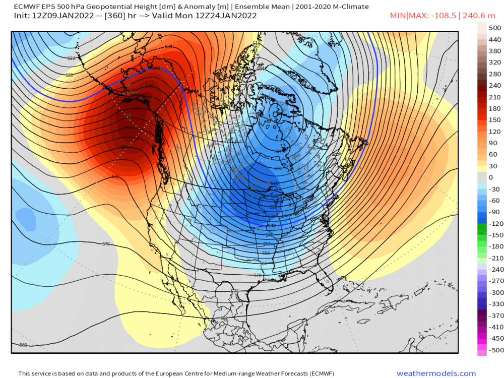
Ensembles have a super strong signal at the end of their run which is like 1/24 or 1/25. Prob no true breakdown until February if that is close to correct. Things can always change though. We’ve seen that enough already this season. But I’m pretty optimistic.
-
Can’t believe how strong the anomalies are in the EPO region for that far out. Very strong signal.
-
I would never guarantee at 5 days out that you are good. But right now Friday looks fine…but definitely keep checking.
-
EPS looks like a super cold pattern for a lot of the CONUS at the end. That’s major arctic express there
-
Euro actually had some really light snow with that. Even a stripe of 1” or so along rt 2 and prob a coating for pike region. But it needs some help to be more than a nuisance. Definitely possible though.
-
Good signal on EPS but plenty of spread a week out


-
No that is the first system that is a longer shot imho. It could produce something but I’d favor the one behind it which would be next weekend.
-
Gets shunted way south but that’s a nice look overall. I like the really strong northern stream there.
-
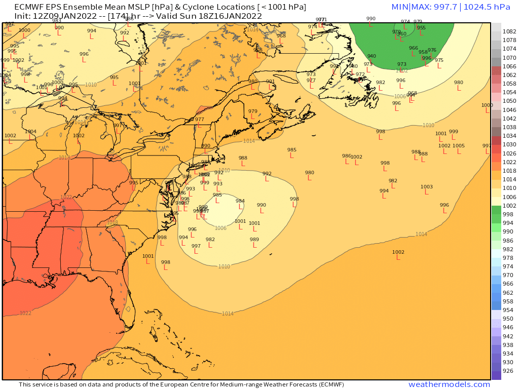
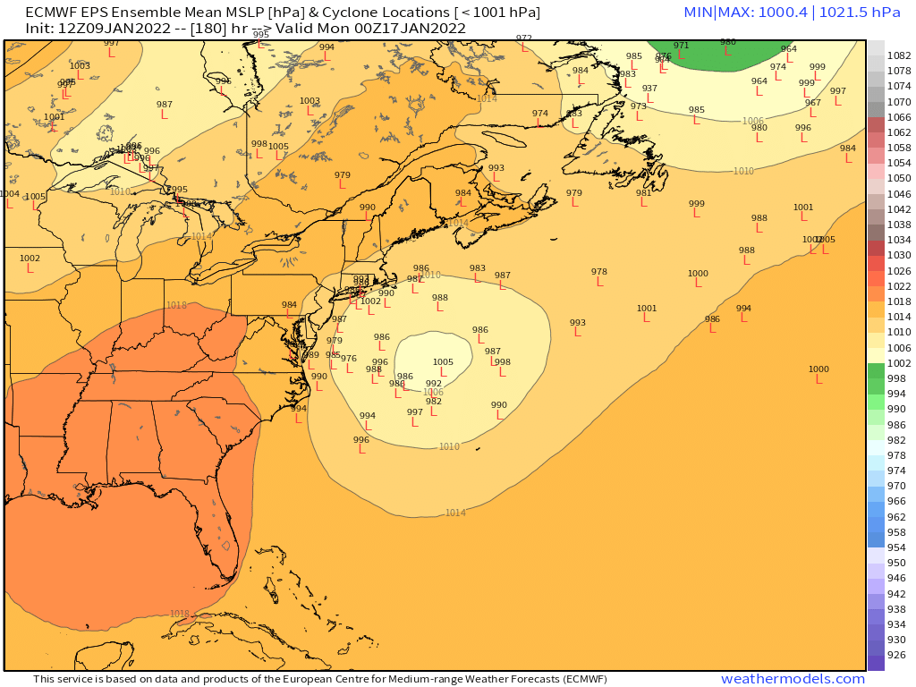
Euro is definitely cooking up something big at 156 here.
-
Yeah this is a lot of shortwaves in the flow. I feel like the event afterward has more support but can’t ignore the Thursday night/Friday deal just yet.
-
My pack is getting pretty ripe/dense. No longer a fake effect fluffer pack. Around 5-6” but it’s gonna be a glacier by tomorrow morning. It’ll make a good bottom base layer on our march to 3+ feet OTG by early February.
-
Up to 39 now. Ice almost totally gone from driveway.
-
Nice stalled Miller b on GGEM. Lol