ORH_wxman
-
Posts
93,110 -
Joined
-
Last visited
Content Type
Profiles
Blogs
Forums
American Weather
Media Demo
Store
Gallery
Everything posted by ORH_wxman
-
The Friday PM stuff is almost like a PRE in the tropical system....it's not really directly associated with the coastal storm.
-
Interior NE MA is probably in a good as spot as any right now. Far enough east to get the Ukie-Esque solutions but far enough west to still do pretty well in the hugger solutions.
-
I want to be near the CF in this one because it’s going to be so defined. Someone will get obliterated just west of it.
-
Probably not, but the hook is always a worry on these southern streamers. But Tip is also right that there is a limit to this...the trough axis is pretty far east already when this starts rapidly gaining latitude.
-
The reason it is stingy west of ORH is that the storm takes a really wide turn....it's pretty far east of Cape Hattaras but then it starts coming almost due north just barely E of the BM into the Gulf of Maine.
-
It's kind of compact with precip....really an eastern zone special. Basically E MA/RI up to your area does well but not good for western areas.
-
I'm not sure you can get much worse conditions for landing in BOS at 18z on Saturday than what a lot of guidance is showing.
-
That would prob be a bit rough in SE MA because the CF sets up right over them...just west gets pounded while just E is SOL....the CF is really potent right up into the 925/900 layer, so it's not just right at the SFC.
-
This run was actually run on my laptop...not the NCEP servers.
-
The northern stream energy that turns this north is coming in at a shallower angle of attack this run...so 12z GFS will be E of 06z unless something else offsets that
-
Because of such a strong CF look on this, someone is going to get obliterated on the other side of the CF
-
Yeah unlike the last storm that tracked through BGM, the sfc front gets pretty well established early on over the coast or just SE of the coast depending on the solution.
-
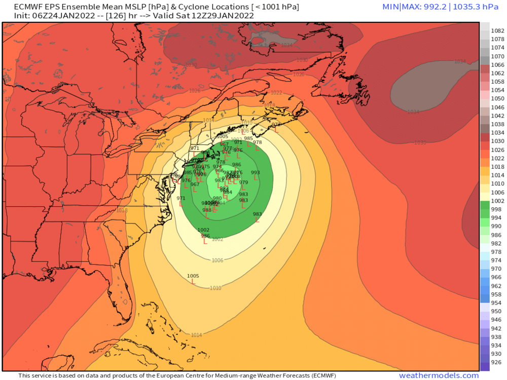
Yeah it's pretty nice.....but if I was being perfect, for a storm this deep and this sharply stem-winding at 5+ days out, I'd want to see it a little east with fewer western inland runners. There's a clear skew west there.
-
John McClain is warming up to the light the runway with those western members
-
White Snake winter. Fully expect this to run up Hudson by the time we’re to Wednesday runs.
-
Yep. We knew. This could easily run up the CT Valley. There’s still an eternity for this to trend too.
-
Good to see some more OP runs getting on board. Validates the ensembles from earlier a bit more.
-
This is one of those lows that will go north into the gulf of maine if it can track near the BM
-
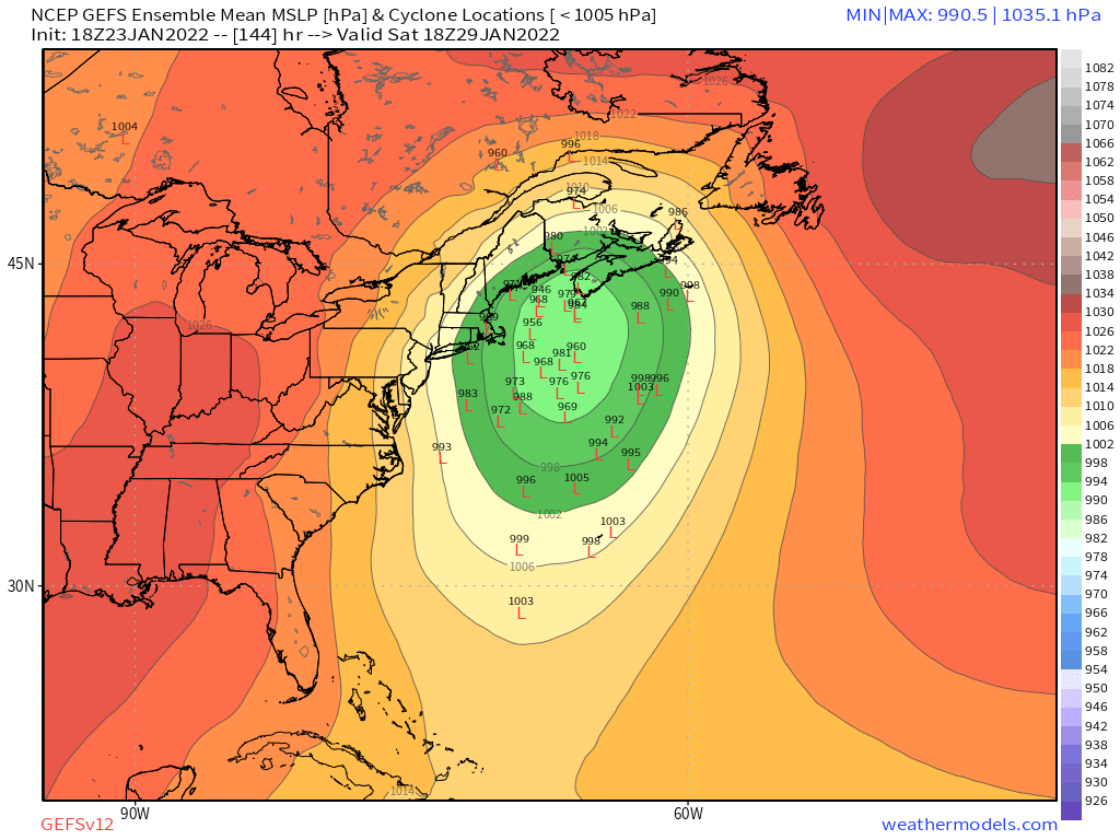
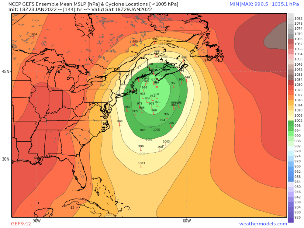
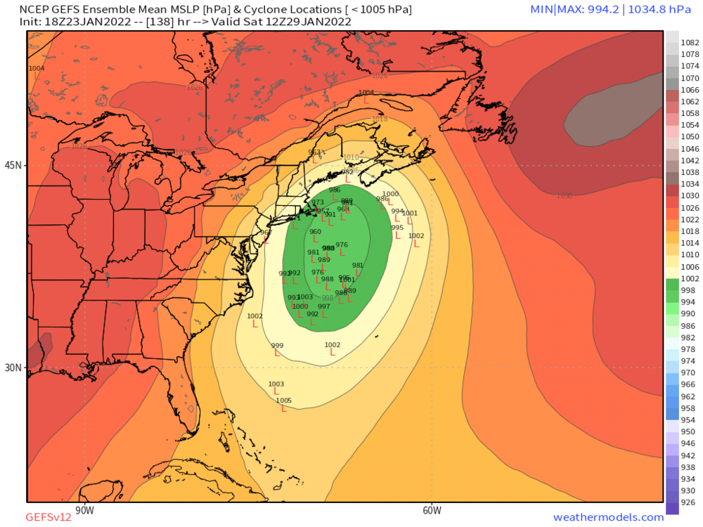
One more image for our NNE peeps
-
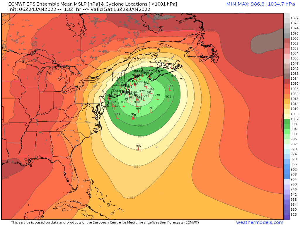
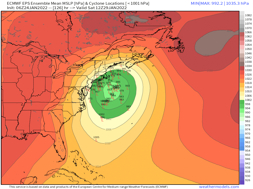
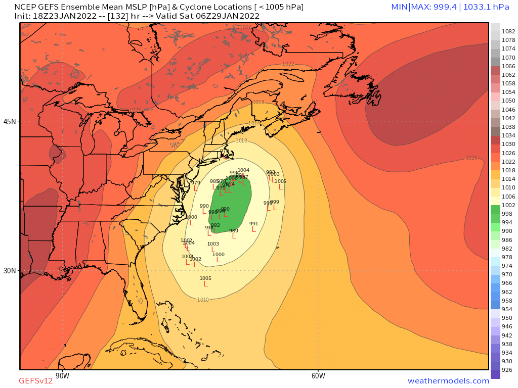
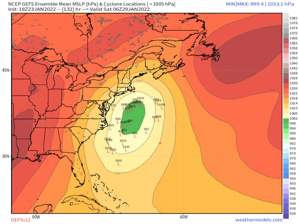
Pretty good set of lows that would hit here
-
Yeah there is definitely an anecdotal element to it for sure. But in some cases (like maybr this one?), you can use ensemble spread to hedge as well. Like right now, there’s considerable spread to the west which is frequently a red flag in coastals.
-
Yeah I think sometimes though you can gauge the pattern and correction probabilities…but this may not be one of those cases. Like, for example, in a SWFE setup, I don’t want to be in the bullseye 3-4 days out. They definitely tick north more often than not. Doesn’t happen all the time but I’ll play the odds. As for this system, I feel like this has the ability to slingshot sharply north so I don’t mind it being a little offshore. I want the scenarios to be a whiff or a crushing. No BGM or ALB tracks. I get that further west in western MA and W CT might feel differently.