ORH_wxman
-
Posts
93,092 -
Joined
-
Last visited
Content Type
Profiles
Blogs
Forums
American Weather
Media Demo
Store
Gallery
Everything posted by ORH_wxman
-
No pretty much nothing for your hood. Maybe starts as a few flakes but goes to rain. NW CT sees some.
-
Yeah euro was ok but was hoping for a better trend. Had advisory snows for ORH county and east slope of berks.
-
Prob had good ratios if it was anything like up here. We got about a half inch of arctic fluff that was prob 25 or 30 to 1. I went outside and I was able to walk completely on top of the pack without sinking…lol.
-
Why? The distribution could be similar. 900-950mb is going to be an issue down south. You might be far enough north but it wouldn’t surprise me if it’s mostly N of pike too. But we’ll see. It’s trended a little bit cooler so far at 12z.
-
I don’t think it’s a direct CIPS analog but MLK 2010 was a really marginal airmass that hit the pike/495 belt pretty good with 5-10” of paste with mostly rain elsewhere south and east.
-
I wouldn’t expect much anywhere yet but it’s definitely starting to trend better which is a good sign (as opposed to being great at day 4-5 and trending worse)….and we’re less than 3 days out.
-
Yeah it lessened the IVT a bit that run which helped.
-
MLK 2010 redux?
-
Wow. 495 N and W.
-
You should move.
-
Weeklies back in January we’re definitely pathetic about the first half of February. Busted badly.
-
Yeah some of the other guidance actually hits 495 west into ORH region pretty good. So hopefully models trend more toward that today.
-
We need the closer tracks because most of the precip actually falls out ahead of the low. So by the time the low makes it up here the forcing is northeast except for the stronger/closer lows which might CCB us with snow.
-
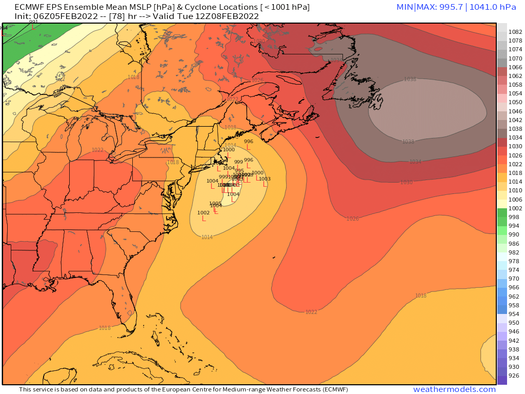
06z EPS

-
Definitely a better trend. Several OP runs now give ORH county over to Ray’s hood several inches. 06z euro looks a little warm for that. Does get interior NH into ME with warning snows though.
-
Looks like we got another half inch of fluff or so. Prob 1.5-2” of total junk yesterday. This pack is officially bulletproof for a while.
-
Lol, I remember I started breaking out in a cold sweat when you showed me that property.
-
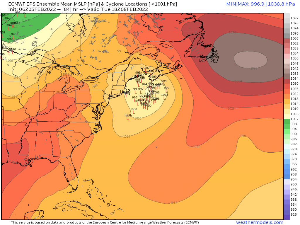
EPS didn’t look bad
-
I wonder what would happen if we saw a few more frames. It had that initial lead pulse of precip but the main show is still well south and that looked promising because it could form a proper midlevel circulation and draw the colder air back in via CCB.
-
Ripping pellets and mixed with some legit flakes in this latest batch. Not as many flakes as earlier today. Ran the shovel over the driveway earlier. Seems pretty useless though as it’s covered in another 1/4 to 1/2 inch of crud again and it will be even harder to scrape now that it’s falling with temps in the mid 20s.
-
GFS still not really interested in this.
-
They are. The GFS was legit forecasting real snow and ended up wrong. But even after it trended north, the “snow depth change” was looking off compared to the usual clown map of just snowfall.
-
Sleet and some crappy flakes mixing in with this next batch....temp down to 24.8F.
-
Yeah the models have gotten a lot better at identifying the marginal boundary layers....but at 3+ days out, it obviously can still be off. The March 7-8, 2013 storm was like that....that's the one where he just got firehosed from the east and slammed 12-24" in mostly a 15-18 hour span (but we were spitting snow showers for 24 hours before that)....model guidance had initially kept trying to warm the BL, though a couple model runs were showing around -1C at 950mb, and then they kept cooling until it was like -5C....obviously that is an extreme example....it can snow at -1C. But the forecasts were very conservative at first....showing very little inside 495 and even only a sloppy 3-6/4-8 for ORH hills.
-
18z NAM has a nice burst for RI and SE MA overnight....like 1-2 inches.