ORH_wxman
-
Posts
93,092 -
Joined
-
Last visited
Content Type
Profiles
Blogs
Forums
American Weather
Media Demo
Store
Gallery
Everything posted by ORH_wxman
-
Oaks are def ahead of schedule here. Maybe by like a week or so. We’ve had a lot of ideal nights for color…you want those marginal frost/crisp cold nights but not full freeze which is what we’ve had here. The hard freeze will cause the leaves to just drop quicker but you don’t get as long a color show.
-
Lake effect areas and upslope areas are by far the best spots for early season snow....the upslope kind of feeds off the leftover lake effect too...esp in VT where they can regenerate dying bands and a boost form Lake Champlain too. In early season, your delta-Ts on the lake temps vs atmosphere are still huge, so you get some prolific stuff at times, and even non-idea setups produce more than they do in mid-winter. In my time out in Ithaca, you could count on accumulating snow relatively frequently starting in mid/late November right until Xmas break when we went home. Synoptic snows don't start becoming more reliable until mid-December usually and for southeastern coastal areas, often later than that as you are well aware.
-
Nice shot of WaWa in the background there....was gonna say that is Green Hill course, but I don't think so after studying the pic. Not Wachusett CC either.
-
You need to move up to like central VT or NH at elevation for it to be normal to have plenty of snow already by mid-December. Or into NW MA or S VT big elevations with the buried bodies.
-
Getting good permanent snow cover by Tday is extremely rare outside of NNE elevations. Getting a white T-day isn't too hard but still uphill climb....prob like 20-25% shot in ORH and way less in BOS. I think these are the White T-days in ORH in the past 4 decades: 1985, 1989, 1994, 1996, 2002, 2005, 2014, 2018. Thats 8/37.
-
Yeah, you missed the brunt of the 5-6 hour blitz on 3/4/19....more of a generic warning event there. You did get near-jackpot in the 2/1/21 storm, but that's prob the only one you'd done well in relative to the region since that early Dec 2019 storm.
-
Yeah March is easily more favored for a big dog storm....December is probably more favored for any type of small snow event (say, less than warning criteria)
-
Yeah after that great run we had between 2013-2019, March is back to being dogshit the past 3 winters.
-
Yeah don't get scared of an AK pig this early....we've had plenty of A-list winters that had AK pigs in October or early November....if we see it setting up shop around Tday or after, then it might be time to get scared.
-
Big AK pig should keep the mild weather that starts today into early November. Ensembles do show a potential transient trough/storminess near or just before Halloween though...so may have to watch that period for cooler/unsettled wx. Hopefully Halloween itself stays dry.
-
Another good fake cold morning here too....was around 38F at my house but widespread frost down the hill again. Temps just below freezing there.
-
I love all the technology with Drago and meanwhile Rocky benching anvils and oxen yoke.
-
I feel like I can run straight through the southeast ridge with my bare hands.
-
I am not....just looked it up and found it on Amazon though and it does seem like a good template. Basically an account of a whole bunch of weather events with a lot of accounts from people who experienced them. Yeah I wouldn't do it to make money. If it makes money, that's a bonus. But I'd do it because I love writing about weather events and I'd want to document a lot of these events before they get forgotten. A lot of past weather events really don't have good historical accounts unless they were absolute top-end events like Feb '78 or Hurricane of '38, Worcester tornado '53, etc. But so many of these semi-large events sort of get relegated to "no memory or historical account" status so it would be nice to have one place to read about them.
-
No I am not aware....though maybe one exists. I have many books on individual weather events such as the Worcester tornado and huge storms (like Feb '78). Maybe I'll write a Worcester weather book when I am older and retired one day.
-
The irony of TLH having their earliest sub-32F on record and earliest 32F of any kind since 1977 when 10/18/77 hit 32F there, is that 1977 is the year with the latest freeze on record at ORH (November 12, 1977).
-
You want a longitudinal gradient for NNJ to be snowier than SNE....or something really weird with obscene blocking like 2009-2010. Those typically won't happen in a La Nina....though it's not impossible. Happened in 2000-2001....parts of interior NNJ had more snow than Boston that winter....but '00-'01 did act a lot more like an El Nino than a La Nina....esp in the North Pacific pattern. But over the interior, there was a massive latitude gradient.....ORH had over 100 inches while interior CT maybe had 50-60"....and then interior S NH had some spots with well over 130 inches.
-
Earliest sub-32F on record there (they did hit exactly 32F on 10/18/77 though, so not technically the earliest freeze)
-
The irony being our last El Nino (2018-19) acted like a La Nina. Then the warm neutral 2019-2020 was about as scintillating as 1988-89 after the early December storm.
-
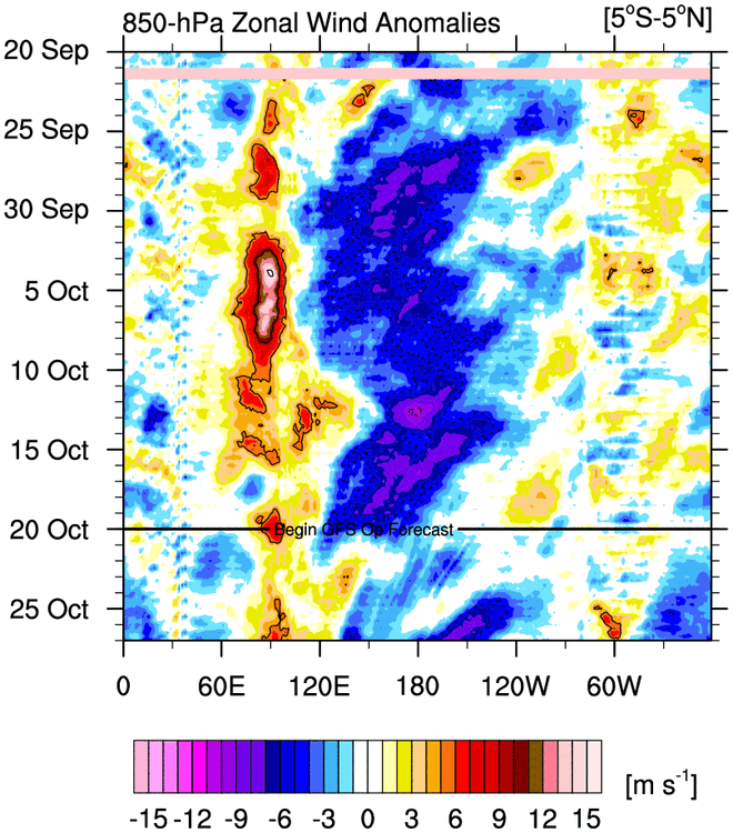
Yeah here you go Here's the link to Mike Ventrice's site where you can get it http://mikeventrice.weebly.com/hovmollers.html
-
I think maybe they are just a proxy for subconsciously being afraid of La Nina? I can understand that from our Mid-Atlantic brethren as Nina gets more hostile the further south you go, but it's really nothing to be scared of in New England.
-
What is with the obsession of the GOA SSTs? I mean yeah, I guess you want them warmer all things equal, but they are about 20th on a list of the top 25 most important variables. We literally spent almost the entire stretch of prolific years between 2007-2013 with frigid ice water in the GOA.
-
Sleeping through 4 inches per hour on 1/27/11 as a snow weenie is a good enough credential for me.
-
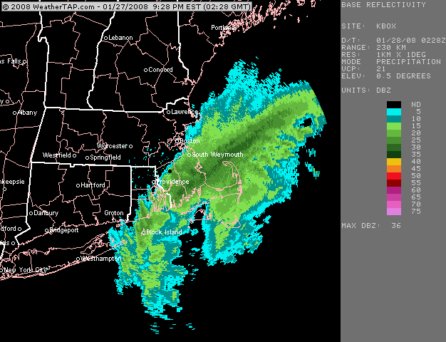
Here's the one close up loop I have....I wish I had it about an hour or two earlier but you can see where the band was before it started sinking back SE...