ORH_wxman
-
Posts
93,092 -
Joined
-
Last visited
Content Type
Profiles
Blogs
Forums
American Weather
Media Demo
Store
Gallery
Everything posted by ORH_wxman
-
No idea at this point. Could stay offshore too. Short term guidance doesn’t really have one at all. But it enhances some bands in N CT and into RI later this evening.
-
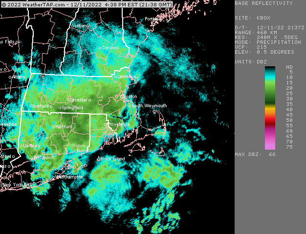
You can see that twist in the echoes in E NY…that’s what we’ll want to watch as it moves SE. Might provide some rejuvenation of returns
-
-
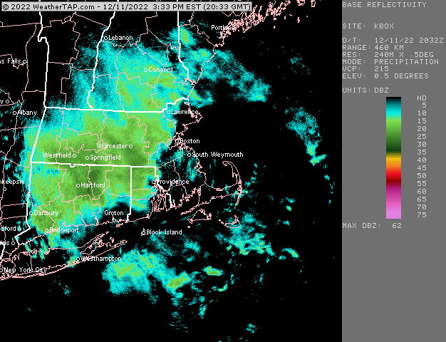
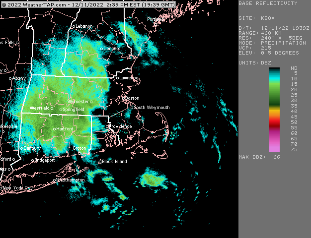
Really coming down with good snow growth now from this nice batch
-
Starting to snow pretty good here now. Snow growth improving.
-
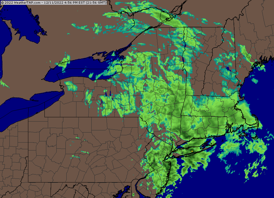
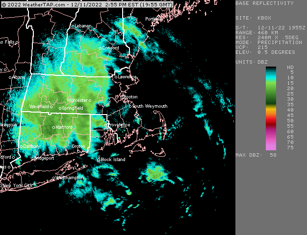
Pretty nice echoes in N CT and adjacent MA
-
Should fill in there…esp between about 4-6pm and your best period is probably 6-9pm. But the nowcasting trends def look really good for N CT.
-
There doesn’t seem to be a lot of Virga so far. We’ll see if that increases though as it heads east.
-
Yeah the squeeze is trying to happen there. We’re probably losing the super high end potential (like Dec ‘92) with the ULL remaining well to the west and further north…but that block is still trying to shunt things and I don’t expect guidance to be handling it properly yet.
-
At 1000+ feet in N ORH county, you’re prob not sticking a fork in this system at all. Maybe if it continues to trend west for another 3-4 runs. But I’d be kind of surprised if it kept doing that.
-
Best snow in your hood looks like 5pm-midnight or so. But gotta watch the IVT potential for between 1-4am.
-
I’ll be jelly, but I’m also very interested in the mesoscale stuff that may happen in CT tonight. The instability on the soundings supports some bands of heavy snow…esp where some localized lift or convergence is going on.
-
Yes. We saw that coming though. That band started extending further east even yesterday.
-
Yeah I could totally see this system turning into more of a SWFE but the thermals tick colder as we get closer as Tip is musing above. That kind of happened in the Nov 2018 event and obviously happened in some other front enders like 12/16/07. We don’t have an intense arctic airmass out ahead of it but it’s not a total garbage airmass either…we get that PV lobe insert about 24-36 hours prior to the system and that’s not just going to erode that quickly over the interior. Still a ways to go though. Let’s see how todays system phases with the PV lobe first and we’re probably going to get some slightly different solutions as more data comes on the west coast…even the ridging out there matters because it may try to interact with the Hudson Bay block.
-
Yeah someone will prob get 3” and 10 miles away could get 6-8”. What I like seeing is the mesoscale lift is kind of getting larger in scale…almost merging at times with the synoptic lift which is why we’re seeing larger areas of good QPF on guidance. There will still be winners and losers, but at least the floor is starting to look higher.
-
Yeah but it mostly depends on how strong this system gets after it’s well east of us…what it does is it phases with the 50/50 low and then retrogrades almost over us which is what sets the stage for a colder 12/16 system. But the snowfall totals tonight won’t really tell us much on how all that interaction with the 50/50 low is going to develop. But I think all else equal, we’d want more rapid development when this is just south of us.
-
Yeah this has overperformer written all over it. I was pretty struck by the soundings yesterday and the shortwave has always been very vigorous on the models.
-
Man, someone is prob gonna see a surprise down in CT.
-
Oh that’s right. How could I forget. The 4th was Kevin on that trip. Ekster doing donuts in the fairway.
-
I totally forgot about that. We went with Ekster and who was the 4th? Lol
-
Me, Bob, and Luke gotta do a golf GTG on a warm summer day and then BS until dark sharing some edibles. Ginxy can meet up with us after the golf.
-
Nice steamer there
-
Yeah it looks like a band tries to form later in the event…almost as it’s trying to spawn the coastal. Like a little mini fronto band that gets near far southern MA and N RI/N CT and maybe into SE MA if it can maintain.
-
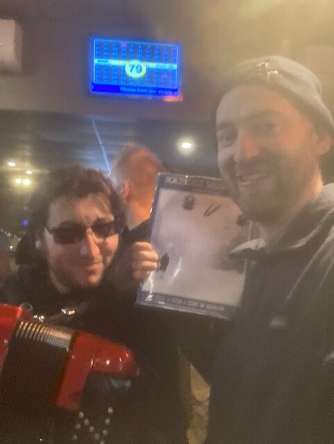
Was a great time. Glad to meet new faces…Don (wxwatcher007) and JD (WinterWolf). I talked with both for quite a bit. Great to see old faces too. The unexpected Tip appearance was fun, and anytime the accordion comes out from Corey, it’s a good time. Great to see Ginxy, Ray, Scooter, Kevin, Luke, Weatherwiz (Paul…but I still call him Weatherwiz), Bob, Pickles, Jay. I have to say, good representation from the CT crowd in this one.
-
Ripping tunes with the kocin book