

ORH_wxman
-
Posts
93,095 -
Joined
-
Last visited
Content Type
Profiles
Blogs
Forums
American Weather
Media Demo
Store
Gallery
Everything posted by ORH_wxman
-
Actually it might as good as 06z...lol....it's backing up surprisingly well at 78h
-
12z is still going to hammer the Cape, but I don't think it will be as far inland into SE MA as 06z was
-
There's no precip.....next round is back in OH/PA....though there should be some lighter stuff trying to develop almost overhead this afternoon.
-
You want the PV at least in Hudson Bay or a little east of that if you have a deep western trough....kind of like Feb '94....we had troughs digging pretty deep there but it worked out because the PV wasn't sitting over Alberta, it was much further east.
-
GFS just keeps dumping deep troughs into the west....we slowly get arctic cold bleeding in here but it takes a long while....so that is partly why I'm not all that gung ho at least prior to 1/25....there's certainly a possibility that one of the pre-1/25 shortwaves produce something interesting, but no way to be confident in that with the deep western troughs it shows.
-
The OP GFS has a good SWFE here anyway
-
We only comment on the OP runs that show cutters these days...we ignore the D13 snowstorms.
-
Euro is prob on crack....I'd be a lot more intrigued if this was a few years ago when it was more dominant on east coast storms.
-
No the original cranberry bog storm was 12/31/08.
-
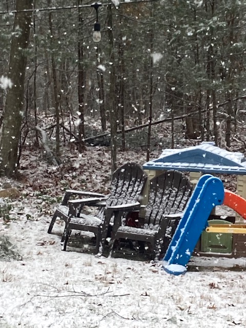
One more pic. Actually coming down a bit harder now. Normally this wouldn’t even get attention but this winter it feels like a real storm
-
Yeah Jan 27, 2008 to be specific.
-
Fatties
-
Icon still a clean whiff but it did back west about 40-50 miles.
-
Let back that in another 40-50 miles.
-
Nice fatties falling here. Solid coating on everything.
-
This weekend....storm that crushed the Cape/SE MA on the 06z Euro
-
Yeah the classic "look for 3-6' or 4-8" before the flip" and then it would flip after 1 inch, and then rain 1-2 inches on top of it and then freeze 6 hours later with temps in the single digits and bare ground.
-
Getting some legit cold airmasses in here would certainly help.....you can have imperfect storm tracks and do well when you have a good antecedent airmass.
-
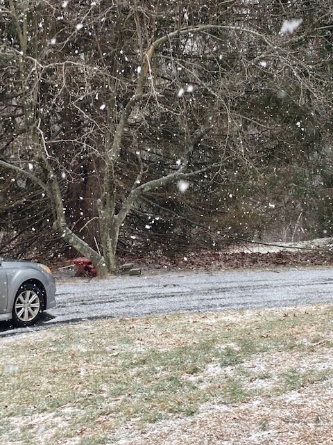
Steadier light snow has commenced here. Maybe we can pick up an inch before the flip later today.
-
Not biting on that coming far enough west, maybe if we see another solid movement today.
-
Happened in 2020.
-
Yeah no use in looking at OP runs in SNE until maybe this weekend or even next week depending on how any individual threats materialize.
-
Same sun angle as 12/1
-
The reveal is: 1. 1989 2. 2014 3. 2021 4. 1994 So 2 through 4 were prolific snow producers but 1 was a horrific dud.
-
They get 6"+ before the flip....root for Reggie to be right because its over a foot up there.


