

ORH_wxman
-
Posts
93,095 -
Joined
-
Last visited
Content Type
Profiles
Blogs
Forums
American Weather
Media Demo
Store
Gallery
Everything posted by ORH_wxman
-
Nah. I can buy some sleet in a small zone but icing (freezing rain) will be almost non-existent in this. Maybe a really small area in high terrain somewhere south of the snow line but it’s likely negligible. This is prob a cold rain for most of us until after the main low passes and then we could get an area of light snow as the upper level energy hangs back. But that might end up north too if the whole system trends north which these always have a good chance of doing.
-
I told him this earlier but he ignored me.
-
Or the Bills in 1992 wildcard round against the Oilers. (35-3 in the 3rd quarter)
-
Ramping up in the last 2-3 min. Started as big fat puffy flakes but light…like almost flurries but now the ridge line 3/4th mile away is starting to get obscured. So almost moderate snow now. Like a snow globe.
-
Sell that idea. Lower levels are garbage ahead of this so I don’t like the icing idea…maybe an extremely narrow zone could get a bit of ice. There is a chance we get a flip to snow as the upper level support hangs back for quite a while.
-
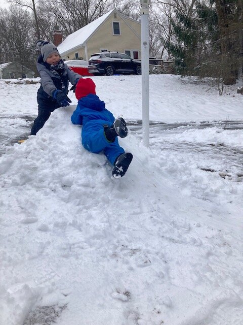
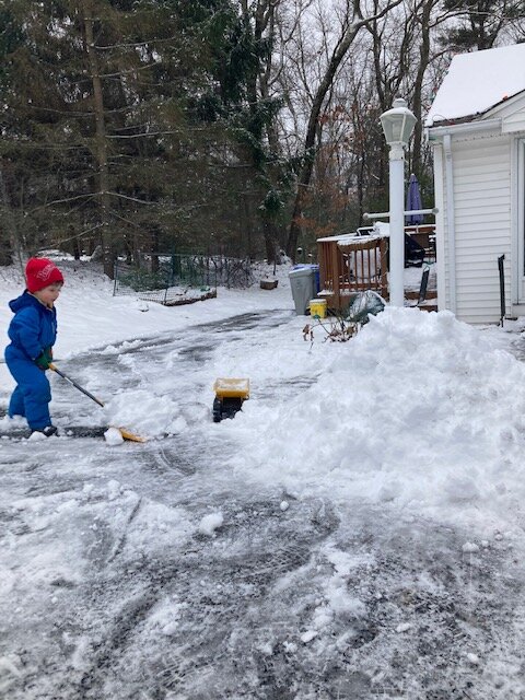
Snow was pretty dense so it made good piles. My boys are enjoying it this morning
-
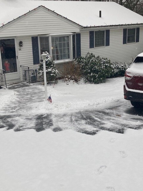
At least grass is covered and looks like winter
-
Ripping here right now. Had some pingers when I was up about an hour ago but now it’s solid moderate snow.
-
It’s def snow on that panel…but yeah, I get not getting invested in a day 8 OP run.
-
That map doesn’t have ptype on it.
-
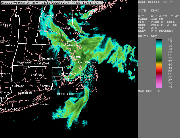
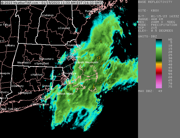
Decent band rotating toward north shore/Cape Anne.
-
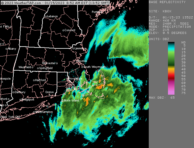
Some of that may be bright banding but not all.
-
Once those big dog echoes hit, it should start sticking much faster I think.
-
I think upper cape and PYM county are starting to look pretty good on this. Nowcast for sure but those are some big echoes moving west.
-
Let’s get a GFS/Euro compromise. Steal a warning event for the pike.
-
Yeah that stuff near ACK is the type of precip we want to see get onshore to get good amounts.
-

-
Not really. It does get a little back that way though.
-
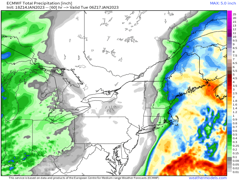
06z euro really crushes PYM county. Much more than 00z.
-
RAP and HRRR both hammer the cape with like 8-12” on clown maps. Lol. Prob overdone because ratios will be a lot less. Still….gonna have to watch if there’s a more intense band with good lift as that will cool the lower levels pretty efficiently underneath one of those.
-
Hopefully some of the mesos can jump on board. I do agree with eduggs that the satellite and radar look kind of decent…hopefully not just weenie goggles which might get enhanced via desperation in an awful winter to date.
-
I think I’d be cautiously optimistic for N Conway over the next 7-10 days. Still a risk thursday totally shits the bed up there but less likely than a couple days ago.
-
Yeah that run threw a little band back there. Hopefully it has a clue. Would be fun to even get a long duration 2-3” event. Just give it a festive look and feel. Something we haven’t had much of this winter.
-
Total QPF
-
Stubborn Euro. 18z not really backing down.


