ORH_wxman
-
Posts
93,092 -
Joined
-
Last visited
Content Type
Profiles
Blogs
Forums
American Weather
Media Demo
Store
Gallery
Everything posted by ORH_wxman
-
Pretty huge week for CNE/NNE. At least it’s snowing again nearby even if we miss. Hopefully laying some goood pack down will help out a little bit after that. Still think 1/25 might be decent…esp over interior SNE. But I’d like to see even just a minor shift east to get better dynamics in here on the front end.
-
Weenie run of the 06z GFS. That’s how to run a gradient pattern.
-
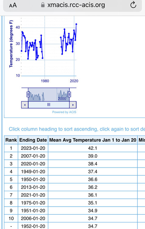
Missing a lot of data though on that dataset. 1978-2001 shows up as missing.
-
This is through 1-20 on the rankings
-
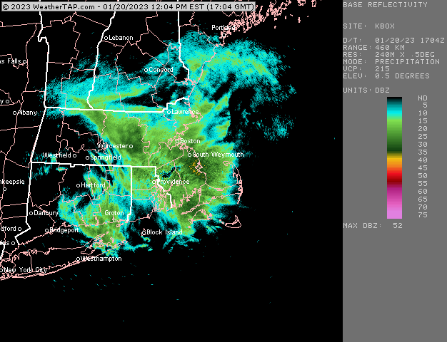
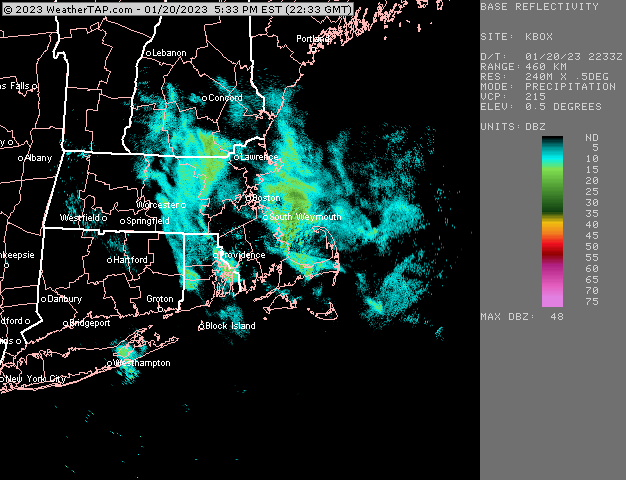
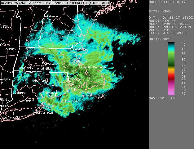
Another band for your area.
-
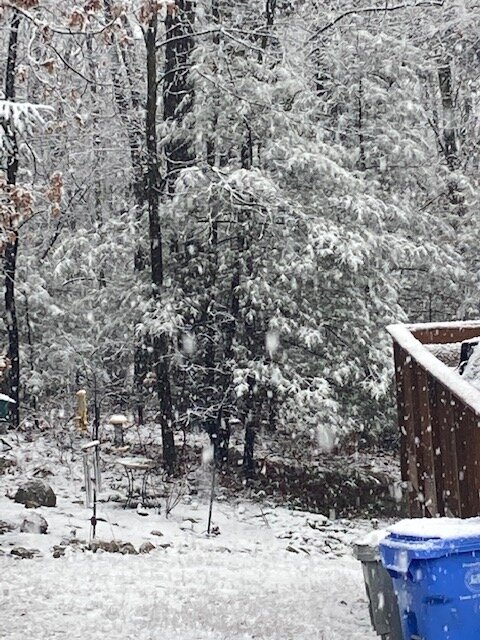
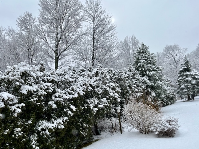
Still some flakes falling out there. Pavement all coated up so it’s actually a pretty wintry looking night. Won’t last long but we take what we can get this winter.
-
It’s cold enough out ahead of that storm…even if not ideal. The biggest problem I see is the high is literally in the worst possible spot. We just get flooded during the WAA phase of the storm. Once winds finally back to northeast, we’re too mild for snow except over far interior zones where it remains just cold enough. Normally a 534 thickness -3C 850 antecedent airmass would work if we had any type of mechanism whatsoever to hold that in, but when the high is sliding southeast of ACK and out into the Atlantic, we’re cooked. The funny part is both the 18z NAM and HFS did try and flip us back to heavy snow at the end…not really buying that depiction but still entertaining.
-
Fatties in this band. Prob about an inch and a half on non-paved surfaces here
-
This storm is prob just a tease from like an ASH-ORH axis....I'd want to be up in the monadnocks and up near CON and NW to be invested.
-
It would be really hard to resist in your spot. I feel pretty good about punting here, but if I was up by NH border, I'd still be getting sucked in.
-
Happy hour NAM.....
-
Is NCEP running on 486-SX computers today? Dreadfully slow all day long.
-
I don't expect much more in way of accumulation, but wouldn't be shocked if we grab another half inch after the sun sets....hopefully those bands hold together enough to give some good mood snow this evening. I def lost snow in the last hour or so when the really steady stuff slowed down and temp creeped to like 33F. Had the front walk completely covered in about a half inch to an inch and it's 100% wet now. Other surfaces are still caked in snow, but it compacted some for sure.
-
Early Feb 2017 pattern.
-
Shoulder linger well into evening for our area. Just looking upstream radar plus 18z NAM, it seems like at least until 8-9pm? Might be even a little later. We won't have it ripping moderate like som eof those brief bands earlier today, but it should accumulate a lot more efficiently even if its light as temps drop below freezing and eventually into upper 20s.
-
Snuck up to 33F during this little lull and all the snow melted off the sidewalk....lol. Looks like next batch is coming in though and temp is dropping again as sun goes down. Should be able to accumulate pretty efficiently from here on out.
-
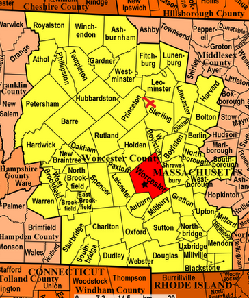
That northeast corner of ORH county seemed to do really well with the flip back to snow last night....down on winter hill in northern ORH city, there was just a brief flip at the end, so it was like 10 miles was the difference between a coating and 4"+ from last night.
-
Winter hill
-
Consistent NW to SE feed on the IVT stuff....hopefully we can keep it going into evening when accumulations would become more efficient.
-
I'm still liking that post-1/25 pattern into early February....skunked or not skunked to date, it's hard to say it looks like crap. Maybe it will trend worse, but there's going to be chances there and there's an awful lot of arctic cold around too which has been absent for over a month.
-
He's about 12 miles north of ORH on east slope. PRetty close to where I drew the X
-
Man, if we can get that shortwave to track a little further east for 1/25 we'd have a miller B type storm....as it is, it''s tracking so far west but decent confluence does give front end snow. Maybe we can trend it a bit east like 1/23 has been doing.
-
Ok yeah...they will prob do ok....most people south of there are prob cooked.
-
Don’t do it
-
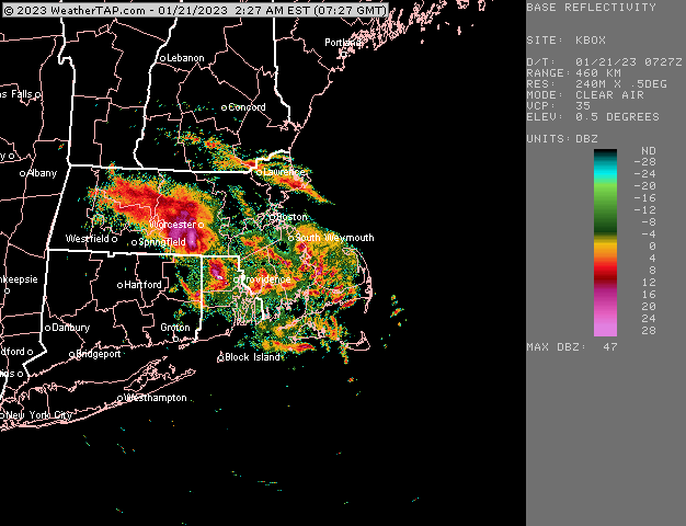
Ripping right now in this band