

ORH_wxman
-
Posts
93,095 -
Joined
-
Last visited
Content Type
Profiles
Blogs
Forums
American Weather
Media Demo
Store
Gallery
Everything posted by ORH_wxman
-
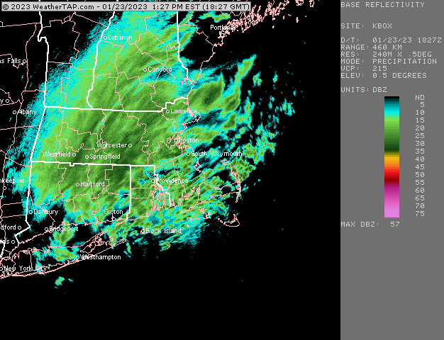
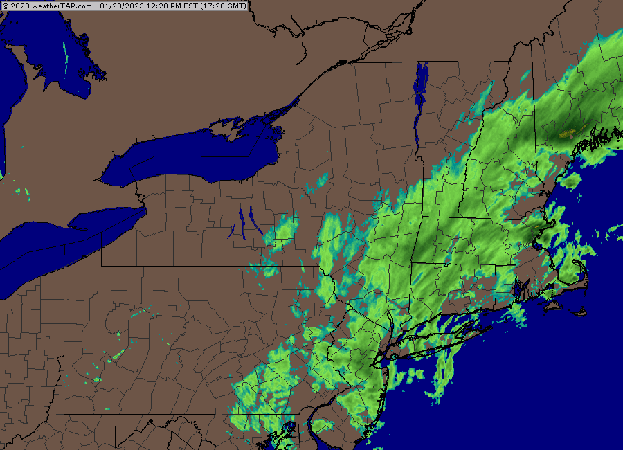
Metrowest band
-
Really going to town now
-
Rippage
-
Metrowest is going to absolutely rip for a bit....these are impressive bands setting up
-
Clock is ticking there....hopefully that stuff rotating SE near NY border keeps backfilling for a bit, but otherwise it's prob another hour or two of the steady stuff.
-
Some impressive bands starting to set up....maybe we can actually exceed 2" in this??....that would exceed expectations. We'll see, but I like the radar right now.
-
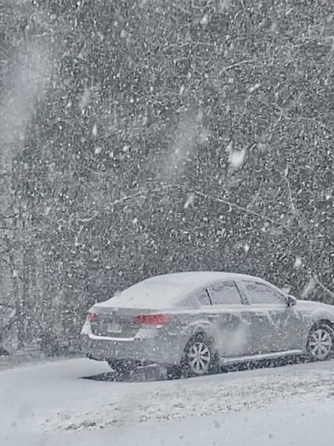
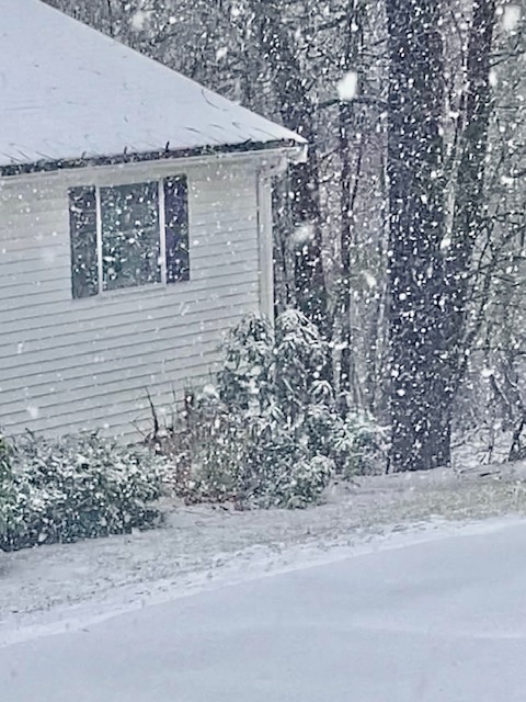
Steady snow...temp has dipped to 32F...shouldnt have much trouble accumulating.
-
Over-stating attribution is just as anti-science as implying there is none.
-
What is the physical mechanism though? Models aren't taking a hypothetical mid-20th century climate and trying to apply it to 2023.....they are ingesting real time data. A smaller PV might make the model performance a bit worse because models perform worse in lower gradient environments....however, the model verification score improvement is at odds with that theory becoming dominant. Models are improving faster than any sort of "shrinking PV" can offset that performance.
-
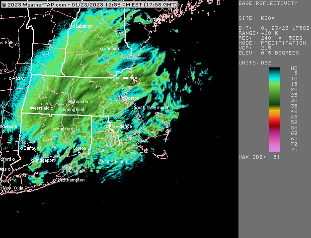
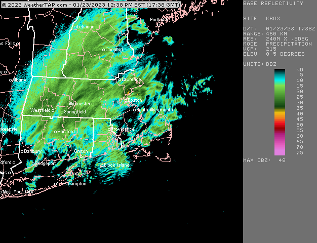
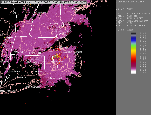
Snow line is basically over BOS now on CC-dual pol. We're not snowing here though, but echoes are really light right now...we'll see if its flakes when this batch knocking on the door comes through.
-
No it does not mean that.....just the average temp of the globe was 1C cooler. The arctic is where the most warming has happened, so it might be like 4C cooler there....while in many tropical areas it hasn't warmed at all. In our case in the state of MA, if we take the average DJFM temps from the middle 20th century and do a least squares regression, we've warmed at about 0.18C per decade which equates to about 1.3C of warming where we are. So it happens that our area is pretty close to that 1C of warming as it turns out but that won't be true everywhere.
-
Flipped over to snow in ORH now.
-
Looks like snow line is just getting near Tolland up through ORH and northeast along 495
-
No it wasn’t directed at you but I’ve seen some posts from others that hinted at it WRT ensemble forecasts and such not verifying as cold. And yeah, I don’t think it’s controversial to say “if this event happened in a world where it was 1C colder, then it would have been more wintry”….duh
-
Attribution studies are inherently imprecise. We know CC is obviously making things warmer….however, I don’t see much utility at all in discussing CC as it pertains to forecasting using NWP guidance. The laws of atmospheric thermodynamics don’t change. Model guidance is not going to be too cold or too warm because of CC. They are simply taking actual data (which is from a CC world) and then simulating the atmosphere with that data using the laws of thermodynamics and physics.
-
Man, and that was the one good storm all winter.
-
CC shows the R/S line basically over you. So anything meaningful from here on out should be snow
-
New HRRR and RAP both went wild on the latest run for eastern areas later.
-
Those can be way too low though at times if the snow is coming down at anything heavier than light snow...usually it ends up in the middle somewhere. If it stays mostly light snow, then the depth maps are prob pretty decent in a marginal airmass.
-
Or if it pounds 1-2" per hour S+, then BL temps won't matter....but those solutions haven't really been believable. I'd go 1-2" for most...but there will prob be a few bands that do better.
-
On the single station menu selection, select "seasonal time series" and then under "options" you choose "average temperature" and then under "period of interest" on that same selection you choose when you want the time series to be for.....I selected "other" and put the date 1/1-1/20 in there. HVN has issues though with all that missing data from 1979-2001. A place like BDR would have the full record.
-
Hard to say....because even the meh solutions have the CCB going over SNE later, but its a matter of how intense it is. So we'll likely see this developing to our southwest one way or the other....we'll know as it gets closer probably based on how intense it is if it's going to be good or not.
-
Kraft got pulled over after the 06z run
-
HRRR is out to 10z run. It’s pretty interesting but not like the 06z NAM.
-
Steady light snow continues but CC says the R/S line is close.


