ORH_wxman
-
Posts
93,099 -
Joined
-
Last visited
Content Type
Profiles
Blogs
Forums
American Weather
Media Demo
Store
Gallery
Everything posted by ORH_wxman
-
Friday February 6 FROPA / WINDEX small event
ORH_wxman replied to HoarfrostHubb's topic in New England
Might get enhanced a bit as the arctic front approaches. You can see all the stuff starting to fill in too in metrowest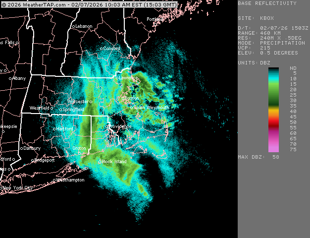
-
Friday February 6 FROPA / WINDEX small event
ORH_wxman replied to HoarfrostHubb's topic in New England
Cape Ann getting crushed now. whiteout in ORH now too.
-
Friday February 6 FROPA / WINDEX small event
ORH_wxman replied to HoarfrostHubb's topic in New England
You might get an hour or two of real good stuff here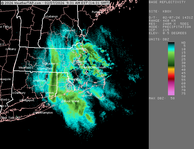
-
Friday February 6 FROPA / WINDEX small event
ORH_wxman replied to HoarfrostHubb's topic in New England
Decent shot at 10”+ there. -
Friday February 6 FROPA / WINDEX small event
ORH_wxman replied to HoarfrostHubb's topic in New England
Prob gonna be some very intense rates for a time. You’ll force a lot of air upwards when it hits the light onshore flow -
Friday February 6 FROPA / WINDEX small event
ORH_wxman replied to HoarfrostHubb's topic in New England
Someone will end up with 18”+ there I think unless it shuts off very quick. -
Friday February 6 FROPA / WINDEX small event
ORH_wxman replied to HoarfrostHubb's topic in New England
Complete crush job for Ginxy up to ORH.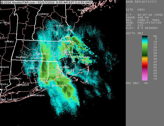
-
Friday February 6 FROPA / WINDEX small event
ORH_wxman replied to HoarfrostHubb's topic in New England
Other than completely whiffing on the North Shore warning snowfall. -
Friday February 6 FROPA / WINDEX small event
ORH_wxman replied to HoarfrostHubb's topic in New England
About 1.5” in Holliston. Starting to ramp up a bit though, flake size has improved despite no real radar trend overhead. That stuff to the west starting to light up though..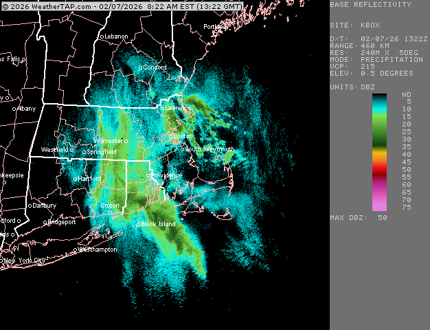
-
Friday February 6 FROPA / WINDEX small event
ORH_wxman replied to HoarfrostHubb's topic in New England
Ginxy gonna get 8”+ -
Friday February 6 FROPA / WINDEX small event
ORH_wxman replied to HoarfrostHubb's topic in New England
Reggie looks solid for RI. Mini-weenies for scooter and Ray.
-
Friday February 6 FROPA / WINDEX small event
ORH_wxman replied to HoarfrostHubb's topic in New England
These are the types of events you really need the large ranges. So much bust potential. These soundings are no joke for whoever gets stuck under some lift. It’s not like a marginal temp sounding with an inversion lower down in the atmosphere…this is lift-off if you can get a little forcing with the max omega cutting through the heart of the DGZ. -
Friday February 6 FROPA / WINDEX small event
ORH_wxman replied to HoarfrostHubb's topic in New England
Not the worst spot to be before an IVT/norlun…playing naked twister with the max interior banding. But obviously these are fickle so you gotta keep expectations low. -
Friday February 6 FROPA / WINDEX small event
ORH_wxman replied to HoarfrostHubb's topic in New England
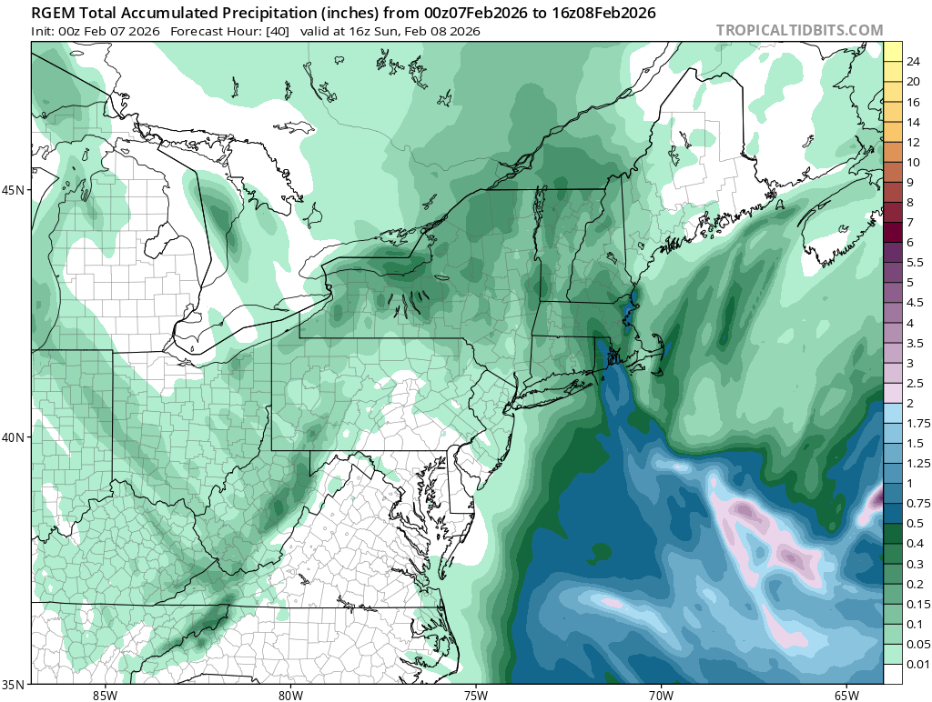
Prob good for 2-4” eastern CT, 1-3” western (the higher side prob being Litchfield county)….might go a little higher near Ginxy and towns near RI. ORH to BOS is 3-6” but obviously someone is gonna get a surprise. Favoring Essex county and then maybe someone down near S RI. Might have to watch south shore too. It’s a really difficult forecast….inverted trough/Norluns probably have the largest bust potential of any snow event as forecasters. -
Friday February 6 FROPA / WINDEX small event
ORH_wxman replied to HoarfrostHubb's topic in New England
Ray might delete his account if that happened. -
Friday February 6 FROPA / WINDEX small event
ORH_wxman replied to HoarfrostHubb's topic in New England
That’s prob 2-3” per hour easy. Might get a clap of thunder if that verified. -
Friday February 6 FROPA / WINDEX small event
ORH_wxman replied to HoarfrostHubb's topic in New England
I’ve only seen those 60+ TTs a small handful of times widespread during a winter/WINDEX type event…Jan 28, 2010 was one of them. I remember a pretty good one in Feb 2013 (wanna say 2/24/13) where some guidance was ramping up the TTs but I don’t think they quite reached 60. -
Friday February 6 FROPA / WINDEX small event
ORH_wxman replied to HoarfrostHubb's topic in New England
Down in RI at 21z.....GFS sounding....TTs now around 55.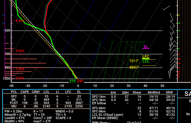
-
Friday February 6 FROPA / WINDEX small event
ORH_wxman replied to HoarfrostHubb's topic in New England
This is the GFS sounding at 18z tomorrow in metrowest 128-495 region....that's prob 2"+ per hour stuff...gotta love the TTs around 50. Someone could get thunder.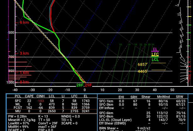
-
There’s no chance NYC goes below 0F. Unless there is just some sort of catastrophic model failure of 3-5C at 925mb.
-
Friday February 6 FROPA / WINDEX small event
ORH_wxman replied to HoarfrostHubb's topic in New England
BOX AFD def went somewhat wild…but I mostly agree with going bullish for the zones they did. That cross hair sig has been on almost every single model sounding. So wherever a band can set up, it’s gonna stack fast. That and the LL lapse rates are crazy good. -
Yeah I think a lot of it is timing which isn't a surprise when you look at the upper level trough....it's coming in via a -PNA look on the west coast, so it's very broad as is crosses the middle of the CONUS....so given the broad trough, prob a lot of timing differences on when energy pops the best coastal.
-
Friday February 6 FROPA / WINDEX small event
ORH_wxman replied to HoarfrostHubb's topic in New England
BVY up to Salem, Manchester-by-the-sea, and Cape Ann could be ground zero. These are fickle so no guarantees, but those spots have done very well before on IVT/Norlun-esque setups. These soundings are excellent too for those near the coast with those steep low level lapse rates being even more enhanced. -
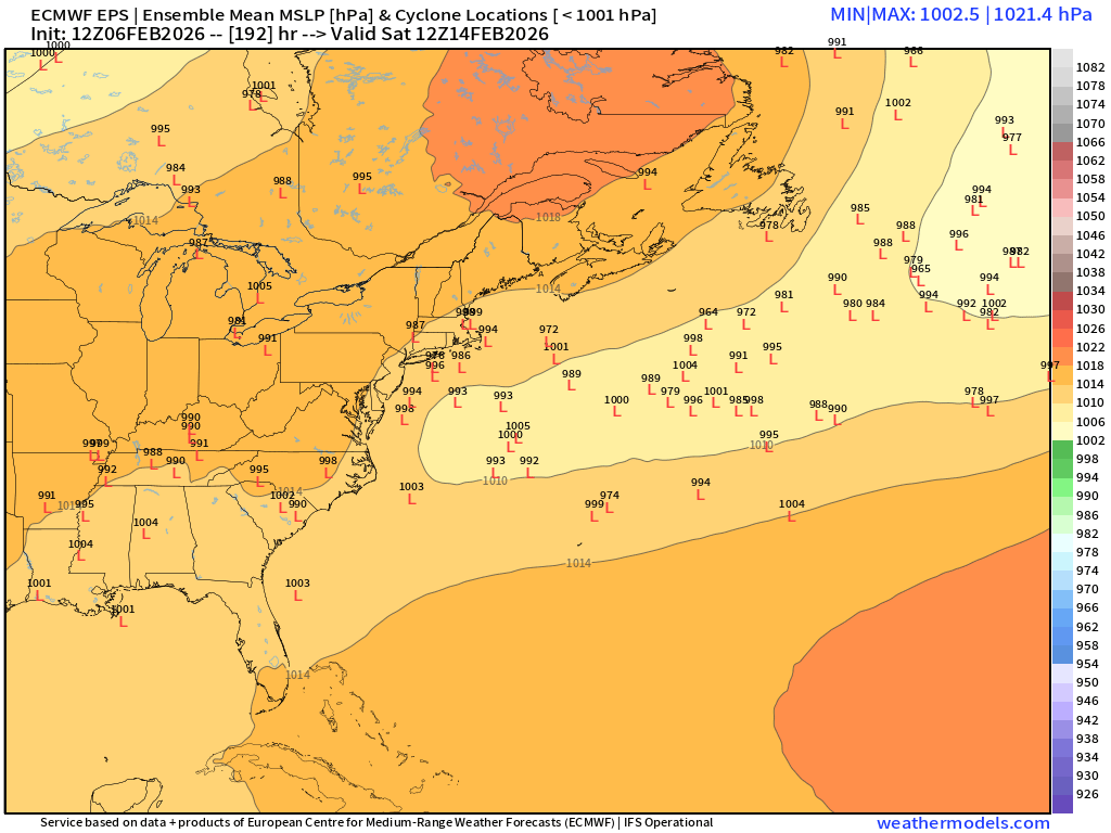
Snowiest EPS run in a while....there's multiple chances in there. Decent signal for next Saturday, but far from tight consensus...good Scooter high in Quebec though
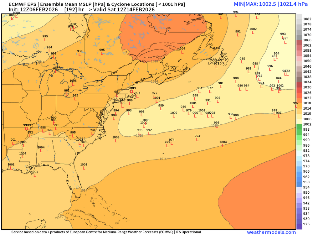
-
Friday February 6 FROPA / WINDEX small event
ORH_wxman replied to HoarfrostHubb's topic in New England
Both 18z NAMs held fairely steady though the 3k reduced the wildness in Essex county and maybe got a touch jucier in metrowest/central MA. But the same idea...still the best shot at warning is North shore.