

ORH_wxman
-
Posts
93,099 -
Joined
-
Last visited
Content Type
Profiles
Blogs
Forums
American Weather
Media Demo
Store
Gallery
Everything posted by ORH_wxman
-
Yeah but it’s all blocked up. GFS def trending toward the Euro idea of blockier look.
-
GFS try to pull a mini-Feb ‘69 next Friday.
-
GFS skynet still way SE...not particularly close.
-
Downslope dandy today....might tickle 40.
-
Euro skynet was much closer but still a whiff. At least it was finally even half-interested. Well need a pretty solid move by all other guidance at 12z I think.
-
Feb 10-11 Mid Week Minor Event - Ride the hot hand?
ORH_wxman replied to HoarfrostHubb's topic in New England
It’s interesting that we had good snow growth during the heaviest rates last night but in between it was kind of grainy. The snow overall felt a little dense shoveling this morning. Looks nice though. 1.6” storm total with a tenth new after 1.5 last night before going to bed. -
Feb 10-11 Mid Week Minor Event - Ride the hot hand?
ORH_wxman replied to HoarfrostHubb's topic in New England
North shore jacked again for SNE. -
Skynet models still have no interest in the 16th
-
Feb 10-11 Mid Week Minor Event - Ride the hot hand?
ORH_wxman replied to HoarfrostHubb's topic in New England
1.5”. We’ll see if we can get a little more from that stuff to the west. Pretty meh on storm total but the rates were really good for 2 brief spurts. -
Feb 10-11 Mid Week Minor Event - Ride the hot hand?
ORH_wxman replied to HoarfrostHubb's topic in New England
Should get decent rates there the next hour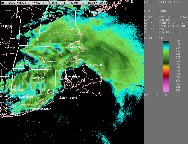
-
Feb 10-11 Mid Week Minor Event - Ride the hot hand?
ORH_wxman replied to HoarfrostHubb's topic in New England
Yeah these rates are fun. Not gonna last long but the convective cells didn’t disappoint on rates here. -
Feb 10-11 Mid Week Minor Event - Ride the hot hand?
ORH_wxman replied to HoarfrostHubb's topic in New England
Yeah def not in this heavier stuff. Lots of dimes and nickels. -
Gotta get the salt off the cruiser somehow
-
Feb 10-11 Mid Week Minor Event - Ride the hot hand?
ORH_wxman replied to HoarfrostHubb's topic in New England
About an inch now. Absolutely nuking. Vis rose from like 1/8 to a half mile or even 3/4 but easily back to 1/4 and dropping quick. Phenomenal snow growth. -
Feb 10-11 Mid Week Minor Event - Ride the hot hand?
ORH_wxman replied to HoarfrostHubb's topic in New England
Vis maybe 1/8 mile now -
Feb 10-11 Mid Week Minor Event - Ride the hot hand?
ORH_wxman replied to HoarfrostHubb's topic in New England
Ok actually white fog here now. Wow. If it can do this for an hour that would go a long ways. But the echoes need to co heal together a bit more.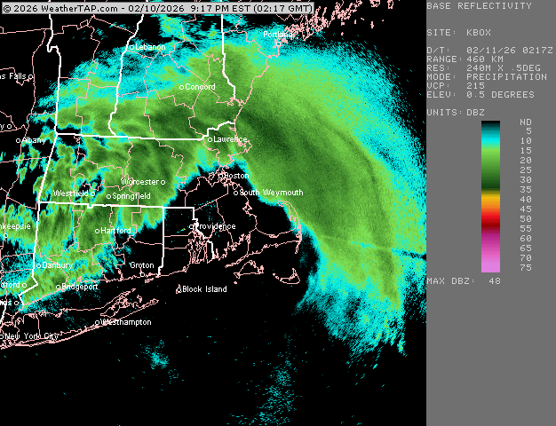
-
Feb 10-11 Mid Week Minor Event - Ride the hot hand?
ORH_wxman replied to HoarfrostHubb's topic in New England
Snowing good here again. But yeah, not an over achiever. We’ll prob be lucky to get 2”. -
Feb 10-11 Mid Week Minor Event - Ride the hot hand?
ORH_wxman replied to HoarfrostHubb's topic in New England
Looks like we may get a decent shot for a couple hours later this evening.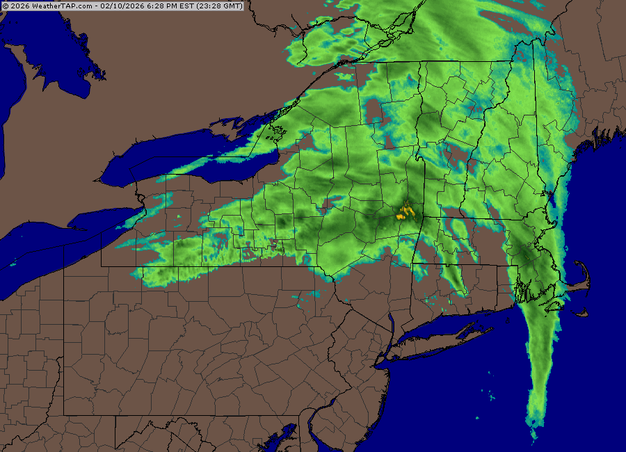
-
Feb 10-11 Mid Week Minor Event - Ride the hot hand?
ORH_wxman replied to HoarfrostHubb's topic in New England
N MA border and S NH look like they are in a prime spot. -
Feb 10-11 Mid Week Minor Event - Ride the hot hand?
ORH_wxman replied to HoarfrostHubb's topic in New England
They key will be how efficiently that NY state stuff develops ESE.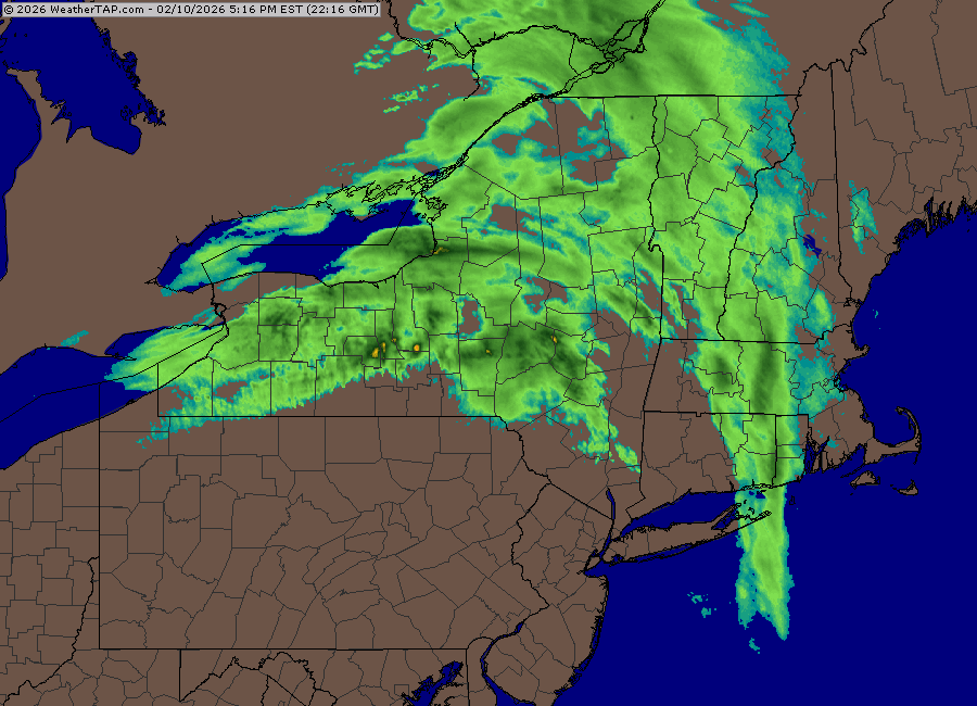
-
Feb 10-11 Mid Week Minor Event - Ride the hot hand?
ORH_wxman replied to HoarfrostHubb's topic in New England
Prob a couple tenths quickly in this. Excellent snow growth. Briefly got mod/hwavy. Starting to lighten a bit now. -
Feb 10-11 Mid Week Minor Event - Ride the hot hand?
ORH_wxman replied to HoarfrostHubb's topic in New England
Actually ripping here pretty good right now. Very good snow growth. Everything coated. This little band won’t last long though. -
Feb 10-11 Mid Week Minor Event - Ride the hot hand?
ORH_wxman replied to HoarfrostHubb's topic in New England
Rap increased QPF a lot on 21z run compared to previous several runs. Mostly due to the convective stuff performing better. -
Longitude obv plays a role too. New England is unique in that it sticks out into the Atlantic. So eastern areas have easier access to a large moisture source to their south and east. But latitude def matters too. But I’d agree in the monsters that longitude might be more important.
-
A lot of it latitude too. Most of E MA is well north of you and Wolfie’s area. Kevin in Tolland is basically the same latitude as Tblizz-Brett. Some of the SW CT posters are even south of the cape’s latitude.
