

ORH_wxman
-
Posts
93,092 -
Joined
-
Last visited
Content Type
Profiles
Blogs
Forums
American Weather
Media Demo
Store
Gallery
Everything posted by ORH_wxman
-
It was a Flop... February 2024 Disco. Thread
ORH_wxman replied to Prismshine Productions's topic in New England
Yeah we’ve had a lot of May cold snaps (some with snow) that were breaking records while months like June/July can’t buy a cold record….well, maybe mid June onward. We had some nasty early June record low-maximum type days especially in the 2000-2015 range, not quite as much recently. Conversly, the October snow has been increased frequency since 2000. I’m not sure if these are just coincidence or something else because those months have warmed in the means, but those individual cold episodes on a sub-monthly level have increased in frequency. -
It was a Flop... February 2024 Disco. Thread
ORH_wxman replied to Prismshine Productions's topic in New England
Yeah that is true. You can occasionally have a really nice spring that was still normal or chilly in the mean temps, but lots of sun. Though often the precip will drive down departures in the spring. Esp the later into spring we get….clouds and precip blocking out a May sun angle really helps keep temps down. If you look at the 2000-2009 composite, it was very wet in those springs which probably helped drive the departures down. In the past decade, our springs have run significantly drier than that 2000s decade. -
It was a Flop... February 2024 Disco. Thread
ORH_wxman replied to Prismshine Productions's topic in New England
Yeah if that had been more like a 2018 or 2020 spring we prob would’ve had regular pack into the 3rd week of April. Yeah we def want to root for high ACE. But even if it isn’t, I won’t be terrified of La Niña. I’d like to see some changes in the N PAC in terms of getting ridging more poleward but we can get good La Niña even without a ton of blocking. 2007-08 and 2016-17 are two relatively recent examples. -
It was a Flop... February 2024 Disco. Thread
ORH_wxman replied to Prismshine Productions's topic in New England
It’s pretty easy to empirically check these spring claims. The mean temp increase for April/May since the middle 20th century is about 2F. We’ve definitely warmed. But in shorter timelines it will be a lot noisier. If you start from 12-15 years ago, then we have cooled in spring because we had some furnace springs like 2010, 2012, and even 2015 was a warm one after the historically cold Jan-Mar period. For anyone who grew up in the 1970s/1980s/1990s, they will remember colder springs because that period was colder than any period recently, individual years not withstanding. Unless you’re memory is etched in 1991 which was a record warm spring in many spots. -
It was a Flop... February 2024 Disco. Thread
ORH_wxman replied to Prismshine Productions's topic in New England
There’s def some support for one last blockier pattern starting the 2nd week of March….we’ll see if it actually materializes. A March big dog would at least get this winter out of the bottom rung if we could improbably pull one off. -
It was a Flop... February 2024 Disco. Thread
ORH_wxman replied to Prismshine Productions's topic in New England
So far it’s been a tradeoff that is worth it. The bigger ticket events and big ticket winters are enough to outweigh the ratters. But certainly a few years of underachieving can test people’s resolve. -
It was a Flop... February 2024 Disco. Thread
ORH_wxman replied to Prismshine Productions's topic in New England
I’m not buying it yet but it would be ironic if when many of us are saying “just bring on the 70s”, we get our best period of winter with multiple threats with highs in Quebec. Something we haven’t been able to buy for 2-3 years. -
Originally forecasted to whiff SNE about 4 days out. Really trended north big time inside of 60-72 hours.
-
Yeesh dude…did you memory-hole the 2016-2020 period? I think like 4 out of 5 of those were fooking nuclear crater landscape near 5/1. Awful springs. We did have some better ones recently like 2021 and 2023.
-
It was a Flop... February 2024 Disco. Thread
ORH_wxman replied to Prismshine Productions's topic in New England
Was actually a nice day to throw the football in the driveway with my oldest. It was around 34-35 when we were out but it felt warmer in the sun…definite March feel to the landscape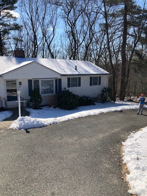
-
Unless it’s a major event, I’m out too. But obviously there’s still like 5-6 weeks left for something like that. The problem with “being out” in New England in snow threats and cold in favor of warmth is that it rarely ever acquiesces to that particular demand. 2012 was a rare exception. Usually it’s mostly a shit sandwich which then makes me start rooting for snow stat-padder events because it beats 41F mist with a “nice” day being 54F self-destructing sunshine day.
-
It was a Flop... February 2024 Disco. Thread
ORH_wxman replied to Prismshine Productions's topic in New England
We’ll need a wholesale hemispheric change where we establish a good cryospheric base from the lakes to S Canada…hopefully we’re able to do that next winter but no guarantees. -
It was a Flop... February 2024 Disco. Thread
ORH_wxman replied to Prismshine Productions's topic in New England
BOS to your area and even up to Cape Ann and then back into the Foxborough area has gotten porked relative to climo pretty bad the last 2 winters. Even worse than most other areas. S CT had been way worse previously but they got a bit of redemption this month. My area has been pretty bad too but at least I got 10” in the 1/7 storm. But some of that is def payback for the jackpots we were pulling out of our rears for years even in blah patterns. -
It was a Flop... February 2024 Disco. Thread
ORH_wxman replied to Prismshine Productions's topic in New England
If we can’t grab that 2/24 storm, then we’re looking at pretty boring weather with temps in the 30s/40s. The snow OTG the last week or so has been nice but since we didn’t get warning criteria, it’s just slowly melting/sublimating and the whole thing is just more of a spring vibe than deep winter. Im all for big storms but this sucks. I’m well aware enough of our climo though to know that we’re not going to get consistently nice outdoor weather for a while. -
Saturday February 16th - Another CT/ Cape special?
ORH_wxman replied to Sey-Mour Snow's topic in New England
Just whiffed here…we got a coating. I bet 5 miles south got crushed. -
It was a Flop... February 2024 Disco. Thread
ORH_wxman replied to Prismshine Productions's topic in New England
Maybe we can grab a 70 in early March looking at ensembles. Weeklies go cold again after that so I’m not expecting 2012…though at this point, I would absolutely take 2012 if offered. Only thing that would keep me on the winter train is if we can get a big dog threat from a bowling ball or something. -
Not interested in this threat at all right now. It could change but todays runs don’t inspire any confidence.
-
It was a Flop... February 2024 Disco. Thread
ORH_wxman replied to Prismshine Productions's topic in New England
Yeah you saw one of the best if not the GOAT in 1966 for that area. Pack that deep is rare in Ithaca. The nickel and dime events though were not. -
Saturday February 16th - Another CT/ Cape special?
ORH_wxman replied to Sey-Mour Snow's topic in New England
SW CT special…someone could pull 2-4” there. Hoping for enough scraps further north for an inch. -
It was a Flop... February 2024 Disco. Thread
ORH_wxman replied to Prismshine Productions's topic in New England
Yeah can’t buy a good setup….but who knows. Maybe we’ll get the unicorn bombing out that makes the airmass less of a concern. We’re due for an April ‘97…not trying to get greedy. -
It was a Flop... February 2024 Disco. Thread
ORH_wxman replied to Prismshine Productions's topic in New England
I think I’d like the evolution better if the southern vort went east a bit and then got captured by the northern stream digging and pulled back NW. That would create a cold CCB -
It was a Flop... February 2024 Disco. Thread
ORH_wxman replied to Prismshine Productions's topic in New England
Northern stream is cold. Feels like you’d need that inserted into the system at some point to turn it into something major. -
It was a Flop... February 2024 Disco. Thread
ORH_wxman replied to Prismshine Productions's topic in New England
Only thing we don’t have is a good antecedent airmass (surprise!) but obviously a big dynamic system could overcome that. Airmass could improve some as we get closer….the setup could look a bit different. People will have to remember this is D7-8 -
It was a Flop... February 2024 Disco. Thread
ORH_wxman replied to Prismshine Productions's topic in New England
Euro def starting to look more interesting for something higher end….long time to go obviously but good to see many of the pieces in place -
Saturday February 16th - Another CT/ Cape special?
ORH_wxman replied to Sey-Mour Snow's topic in New England
Euro ticked north again. 1-2” from much of the southern half of CT


