ORH_wxman
-
Posts
93,099 -
Joined
-
Last visited
Content Type
Profiles
Blogs
Forums
American Weather
Media Demo
Store
Gallery
Everything posted by ORH_wxman
-
Bluebird sky out there this morning…with strong CAA at least it looks and feels like winter out there today.
-
It was a Flop... February 2024 Disco. Thread
ORH_wxman replied to Prismshine Productions's topic in New England
It’s going to be a relatively fast band of snow for anyone south of MA/NH border because we’re south of the low track…so we’ll get the WAA burst in front of it and then it dryslots. But yeah, some of these soundings look nice and if they continue to look like that tomorrow, then I could see a quick 2” in spots. But it could also end up a bit shredded if that vort trends a little north. We want to root for that vort to dig a little more -
It was a Flop... February 2024 Disco. Thread
ORH_wxman replied to Prismshine Productions's topic in New England
Yeah I’d be a little bit surprised if you didn’t…assuming it doesn’t trend worse in the next 24h like most other systems this year. Too bad we’re all jaded at this point in a shit winter…this is the type of system we’d be semi-excited about if it was progged for December 15th instead of February 15th. -
It was a Flop... February 2024 Disco. Thread
ORH_wxman replied to Prismshine Productions's topic in New England
GFS actually has a nice burst of omega right in the DGZ tomorrow night over MA including BOS. I don’t know if it’s correct but that would prob drop a couple inches. NAM has a similar look on the soundings but a bit more paltry on QPF. -
It was a Flop... February 2024 Disco. Thread
ORH_wxman replied to Prismshine Productions's topic in New England
Yeah I’m not expecting much from the clipper down here. Maybe an inch or so if lucky. Vort track is pretty solid for CNE/NNE though so someone will do 2-3” with spot 4” up there I think. -
It was a Flop... February 2024 Disco. Thread
ORH_wxman replied to Prismshine Productions's topic in New England
Flow goes very meridional for a time so that’s the period to watch imho. Model guidance tends to struggle the most when you have northern stream shortwaves coming out of the arctic where sampling is bad and satellite data is distorted. That’s when we can get those threats to pop out of nowhere at like D5-6 -
It was a Flop... February 2024 Disco. Thread
ORH_wxman replied to Prismshine Productions's topic in New England
You’ll be right back on the train once the clown maps have you in double digits on the next threat. -
Snow has become crunchy under foot as temp is down to 27. Somewhat frustrating storm here as we missed the real goods by maybe 25-30 miles but can’t complain too much considering further northeast got totally hosed…and it was good to see the snow drought areas in CT get slammed. They were due for one.
-
It was a Flop... February 2024 Disco. Thread
ORH_wxman replied to Prismshine Productions's topic in New England
Actually a lot of longer range guidance tries to reload after about a week. I don’t necessarily buy it but LR guidance isn’t in any type of consensus. -
Drove down to Ashland center a while ago and they literally had like 1.5” of compacted glop. Less than half of what I had a couple miles away and 200+ feet higher.
-
Well done on the bolded. Lol
-
Classic. Short term busts have become rarer and rarer, but then when one happens, it’s because of CC. No shame at all.
-
Temp has dropped to 30F. Things starting to freeze solid.
-
It was a Flop... February 2024 Disco. Thread
ORH_wxman replied to Prismshine Productions's topic in New England
Seriously. Nice clipper event and then it’s teeing up potential for Saturday. Would be nice to grab some events even if they aren’t huge. Hopefully we can time up a bigger one next week. -
Metfan is expanding the company as new CEO
-
It was a Flop... February 2024 Disco. Thread
ORH_wxman replied to Prismshine Productions's topic in New England
Saturday has been off and on, but I think it's mostly off for now. -
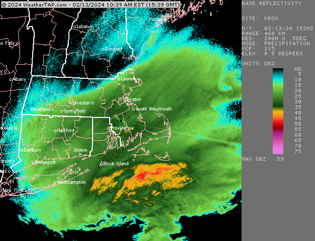
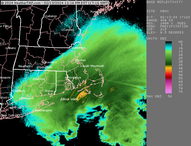
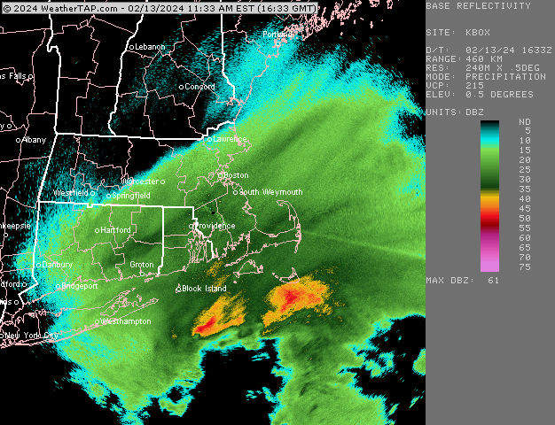
Barnstable/HYA and over to the eastern part of Sandwich is probably just getting destroyed right now
-
It was a Flop... February 2024 Disco. Thread
ORH_wxman replied to Prismshine Productions's topic in New England
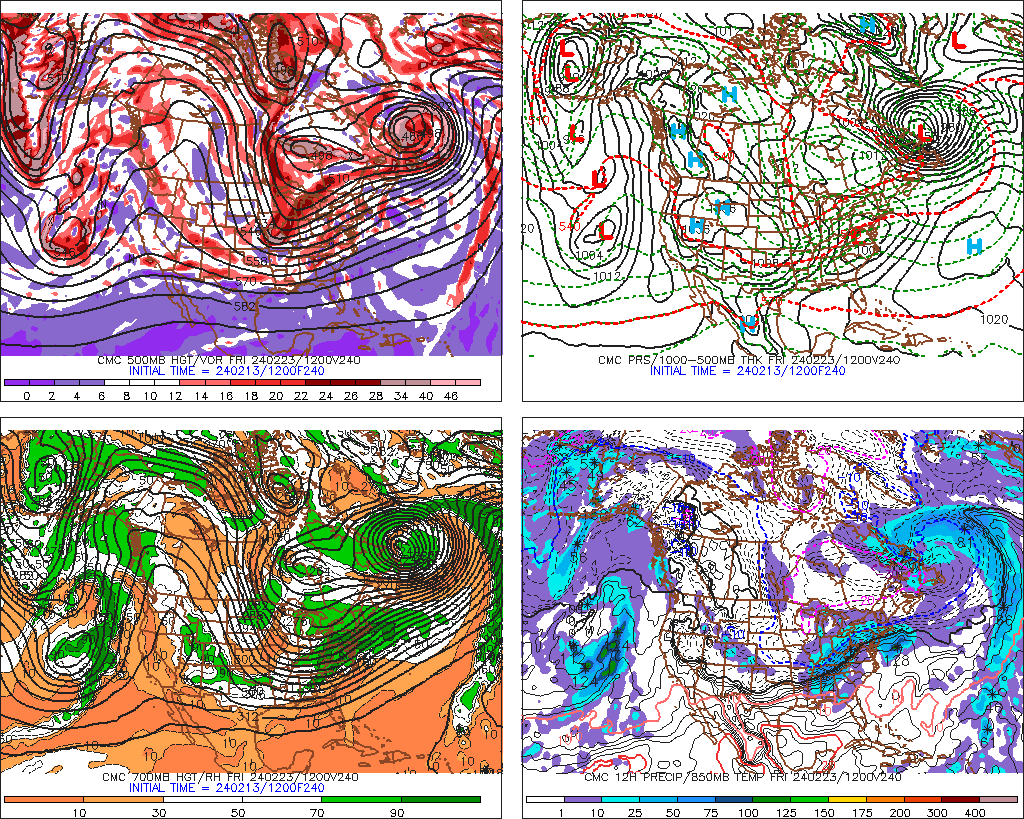
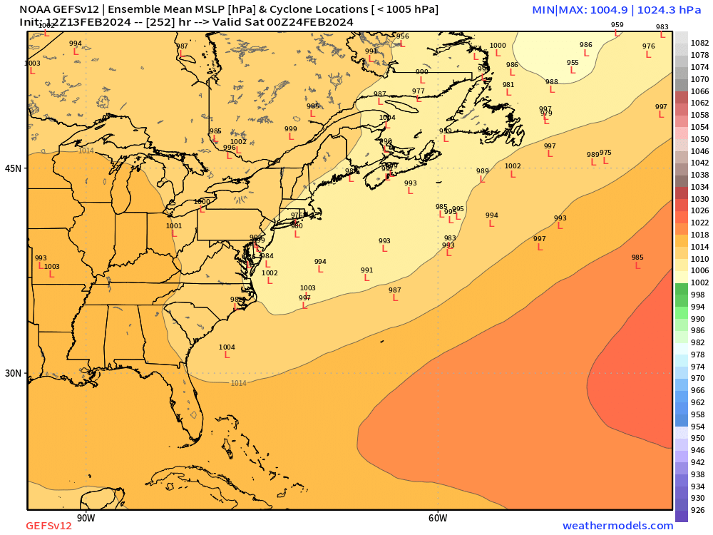
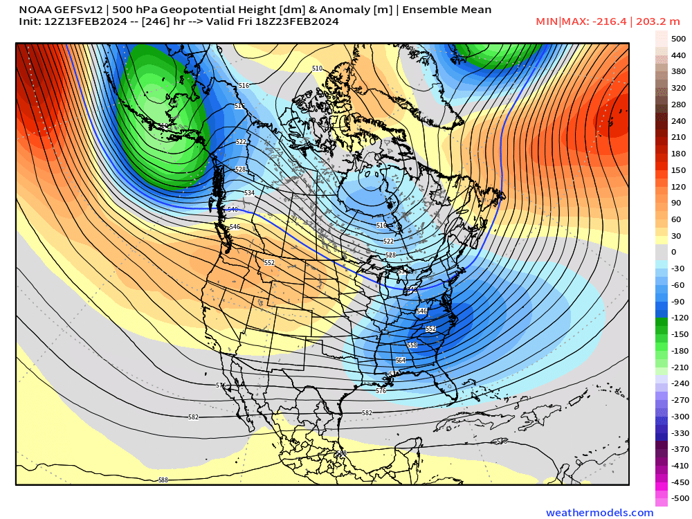
2/24 has some tepid support in the ensembles....OP GGEM liked it a lot, but thats an OP run....GEFS you can see have a weak signal, but the western ridge is there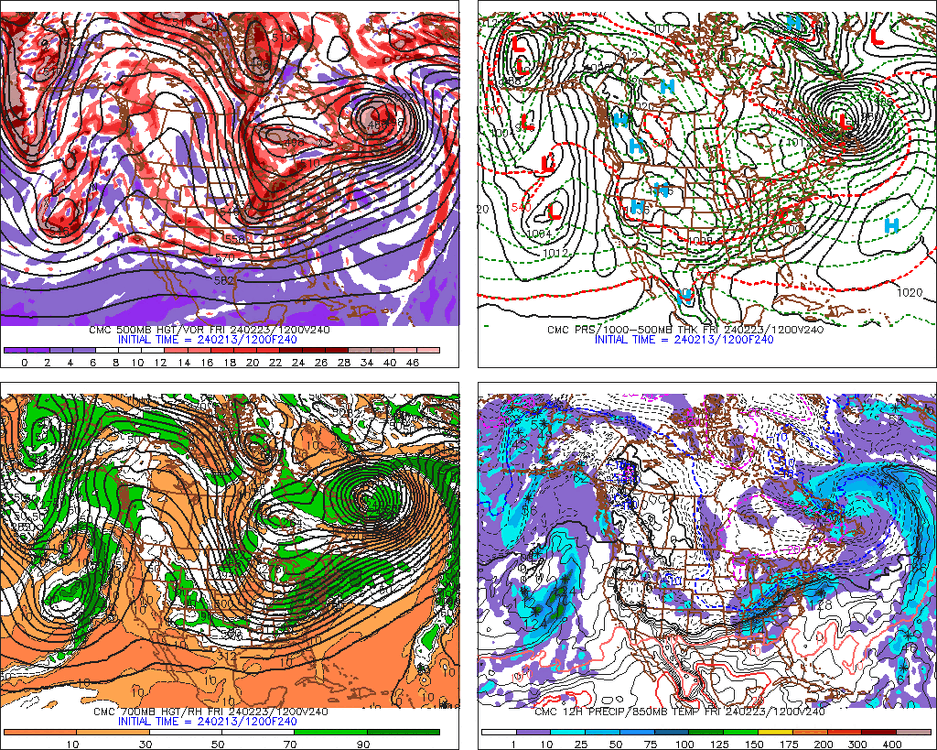
-
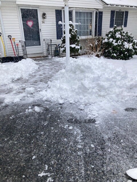
Winding down here. About 4” of paste…on the pavement it was more like 3”. At least it makes nice piles.
-
Cape is getting destroyed. Down to 32F and heavy snow at HYA. Radar looks great for them
-
Trying to get one last boost on the echoes. Snowing pretty hard.
-
Between 3-4"....but areas near me 200 feet lower might have half that im guessing.
-
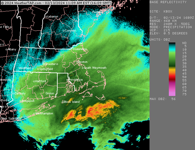
I'm also wondering if up by here we were fighting just a little bit of dry air aloft....we had some really good echoes over us for a time, but we never approached the rates that were occurring in CT. Maybe maxed out around an 1 inch per hour and it didn't last long. Deep moisture/saturation versus some very marginal dry air trying to nose its way into the bands can make a huge difference....particularly when you're trying to shoot for 2"/hr or higher.