-
Posts
187 -
Joined
-
Last visited
Content Type
Profiles
Blogs
Forums
American Weather
Media Demo
Store
Gallery
Everything posted by VOLtage
-
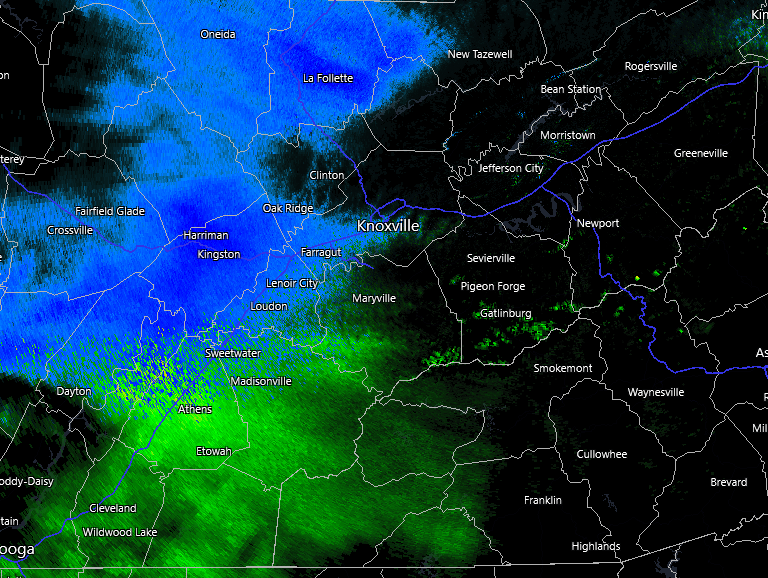
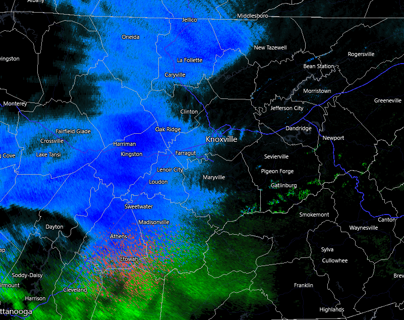
All rain in Maryville.
-
Never mind it stopped
-
All Virga so far here in Maryville. Edit: just as I post this flakes start falling
-
Hopefully the snow can break through
-
It's 31 here in Maryville and overcast. Hopefully it stays this way.
-
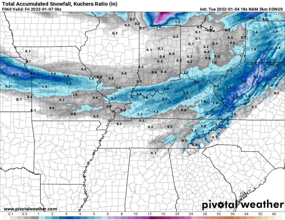
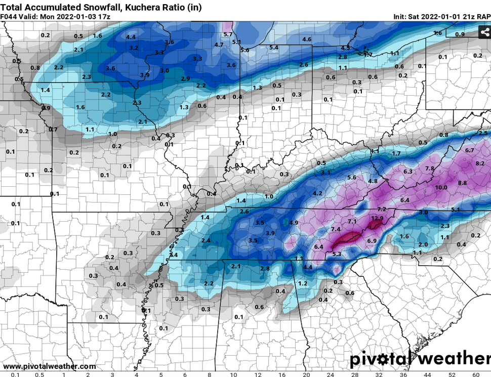
They'll need to extend the WSW's farther south and west if the current trends hold.
-
Latest NAM looking very similar to the NAM 3k last night.
-
Seems as if Blount county is right on the edge of either getting something or hardly anything.
-
https://forecast.weather.gov/product.php?site=MRX&issuedby=MRX&product=AFD&format=CI&version=1&glossary=1 "Precipitation will begin to move in near Chattanooga around sunrise on Thursday, and as the system progresses to the east, precipitation will spread northeastward during the day. Still some big question marks with how soon precipitation will start making it to the surface as initially we`ll have some very dry air in place, and won`t really be advecting much low level moisture into the area. So the column will need to saturate from the top down. Some of the forecast soundings show in the Valley that this will happen closer to around 18z, while others are holding off saturation to the surface till closer to 00z. How fast this column can saturate will have major impacts on how much precipitation and snowfall makes it to the surface."
-
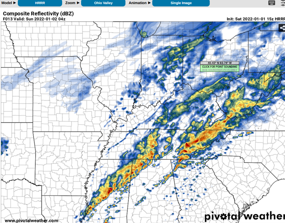
Enhanced Severe risk and storms Dec 31,Jan1
VOLtage replied to jaxjagman's topic in Tennessee Valley
Getting approximately 40-50 mph winds ahead of this line of storms here in Maryville. -

Enhanced Severe risk and storms Dec 31,Jan1
VOLtage replied to jaxjagman's topic in Tennessee Valley
Seems as if the best chance of severe weather for East Tennessee will be the squall line tonight. -

Enhanced Severe risk and storms Dec 31,Jan1
VOLtage replied to jaxjagman's topic in Tennessee Valley
https://www.spc.noaa.gov/products/md/md0011.html Mesoscale Discussion 0011 NWS Storm Prediction Center Norman OK 0327 PM CST Sat Jan 01 2022 Areas affected...North/Northeast MS...Northern AL...Middle TN Concerning...Tornado Watch 3...4...5... Valid 012127Z - 012300Z The severe weather threat for Tornado Watch 3, 4, 5 continues. SUMMARY...Severe thunderstorm threat, including the potential for a tornado, continues ahead of the outflow boundary from northeast MS across northern AL into middle TN. DISCUSSION...Despite an abundance of warm sector development, most of this activity has failed to materialize into supercells thus far. The only exception is the pair of northeastward moving supercells, one over far north-central MS and the other over far northwest AL. Westernmost cell in this pair has begun to interact with the outflow while the easternmost cell is still slightly ahead of the boundary and may be able to remain more intense for a bit longer. While some weakening of the buoyancy has occurred, this narrow corridor ahead of the outflow still represents the best area for potential severe thunderstorms for the next few hours. -

Enhanced Severe risk and storms Dec 31,Jan1
VOLtage replied to jaxjagman's topic in Tennessee Valley
https://www.spc.noaa.gov/products/md/md0009.html Mesoscale Discussion 0009 NWS Storm Prediction Center Norman OK 0157 PM CST Sat Jan 01 2022 Areas affected...Northern MS into Far Northern AL and Southern Middle TN. Concerning...Tornado Watch 3...4...5... Valid 011957Z - 012130Z The severe weather threat for Tornado Watch 3, 4, 5 continues. SUMMARY...Development of a few discrete supercells capable of producing tornadoes and damaging wind gusts possible from northern MS into far northern AL and southern middle TN. DISCUSSION...Recent observations suggest the outflow boundary moving through western TN has become less defined near the TN/MS border, suggesting that much of warm sector across northern MS and adjacent northern AL/southern middle TN will likely stay free from the influence of this boundary. Additionally, the amount and intensity of the warm sector cells has continued to increase, with several cells producing lightning over the past hour. This development is occurring within an environment characterized by warm and moist low-levels and strong vertical shear. Recent GWX VAD also sampled 300 m2/s2 of 0-1 km storm-relative helicity. Expectation is for the storms currently in northern MS to organize/intensify further as they continue northeastward into a more sheared downstream environment. -

Enhanced Severe risk and storms Dec 31,Jan1
VOLtage replied to jaxjagman's topic in Tennessee Valley
Mesoscale Discussion 0008 NWS Storm Prediction Center Norman OK 1238 PM CST Sat Jan 01 2022 Areas affected...Central KY...Middle TN...Northern AL Concerning...Tornado Watch 3... Valid 011838Z - 012015Z The severe weather threat for Tornado Watch 3 continues. SUMMARY...Threat for damaging wind gust and tornadoes continues across central KY and middle TN within Tornado Watch 3. This threat will persist downstream into more of central KY, middle TN, and northern AL, where a watch will likely be needed. DISCUSSION...Recent observations place the outflow boundary from about 20 miles south of LEX southwestward to just southeast of BWG, continuing southeastward through western TN to about 20 miles southeast of MEM. Numerous shallow but strong/organized cells have developed along this outflow boundary and lightning has become slightly more frequent over the last hour. General trend with the stronger storms developing within the line is for an initially cell-in-line structure with a strong, more organized updraft. This more cellular structure then relatively quickly trends towards bowing line segments as the outflow boundary continues pushing southeastward. As such, a relatively brief period for tornadogenesis exists before the storms then transition to more of a damaging wind threat. Initial, more discrete development has also occurred sporadically ahead of the line, with a longer duration of more cellular structure contributing to a slightly greater tornado risk. These storms also trend towards bowing line segments as the outflow overtakes them. This overall pattern is expected to continue for at least the next few hours as the outflow pushes quickly eastward/southeastward. Current motion places the outflow near the edge of Tornado Watch 3 by 1930Z-2000Z. Winds are currently a bit more veered downstream, but vertical shear remains very strong. As such, supercells capable of damaging wind gusts and tornadoes remain possible and a downstream watch will likely be needed. -

Enhanced Severe risk and storms Dec 31,Jan1
VOLtage replied to jaxjagman's topic in Tennessee Valley
Nashville is in the crosshairs of that tornado warned storm. -

Enhanced Severe risk and storms Dec 31,Jan1
VOLtage replied to jaxjagman's topic in Tennessee Valley
-
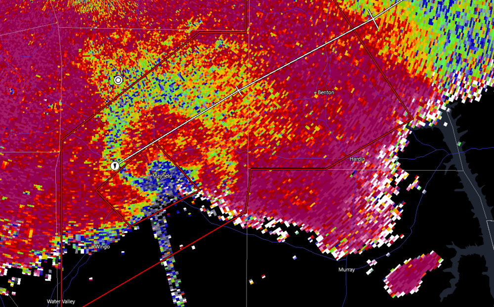
Kind of surprised it wasn't rated an EF-5 with that kind of catastrophic damage. Edit: It is preliminary, so it might get upgraded.
-


