VOLtage
-
Posts
187 -
Joined
-
Last visited
About VOLtage

-
What a monster storm

-
March 3 High Wind and Severe potential
VOLtage replied to Holston_River_Rambler's topic in Tennessee Valley
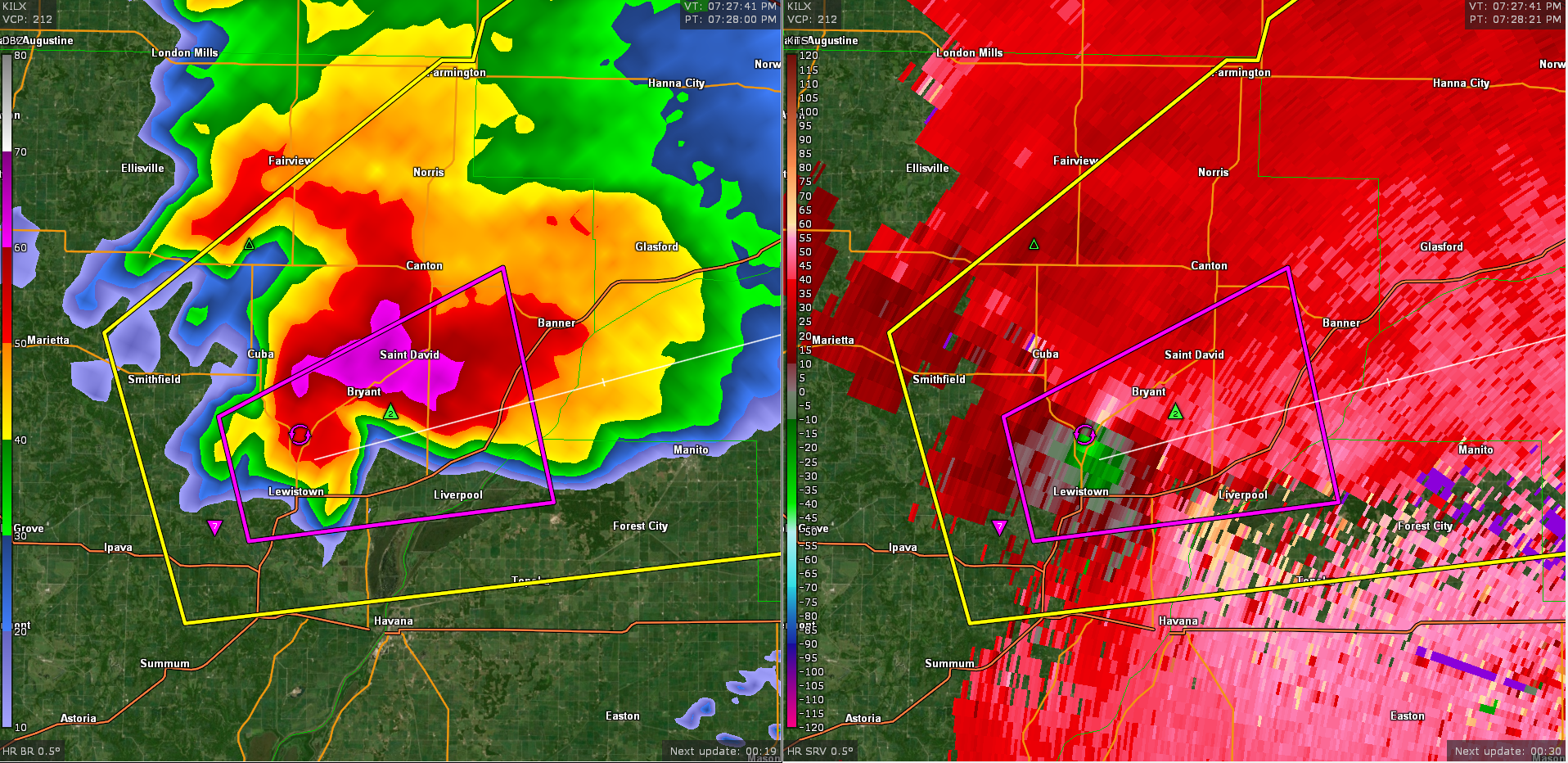
Confirmed tornado on the ground east of Scottsboro, AL. -
Historic Christmas Cold & maybe snow?! Dec 23rd-30th
VOLtage replied to Wurbus's topic in Tennessee Valley
Southern part of Maryville -
Historic Christmas Cold & maybe snow?! Dec 23rd-30th
VOLtage replied to Wurbus's topic in Tennessee Valley
There’s at least 3 inches now on my deck. -
Historic Christmas Cold & maybe snow?! Dec 23rd-30th
VOLtage replied to Wurbus's topic in Tennessee Valley
Got roughly 1.5 inches so far here in Maryville and it’s still coming down good. The roads look treacherous. -
Well that was a bust, in a good way.
-
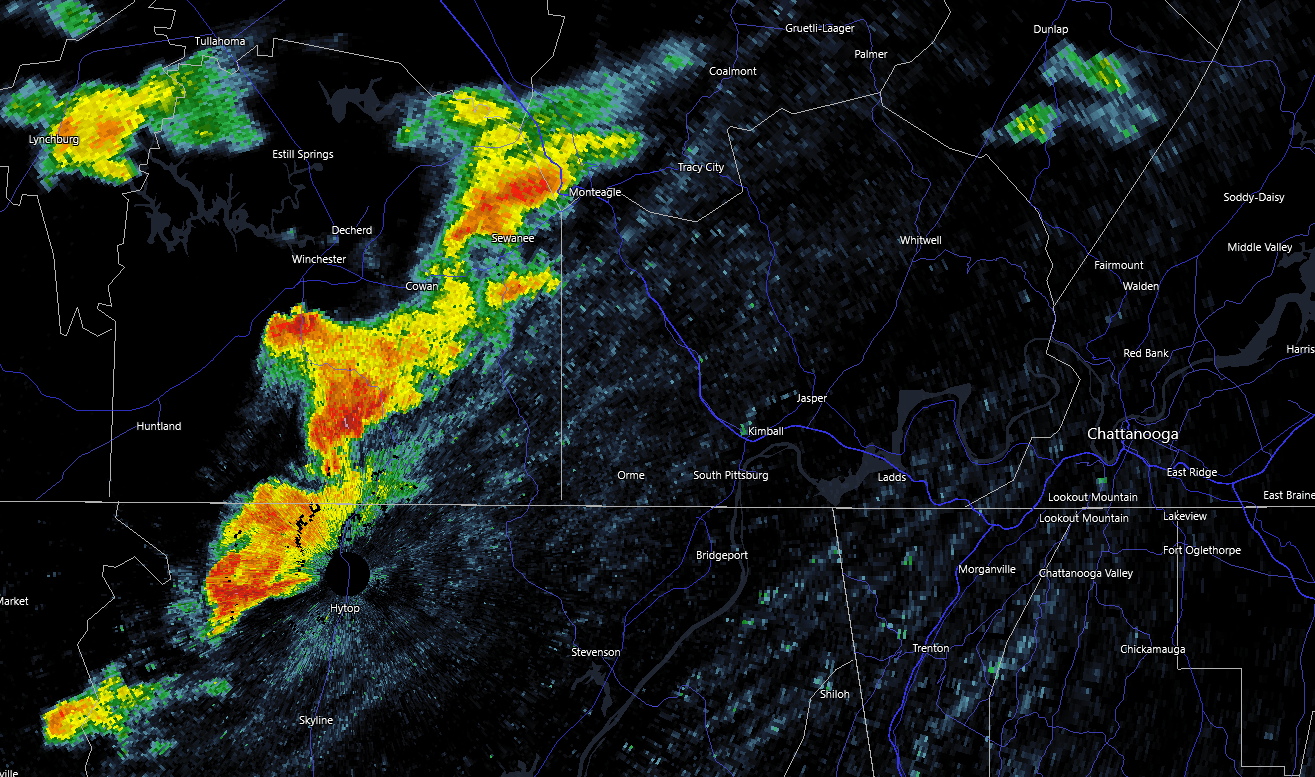
Keeping a close eye on this cluster of cells near the TN/AL border. They'll be moving into a pretty favorable kinematic environment.

-
Probability of Watch Issuance...80 percent SUMMARY...A severe threat may develop with storms that initiate along a cold front, posing a threat for damaging gusts. A couple instances of severe hail/tornadoes are also possible. DISCUSSION...Storms have struggled to develop within the warm sector environment 50-150 nautical miles ahead of the cold front despite ample diurnal heating and the presence of adequate buoyancy. However, storms have been developing along and immediately behind the cold front over the past hour. An uptick in storm coverage and intensity is possible over the next few hours as the cold front continues to progress eastward. The 500-1500 J/kg MLCAPE, driven by 60-65 F surface dewpoints and steep low-level lapse rates, along with 40+ kts of effective bulk shear suggest that damaging gusts may be the main threat with the more organized multicells/transient supercells that can develop. However, a few surface observations along a CHA to CPF line show some backing of the surface winds. Any storms that can mature amid these back winds may exhibit at least brief bouts of strong low-level rotation, with severe hail and a couple of tornadoes possible.
-
The sun has been out for a while now here in Maryville.
-
Looks like another tornadic supercell is hitting the areas just affected by the last one in SC.
-
March 11th-13th Winter Weather Event. Winter's last gasp?
VOLtage replied to Windspeed's topic in Tennessee Valley
-
March 11th-13th Winter Weather Event. Winter's last gasp?
VOLtage replied to Windspeed's topic in Tennessee Valley
I ended up with 6" here in Maryville. -
March 11th-13th Winter Weather Event. Winter's last gasp?
VOLtage replied to Windspeed's topic in Tennessee Valley
The wind has really picked up -
March 11th-13th Winter Weather Event. Winter's last gasp?
VOLtage replied to Windspeed's topic in Tennessee Valley
Absolutely ripping where I’m at