Torch Tiger
-
Posts
15,635 -
Joined
-
Last visited
Content Type
Profiles
Blogs
Forums
American Weather
Media Demo
Store
Gallery
Everything posted by Torch Tiger
-
so Cannon mountain the entire 1980's
-
how far above average above climo snowfall, approximately, are you? "B"-grade seems harsh
-
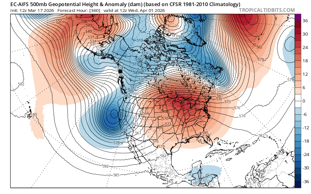
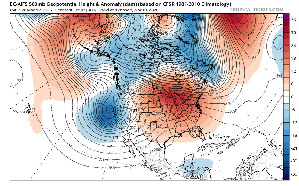
12z Euro AI has a more Spring-like configuration in la-la land. Most of the cold is crapped out of Canada as well
-
Outside of a renegade snow, most likely done for most of SNE as well
-
Just like the frigid March you promised, then we are breaking record highs
-
Nice slug of rain approaching BID!
-
65!
-
-
nice severe KY/TN
-
Lfg
-
that's probably going to be close to reality. Not bad
-
Wind is really whipping up the trash and debris. Especially lowell, just ripping litter with reduced vis
-
Maybe next October
-
Snowing
-
enjoy the cool dry wx
-
yeah most SNE winter weenies have long checked out
-
yeah let's get some wind damage, much more interesting than 1" of glop that melts as it falls
-
super nino lfg...19 months to go?
-
beyond that it snows in October and May, but it's not winter...nothing close. I guess late March/April can be "winter-like" in the mountains, that aside it's done
-
you'll see more snow but I don't consider it "winter" when it's late March or April regardless
-
sadly, that is most likely correct. forecast be damned, wet roads, non-accumulating snow, etc. we're gonna dump
-
DPW crapped on all the main roads with salt here. What a nasty stupid waste