

Sernest14
-
Posts
340 -
Joined
-
Last visited
Content Type
Profiles
Blogs
Forums
American Weather
Media Demo
Store
Gallery
Posts posted by Sernest14
-
-
Power back on for now. Still nice gusts with light/moderate
-
Has been moderate all snow for the past hour or so just north in Ashland
-
 1
1
-
-
How do y’all upload pics? I keep getting file too large error
-
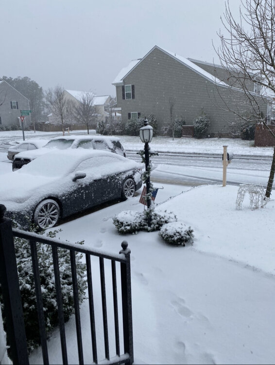
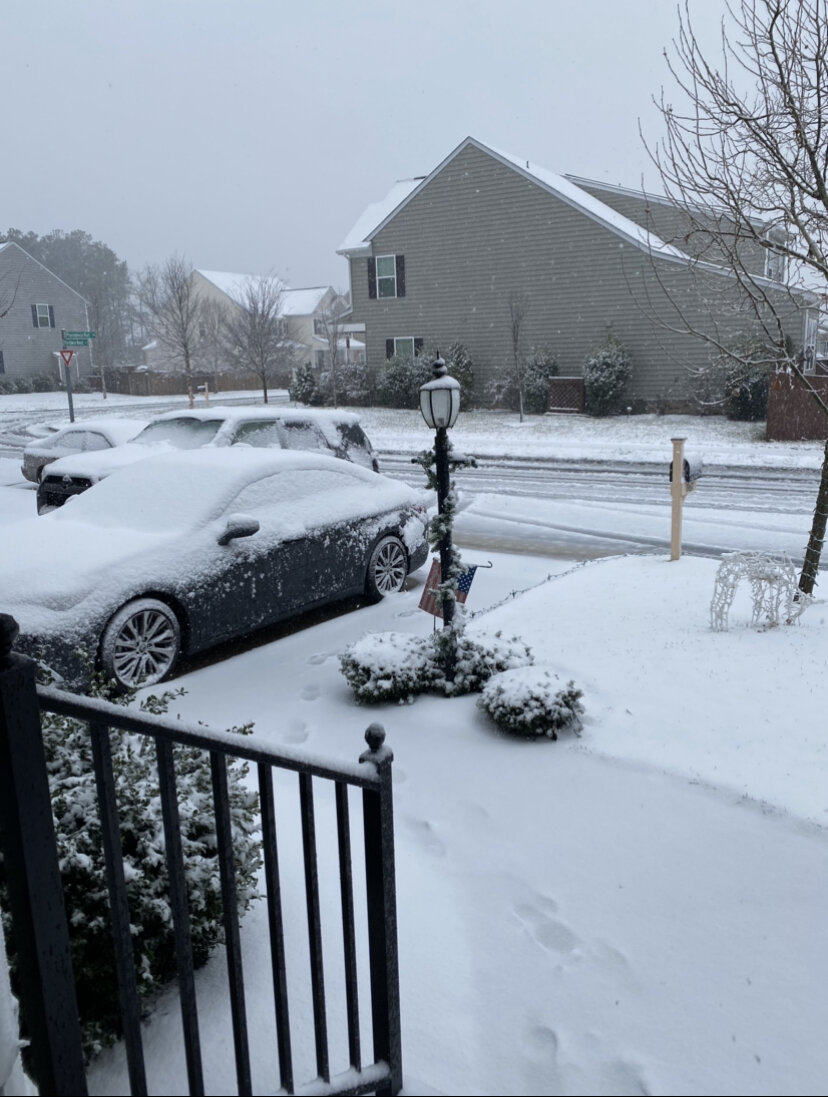
Woke up to no power and covered everything in sleet/snow. Wasn’t expecting it like this until a few more hours
-
5 minutes ago, CoastalWx said:
The issue is not ratios. Not sure I follow that logic.
Assuming he’s talking ratios in terms of more compaction and on the heavy/wet side which would likely drop it to more of a 6:1-8:1
-
HRRR trending wetter and longer duration. .2-.25” for the AM ending around noon
-
3
-
-
8 minutes ago, eaglesin2011 said:
Stil will be a 2nd batch later tonight into the morning..its probably a good thing we will get the break to avoid major issues...
Looks like the NAM lost that 2nd batch - HRRR does show lighter (.08")
-
1
-
-
Kind of wish this wasn't ending in 2 hours - different type of storm and fun to watch.
-
Got a little base of sleet for the rest of the freezing rain, should be bad for what surfaces were doing ok

-
1
-
-
Looks like it'll end really early compared to originally modeled? HRRR and NAM showing sometime between 1-2pm with an isolated shower
-
dumping sleet at the moment - don't think i've seen it this heavy.
-
HRRR got uglier though, by a lot
-
7 minutes ago, RVASnowLover said:
Not really. It just shifted the heavier precip south. Petersburg still gets crushed
Yeah definitely not good for them, looked to me that RIC metro and points west and north seem to have .15”-.25 cut
-
I was just about to say we may get out of this lucky haha - looked like less frozen and cutting ice totals on NAM by a bit (at least what was posted in the main forum)
-
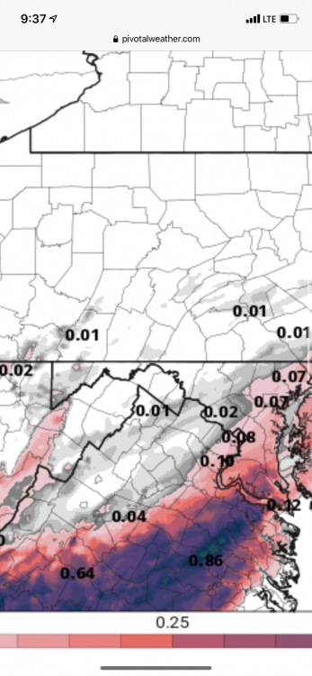
anyone know where to get the sleet maps? trying to see through 15z tomorrow when the freezing rain starts accumulating (~.1" at that point)
-
2 minutes ago, eaglesin2011 said:
Did anything change from the last warning? Dosnt look like it to me for our area???
Looks to still be the same:
URGENT - WINTER WEATHER MESSAGE
National Weather Service Wakefield VA
310 PM EST Wed Feb 17 2021

VAZ080-513>516-180415-
/O.CON.KAKQ.WS.W.0003.210218T0600Z-210219T1200Z/
Dinwiddie-Western Chesterfield-
Eastern Chesterfield (Including Col. Heights)-
Western Henrico (Including the City of Richmond)-Eastern Henrico-
Including the cities of Reams, Bon Air, Midlothian, Chesterfield,
Chester, Colonial Heights, Richmond, and Sandston
310 PM EST Wed Feb 17 2021

...WINTER STORM WARNING REMAINS IN EFFECT FROM 1 AM THURSDAY TO
7 AM EST FRIDAY...

* WHAT...Snow and sleet followed by an extended period of freezing
  rain. Total snow and sleet accumulation of up to one inch and
  significant ice accumulation of three tenths to one half of an
  inch.

* WHERE...Western Chesterfield, Eastern Chesterfield (Including
  Col. Heights), Western Henrico (Including the City of
  Richmond) and Eastern Henrico Counties.

* WHEN...From 1 AM Thursday to 7 AM EST Friday.
-
18z NAM still says >.5" ice
-
4 minutes ago, eaglesin2011 said:
Well your Also in Ashland right big difference from Richmond where its reporting 41
Its 40 at the moment here in Glen Allen
usually only a degree off at most from GA and like 2 from RIC. Where's best place to view reports? I'm seeing like a 3 degree difference for ashland depending on where I check.
-
HRRR 18Z drops ice down for us to under .25" but really hits us more with sleet at a decent clip 9am -1pm.
-
temps seem to be busted low (gauging apps/sites we're at 37 with a forecasted high of 39)
-
2 minutes ago, Rvarookie said:
Is it trending drier? Or shifting precip elsewhere?
There's a few bands - i think it's trending a little drier with us but still most have us between .8" - 1"+ in total precip.
-
Just now, mikeeng92 said:
HRRR is starting to show no sleet/snow. Just straight to freezing rain tomorrow morning.
Also that initial heavy thump is happening overnight which will make it worse.
-
19 minutes ago, Rvarookie said:
How we looking?

Looks like an inch of sleet followed by .3"-.5"+ ice (some models show more ice but think .3" is the low end)
-
 3
3
-
-
Also, Northern Tool over by Rooms To Go was where we got ours a few years back. I'd check there too
And should have read the other comments first haha
-
1
-

Richmond Metro/Hampton Roads Discussion
in Mid Atlantic
Posted
First measurement (grass) 3.25” about 30 min ago. Other hard surfaces about 2”