

Sernest14
-
Posts
340 -
Joined
-
Last visited
Content Type
Profiles
Blogs
Forums
American Weather
Media Demo
Store
Gallery
Posts posted by Sernest14
-
-
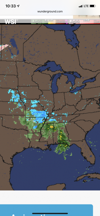
Radar still seems a lot more put together and larger areas of precipitation (especially north) than what models have been and continue to depicts. Will be interesting to see how long that northern half stays together as most have that gone by now or later afternoon
-
18 minutes ago, RVASnowLover said:
Well onto the next one
Eh, see what it’s like at 12z. Pretty big change with 0z on the whole northern half of the system. Hopefully a hiccup- RGEM running now so we’ll see if that follows suite too
-
 2
2
-
-
Well the Nam crapped the bed on the 0z runs. VA pretty much shut out even at the NC border for south central. Solid run if your in Hampton roads towards Virginia Beach. Nice heavy dumping for a little on the tail end
-
Radar looks a bit more amped and quicker than models at this point which should be a good sign for the trend to continue
-
1
-
-
Just now, Hyphnx said:
But when that snow line hits us in the NAM 18z.. it's a ton. Like.... high ass rates.
Yeah it's a crush job from about 6-9/10 buuut if that same hits a few hours earlier then we could be looking at a longer duration as well which could up the totals a little bit before the change.
-
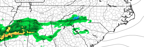
even 3k 18Z looks much slower and less expansive
19Z Tues
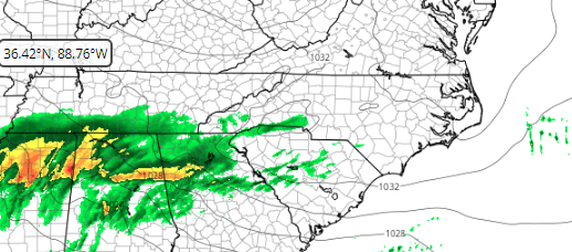
01Z Wed
-
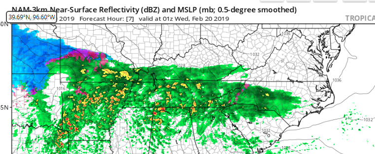
Yeah I'm not sure if the HRRR is picking up on the eastern side of this storm very well. Below is 00Z Wed. followed by current radar. You can see the massive expansion east already (9 hours early) plus some heavier precip in Georgia/SC
Current Radar:
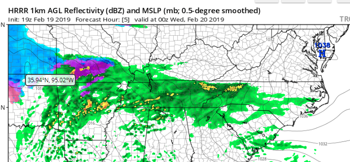
HRRR at 16Z to give some comparison
-
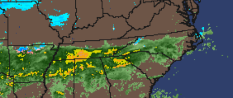
the radar continues to look much more expanded eastward than models want to show. not sure if this means we'll see more of a front end thump before the changeover. looks to me that where the radar is now is what the models show for 0z wed.
-
1
-
-
2 hours ago, Hyphnx said:
We have not. Our time has come!
We had an area wide 2-4” in January
-
Right at 4” total for Ashland
-
2
-
-
Flipped from heavy sleet to snow in Ashland about 15-20 min ago, close to 1/2” since the flip

Richmond Metro/Hampton Roads Discussion
in Mid Atlantic
Posted
3k nam