

Sernest14
-
Posts
340 -
Joined
-
Last visited
Content Type
Profiles
Blogs
Forums
American Weather
Media Demo
Store
Gallery
Posts posted by Sernest14
-
-
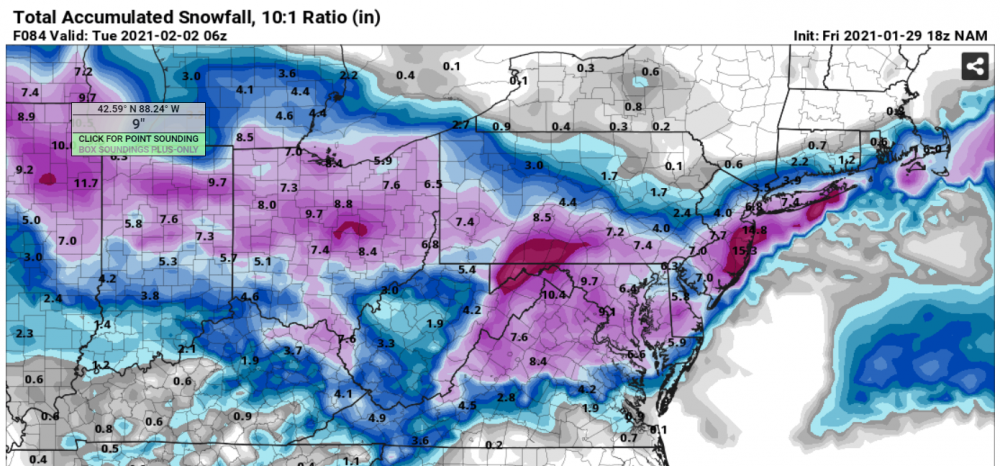
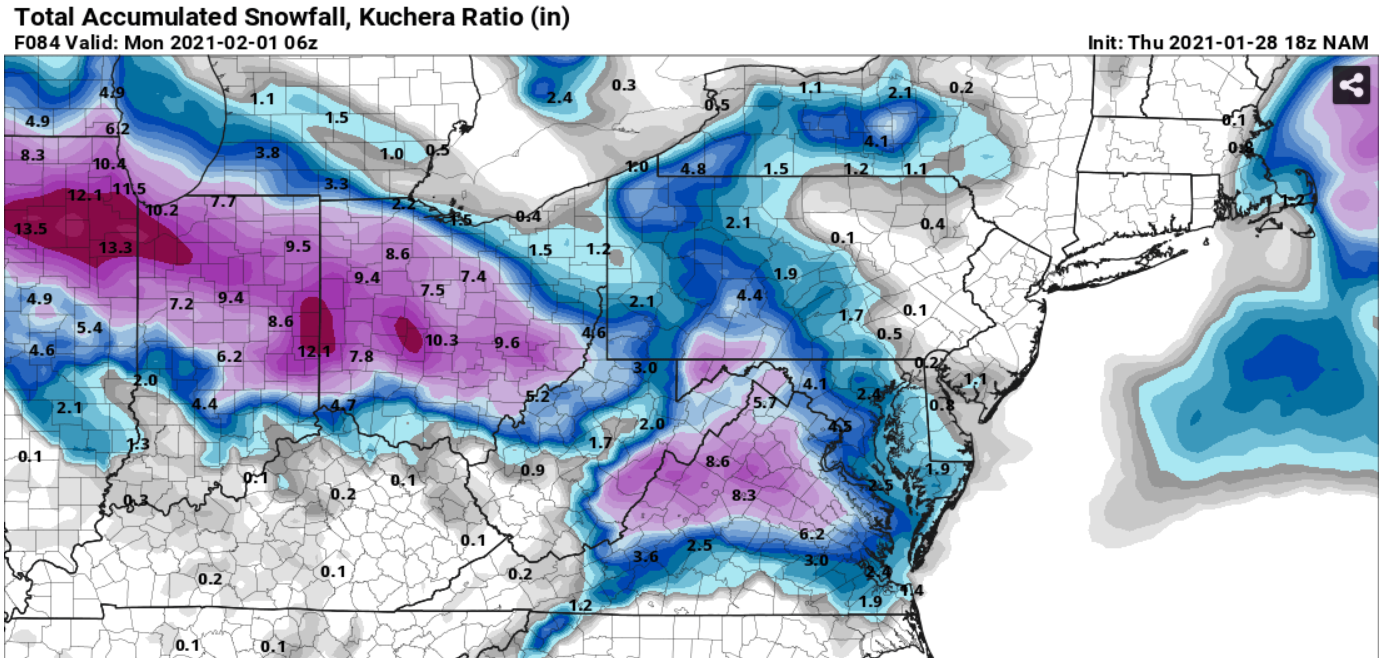
18z NAM 3k is ugly. Lucky to get an inch. not as amped on the initial thump and temps are higher than what we’ve seen.
Per pivotal- just checked TT and that looks more in line with other models. No idea how the algorithms are so far off for the same model?
-
Actually not sure if that temp is right? Going by phone and seeing 37 on one and 40 on the other ?
-
We’re also at 37 from a forecasted 39 so hoping those 2 degrees continues to carry and helps
-
 1
1
-
-
Same with Ashland on the warning still in place for 4-6
-
3 minutes ago, RIC Airport said:
Different algorithms.
Thanks! I'll switch to looking at the algorithms that give us more

-
 1
1
-
-
^^NAM 18Z - why are these so much different?
-
1
-
-
-
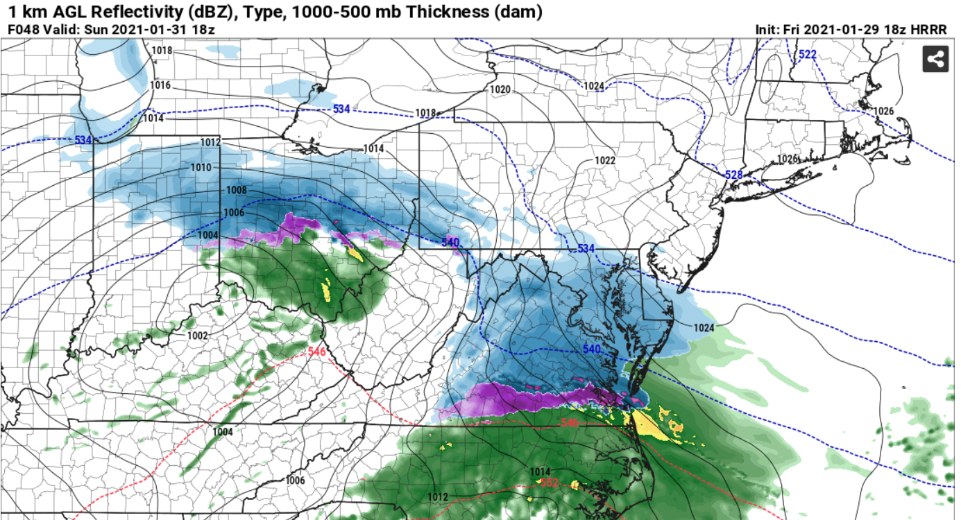
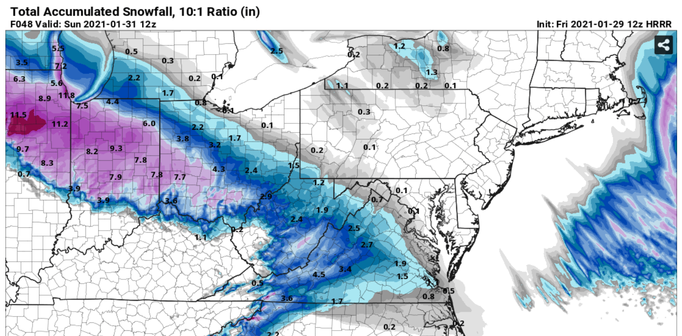
18Z HRRR looks good through 48:

-
16 minutes ago, eaglesin2011 said:
Can someone post the models predictions for the front and back end dumps.
I haven't seen anything more than 1" on recent models for the back end - everything is more or less the front. Dry slot and then maybe some light snow/showers for a few hours
-
UK 12Z with another good hit
 UK
UK
-
2
-
-
Not sure how well the HRRR generally holds up but that does look like it would be better for us. Cold extends pretty far to our south so don't see any change to rain like the Nam

-
2
-
-
Just now, JB Fins said:
That's a slight improvement for us in central VA compared to previous runs is it not? 0.4 to 0.9?

Has the EURO ever caved to the NAM? I know they all have their victories but hard to bet against the King in winter.
True but Nam only goes to 60 so that's with 6 hours of additional precip haha
-
3K Nam bad for everyone Sunday compared to what we have been seeing- the initial thump has essentially gone away for most.
-
 1
1
-
-
Yeah that is good but at 42 hours it's showing a slight N movement compared to 18. Hopefully changes back south a little as it moves across OH Valley
-
1
-
-
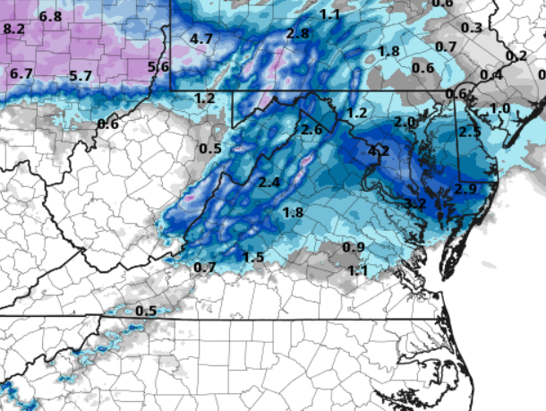
Bad NAM run for us - a lot of sleet and freezing rain - definitely a shift N with only 1" on the initial thump.
-
Freezing line has moved north from 18Z NAM to 0Z for early Sunday AM
-
HRRR and Nam are pretty close (HRRR more amped) at 48
-
-
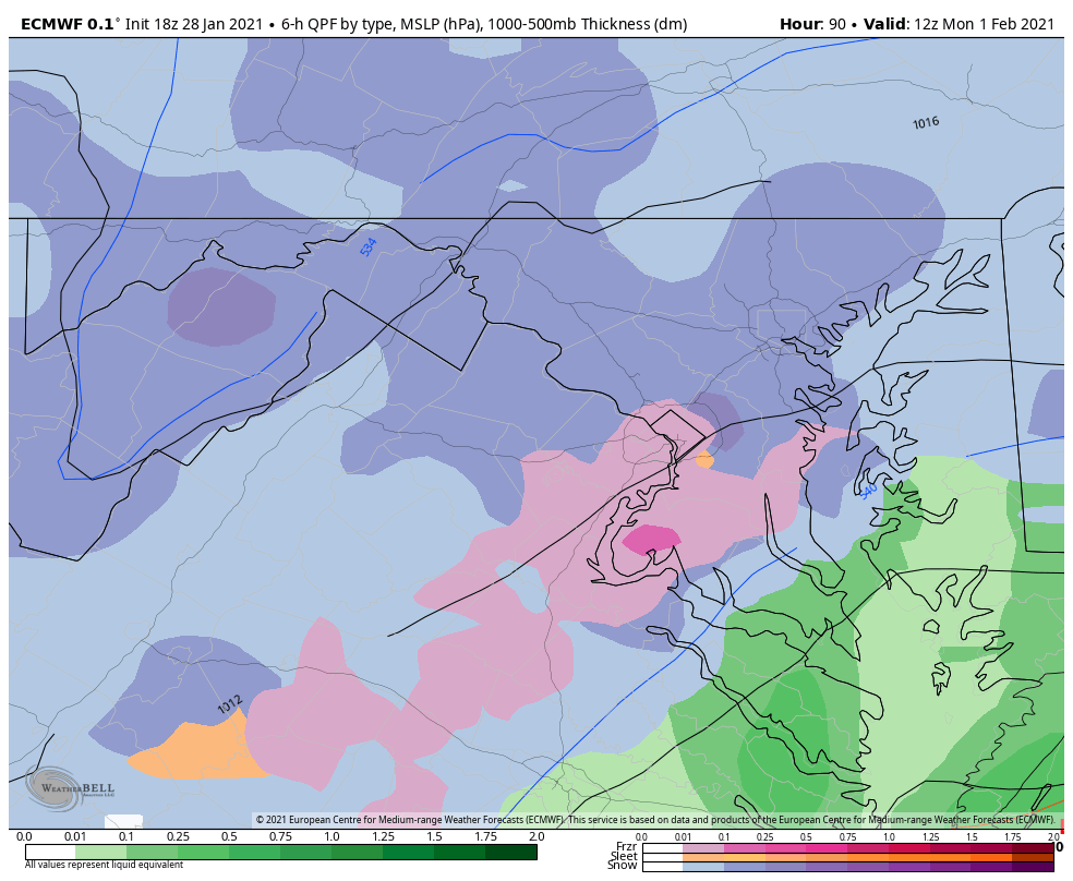
Euro run keeps the cold around longer and decent front thump again. 12z Monday still has snow north and west of city with a 295/95 cutoff east for rain
-
2
-
-
5 minutes ago, RVASnowLover said:
18Z GFS was a step in right direction. Doesn't give us much snow but more than it has been.
Still way too warm but getting closer - has the area getting into the low 40s overnight Sunday. Just don't see that happening
-
2
-
-
-
Hoping that 32-33 that we keep getting forecasted can be pulled down a couple degrees from the initial thump and not push us above freezing until the dry slot.
-
1
-
-
Through 114: Euro nothing to write home about - looks like a 3-4" - precip switches to a light rain Monday and back to light snow 0Z Tuesday. Really a lack of moisture in our area this run. Good initial lump but lacking after 18z Sunday. Still a little wrap around to come through but don't anticipate more than an inch with that
-
Great UK run for the area - 7" through first 12 hours with a lengthy break (hopefully we can stay a little cooler - at around 33 degrees all day Monday but this is during very light precip or dry slots) with an additional 1-4" depending on area to finish off the storm.
-
2
-

Jan 31st - 33rd Storm Obs and Disco like it's 1979
in Mid Atlantic
Posted
Anyone know why the 3k NAM are so different between TT and Pivotal?