Weather Will
-
Posts
7,313 -
Joined
-
Last visited
Content Type
Profiles
Blogs
Forums
American Weather
Media Demo
Store
Gallery
Everything posted by Weather Will
-
EURO AI remains weak sauce and south.
-
The tracking so long is really exhausting. Really need to dial back until we get inside 5 days to keep one's sanity. Just look at whether pattern is favorable outside 5 days rather than focus on a particular shortwave.
-
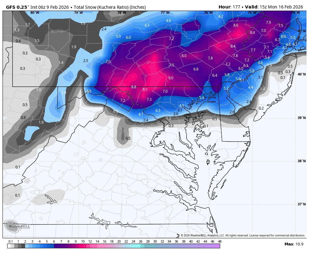
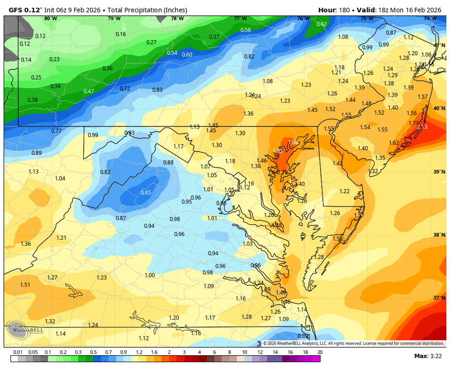
Have a system to track inside 5 days.. 12Z model summary. GFS: still a southern slider with no phasing. Heaviest precip. southeast; DC about .3 inch; temps upper 30s-40s SE. Canadian: less amped this run so not as cold; but still snow for NW burbs. Precip. 1-2 inches; 6 inches snow NW; 2 inches DC; temps mid 30s this run compared to upper 20s last run.
-
WB latest EPS extended control will verify.....Ji get the Tylenol....
-
Kind of exhausted tracking the last two weeks; get something showing up inside 5 days and I will get back on the saddle...
-
WB 18Z AI EPS tanked like the GEFS.
-
WB 18Z GEFS says it is over for this weekend.
-
The WB 18Z GFS is awful for several reasons. 1. The high is way off the east coast allowing for SE winds 2. The upper level low is tracking too far south and therefore so is the surface low. 3. The surface low is weak. 4. We have marginally cold air at best so without a near perfect alignment of the high, upper level low, and surface low, we get rain or nothing at all. Looking for the more perfect alignment? How about the New Canadian model at 12Z. (Pictures below 10pm Sunday.)
-
WB 12Z Euro and Ai at 7 pm Sunday. Maybe they meet in the middle....
-
12Z ICON is all rain with low heading through western Ohio into PA.
-
Maybe I looked at too many maps the past two weeks. Look at the latest NAM highs: are lower than I thought were forecast for this week. WB 12Z 12K NAM for 4pm Tues, Wed and Th.
-
Compared to WB 6Z AI EPS at Day 6.
-
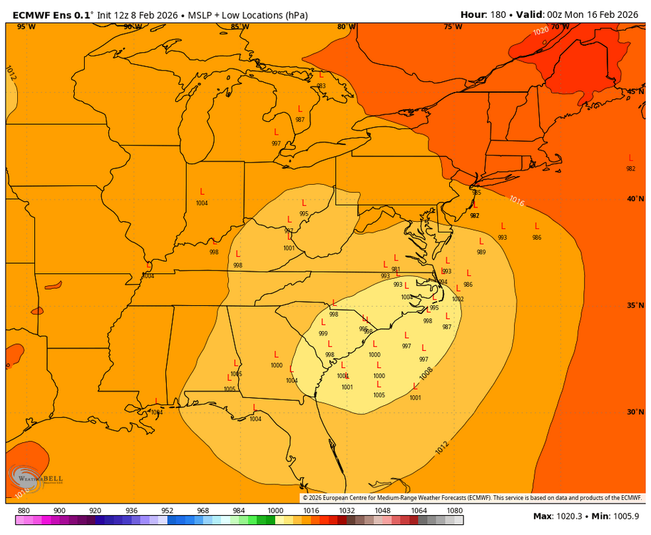
WB 6Z EPS pressure locations Day 6. Still some spread.
-
WB 6Z EURO much further north compared to AI. Track still very uncertain.
-
WB 6Z AI stays to the south for the weekend.
-
At least the NWS is not saying partly sunny for Sunday anymore! Sunday A chance of rain and snow. Cloudy, with a high near 39. Chance of precipitation is 50%.
-
WB 6Z GFS. Low dies over Tenn. Valley this run and starts a slow transfer to the coast.

-
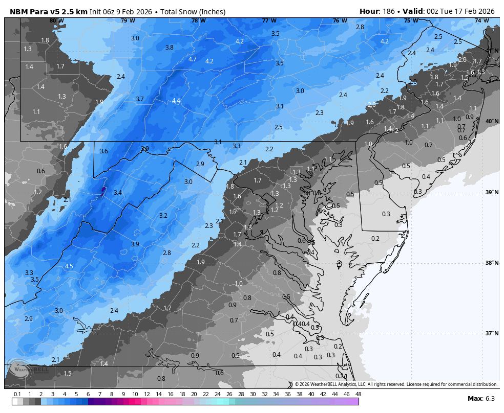
WB 6Z NBM para for weekend

-
0Z ICON has a low moving through the Ohio Valley bringing a wintry mix quickly changing over to rain this weekend.
-
NWS forecast for Sunday shows the uncertainty in the forecast but I don't know how they can word it this way. It's worthless. Sunday A chance of rain and snow. Partly sunny, with a high near 41. Chance of precipitation is 40%.
-
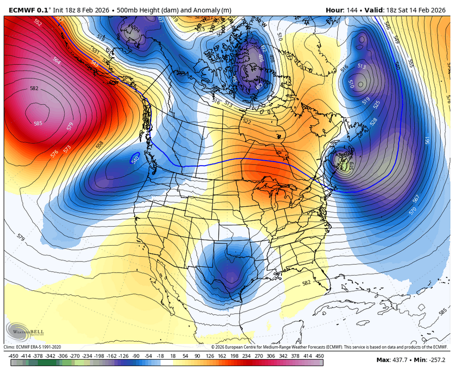
WB 18Z EURO: impressive vortex heading east but I don't know how it is going to be cold enough by the time it gets here unless the track is perfect. Also noticed no 50-50 low this run which makes it even harder.
-
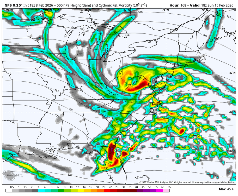
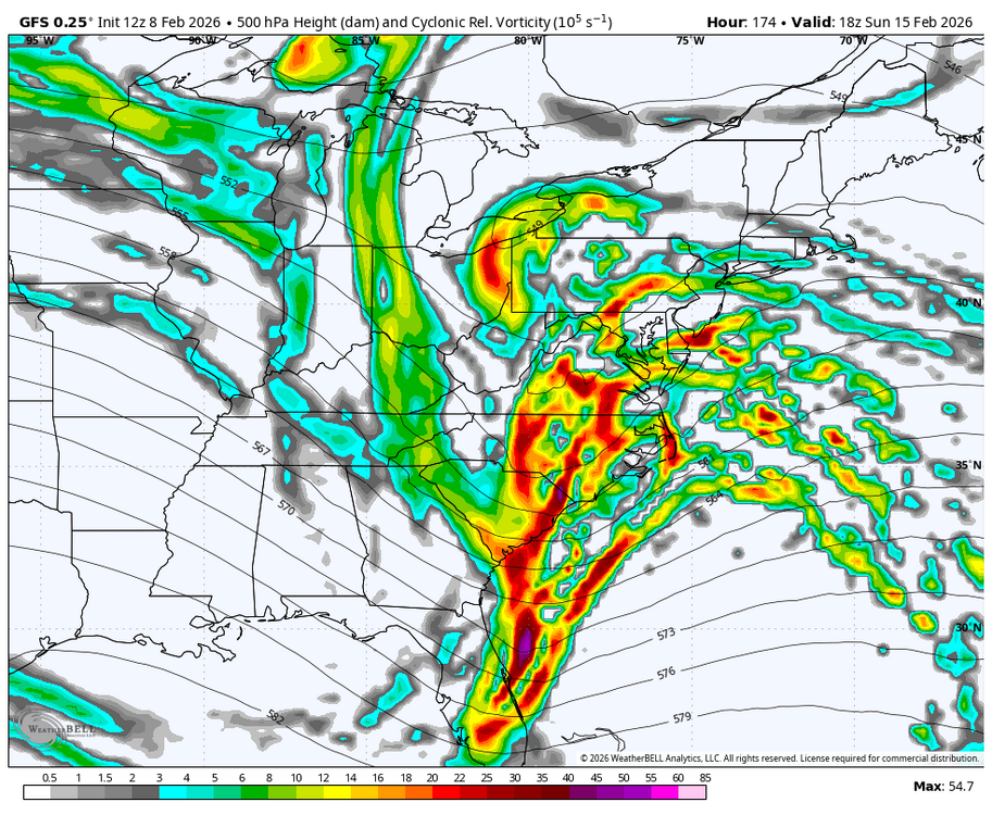
Was it that or lack of a phase. Northern stream was dominant? See WB 18Z GFS compared to 12Z.
-
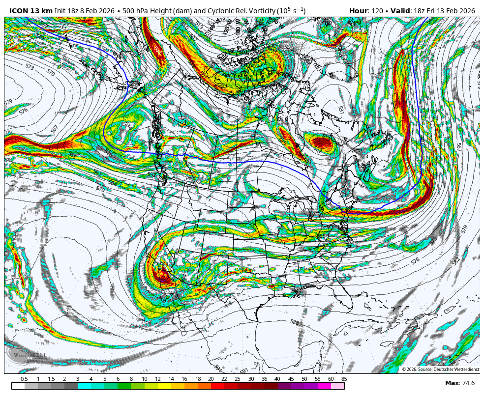
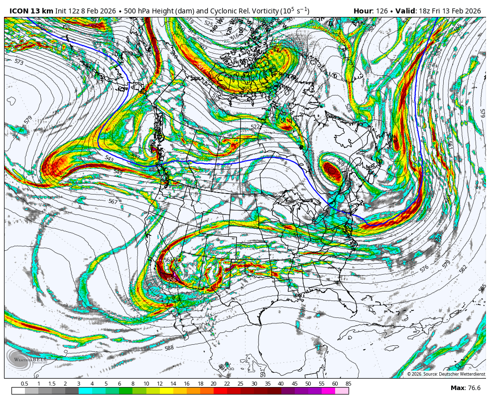
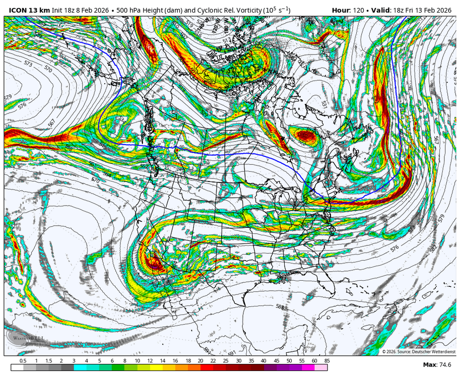
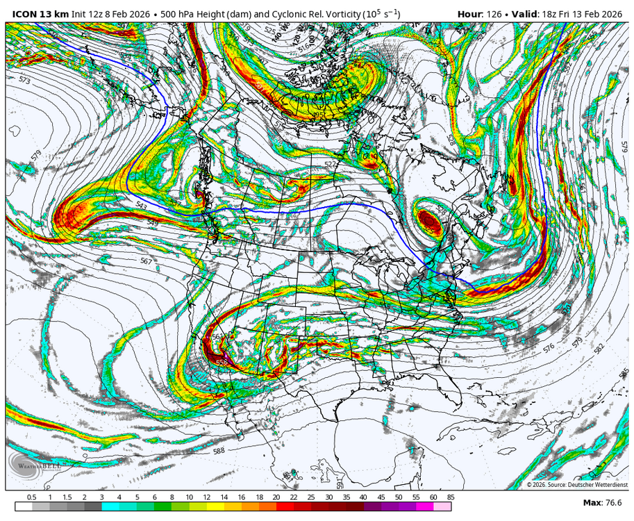
WB 18Z ICON at 120 compared to 12Z
-
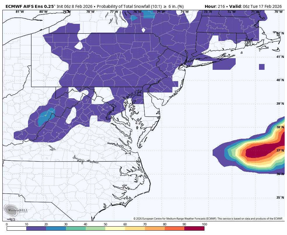
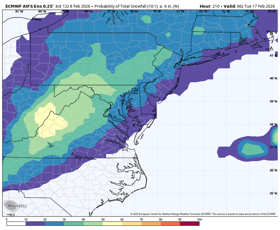
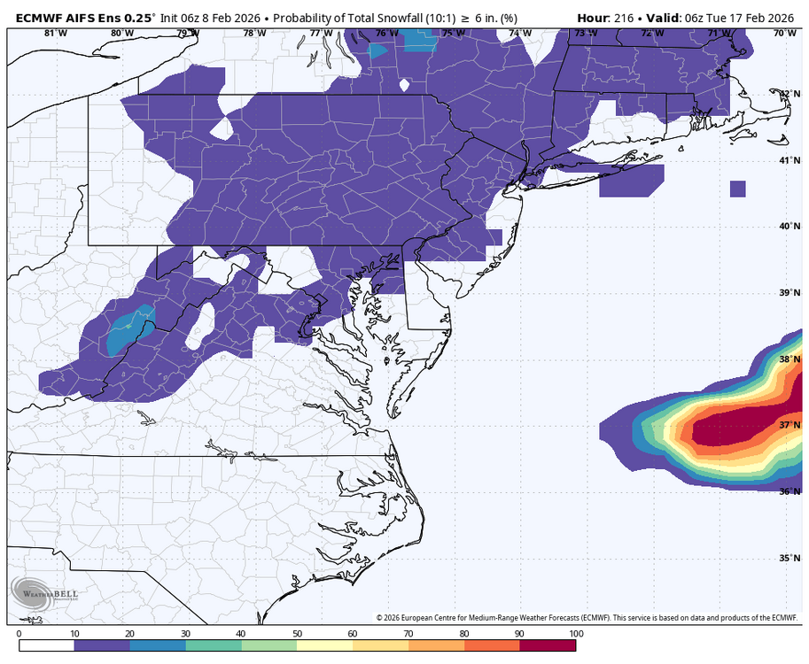
WB EPS snow prob. Greatly increased between 6Z and 12Z. Blip or new trend TBD. To illustrate, see 6 inch prob. at 12Z compared to 6Z.
-
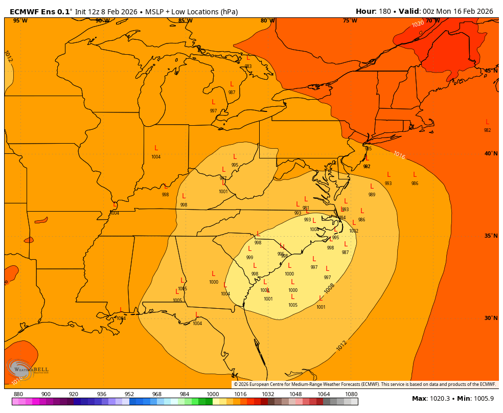
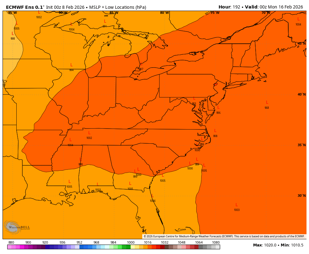
We really need to appreciate that the EURO is really just catching on....compare WB EPS low positions at 12Z compared to 0Z.