ChiTownSnow
-
Posts
814 -
Joined
-
Last visited
Content Type
Profiles
Blogs
Forums
American Weather
Media Demo
Store
Gallery
Everything posted by ChiTownSnow
-
Confirmed..had a brief period of snow which led to a quick dusting in spots
-
++ New Years Day
-
Go Notre Dame!
-
Idk..latest NAM looks like it'll be close
-
Not sure on this one..I get the whole pac moisture feed in cold sector. But isn't there still is a warm sector to this with some sort of transport of moisture into to the cold sector, albeit short lived?
-
Qpf mean has been pretty consistent for ORD. What has changed over time, has been less mixing issues and mostly all snow
-
It was one of LOTs "caveats" in yesterday's AFD. As a possible scenario for lower end totals
-
It is New Year's Eve
-
I think ALEK needs a friendly well being check.. make sure he's doing ok
-
Mostly all snow now is the difference. But it did bump qpf up slightly
-
He's getting more and more bullish in his old age.
-
Plumes steady at 5 at ORD with a cluster higher
-
Yeah I guess waiting for the rest of the model runs before making changes? Surprised to they still posted the map instead of waiting.
-
LOT snow map seems pretty bullish 4 to 8 across the metro plus lake enhancement https://www.weather.gov/lot/weatherstory
-
Still can give us 2-4 + lake enhancement. I wouldn't call it a full dud
-
Looses it's moisture feed as it moves further east, and as the ULL moves further away from the deformation band. I was hoping that secondary woud help continusely feeding it moisture, but doesn't look like that'll happen
-
When is full sampling of models Or has that already happened?
-
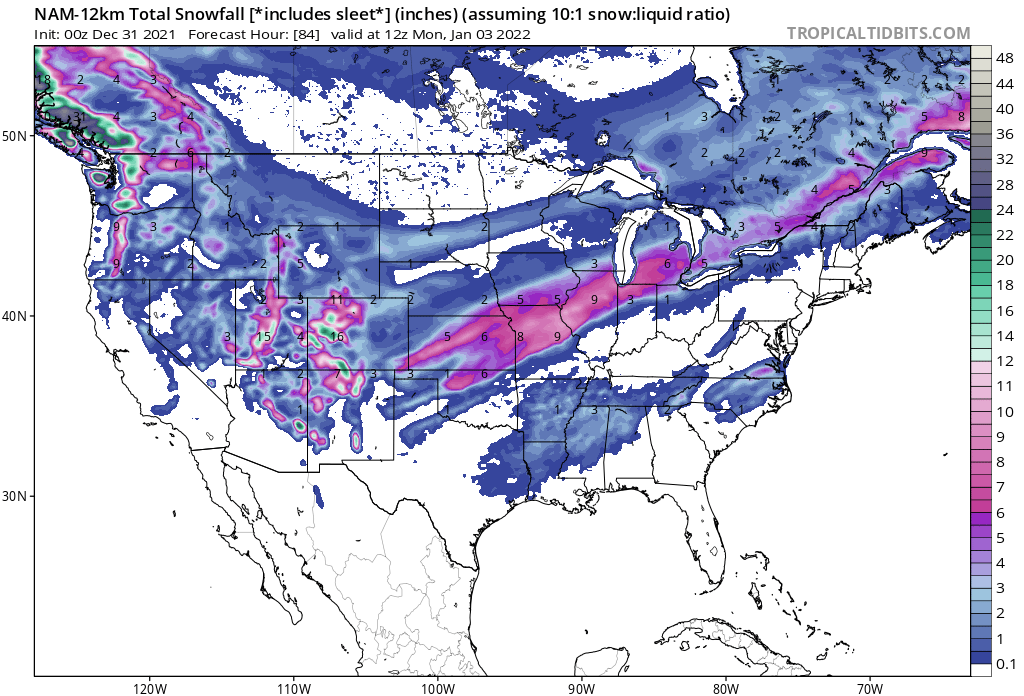
Overall a pretty solid hit for Chicago on 00z NAM

-
Seems like HRRR timing is much faster/earlier?
-
Plumes for ORD back up to 0.67 mean qpf. Not all snow verbatim but that can be argued a bit IF all snow, figure mean 7 inches at 10:1. Add in better ratio per LOT at 20:1 for a bit, and can easily argue the 6-10
-
LOT mentions the below caveats In their discussion 1). The leading and secondary troughs phase more than currently anticipated, leading to the surface low path much further northwest than advertised. In this scenario, a much larger portion of area would end up with a cold, wet rain with the southern edge of the snow roughly along a line from Dixon to Waukegan. While displayed by NAM/SREF guidance, we (as well as WPC) believe this outcome is unlikely. 2). Convective episodes across the Lower Mississippi River Valley muddy the surface low pressure pattern leading to a more "sheared" out wave and less forcing overall. While this would not necessarily shift the zone of anticipated accumulating snow, eventual amounts would end up lower than in our forecast (more in the range of 3-5" instead of 6"+). We saw this occur with a similar-looking storm system in February 2020. Of the two possible failure modes, this appears more realistic.
-
Wait. Didn't really materialize
-
Secondary wave playing catch up. Maybe similar to what EURO was showing earlier
-
Ha.. It's more about the trajectory and duration of the event
-
I've learned to be happy with a 5 inch total