

Malacka11
-
Posts
2,395 -
Joined
-
Last visited
Content Type
Profiles
Blogs
Forums
American Weather
Media Demo
Store
Gallery
Everything posted by Malacka11
-
Easy inch plus here fucking never heard something like this before
-
Nice watch
-
This is fucking cool we do indeed need all four seasons
-
I thought you were talking about a bug this am
-
Fr he's always set the standard. I think it's just a Simpsons reference fwiw having done some googling
-
That part I got, I meant literally what is "smarch" a combination of if morch is march+torch
-
I'm sorry I'm pretty sure I understand the vibe but what is smarch again
-
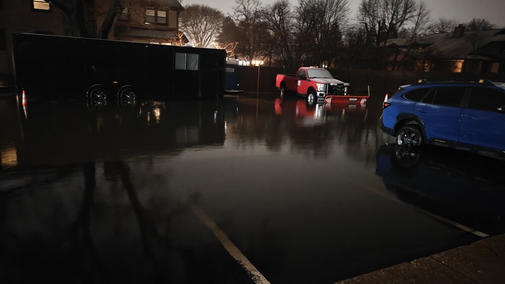
This is what my parking lot looks like atm. The tornado intercept shitbox is sitting right outside frame also partially submerged. This does happen every time it rains somewhat hard apparently.
-
We actually changed over here in westmont atm. Heavy pixie dust still but at least it's changed over. Don't really expect to be on the right side of the band tonight but just getting the grass white for the cold is swag
-
It's a sign you're successfully reeling the slablizzard in
-
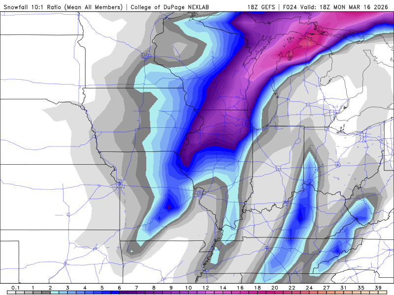
Best model
-
The qualm before the storm
-
So mysterious
-
Is the nam actually doing something legit or is that just noise? I understand that we've been trending minorly better for NE IL again but
-
Will certainly be a fun 24 hours. See how long it'll take gusts to start, hoping for some good GV storms maybe in a few hours, and I'd love to reel in some surprise death band tomorrow morning with winds but not holding onto that one ofc. Would love to see it happen though
-
If we're getting one more semi decent clipper in a few days then covering the grass with this one first would be cool. Ik I was talking big game about 12" or leave it but I hadn't fully processed that we could have one more mini winter period if we just get enough to stack at least Especially with the cold that comes part and parcel might as well play pretend one more time before next year
-
So it really is just a new thing huh
-
Gfs slightly better?
-
That's an almost comical cutout of Iowa
-
18z moment
-
If it's less than 12" here personally I'd rather just let WI get their 30"
-
I was literally waiting
-
Does this still count as the storm that you postered something about like three weeks ago re it being only 60-something runs out? Iirc it's only a day off right
-
According to googler Ai slopolopolis some previous 8 in stone was close to 2 lbs. Could you imagine getting hit in the head w a mini gym weight falling out of the sky at 100+mph? Shit could glance off my back and I'd probably choose to die anyway.
-
@frostfern I only have one 18-second long video that both of the other screenshots I shared were taken from. The transformer flash is visible at the end, barely; please don't mind my terrible camera work Btw maybe I'm reaching but what's going on at the far left end of the base there?


