Sw NC weather
-
Posts
629 -
Joined
-
Last visited
Content Type
Profiles
Blogs
Forums
American Weather
Media Demo
Store
Gallery
Everything posted by Sw NC weather
-

2024-2025 Fall/Winter Mountain Thread
Sw NC weather replied to Buckethead's topic in Southeastern States
Already at 1.62” on the day. Things are gonna get bad quick by tonight. -
2024-2025 Fall/Winter Mountain Thread
Sw NC weather replied to Buckethead's topic in Southeastern States
This is starting to get a nasty look to it. If the predecessor rain comes through and then a strong core moves over top we’re in a lot of trouble. Every 12z model I have looked at is spitting 6”-12” out for WNC. -
2024 Spring/Summer Mountain Thread
Sw NC weather replied to Buckethead's topic in Southeastern States
Looks like a good bit more coming in out of N GA and TN. -
2024 Spring/Summer Mountain Thread
Sw NC weather replied to Buckethead's topic in Southeastern States
Gonna miss me to the south, it has fallen apart some as well. -
2024 Spring/Summer Mountain Thread
Sw NC weather replied to Buckethead's topic in Southeastern States
Big time storm rolling into Macon County. I’m in the NE part of the county I’ll let you know how it is when it comes thru. -
2024 Spring/Summer Mountain Thread
Sw NC weather replied to Buckethead's topic in Southeastern States
Bottomed out at 30 this morning. -
2024 Spring/Summer Mountain Thread
Sw NC weather replied to Buckethead's topic in Southeastern States
31 last night here north of Franklin. Looks like another cold coming tonight. -
2023-2024 Fall/Winter Mountain Thread
Sw NC weather replied to The Alchemist's topic in Southeastern States
Lots of thunder and lightning out this morning. -
2023-2024 Fall/Winter Mountain Thread
Sw NC weather replied to The Alchemist's topic in Southeastern States
Finally turned over to all snow but sitting at 35.1 degrees. Coming down at a decent clip. -
2023-2024 Fall/Winter Mountain Thread
Sw NC weather replied to The Alchemist's topic in Southeastern States
Nam continues to look really good for you border guys. Hope yall get smoked.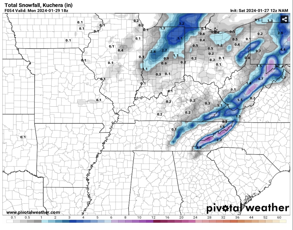
-
2023-2024 Fall/Winter Mountain Thread
Sw NC weather replied to The Alchemist's topic in Southeastern States
Bottomed out at 2 here this morning. -
2023-2024 Fall/Winter Mountain Thread
Sw NC weather replied to The Alchemist's topic in Southeastern States
Already a dusting in northern Macon with light snow falling. Radar looks good! Maybe I can squeeze out my first inch of snow this winter. -
2023-2024 Fall/Winter Mountain Thread
Sw NC weather replied to The Alchemist's topic in Southeastern States
Wow, I live on a north side but I didn’t expect this. Temp hovered 33-34 all night but there is a 1/10” ice on everything. Almost fell walking out to the truck. -
2023-2024 Fall/Winter Mountain Thread
Sw NC weather replied to The Alchemist's topic in Southeastern States
32.5 and light rain falling. May be a bit slick out in the morning. -
2023-2024 Fall/Winter Mountain Thread
Sw NC weather replied to The Alchemist's topic in Southeastern States
6.6 here, luckily very little wind. -
2023-2024 Fall/Winter Mountain Thread
Sw NC weather replied to The Alchemist's topic in Southeastern States
I’m kinda of tied up in Macon right now with work. I know there’s some land above rainbow springs available above 4k. -
2023-2024 Fall/Winter Mountain Thread
Sw NC weather replied to The Alchemist's topic in Southeastern States
I’m looking at a tract of land that ranges 3100-3500 here in Macon. But will be 3-4 years before I can afford to build. -
2023-2024 Fall/Winter Mountain Thread
Sw NC weather replied to The Alchemist's topic in Southeastern States
We may just have to move up the mountain and be buckethead’s neighbor. -
2023-2024 Fall/Winter Mountain Thread
Sw NC weather replied to The Alchemist's topic in Southeastern States
It’s gotta happen eventually, I’m hoping February will be rocking. Only a 1/2” here this season. Average is about 11.5”. -
2023-2024 Fall/Winter Mountain Thread
Sw NC weather replied to The Alchemist's topic in Southeastern States
I know what you mean. Had a rain snow mix all evening while the mountain in front of the house was dumped on with a few inches. -
2023-2024 Fall/Winter Mountain Thread
Sw NC weather replied to The Alchemist's topic in Southeastern States
Looks like yall northern mountain people will be getting smoked over the next hour or so. Temp is down to 33 here hoping the batch from Chattanooga will stay far enough south for me to get a inch or two at the house. -
2023-2024 Fall/Winter Mountain Thread
Sw NC weather replied to The Alchemist's topic in Southeastern States
Down to 35.9 here a few more snow flakes are starting to mix in. Snow line is right at 2900’ here. -
2023-2024 Fall/Winter Mountain Thread
Sw NC weather replied to The Alchemist's topic in Southeastern States
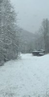
Had a rain/ snow mix at the house around 30 minutes ago. Rode up the mountain and it’s flat coming down with about 1.5” on the ground. Radar looks promising as well. Do we pull a last minute miracle out of this thing? -
2023-2024 Fall/Winter Mountain Thread
Sw NC weather replied to The Alchemist's topic in Southeastern States
GFS says we might do better Friday morning.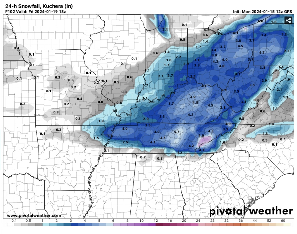
-
2023-2024 Fall/Winter Mountain Thread
Sw NC weather replied to The Alchemist's topic in Southeastern States
Just light drizzle in Northern Macon. Temp rose to 36 overnight.
