-
Posts
2,988 -
Joined
-
Last visited
Content Type
Profiles
Blogs
Forums
American Weather
Media Demo
Store
Gallery
Posts posted by CheeselandSkies
-
-
Thought it was just my 2009 Corolla because I don't really care how it looks anymore, but I realized this morning that every car left outside has a grubby, dusty film all over it from the combination of prolonged dryness, air quality issues and construction zones everywhere. I ran the windshield sprayers to clear it out of my view and the fluid ran down black and streaked when the wipers hit it.
Sent from my Pixel 4a using Tapatalk -
Grass turning brown about 3 weeks after it finally turned fully green.
Sent from my Pixel 4a using Tapatalk -
Once again here we are almost to June, and every thunderstorm I've seen this year was because I drove to it.
-
 3
3
-
 1
1
-
-
Quote
As for any chance for rain.... chances are still very low to zero
across southern Wisconsin. There will be some low chance POPs in
the forecast at times for the middle and end of the week. These
low end POPs are a result of some shortwave troughs and low
pressure systems working through the upper level flow and riding
over the high pressure system. With moisture expected to be low
during this time and the better lift well to our west its unlikely
these low chance POPs will amount to anything down here. The more
likely solution at this time are these low chance POPs decreasing
or being removed as we get closer.

Patterson

-
2 hours ago, cyclone77 said:
MLI currently 79/28 with 15% humidity. Don't see dews in the upper 20s very often in late May around these parts.
You see why I get skeptical that we can get sufficient moisture for significant
 up into this region in late (let alone early, i.e. Winterset '22) March.
-
7 minutes ago, Scorpion said:
Where’s the severe weather, I don’t think I’ve heard a rumble of thunder once this year
Even 3/31?
-
1 hour ago, SchaumburgStormer said:
From LOT's morning AFD
...May 2023 will be the 2nd driest on record in Chicago beyond
1992 when 0.30" of rain fell.
Hmmmmmm...
https://en.wikipedia.org/wiki/Tornado_outbreak_of_June_14–18,_1992The CFS doesn't always show life, but when it does, it's generally been in that timeframe since it came into range.

-
Dry fropa FTL.
-
-
If possible this May has managed to be even more boring than 2020-22. It used to be my favorite month for its volatile weather and thunder/
 threats. What is with these locked-in doldrums patterns/endless stretches of absolutely nothing to track? I mean, it's nice that it's pleasant outside but with the ultra-low dewpoints I'm on the verge of having the same dry skin issues I do in the winter.
-
6 minutes ago, RCNYILWX said:
That's what we had in May-June 2012. 5 days in the 90s and 14 days of 80+ highs in May 2012 got things rolling.
Sent from my SM-G998U using Tapatalk
The "Morch" and near-total lack of snow the preceding winter didn't help, I'm sure.
-
So bizarre to flip right from a historic (in some places) upper Mississippi flood, to the brink of drought. River flooding is nearly always driven at least in part by excessive rainfall, not exclusively by northern snowmelt.
Sent from my Pixel 4a using Tapatalk -
Well despite the storms appearing to be petering out around the La Crosse area on radar yesterday evening, we actually got a decent round of rain overnight in southern Wisconsin (although no thunder that I noticed). Now a pretty solid NE-SW oriented band from SE WI down to around Savanna/Clinton. Looks like most locations west/southwest of there got screwed again, though.
You'd think the transition away from La Nina would be helping us out more, like it is in parts of the western Plains.
-
Looks like any storms will be biting the dust well to the northwest of here.

-
 1
1
-
-
As nice as it was to finally get on the board with a sig
 catch at Keota on 3/31, would appreciate a few more at least somewhat synoptically-evident regional chase opportunities that don't involve 50+ MPH storm motions.
Still haven't seen a signal strong enough to take a week of PTO strictly for chasing. CFS keeps waffling about the week following Memorial Day.
-
If it ain't gonna
 in May, it might as well be like this:
TonightMostly clear, with a low around 50. West wind around 5 mph.TuesdayA 20 percent chance of showers and thunderstorms after 4pm. Sunny, with a high near 78. West wind 5 to 10 mph.Tuesday NightA 20 percent chance of showers and thunderstorms before 10pm. Mostly clear, with a low around 43. Northeast wind 10 to 15 mph.WednesdaySunny, with a high near 67. East wind 5 to 10 mph.Wednesday NightMostly clear, with a low around 41. East wind 5 to 10 mph.ThursdaySunny, with a high near 75. South wind 10 to 15 mph.Thursday NightA slight chance of showers and thunderstorms, then a chance of showers after 1am. Mostly cloudy, with a low around 55. South wind around 15 mph. Chance of precipitation is 40%.FridayA chance of showers, with thunderstorms also possible after 1pm. Partly sunny, with a high near 70. Southwest wind around 15 mph. Chance of precipitation is 50%.Friday NightA 40 percent chance of showers. Mostly cloudy, with a low around 50.SaturdayA 30 percent chance of showers. Mostly sunny, with a high near 69.Saturday NightMostly clear, with a low around 50.SundayA 20 percent chance of showers. Mostly sunny, with a high near 71.Sunday NightMostly clear, with a low around 45.MondaySunny, with a high near 71.
 -
Based on yesterday's Day 2 outlooks, wasn't expecting any part of WI to be in a slight risk today, lol.
-
There are some days where it pays to hold fast to your preconceived target area (like 3/31 for me, was planning to go to SE IA after getting off work at noon but overnight/morning of IL started to look much better according to CAMS which was tempting due to depicted later initation/slower upscale growth, would have cost me Keota
 that is in my avatar had I bit, as those simulated sups east of the MS formed but by and large did not produce photogenic
  ). Today is not one of those days. So much for OK/KS border. OK/TX border it is, for those chasing!
-
4 hours ago, madwx said:
Excited to see convection over the next week
It's so weird to see a monster tornado on March 31, chase again four days later, then barely see a storm for another 5 weeks (would have been the entire period if not for April 20).
This is why it was so hard for me to bite on early season setups at this latitude for so long (2/28/17, 3/5/22). After all, if we have trouble getting the juice for good storms up here in May...
-
Is the additional heavy, waterlogged snow in the UP going to melt into the upper MS watershed?
-
-
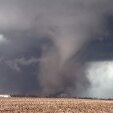
Didn't realize this until reading through NWS Chicago's summary page today, but apparently the Woodhaven Lakes campground near Amboy/Sublette, IL was hit by an EF2 on March 31st, same as they were on June 22, 2015 (same day as the Coal City-Braidwood EF3).
Frame grab from my video looking toward the totally rain-wrapped 2015 tornado (small consolation for me at the time for missing Rochelle 2 months earlier).
-
 4
4
-
-
Let's not.
-
 1
1
-
 1
1
-
-
Up to slight risk/5%
 prob. Cloud breaks showing up in southwest Wisconsin.


June 2023 General Discussion
in Lakes/Ohio Valley
Posted
True.
Tried to wash the Corolla after work today and the automated car wash at the Kwik Trip went stupid and just stopped in the middle of the cycle. The driver in front of me had to back out with his car still covered in soap, and they closed the wash since no one there knew how to service it.