DanLarsen34
-
Posts
514 -
Joined
-
Last visited
Content Type
Profiles
Blogs
Forums
American Weather
Media Demo
Store
Gallery
Everything posted by DanLarsen34
-
Reflectivity might be picking up on a debris ball.


-
Hard to tell, but reflectivity is showing what looks like a debris ball. CC drop not evident yet though, and velocity couplet not overly strong either. Regardless, this cell is very dangerous
-
Uh oh...
-
Hang on to your butts.
-
Storm of the year. I’m speechless. https://twitter.com/kamcnews/status/1132843274111279104?s=21
-
Yes. Seeing chasers confirm accidents are occurring too. The screen grab is from one of the people I follow who’s out in the field, Paxton Biggs.
-
This chaser convergence is going to get people killed one of these days. Chasers already reporting 3 accidents in this convoy...
-
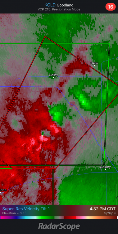
This is one of the oddest strong tornado signatures I’ve seen. Meso is completely wrapped in rain. No discernable CC drop, but we could be looking at a significant tornado.
-
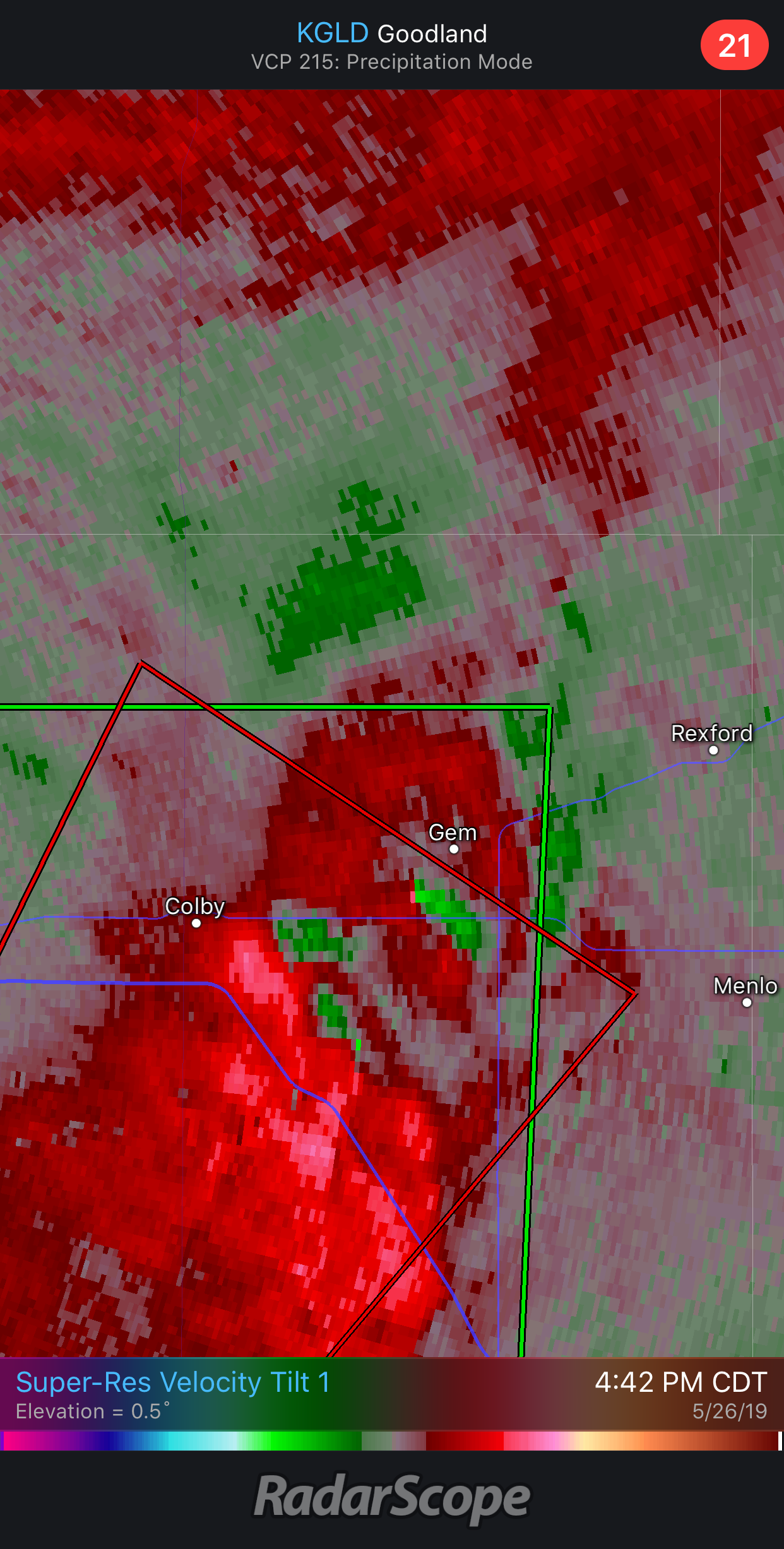
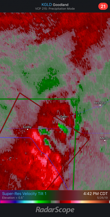
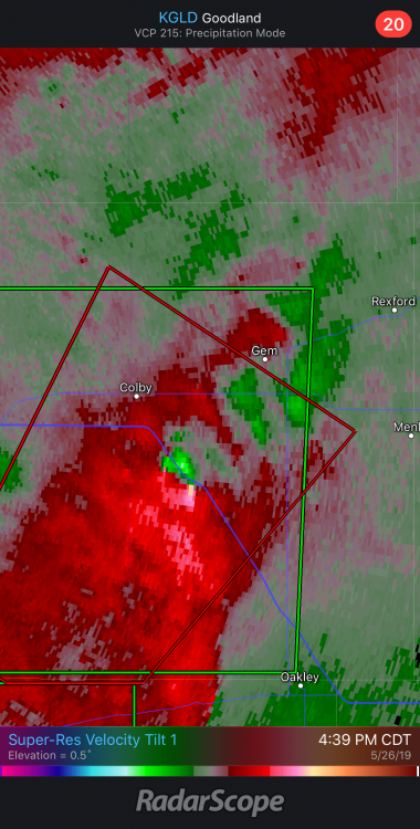
Wicked embedded circulation with this cell approaching Colby, KS.
-
Storm mode is just awful right now. Everything is a blob in the warm sector. Precipitation is also blowing up well ahead of the main show in CO.
-
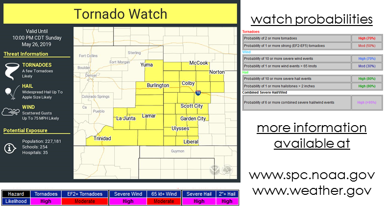
Also, tornado watch is now up for the moderate risk area in KS and CO.
-
Norman just confirmed EF-3 damage in El Reno.
-
NWS Norman is currently surveying the area and has said there’s at least EF-2 damage.
-
Just did a scan of twitter. It seems most of the damage pictures circulating are in this specific area. https://twitter.com/jeff_paul/status/1132697731556937729?s=21
-
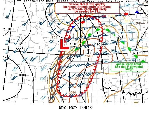
Tornado watch coming soon for the region highlighted by the SPC outlook area.
-
This is one of the more intense, but narrow paths of damage I’ve seen in a while. This is the damage from the El Reno QLCS tornado last night.
-
2019 Short/Medium Range Severe Weather Thread
DanLarsen34 replied to snowlover2's topic in Lakes/Ohio Valley
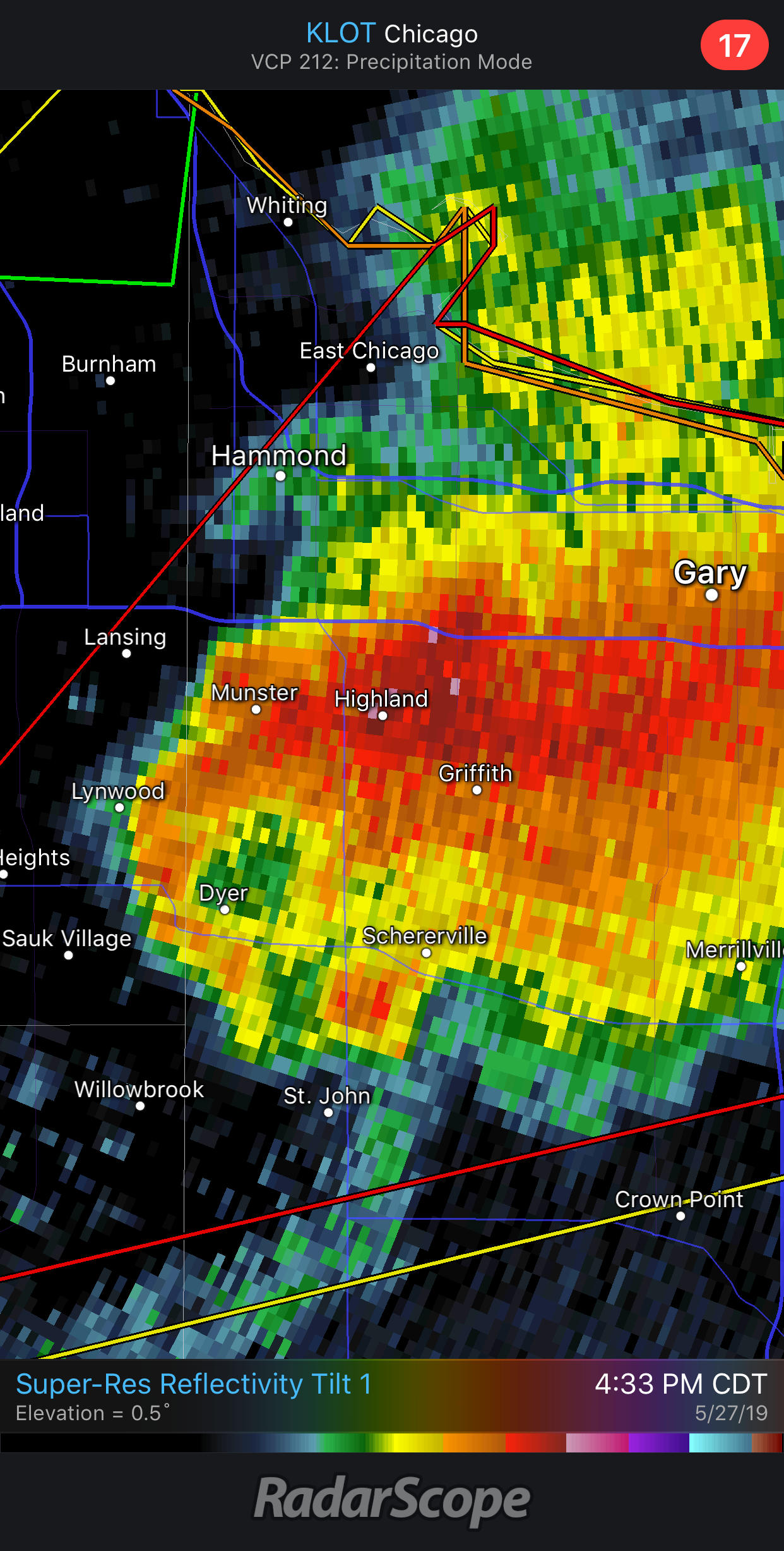
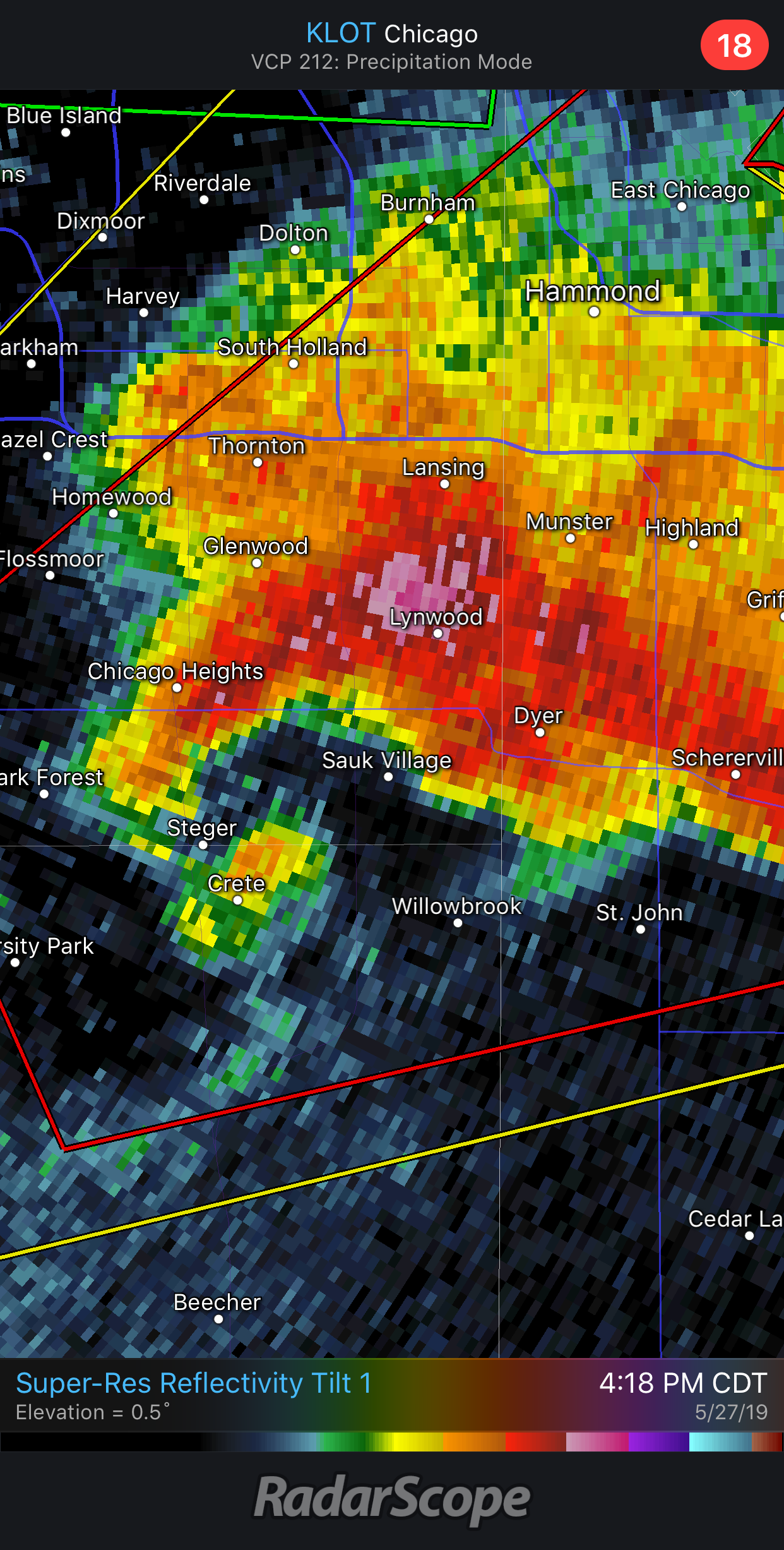
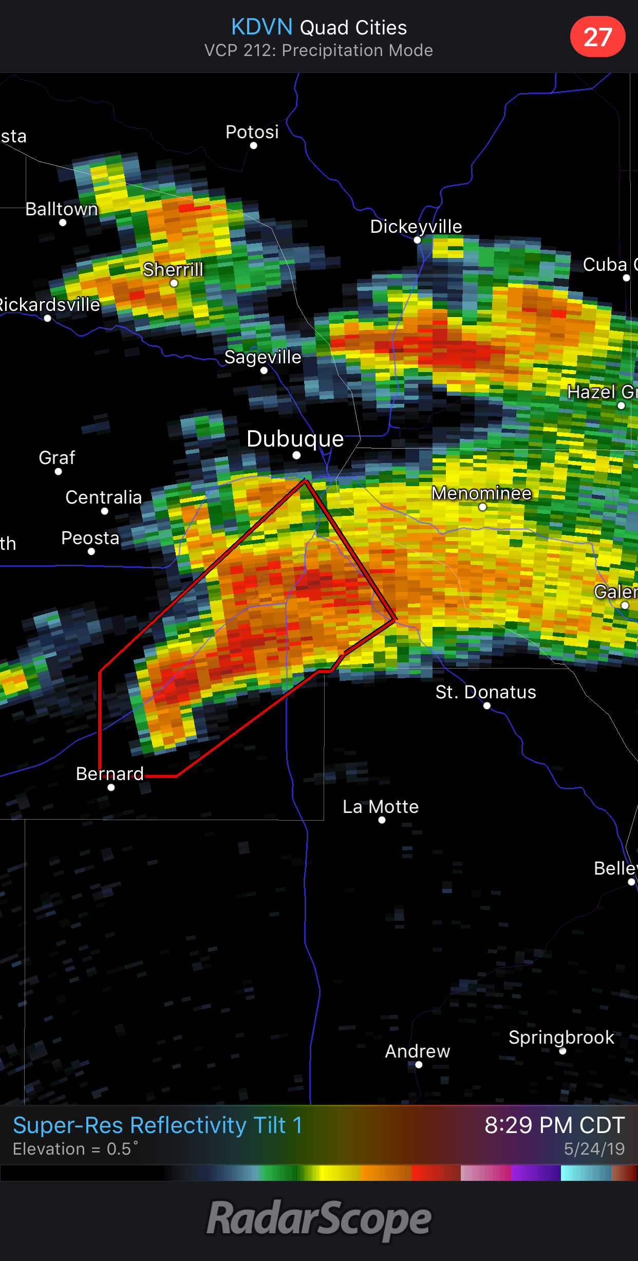
This cell near Dubuque is really beginning to look dangerous at the moment.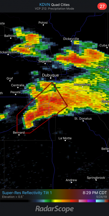
-
What was weird about yesterday was I wasn’t particularly impressed with the storm mode or the radar presentation of the ones that produced before they had those violent wedges. There were definitely some high-end parameters (looked like relative helicity was upwards of 500-600 in that region), but I didn’t follow yesterday as close as the days prior for those reasons. Didn’t seem like many chasing in that area were optimistic either, especially with smoke affecting visibility. This stretch has definitely had several potentially violent tornadoes that have so far avoided significantly worse outcomes. Think we would have seen several EF4s if they had tracked over more well-built structures. Thankfully, that’s largely been avoided (Carl Junction and Jefferson City excluded).
-
Man the Oklahoma tornado looked violent yesterday.
-
Uh oh...
-
Violent tornado in progress with the cell to the NW of Canadian.
-
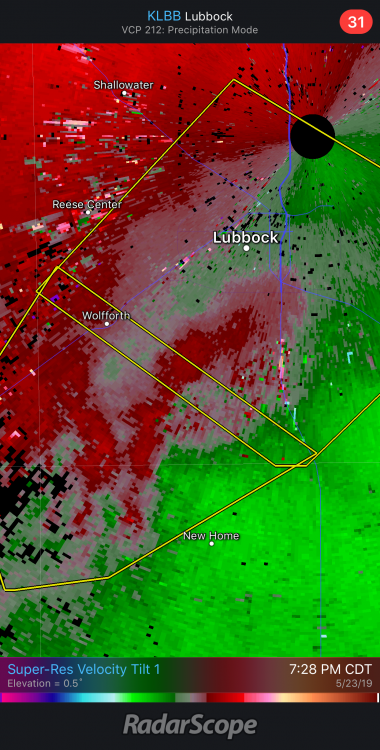
Tornado looking imminent just to the south of Lubbock.
-
Holy cow!
-
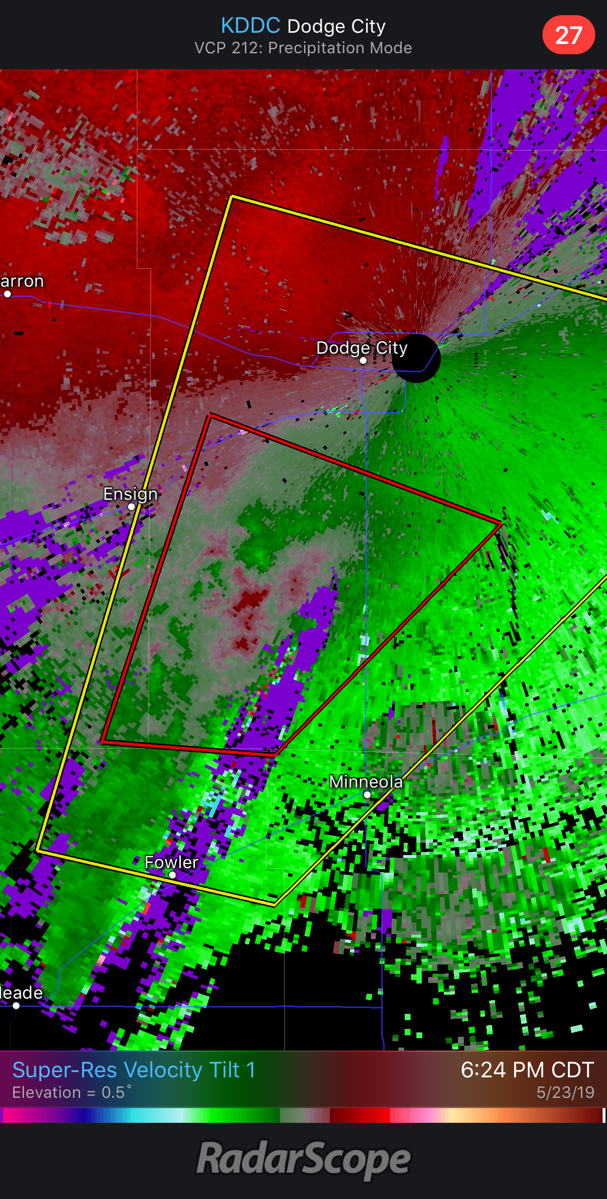
Everything is pretty blobby or unimpressive looking, but this cell approaching Dodge City has some decent rotation as it races towards the city.

-
I should apologize. What I meant to say was it didn’t take take the worst possible track into the city. I’ll edit my post.