DanLarsen34
-
Posts
514 -
Joined
-
Last visited
Content Type
Profiles
Blogs
Forums
American Weather
Media Demo
Store
Gallery
Everything posted by DanLarsen34
-
This footage is incredible.
-
Sounds like we got quite fortunate yesterday and last night. The Carl Junction/Golden City cell seems to have avoided the most populous areas. If it had tracked just a little further south at peak intensity, we would have probably seen catastrophic tornado damage with that cell somewhere in that area. The Jefferson City tornado appears to have avoided being a worst case scenario too, though it came darn close. It appears poorly built structures were lofted by it, which explains the radar presentation we saw after. The CC drop, and debris falling out of the sky well out ahead of the storm, was highly suggestive of an EF4+ tornado. Not saying we didn’t get that kind of damage somewhere, but it seems like the worst case scenario was avoided with that one as well. Factor in that storms didn’t quite take off by the OKC metro, and we really dodged a bullet on the whole. Thoughts are with those who were a lot less lucky yesterday.
-
The fact that this cell is still alive, after several tried and failed to do the same during the daylight hours, is stunning. If this somehow goes on to produce tornadoes too...
-
It wasn’t. It formed just to the north of those cells.
-
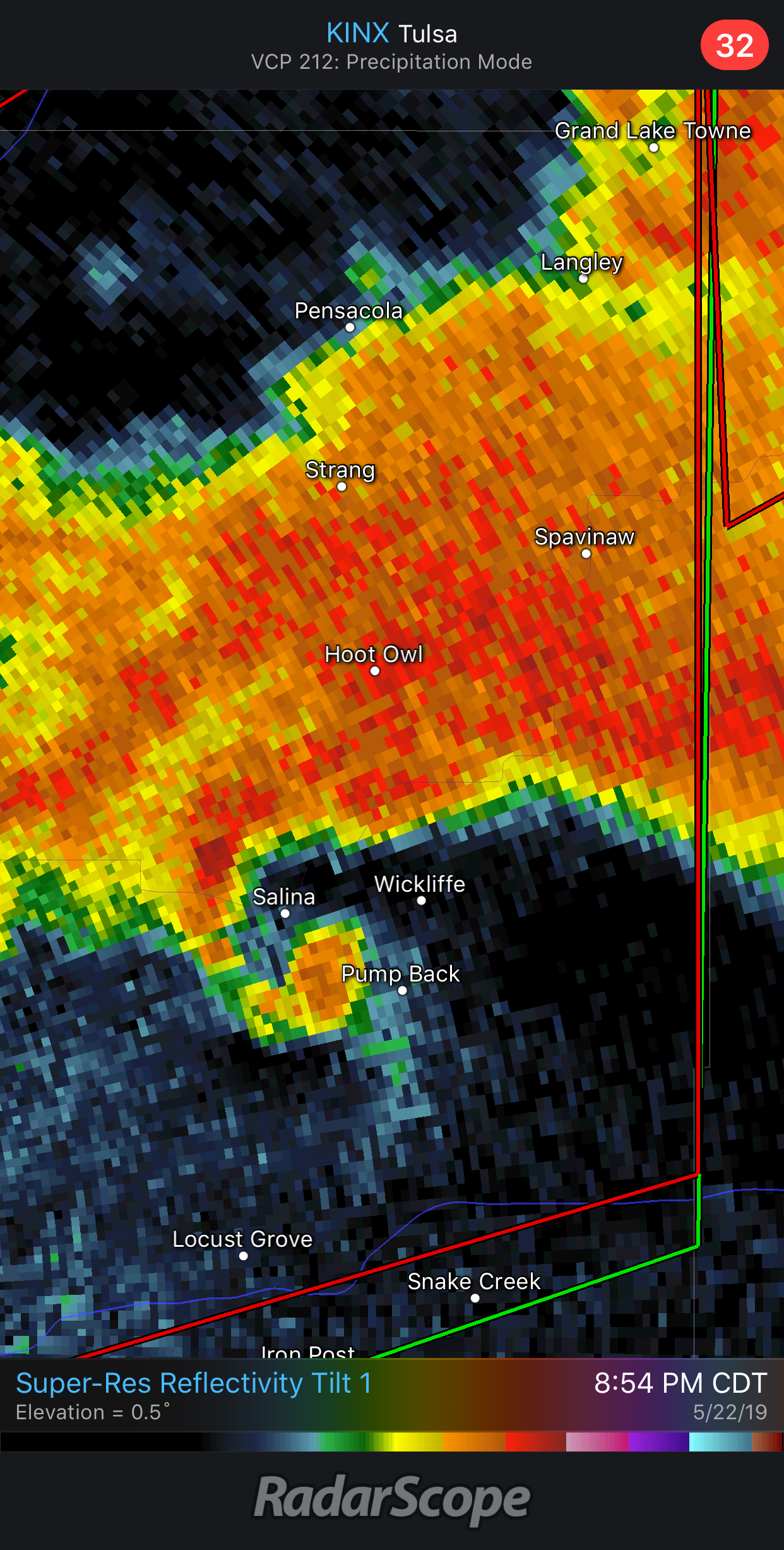
The cell that produced the intense tornadoes we saw near Joplin is at it again.

-
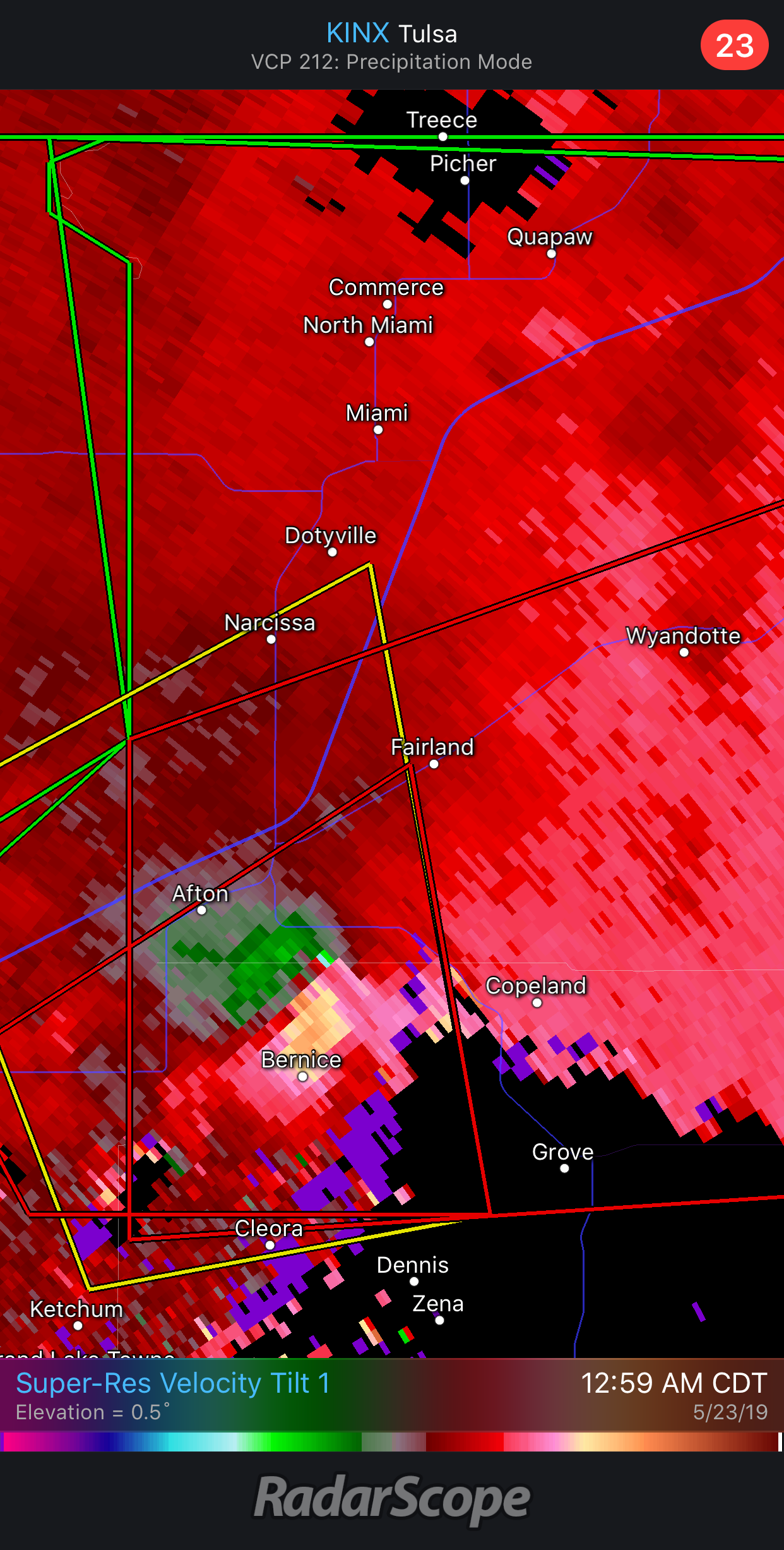
Intense tornado in progress near Bernice, OK.

-
Velocity couplet and overall organization is really ramping up. This storm is capable of producing a violent tornado.
-
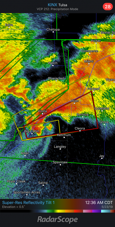
Looks like we have another debris ball to the east of Big Cabin, OK.
-
Here’s a loop from twitter since I couldn’t upload the CC from my phone.
-
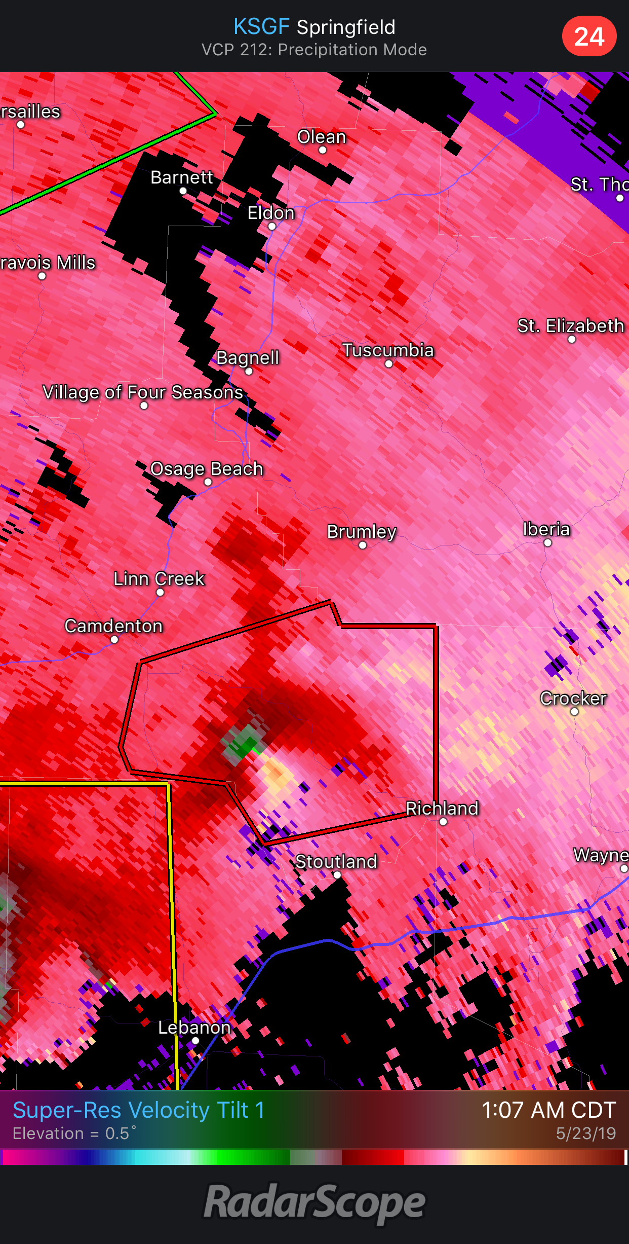
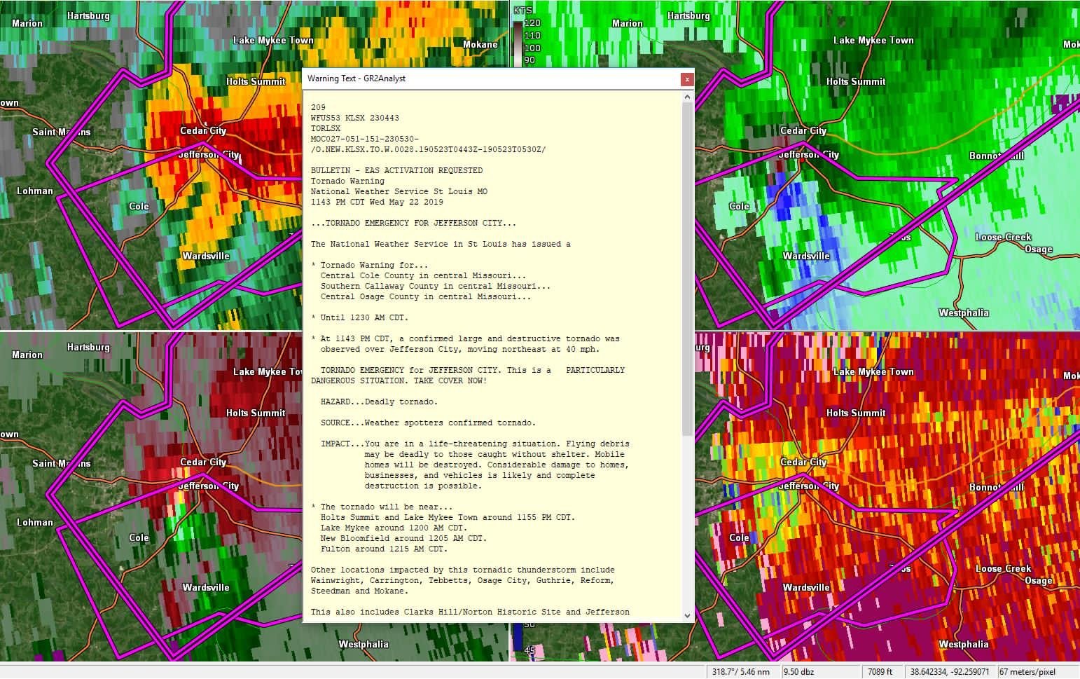
I can’t upload the CC loop, but There’s debris falling out of the sky well out of ahead of the super cell. There’s a very high likelihood this was an EF-4 or EF-5 that just tracked through Jefferson City.
-
It’s going to be a miracle if there aren’t mass casualties from the tornado that just moved through Jefferson City. Debris is still falling out of the storm which highly suggests this was a violent tornado. This sucks...
-
Decided to call it a night after everything seemed to be ramping down about an hour ago. Looks like a violent tornado just moved through Jefferson City. Seeing initial reports of major damage.

-
This is video of the tornado near CarlJunction earlier. Looks like a high-end tornado.
-
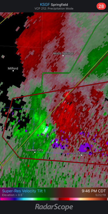
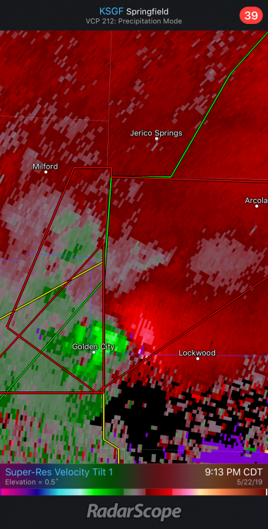
Small, but intense velocity couplet just popped up north of Golden City.
-
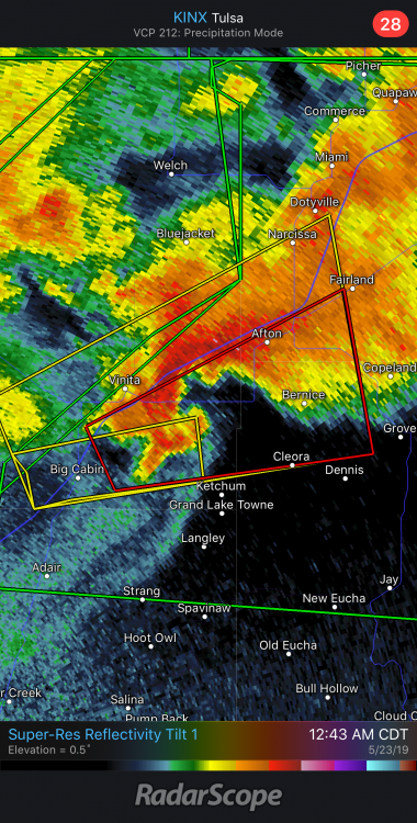
Jay Tornado is trending high-end. Well defined velocity couplet and developing debris ball.
-
It’s getting more intense with time. It’s been trying for what feels like two hours, but is getting better organized.
-
Seems to be conflicting reports on whether there’s a tornado in progress. Sounds like one is imminent near Lockwood either way.
-
Storm off to the North of Golden City has lost a bit of its organization. It could still cycle at any time, but it’s been taking a bit of a breather after putting down at least 2 long track and potentially violent tornadoes.
-
It keeps ramping up, then ramping down. It may put down a monster soon.
-
Three distinct areas of rotation showing up now.
-
Anyone have any idea why this isn’t a tornado emergency? It’s passing off to a new one too.
-
It’s way too close. Looks like the main tornado is about to pass off to a new circulation, but it’s almost in the city limits of Golden City.
-
This thing is going to come really close to a Golden City. Well defined debris ball signature just west of the city.
-
This is the tornado approaching Golden City. Jesus Christ...
-
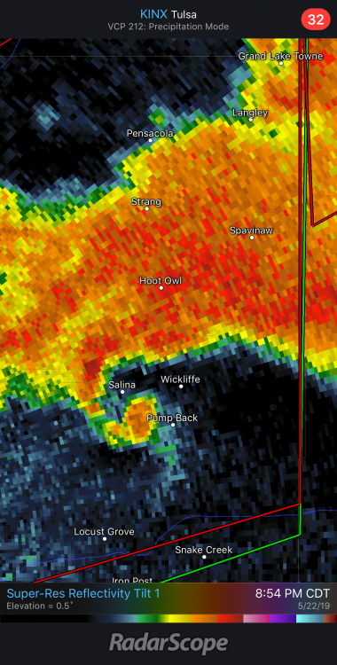
Strong/violent tornado also in progress near Salina, OK. This thing is on the verge of producing a violent long-track tornado.