DanLarsen34
-
Posts
514 -
Joined
-
Last visited
Content Type
Profiles
Blogs
Forums
American Weather
Media Demo
Store
Gallery
Everything posted by DanLarsen34
-
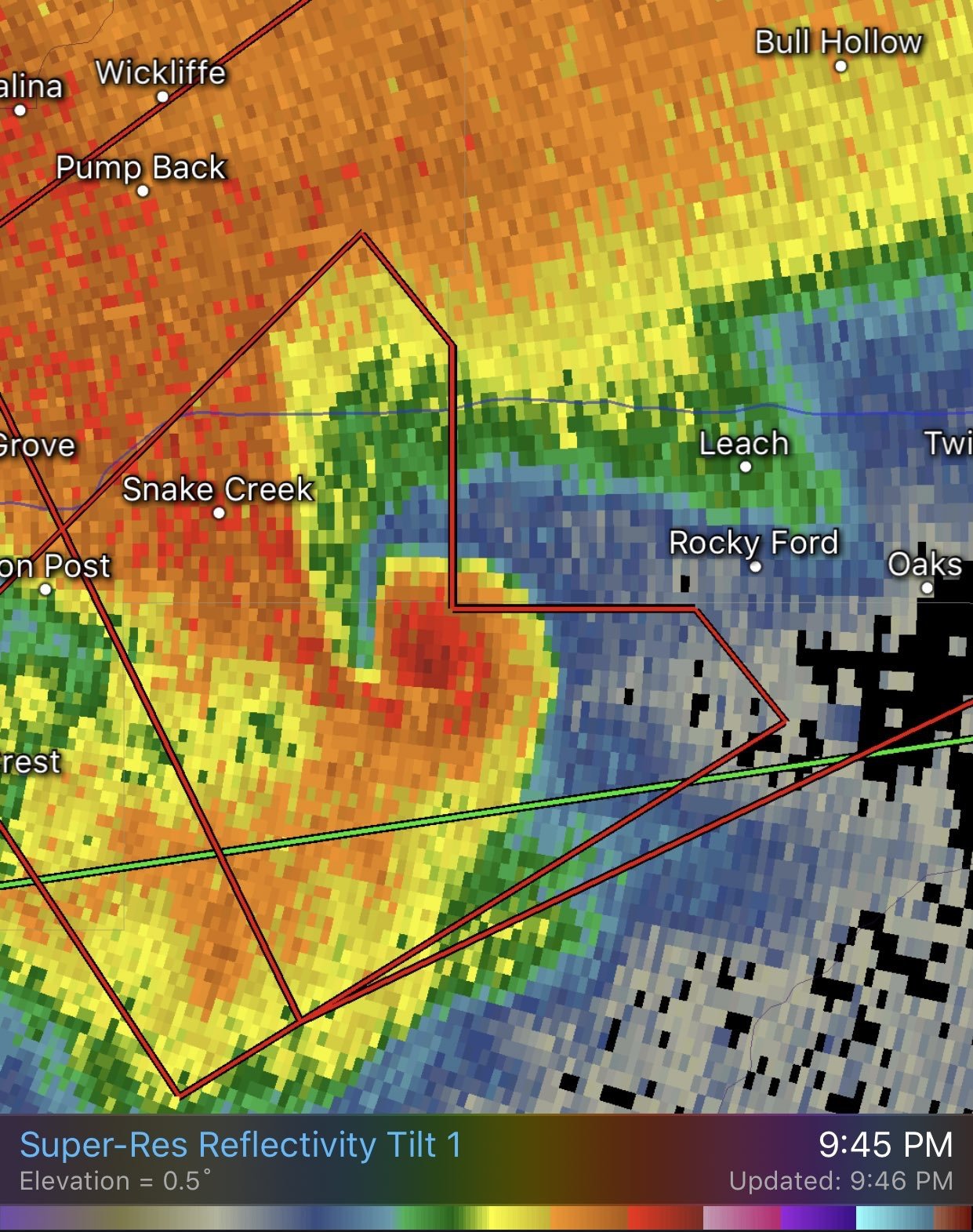
A few things I noticed about yesterday that I haven’t seen discussed in much detail yet, but wanted to share to see if they were factors. 1) beyond the capping issues, another problem with the Oklahoma part of the high risk area was storm motions. The few early storms that were able to break the cap, like the one north of the OKC metro, raced north and crossed over the warm front before they ever had a chance to get going. Several cells that attempted do the same later in the evening suffered the same fate. Had storms moved in a more E or NE fashion, they would have had a lot more of the environment to work with before they were undercut by the cold air north of the front, and that which was generated by the outflow from the complex that was ongoing there. That leads me to the second observation. 2) it appears as if the low level jet wasn’t as strong as anticipated. Because of this, the blob of storms along the front, along with other cells merging which formed off the W TX dry line, generated a massive cold pool that rapidly advanced southward in the 5-7 PM time frame. This cold air not only undercut the one lone discrete cell we had, it undercut several updrafts to the east that tried to get going as well. It wasn’t until the low level jet really kicked in around 8-9 PM that we saw storm organization improve, resulting in this brief, but intense tornado east of Tulsa.

-
The critiques I and others lobbied towards people calling a “bust” yesterday weren’t directed at you. It was to those other individuals that said it without discussing WHY they thought that. Like you said, we are here to discuss an event. Many of the others screaming it had no intention of contributing to that discussion.
-
This was why the moderate risk was maintained. As soon as the outflow boundary was pushed back, we finally had storms able to tap into a violent tornado environment.
-
Just wanted to say: I think all of us can acknowledge this “busted” for a 45% tornado risk day. However, the potential was there, and I don’t think many could begrudge the SPC for issuing it given what everything looked like pre-initiation. Days like today really make you appreciate just how unique the major outbreak days are! The subtlest thing being off can put the lid on what otherwise could have been a ridiculous outbreak of violent tornadoes. i just don’t understand why many have the urge to call everything a bust as soon as possible though. It’s not productive. If you want to critique, that’s fine. I’m here for all of your expertise and want to see actual technical discussion of that. However, you’re not contributing to a discussion of the event by calling “bust” every 15 minutes. Every set-up, no matter how high-end, plays out differently, and it was absurd to be calling it one of the “worst busts ever” as we had four tornado warned discrete cells going on in the southern part of the risk area. We’ve seen several set-ups look like crap, then do something big later in the afternoon/evening. We may even end up with a 30% contour verifying after storm surveys somewhere in the Red River valley. It wasn’t what we expected, but it wasn’t a complete cap bust with no tornado reports either.
-
By the way, thought the Wichita Falls storm summarized today perfectly in the north. It was HP, but had good inflow and looked like it might do something big given the environment that was in place. I don’t even think it took ten minutes after the high risk was maintained for that region (for that storm specifically) that it went outflow dominant! Lol Just one of those days. Don’t think you’ll ever see a 45% risk area perform like this again.
-
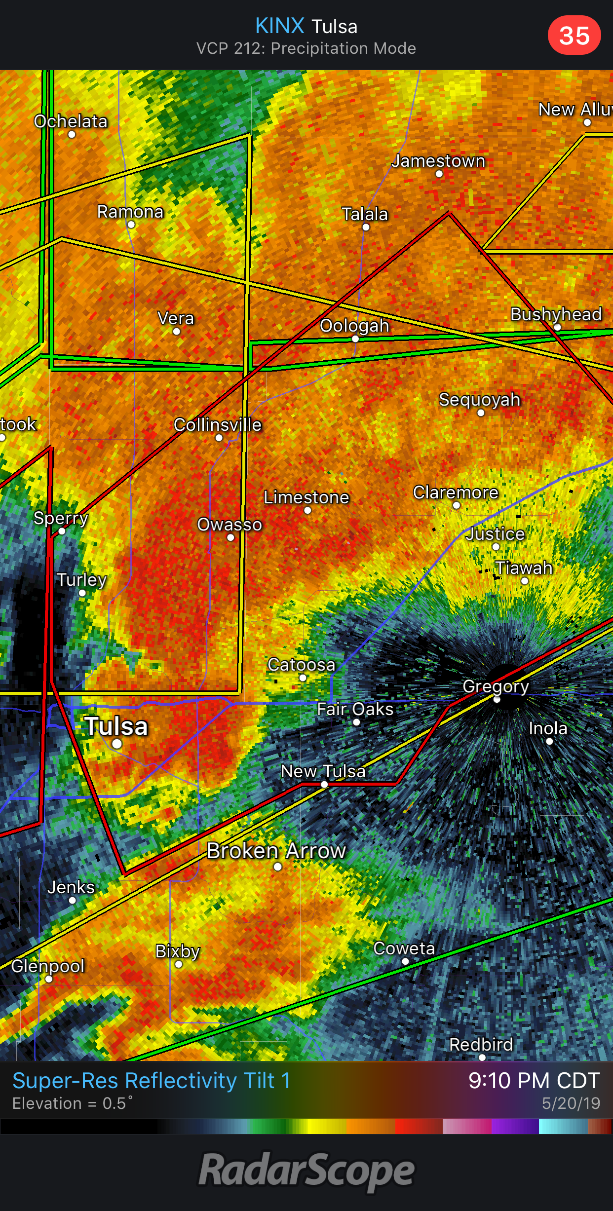
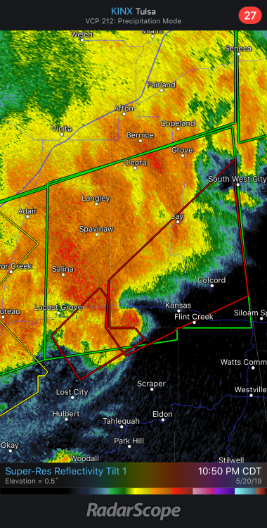
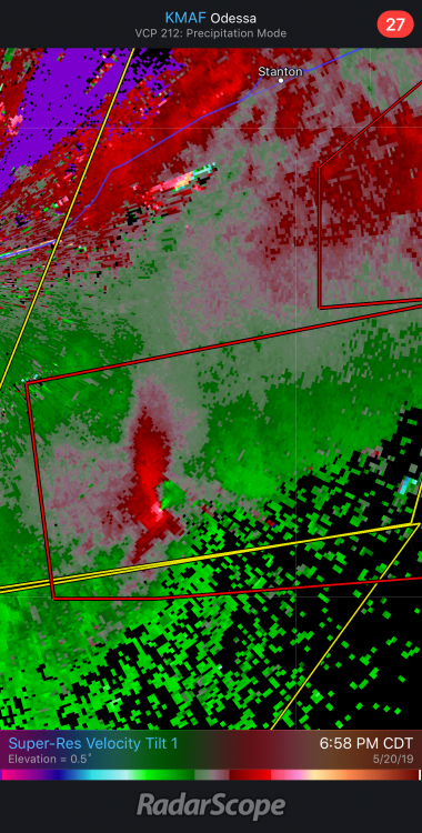
Holy hell. The Tulsa storm is looking very ominous at the moment. Not a strong couplet yet, but it’s got a chance to do something.

-
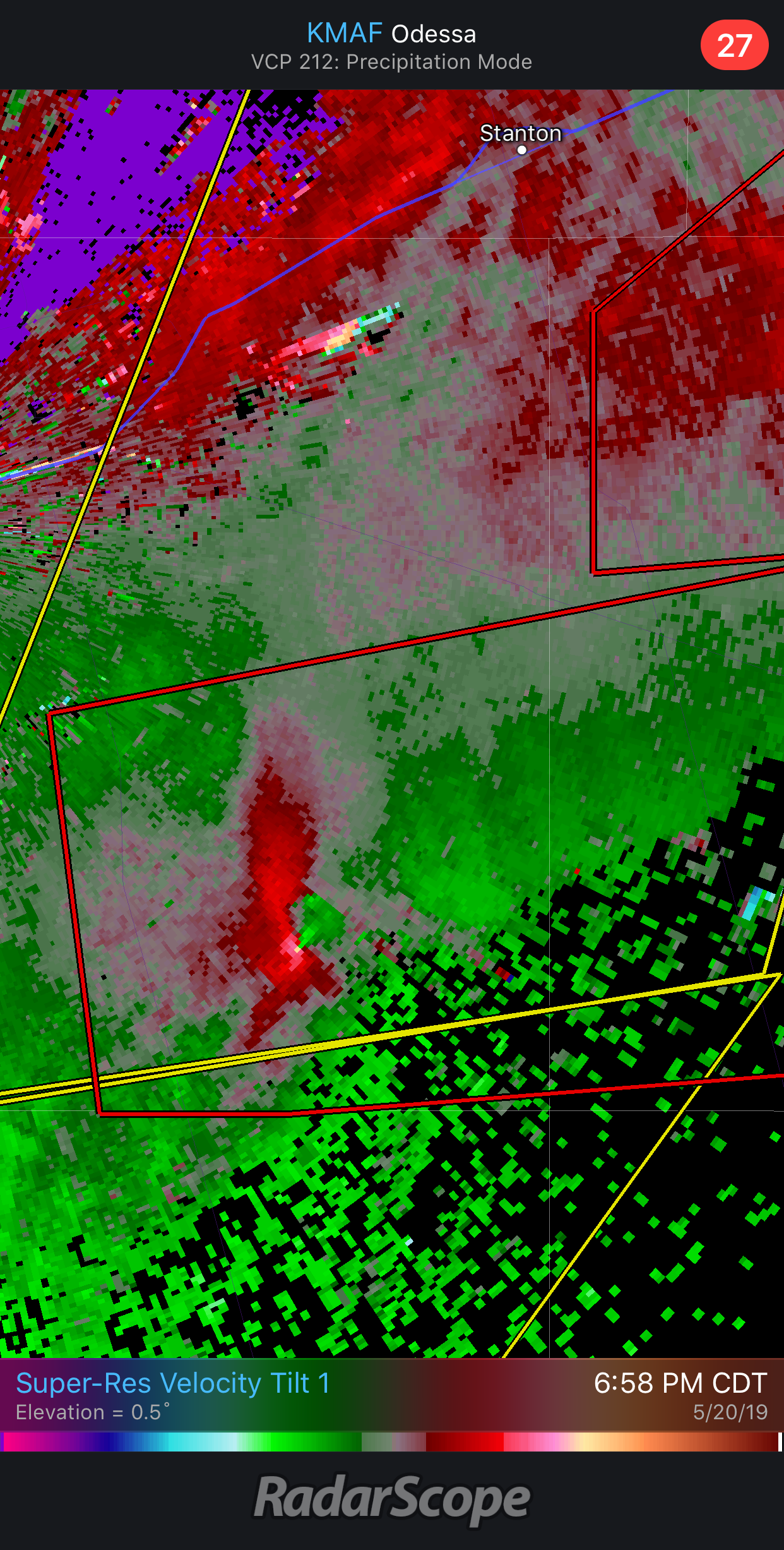
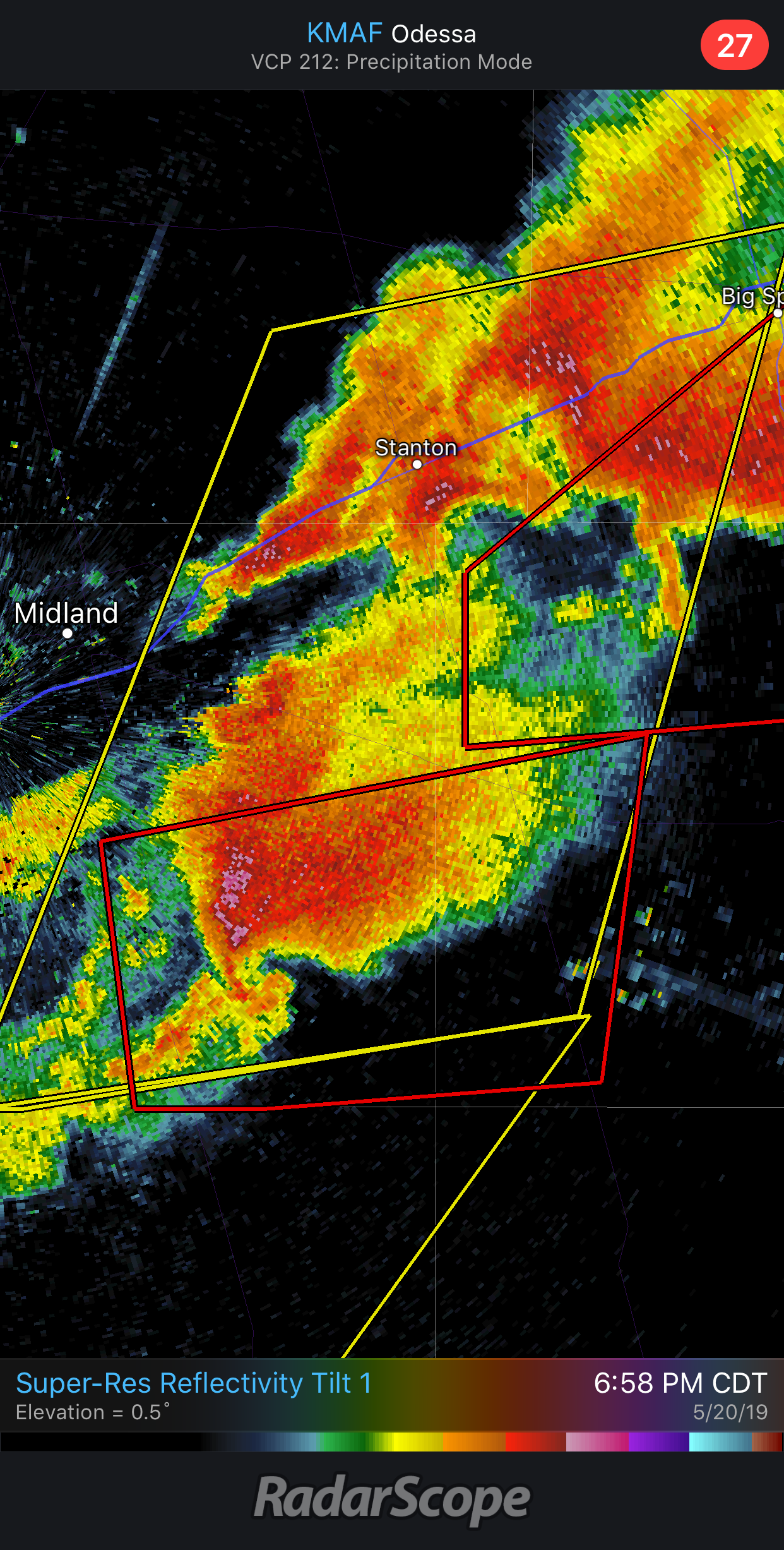
We got a textbook one in progress south of Midland.

-
Would y’all stop complaining and focus on the storms we have ongoing? For gods sake, we have a large and extremely dangerous tornado report on the HP cell in the high risk area in W TX, and two tornado warnings ongoing further south across the moderate risk too. This set-up may literally still verify on the southern side of the risk area this evening.
-
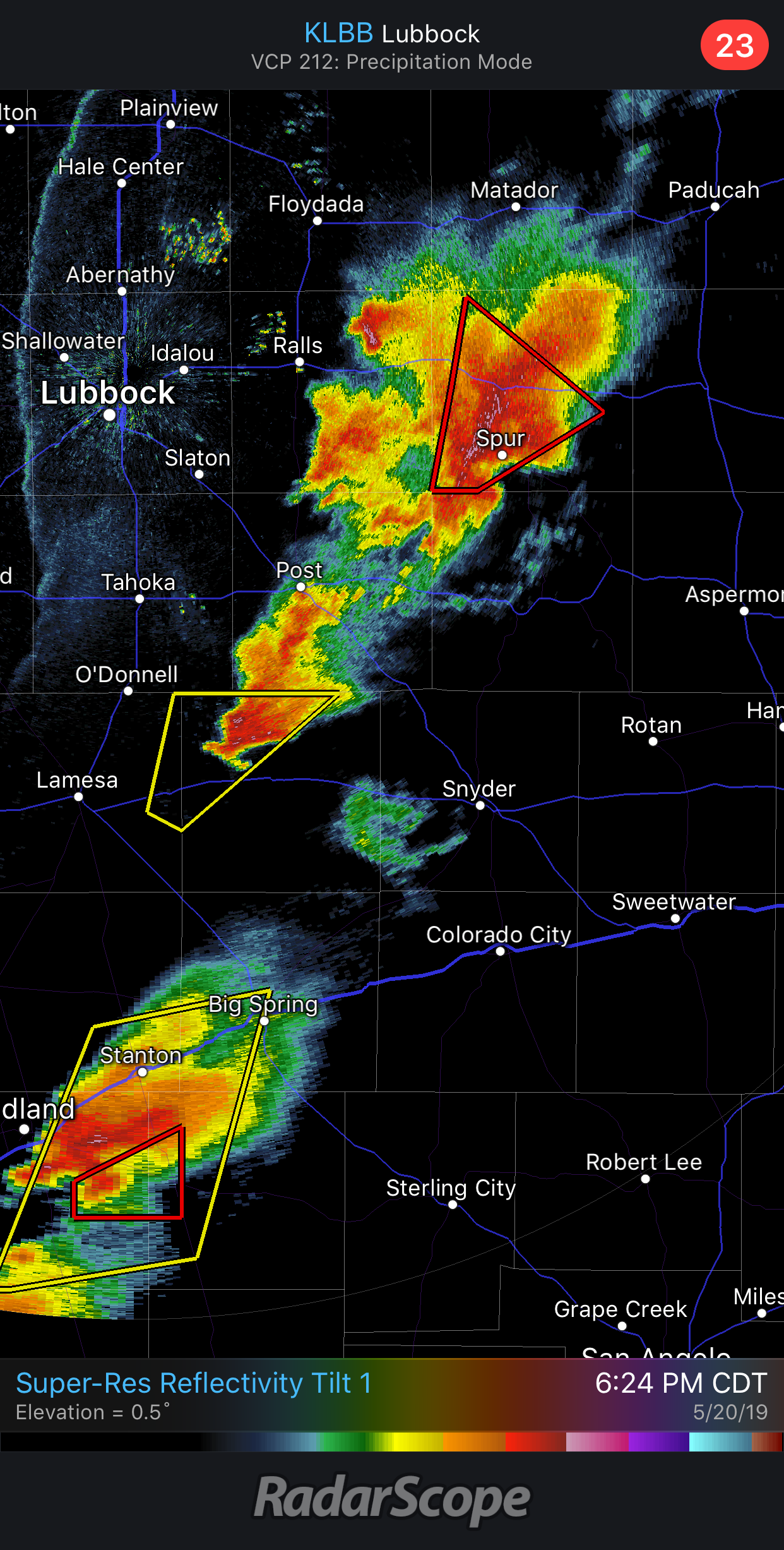
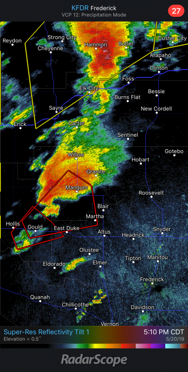
These are the cells i’m referring to

-
Only thing that’s going to verify a high risk are if some of these cells in Texas get going, though one of the best looking ones right now is on the edge of the moderate area from earlier. The northern part of it in Oklahoma looks like it may be largely done.
-
Don’t discount these cells firing in central Oklahoma. If they don’t crash north too fast, we might get some discrete cells out of these. Seems like the better lapse rates are arriving.
-
More likely scenario for that storm is the southern one takes over.
-
It’s only a matter of time before this one puts down a monster.
-
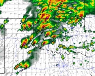
I’m going to preach patience with this set-up. Things are really starting organize across the high risk area. Yes, we don’t have widespread warm sector development well ahead of the dry line, but we don’t need that to have several long-track violent tornadoes today.
-
Hey guys. A May 20 thread is up now on the forum if everyone wants to jump over there.
-
If the models are accurate, we are looking at a potentially historic outbreak today.
-
These model runs are just unreal. Everything’s converging on this being an outbreak for the history books. This screen shot looks like a radar grab from the super outbreak in 2011.
-
These MDs are the most strongly worded I’ve seen since 4-27-2011. SPC seems very confident that were going to see several long-track and potentially violent tornadoes today.
-
I’ve got a horrible feeling about today. Let’s just hope these tornadoes avoid people as much as possible.
-
This is the strongest wording I’ve seen from them. If you go back to the 4-27 outlooks, they understated the violent tornado threat by a bit that day given the parameters that were in place. Going to be a long day!
-
This is the strongest wording I’ve seen them use in years. 4-14-12 and 4-27-2011 are the only recent ones I recall coming close (purely based on wording). It’s very rare, but definitely warranted given this extremely high-end set-up.
-
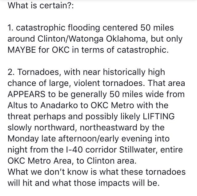
I really feel for anyone who’s responsible for forecasting this event. Seems like the consensus is that tomorrow has a relatively low floor, but extremely high ceiling. We are talking about a major outbreak with several violent long-track tornadoes IF everything materializes. However, there are still several uncertainties that could significantly mitigate that potential. Of course, this hasn’t stopped Mike Morgan from claiming the world is going to end. Even if a set-up looked like April 27 or April 3 the day before, his level of fear-mongering would be completely uncalled for. Here’s the post in question from his twitter account.
-
I’m starting to get a bad feeling about Monday. This has very high-end potential.

-
I’ve been following severe weather quite close since 2012. This sequence feels different. I’ve seen the more reserved people I follow pointing out the potential ceiling of this, and going as far to say it could be May ‘03 or ‘08 level. I hope everyone who chases has great success in the field in coming days. Should be ample opportunities! Let’s just hope these tornadoes stay out in the fields of plains away from people.
-
Central/Western Medium-Long Range Discussion
DanLarsen34 replied to andyhb's topic in Central/Western States
I’m a little surprised this forum has been quiet. The long-range models are suggesting we could be looking at the most active stretch of severe weather we’ve had since 2011. Right now, the models are depicting several days of favorable flow across the plains from May 19-26 with ample moisture and instability. Obviously, there’s still a ways to go, but I’ve seen some of the most reserved meteorologists I know starting to highlight this period as potentially being a May 2003 or May 2008 sequence if everything comes together.