Greg
-
Posts
2,043 -
Joined
-
Last visited
Content Type
Profiles
Blogs
Forums
American Weather
Media Demo
Store
Gallery
Everything posted by Greg
-
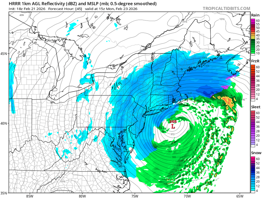
The Jet streak/confluence strengthened a little this time vs the others on this model output; that's why.
-
Absolutely with this signature taking place now.
-
Stupid output yes, but definitely a signature one likes to see as we getting closer and closer in.
-
I know it's the 18Z NAM but man oh man! If that ever came to for wishing, we would be in a major coastal blizzard of the Boston Area including surrounding suburbs. Very serious and damaging storm. Talking about a complete shutdown. Bet people would still try to go to work in the morning end up being trapped on the interstates. Insane!
-
-
Excellent spot for us and heart of our viewing area if this track was to ever hold.
-
Same here. Looks like a slight dry slought then mix for the Cape and Islands with this track. Everybody else heavy

-

-
Actually, '78 had 79 to 83 MPH Gust in Boston recorded at the time.
-
The so-called Messenger Shuffle occurred and the storm center went further east than initially forecasted. Stopped it from really being a true all-timer.
-
Probably a big storm with great snow and liquid output but one would see how each model even today would still have their biases still.
-
I was just about to say the same thing. The configuration of that "Mean" Snowfall area distribution looks like a '78 situation in Eastern Mass although I use that example loosely. Not a prediction of this storm on my part of coursé.
-
I stated that potential earlier. Temps will be in the mid 30's there while the storm makes it closest pass.
-
Close but not quite in the final quantity. In the that 1978 analysis the 1.5" was the equivalence around 23.0" of snow due to ratios which they stated was a crude estimate at the time but one should get the point. The Cape got less in that due to the track and dry slought of the storm.
-
I remember that! Some mets where very stubborn on air to move the banding from the Southshore further northwest which as we know it did.
-
Yes, he always will start out like that. He's not ready to pull the lever yet. By tomorrow late morning changes will be a coming.
-
-
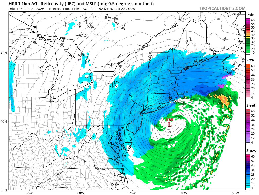
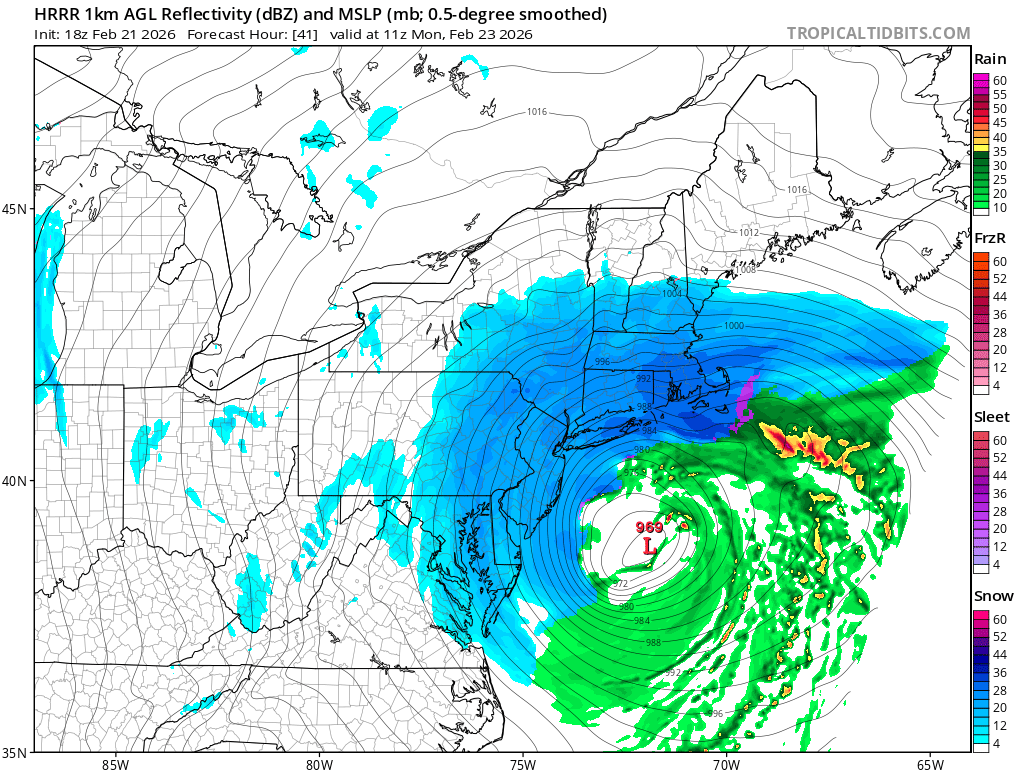
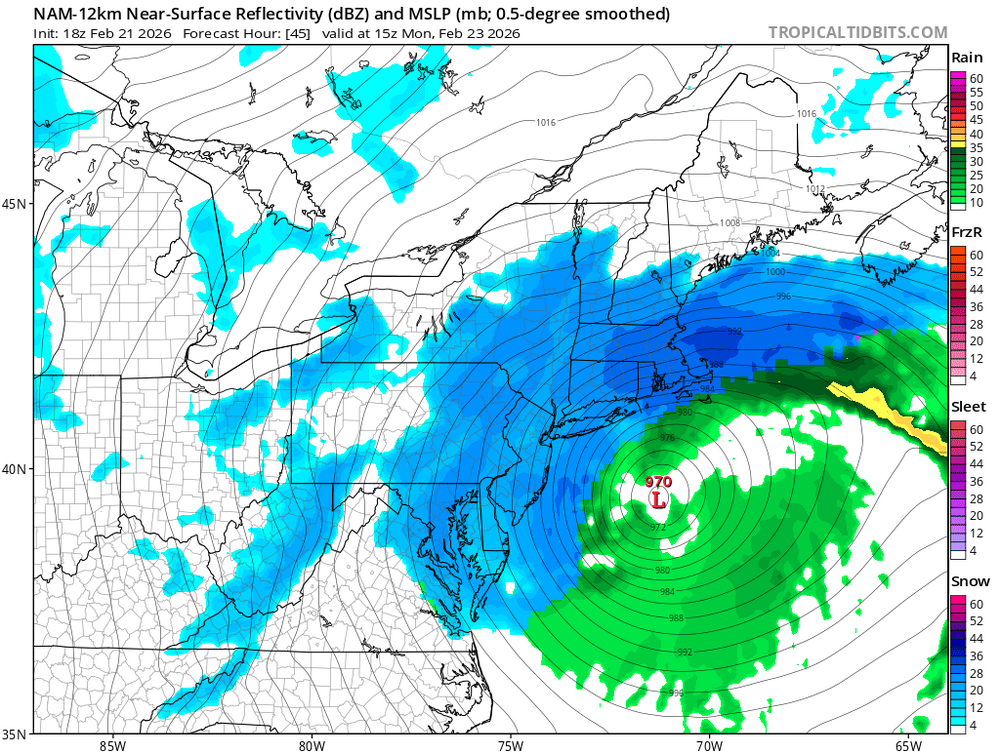
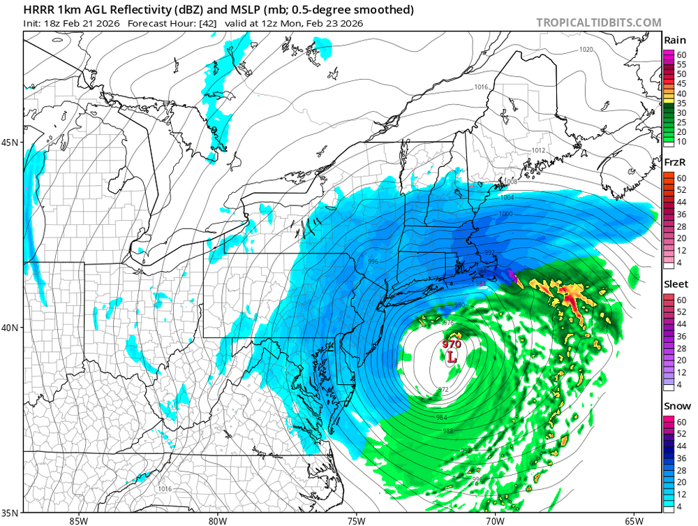
Always the toughest part of the forecast will be where the heaviest banding actually sets up. It can sometimes take it all the way to the day the storm starts to see how they really end up. They can surprise many people. Models do have a tough time with these mesoscale placement features.
-
I have a belief that is a little overdone by this NAM model.
-
I know. The banding is getting further Northwest into the Boston area, North shore, South Shore and Surrounding suburbs. Generally, the very heart of our viewing area. Excellent look. Very classic Coastal Bomb.
-
Willy Wonka?
-
1.5-1.6"here so far... Still snowing! 32F
-
Downsloping/shadow effect of the CT Valley
-
Oh, no worries. I know.
-
Guaranteed one won't hit 70 MPH around the CT river valley. Any real hurricane Force wind gust potential will be on the Cape to Northshore.