Jump to content

cold air aloft

Members
  • Posts

    110
  • Joined

  • Last visited

Everything posted by cold air aloft
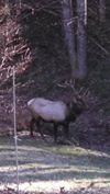
  1. Yes, The Fines Creek/Crabtree areas usually hit the jackpot in NW flow events.
  2. As Met mentioned, a nice little snow accross Haywood County last night through this morning. Very nice to wake up to this view this morning.
  3. Here's the little glaze we had last night. Stayed confined to trees as the roads around here just stayed wet. Not much I know, but I won't be surprised if it's several more years before we see freezing rain again in Maggie.
  4. Temperature bumped up to 33 degrees where it still hovering. I enjoyed the little ice that we had, but glad it didn't amount to much. I'm still surpised it didn't warm up more than it did in this part of Haywood County.
  5. Well, well, well. 32 degrees and freezing rain in Maggie Valley of all places. We were forecasted to reach 40 degrees today, but my thermometer never got above 33. I’m sure the warm nose will make it’s presence felt soon, but I’m kind of enjoying this novelty right now. It’s been several years since we’ve had ZR IMBY.
  6. It will be interesting to see how this event unfolds for us mountain folks. These CAD events are always fascinating in Haywood County. I live in Maggie Valley right at 3,000 ft. elevation and we rarely see freezing rain, can't even remember the last time. I work in Canton 12 miles away and it's an entirely different story. I remember an event we had a couple of years ago where I left Canton with freezing rain and a temperature of 25 and when I got home it was 43 degrees and plain old rain. The way it looks right now, maybe a dusting of snow on the front in before the WAA moves in, a cold, rainy Saturday night and Sunday and hopefully some snow on backside Sunday night into Monday. Curious to see if any ZR develops in Eastern Haywood County tomorrow. Hope everyone hold on to their electricity and tree damage is minimal.
  7. No white Christmas, but 40 degrees and overcast, I’ll take it. Merry Christmas y’all.
  8. Agreed. IMO GSP and Blacksburg offices do a fantastic job with their respective AFD's especially with the terrain and elevation variables that make our area so unique and hard to pin down forecast wise at times. Also, it's kind of fun when Mets personalities are revealed sometimes when major weather systems are approaching. You can tell they genuinely love what they do. On the flip side, I would be disappointed if I lived in East Tennessee. The AFD is virtually nonexistent from the Knoxville office
  9. We had an additional 1.5 inches of snow last night for a storm total of 14.5 inches. Here are a few pictures from around my place, g our new puppy having a blast in his first snow.
  10. Great reports and congratulations y’all! I measured 13 inches so far, with snow picking back up again. Just absolutely beautiful out there. I know we weather geeks get caught up in amounts, historical perspective and all of that and that’s all part of the fun, but I never get tired of simply enjoying the wonder of a big snow in these mountains. Time to wake my girls up and get out the sled!
  11. Just did the Canton to Maggie Valley drive home from work. Word of advice, if you don't have to drive in Haywood County, avoid it. Cars slld off the road everywhere. It is beautiful out there and the snow is still thumping. Good luck to everyone for a big thump and may we avoid the evil warm nose.
  12. Looking at the radar, it looks like the heavier precipitation moving in from Georgia is causing a quick change over in NE Georgia and the SW mountains of NC. Hopefully those of still battling mixing issues can see a complete change over soon.
  13. At work today, and the rain/snow mix is finally transitioning to all snow in the snow hole that is Canton. N/NE winds picking up as well.
  14. Things are definately coming into better focus this morning and this is looking like the storm we all hoped for before all of the confusion yesterday evening. Curious though, on GSP's latest snow map they have most of Haywood County in the 10+ inch range. Yet right now, we are under a Winter Storm Watch with the discussion calling for 1-8 inches. In all my years of experiencing these type of storm set ups here, the Balsams will get hammered. Won't be surprised to see some 20+ reports around here by the time this is all said and done. Enjoy the ride y'all!
  15. I know folks have varying opinions of TWC, but Tom Nizzel is still confidently bullish on this event for most of us. Calling for around a foot for most of the mountains.
  16. I have to say, in my 30+ years of tracking storms here in WNC, this one really has me baffled and apparently the the NWS as well. To see the two snow total maps they have put out today is just stunning. I have a lot of respect for the folks at GSP and they know a heck of a lot more than I do weather wise, but I’m really perplexed by the this evenings maps and warnings. Still have a hard time believing that some areas of the Piedmont smoke the mountains in snow totals out of this system. Time will tell.
  17. Like Met mentioned, I'm looking forward to tonight's mini-event. My neck of the woods usually doesn't fare too well with NW flow events, but some of us look to have a good night. Heck, I was pleasantly surprised this morning. Went out to walk my dog around 6 am to find the ground covered with a dusting of snow and a few flakes still flying. Wasn't expecting that at all. Nice start to Winter!
  18. I'm really curious about this afternoon's discussion from GSP. Obviously they don't want to create a panic when the potential event is still several days away and of course the models will change. But holy smokes, if anything close to what the models are saying verifies, folks need to be prepared.
  19. Interesting tidbit from the 11:30 GSP discussion update: Another note is that new HRRR guidance (HRRE specifically) is quite concerning across the mountains tonight. Probably a little too high (4-8"!) but is concerning enough to mention as a possibility. With this thing being strong on the NW side, it will be very interesting to see what we get tonight and tomorrow, especially for those of you who already have a few inches of upslope rain.
  20. Tropical systems that effect us here in the mountains remind me a lot of the snow producing storms we get in that there is going to be great variation in precipitation accumulation in very short distances, with so much of it being slope dependent. Unfortunately, some us are going to see major flooding and/or land slide issues. I work in Canton right on the Pigeon River. We took in 4 feet of water with the 2004 Hurricanes, I hope we don't see anything like that with this.
×
×
  • Create New...