Paleocene
-
Posts
2,054 -
Joined
-
Last visited
Content Type
Profiles
Blogs
Forums
American Weather
Media Demo
Store
Gallery
Everything posted by Paleocene
-
Love the 90 degree day tracking. Who's tracking 70+ degree dew point days? Yesterday was a nice respite but back over 70 here inside the beltway. Yuck. Slightly more tolerable with cloud cover and a breeze
-
I saw on reddit that it was the blue angels, tho I didn't catch it. Practice for the 4th, perhaps?
-
Just noticed that. Looks potentially soggy for much of DC-Balt around 7am
-
First fireflies visible tonight in the yard. Probably my favorite thing about June around here.
-
Hot
-
Another gorgeous morning - comfortable dew points for the whole work week ahead? Sign me up for that, any week june thru sept.
-
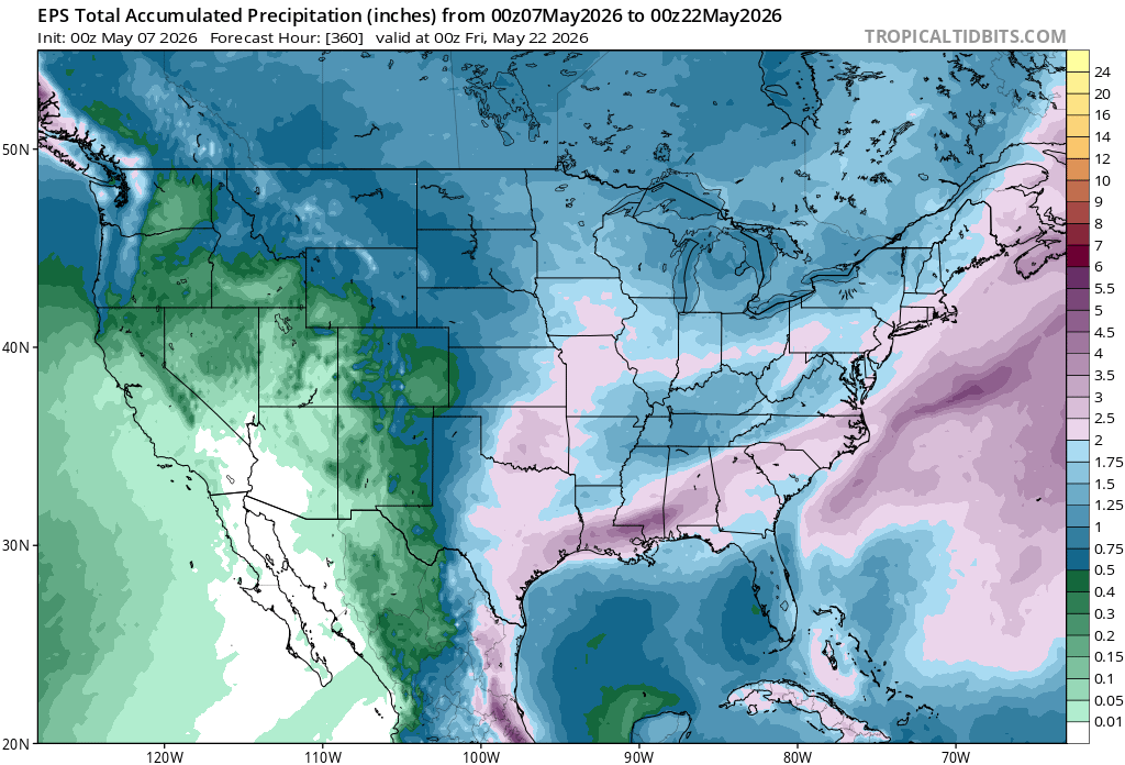
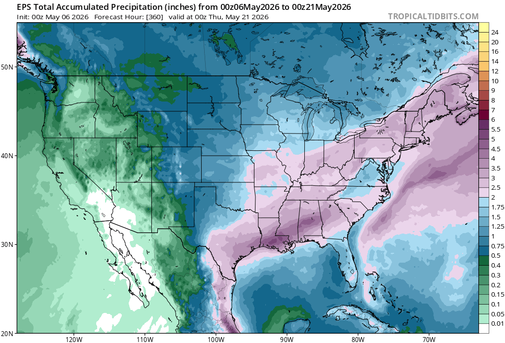
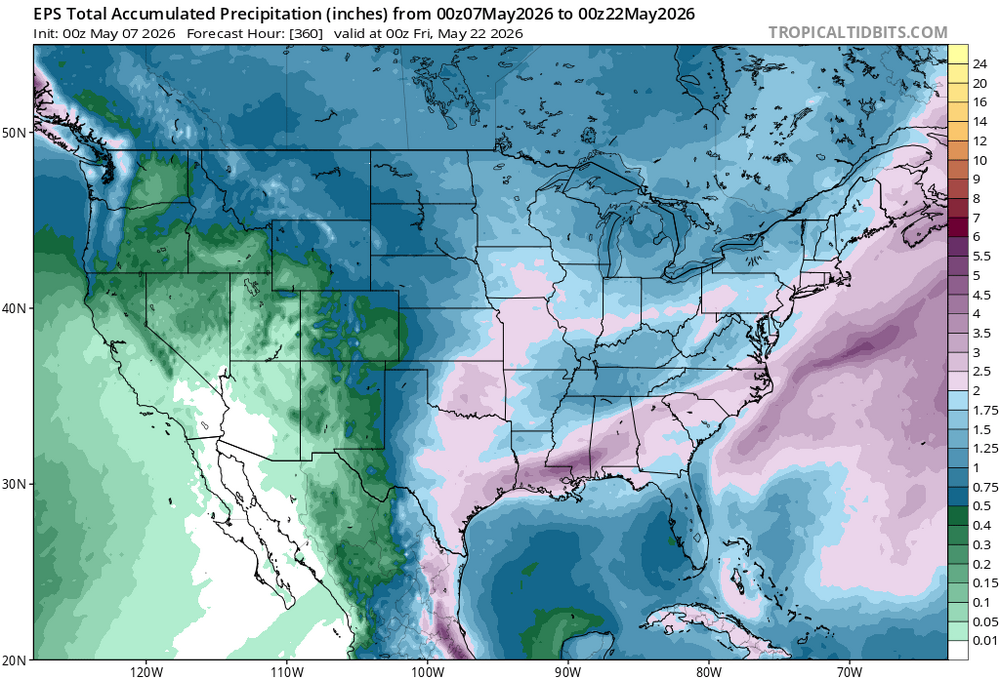
Yikes, the ensembles are not pretty for total rainfall for the next couple weeks. Posting the canadian for no real reason, the others all tell the same dry story:
- 259 replies
-
- 1
-

-
- we got burned
- rugpull central
- (and 1 more)
-
Yep. Did a bit better than you last week with the drizzle here, but my veggie garden is already thirsty as heck after two sunny days
-
Those March through May numbers are rough. Hope the El nino juice heads your way
-
Impossibly nice outside right now. This is like a 1 out of 100 type day in the greater DC region
-
I saw an orange glow to the east at sunrise. Back to gray now
-
Steady drizz and showers all day in silver spring. Maybe a half inch by now? Can't complain, need it.
-
Most/all rain sitting just north of silver spring since the 4pm hour. We got some showers then. Didn't amount to much. But just a few miles away looks soaked
-
send some of that up this way. silver spring is going to just be "silver" soon
-
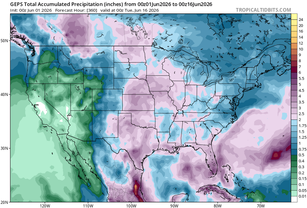
Pretty decent agreement on the ensembles for an inch or so of rain over the broad area of the forum, over the next 7 days. Hope it pans out. We need a lot more than that.
-
Cooking
-
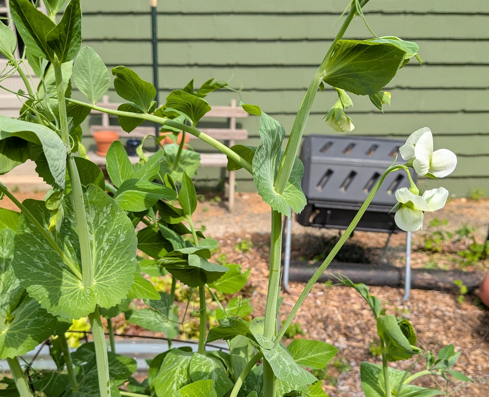
Snap pea plants are flowering -- snacktime soon
-
Agreed. Windy when the air temp is 70-75 and above, with sun = yes please
-
awww yeah. gonna cook
-
Fringed so far in southern moco but hoping it spreads further north in this incoming stuff
-
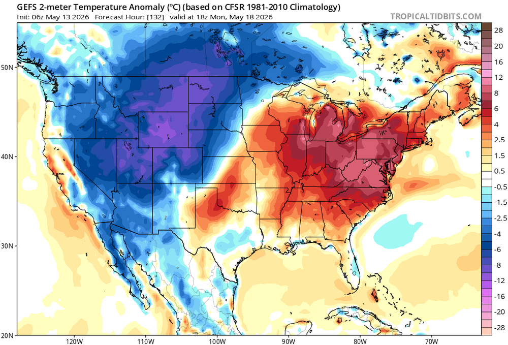
Still not looking great on eps and gets
-
Yep, in my area it's been a half or quarter inch or so every week to ten days. Building up a deficit, but enough to keep things green. I can tell its dry because my grass (and grass in local parks) isn't as thick and lush as it usually is. As sun angle season builds, if we don't get more moisture (like at least 4" by the end of the month) it's gonna start to bake and burn out
-
One of these days I'll get more than 0.5" from an event...
-
Those meandering cutoffs are the bane of my may-june existence around here. This time of year I want SUN