MAG5035
-
Posts
6,054 -
Joined
-
Last visited
Content Type
Profiles
Blogs
Forums
American Weather
Media Demo
Store
Gallery
Everything posted by MAG5035
-
Central PA - Summer 2021
MAG5035 replied to Itstrainingtime's topic in Upstate New York/Pennsylvania
I should be able to make some obs and discussion as this unfolds tonight and tomorrow. Since I literally sat on the edge of the precip with Isaias pretty close to this time last summer, it’s been awhile since I’ve had a decent tropical remnant event come right through here. -
Central PA - Summer 2021
MAG5035 replied to Itstrainingtime's topic in Upstate New York/Pennsylvania
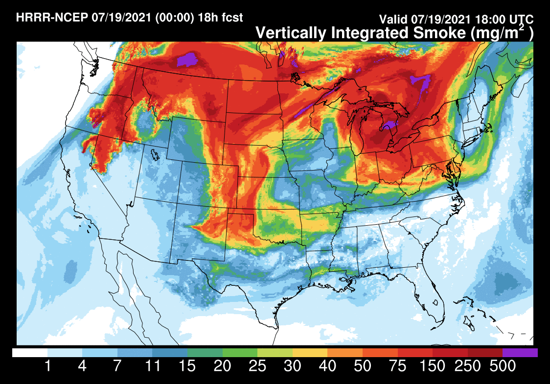
It looks like the HRRR smoke product works most of it out later tomorrow with the passage of the shortwave trough... at least at the low levels anyways. After the brief shortwave passage, we continue to be under the general influence of the sprawling 500mb ridge that has been sending it over here. So while it might not be the lower level stuff that is currently causing degraded air quality over a pretty widespread area of the northeastern US, we might continue to see it in the upper levels later this week. -
Central PA - Summer 2021
MAG5035 replied to Itstrainingtime's topic in Upstate New York/Pennsylvania
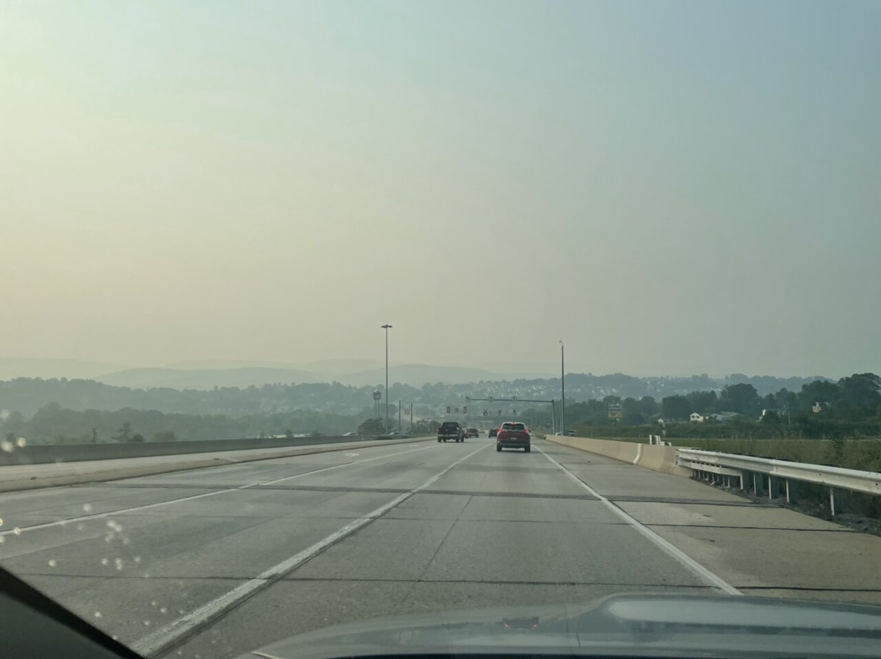
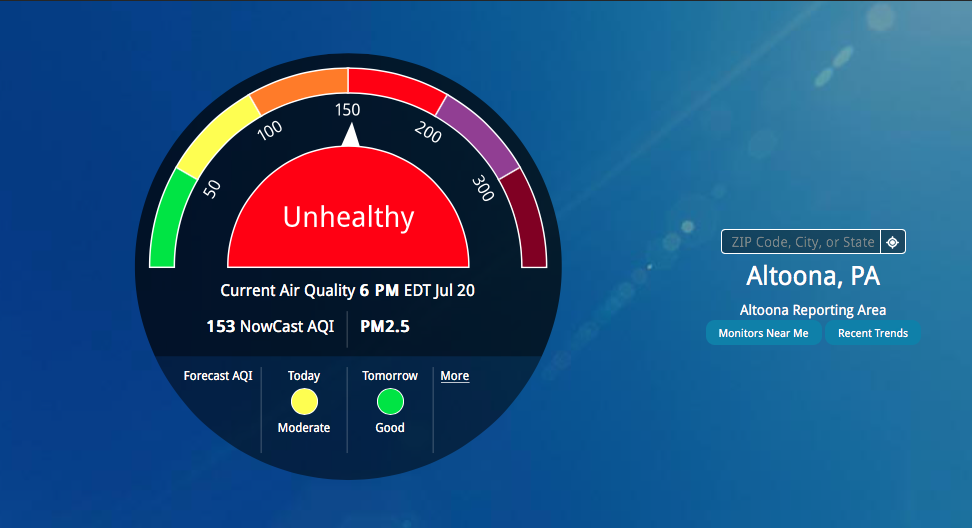
The obligatory “it’s smoky out” pictures. I'm also surprised there isn't an air quality alert in this particular area. It's currently in the "Unhealthy" category with 2.5 PM at 153. Pretty rare for those type of issues around here.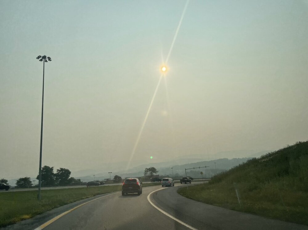

-
Central PA - Summer 2021
MAG5035 replied to Itstrainingtime's topic in Upstate New York/Pennsylvania
With it looking to dry out some, it appears the big weather/atmospheric story in our area for at least the first part of the week is going to be a significant amount of wildfire smoke overhead. Which by the way, I don't ever recall this happening anywhere close to as often as it has in the past two summers. Full loop HERE There's also loops for near-surface, 1000', and 6000' AGL on the NOAA site, which the HRRR also eventually shows into PA the next couple days at those levels. Kinda surprised CTP disco didn't have any mention about it today.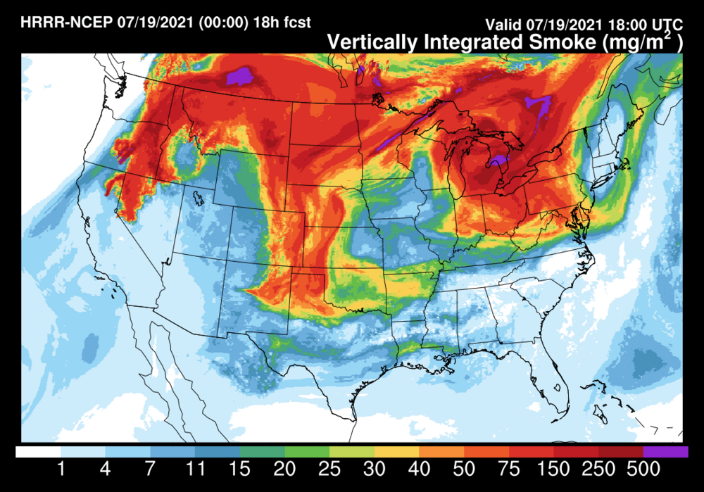
-
Central PA - Summer 2021
MAG5035 replied to Itstrainingtime's topic in Upstate New York/Pennsylvania
It almost looks like the circled portion of the line is taking on the signature of an MCV.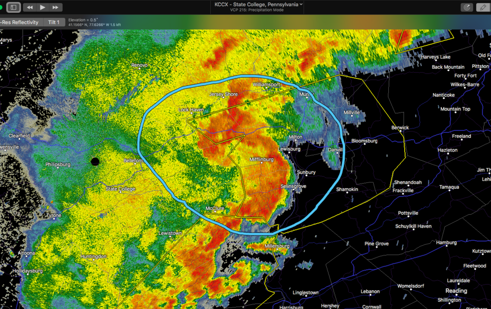
-
Central PA - Summer 2021
MAG5035 replied to Itstrainingtime's topic in Upstate New York/Pennsylvania
Yea everything's good, I'm just a lot busier during the summer months and don't get a chance to post as much as the wintertime. Other than a pretty significant flash flood event in town on the morning of June 10th (3"+ of rain in an hour) we were having a really quiet summer around here severe wise (non-existent) until this past week. Wednesday's severe weather did a lot of tree damage in some parts of town and especially the next valley over. I wonder how @Cashtown_Coopwould feel having to clear 50+ damaged trees off the course 3 days before a golf tourney haha. https://www.altoonamirror.com/news/local-news/2021/07/volunteers-flood-sinking-valley-course/ -
Central PA - Summer 2021
MAG5035 replied to Itstrainingtime's topic in Upstate New York/Pennsylvania
He'd probably know first hand since it looks like the center of that couplet passed over the part of town where the university is. There's def good low level rotation but velocities aren't super high and the couplet isn't really tight with opposing high velocities. I'd still say there's a good chance of a weaker tornado being spawned in there and definitely some severe winds at the least. -
Central PA - Summer 2021
MAG5035 replied to Itstrainingtime's topic in Upstate New York/Pennsylvania
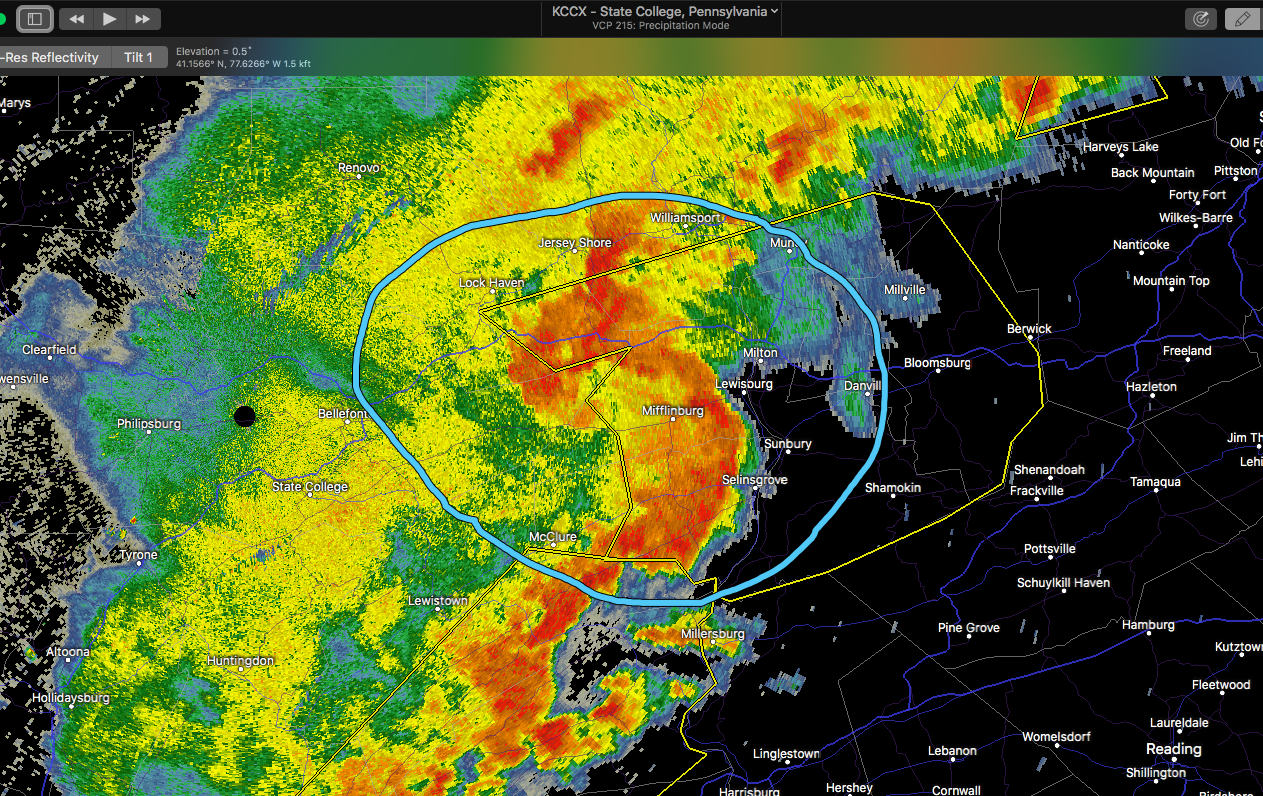
Fresh tornado warning issued for the section of the line over Lock Haven. Pretty decent couplet showing back up. I believe this was the portion that had the pronounced hook/couplet a little while ago. This is pretty close to CCX so the radar's getting a pretty good look at the low levels.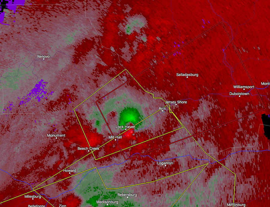
-
Central PA - Summer 2021
MAG5035 replied to Itstrainingtime's topic in Upstate New York/Pennsylvania
I wasn't sure how well that was gonna work since videos are always hit and miss posting on here if its not a youtube link or something like that. I can see it on my phone and laptop. -
Central PA - Summer 2021
MAG5035 replied to Itstrainingtime's topic in Upstate New York/Pennsylvania
I think the line probably makes it but it does seem the real business part of that line is gonna go north. Very pronounced bow on velocity working from just east of State College down to just below Lewistown and that seems to be generally pressing towards Sunbury/Selinsgrove. -
Central PA - Summer 2021
MAG5035 replied to Itstrainingtime's topic in Upstate New York/Pennsylvania
Above post is a quick time-lapse of the severe warned storm I just got right after it passed north. -
Central PA - Summer 2021
MAG5035 replied to Itstrainingtime's topic in Upstate New York/Pennsylvania
IMG_3583.MOV -
Central PA - Summer 2021
MAG5035 replied to Itstrainingtime's topic in Upstate New York/Pennsylvania
I haven't seen a legitimate thunderstorm all year around here until an hour ago. That stuff coming towards State College means business. -
Central PA - Summer 2021
MAG5035 replied to Itstrainingtime's topic in Upstate New York/Pennsylvania
Yea I thought that was pretty wild. It makes me wonder what the air quality was like here back in Altoona's Pennsylvania Railroad heyday. -
Central PA - Summer 2021
MAG5035 replied to Itstrainingtime's topic in Upstate New York/Pennsylvania
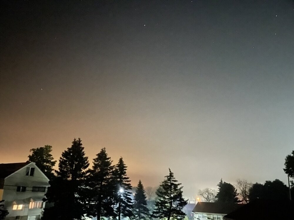
All the local fireworks backyard and otherwise this evening actually made a noticeable impact on the Air Quality monitor here with the combination of Altoona being in a valley and a bit of a temp inversion with some mostly clear skies and cooling tonight, trapping all the smoke and etc and making it pretty hazy here right now. The PM2.5 really shot up after dark. Edit to add a current outside pic (3 sec exposure)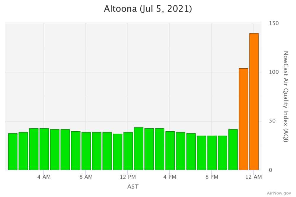
-
Fun fact about the run of record low maxes in 1972. That actually occurred during Hurricane Agnes as the tropical system was absorbed by an anomalous trough and associated mid-latitude system over PA. That whole mess sat and spun over us for days, leading of course to all the insane rain totals and flooding. With the historic flooding obviously being the most memorable aspect, it's not often mentioned how chilly it actually was during most of that event in central PA.
-
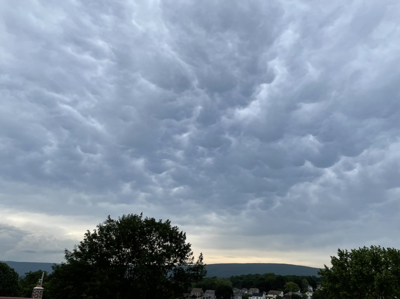
Nothing major to report around here this afternoon as most of the action has been firing in north-central and southwestern PA. Do have some nice mammatus clouds downstream of the Pittsburgh storms.

-
Ended up being under a really localized area of heavy rains first thing this morning. 1.5” estimated over my location and a couple 2”+ spots nearby.
-
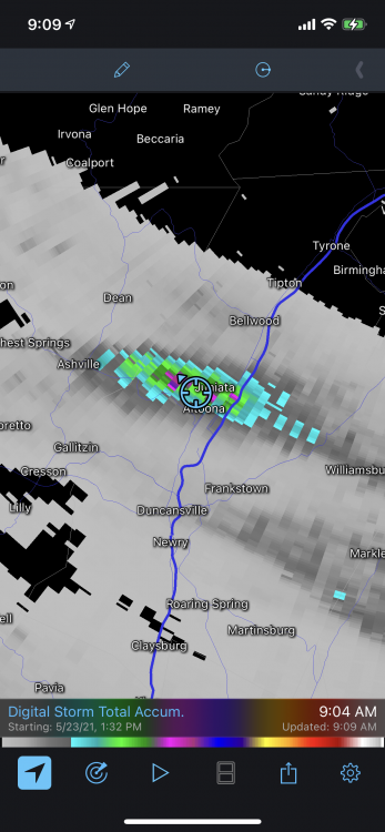
Lol, this is turning into a straight up snow event on the I-80 corridor west of Clearfield. Starting to lay on the highway on top of Rockton Mountain west of Clearfield.
-
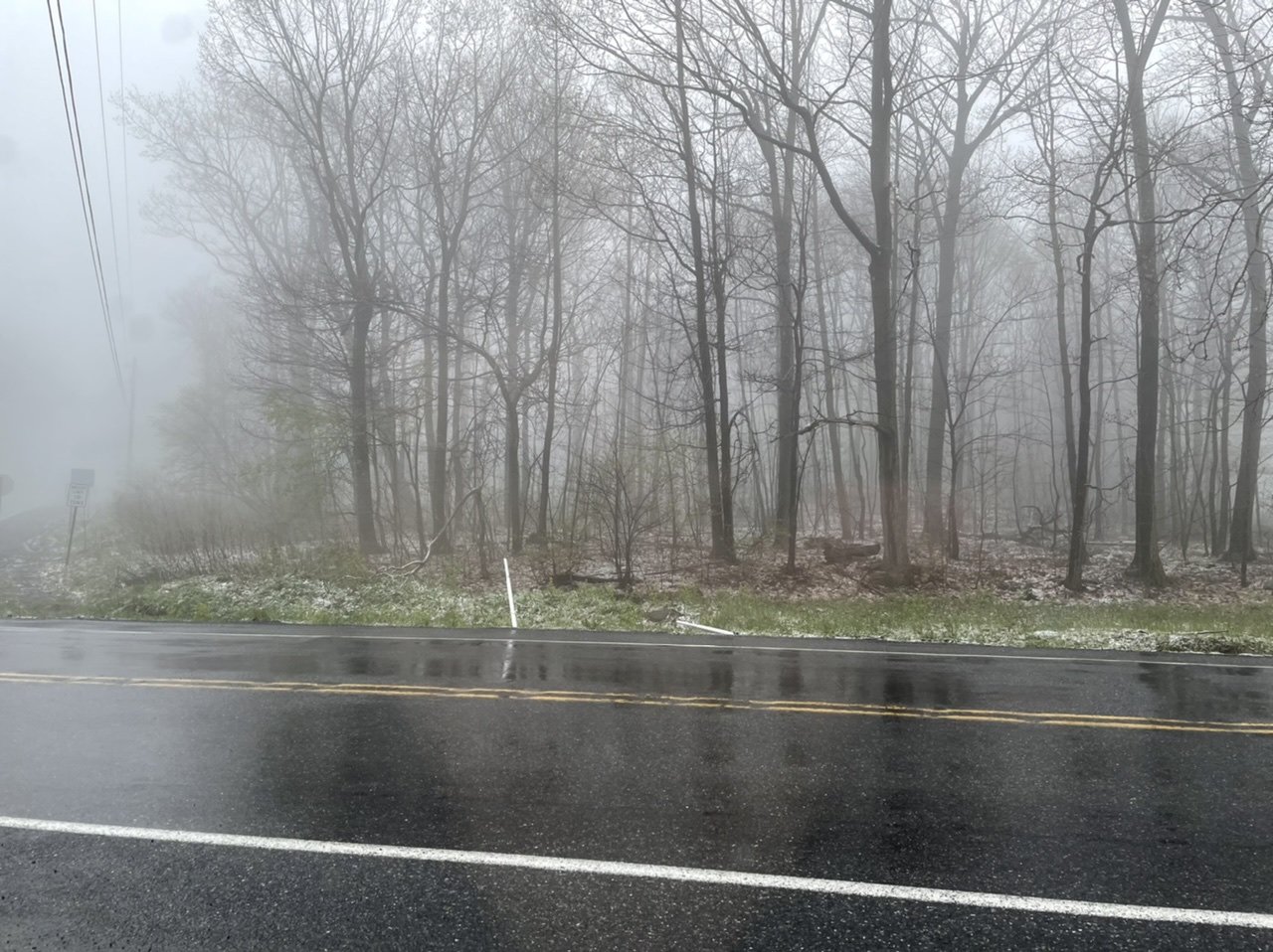
Got to throw in the May snow pic, since it’s an annual thing now apparently. Top of Wopsy Mountain Also some occasional mangled flakes/cat paws down at my elevation as well in heavier precip.

-
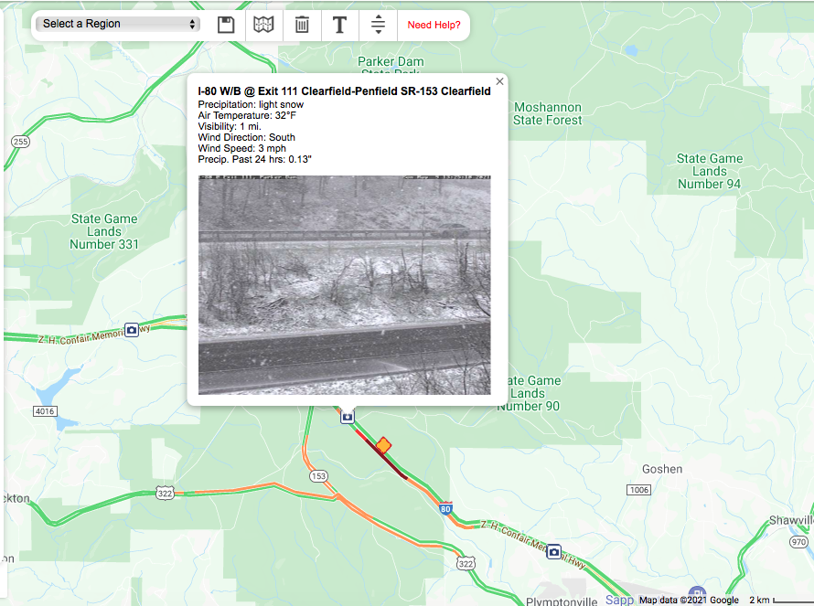
Snow showing on the 511 cams in some of the Laurels spots.
-
It's very cold aloft today with 850mb temps a couple degrees below zero, 700mb temps around -10C and 500mb nearly -30ºC over the commonwealth...which is quite significant. Combine that with the strong May sun providing surface heating and instability and that's definitely a recipe for graupel, which would count as frozen. Technically regular hail does too, but I think considering the cold low-mid levels any frozen p-type is probably mostly graupel. Would have to see some pics if anyone gets any decent hail/graupel. There was some actual snow in some of the higher Laurel's spots this morning. Not quite the extent of last May's major cold shot, but it's certainly a pretty chilly/unsettled weekend. Also, sorry I haven't been posting too much.. I usually get pretty busy in the spring/summer months.
-
I sit at approx 1300' here on the NW corner of the city right up against the Allegheny Front. A 4 mile drive up the road out of town gets me to almost 2500'.
-
Yea we had a pretty good blast of snow during the late morning. I just got home here and I was surprised to measure 1.5" on the glass table on my deck. All on grassy and elevated surfaces, this stuff isn't touching any pavement or gravel at this elevation. I'll bet the top of the Allegheny front has advisory amounts on it, I was up in Cambria County early this morning and the higher spots already had snow on the ground presumably from the back end of the main precip changing to snow overnight. Accumulations are pretty elevational and localized down here.
-
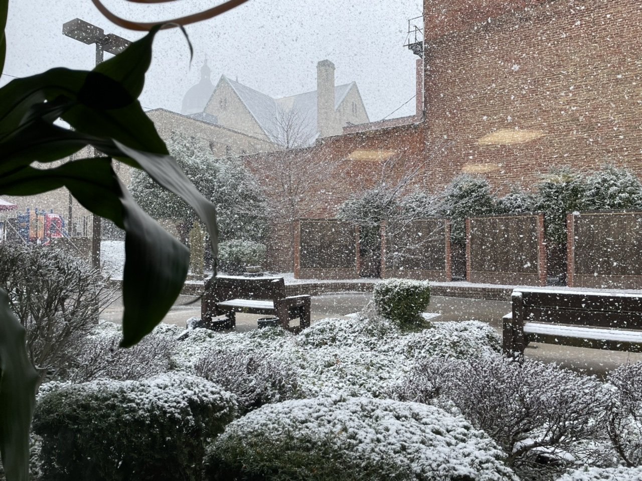
Pretty snowy this morning. Downtown Altoona