MAG5035
-
Posts
6,078 -
Joined
-
Last visited
Content Type
Profiles
Blogs
Forums
American Weather
Media Demo
Store
Gallery
Everything posted by MAG5035
-
So far so good here in my immediate neighborhood, but that wind is definitely legit.
-
Possibly, I think the timeframe looks pretty solid. Gusty winds are going to linger into the evening tomorrow but It does appear that late morning-mid afternoon period might be the time of highest gusts.
-
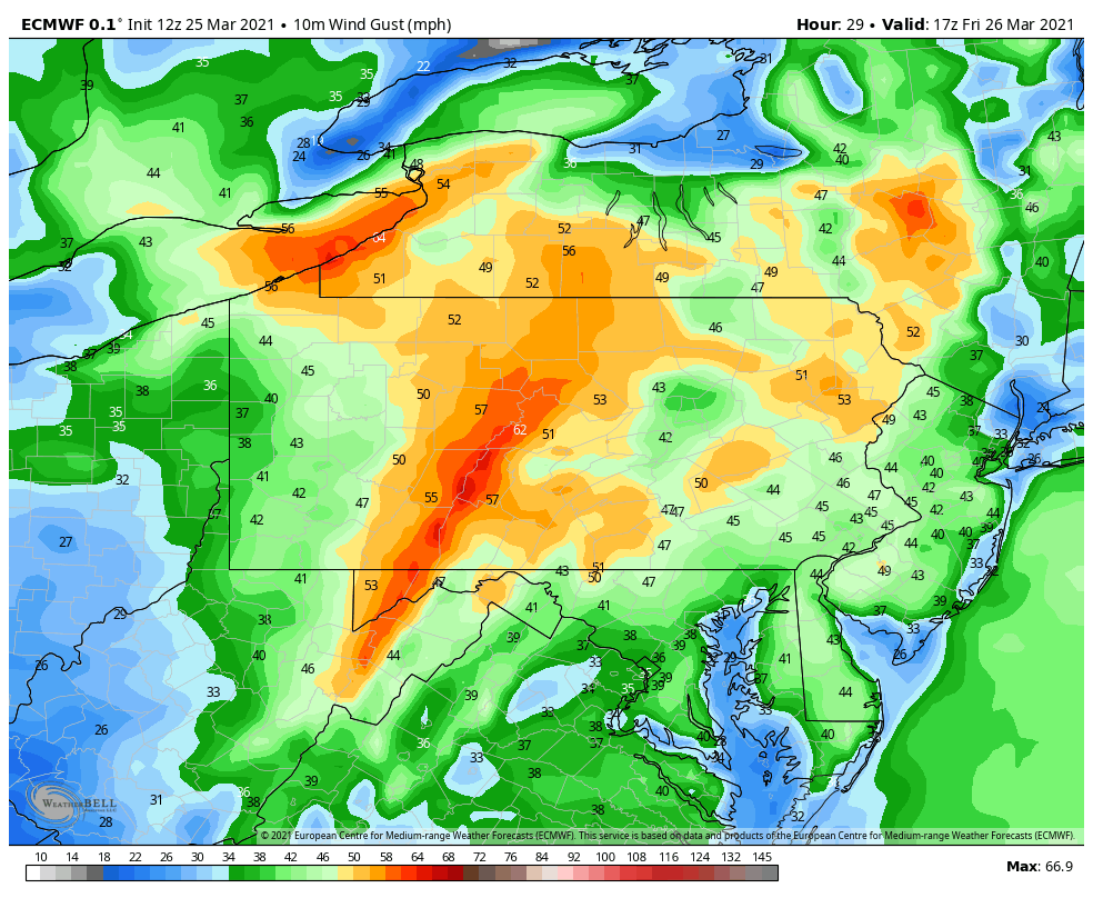
Probably a good thing for us it's early in the spring (and not having diurnal heating given time of the day) because a lot of these same dynamics driving the impending PDS situation in the deep south ride up through PA overnight into tomorrow morning. The NAM actually does briefly inject higher surface dewpoints, high helicity, and some CAPE (mainly 500-800) into eastern PA around daybreak but dry air aloft is already punched in at 700mb and most of the scattered showers/possible storms are lifted north. Seeing this type of a dynamic situation in say, May would likely be a much different story. At any rate, the wind situation looks to be a pretty significant deal tomorrow with most of the area easily seeing wind advisory criteria. Guess I'm the lucky one that get's the high wind warning in this situation. I don't often see a high wind warning actually verify here but this is looking like that once in a few years time that it actually does as I'm co-located nearest the best dynamics plus the immediate downslope off the Allegheny Front with the westerly winds. The Euro was through the roof (or blowing the roof away) with wind gusts around here in today's run. 18z 3k NAM coming in isn't quite that nuts but it's close.

-
Central PA - Winter 2020/2021 Part 2
MAG5035 replied to MAG5035's topic in Upstate New York/Pennsylvania
Looks like about 62ºF here this afternoon, which just happened to be the number of inches of snow the 12z GFS had for Denver today (mostly Sun-Tues). Boy those model and ensemble plots are a sight to behold in that region. -
Central PA - Winter 2020/2021 Part 2
MAG5035 replied to MAG5035's topic in Upstate New York/Pennsylvania
Lol. Proclaiming such things north of DC and north of the Ohio River west of the Apps in that group of states is a hot take at best at this point with more than three weeks left in March. And I'm not even super excited about the prospects at the moment beyond acknowledging the warm-up this week is probably an early spring tease (aka "Spring of Deception" in that often shared 12 seasons of *insert state or region here* meme). I'm personally not really eyeing up individual storm threats that pop up in the long range GFS/Euro quite yet, as I believe we're going to need to get through the warm-up this week to see where the pattern is actually going to evolve... and I think this potential window probably shows up somewhere in the last two weeks of the month if it materializes. Nearest potential bigger thing showing up just before St Patty's Day on the models I feel is actually too early for the potential overall pattern change as NAO/AO still looks quite positive at that stage with lots of low heights over Greenland. 18z GFS evolution of the parent low going west isn't quite ideal this late with core of preceding cold NE of PA and a retreating high. So I think 12z Euro or maybe the 18z ||GFS depending on if there's a retreating high to the NE is probably a better take on something that's still in D7-9 to begin with. There were a couple individual ensemble members on both Euro and GEFS that were cranking out some wild stuff accum wise for that too, likely driving the mean a bit. I mean we could score something there, but I think the general period of interest is after that. We definitely look chilly late month but we need more than just a bit below average in the second half of March outside of a one-off thread the needle hail mary. I want to see a more dominant teleconnection signal show up...whether its an -EPO (and/or +PNA), a redevelopment of a stronger -NAO (preferred) or some combination thereof to sign off on a Late March/early April 2018 kind of late season run. Today's 12z Euro control run for instance really built a -NAO with big ridging over Greenland and presented the kind of pattern and strong eastern trough you need to see for a run of late March winter weather. Ensembles look somewhat mixed, showing eastern troughing but not really showing much -NAO (esp GEFS) and some Greenland ridging in the case of the 12 Euro EPS. Both are showing some semblances of an -EPO which is reflective on the plots (mean is negative in the longer range). MJO plots are stalling near phase 1 or going null right now. We need 2-3 this time of the year for that teleconnection to correlate best to eastern cold. So workable overall but as I said we need something more dominant teleconnection-wise to materialize to have a better chance at scoring from a late season wintry period. -
Central PA - Winter 2020/2021 Part 2
MAG5035 replied to MAG5035's topic in Upstate New York/Pennsylvania
It looks like we're going to come up dry this week on our best looking nearer term window for anything with respect to the teleconnections, which seems to be approx Mar 4-7. This is where we see the PNA briefly neutralize and the NAO/AO fairly negative. However, the deep 500mb low retro-ing underneath the NAO block to about eastern most Quebec/Labrador and the mean 500mb ridge pressing into the central US puts us on the back end of the trough, which will stuff the progged wave around Mar 6th way south through the SE US and out. The result for us looks like a chilly but relatively quiet week this week before presumably some moderation next week as we flip the NAO/AO positive and PNA negative again. As was just posted above with the MJO, we could have a run through phase 2-3 eventually later this month. FMA temp anomalies have a pretty strong correlation to NE/Great Lakes cold in those two phases, so if that were to come to fruition we could conceivably see a favorable period materialize 2nd half of the month.. especially with seasonal shortening of wavelengths and amplification. Im generally ready for warmer spring-like weather after about March 15th or so unless it's a go big or go home situation, so I'd hope we can see a late March/early April 2018 type deal if it's going to be colder than average and unsettled the back half of the month. Either way, I don't really see any real northeastern spring fling breakouts right now. -
Central PA - Winter 2020/2021 Part 2
MAG5035 replied to MAG5035's topic in Upstate New York/Pennsylvania
I got grass showing by the tree line edge of my property, fortunately it’s on the neighbor’s side lol. It’s def warm. KAOO at 54°F but the local meso obs in town are near 60°F -
Central PA - Winter 2020/2021 Part 2
MAG5035 replied to MAG5035's topic in Upstate New York/Pennsylvania
Some definite shrinkage in the pack today with the brisk winds, some sun, and temps gettin into the low-mid 40s. -
Central PA - Winter 2020/2021 Part 2
MAG5035 replied to MAG5035's topic in Upstate New York/Pennsylvania
Catching the height of the snowpack. Temps are above freezing and winds have kicked up.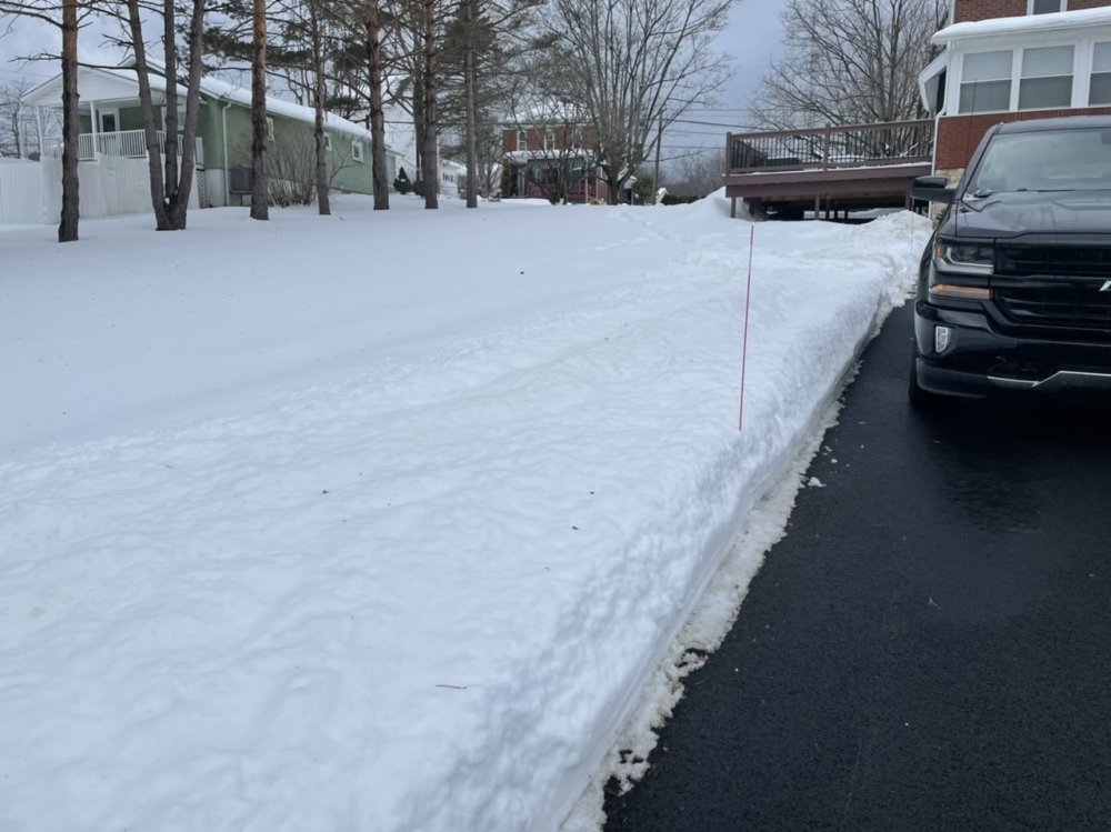
-
Central PA - Winter 2020/2021 Part 2
MAG5035 replied to MAG5035's topic in Upstate New York/Pennsylvania
Well this is fun, a snow rainbow. Been quite a last few days with the picture taking haha.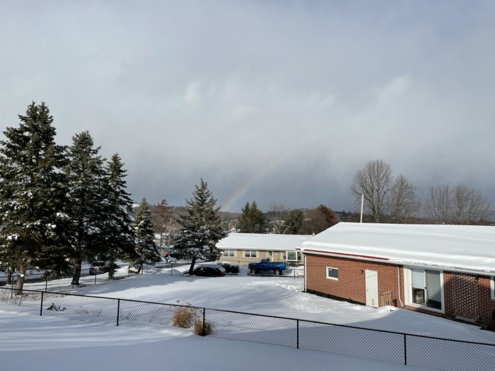
-
Central PA - Winter 2020/2021 Part 2
MAG5035 replied to MAG5035's topic in Upstate New York/Pennsylvania
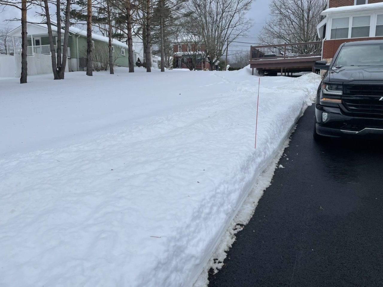
3.6" is going to be my final. Checking the pack yielded mostly 10-15" depth measurements, roughly a 12" average. Season snow total to date is 48.5". -
Central PA - Winter 2020/2021 Part 2
MAG5035 replied to MAG5035's topic in Upstate New York/Pennsylvania
Was going to call a final a bit ago but still getting quick bursts of moderate to heavy snow with the lingering scattered precip. I was curious about this as well, as I did mention last night just a couple degrees colder on the low level temps might make a difference between 10:1 and <10:1 and higher amounts. There definitely must have been some good snow growth with at least the front part of the event and those colder low level temps meant the flakes didn't get rimed or anything like that. This thing arriving a bit early helped too. -
Central PA - Winter 2020/2021 Part 2
MAG5035 replied to MAG5035's topic in Upstate New York/Pennsylvania
3.3” and moderate snow. 3” was my expected target # for here so definitely a nice snowfall this morning. Today’s likely to be the “crest” of the snowpack depth this winter here unless something wild happens down the stretch. -
Central PA - Winter 2020/2021 Part 2
MAG5035 replied to MAG5035's topic in Upstate New York/Pennsylvania
Just woke up and there's already over an inch of new snow. Moderate-heavy rates, 28ºF. -
Central PA - Winter 2020/2021 Part 2
MAG5035 replied to MAG5035's topic in Upstate New York/Pennsylvania
Bringing this post back up from yesterday as my thought's really haven't changed too much on it and neither has guidance. Still seeing the weak spot in the aformentioned part of the south-central between I-81 and I-99. Still should see at least a quick 1-2" up front there though. Biggest thing is this does look to take the whole LSV as a period of snow up front and how aggressive the rates are is going to ultimately determine impacts and accumulations. Sped up a tad too, with this looking to get into the Sus Valley by mid-morning so if it comes in gangbusters it's obviously going to screw the roads up pretty good. A couple degrees colder in the low levels might be enough to realize 10:1 instead of <10:1 ratios so all of the Sus Valley looking pretty solid on that 2-3" scattered 4". The wave of snowfall is probably done in 4-6 hrs tops, with any lingering precip east of the mountains likely in the form of some scattered showers later in the afternoon. -
Central PA - Winter 2020/2021 Part 2
MAG5035 replied to MAG5035's topic in Upstate New York/Pennsylvania
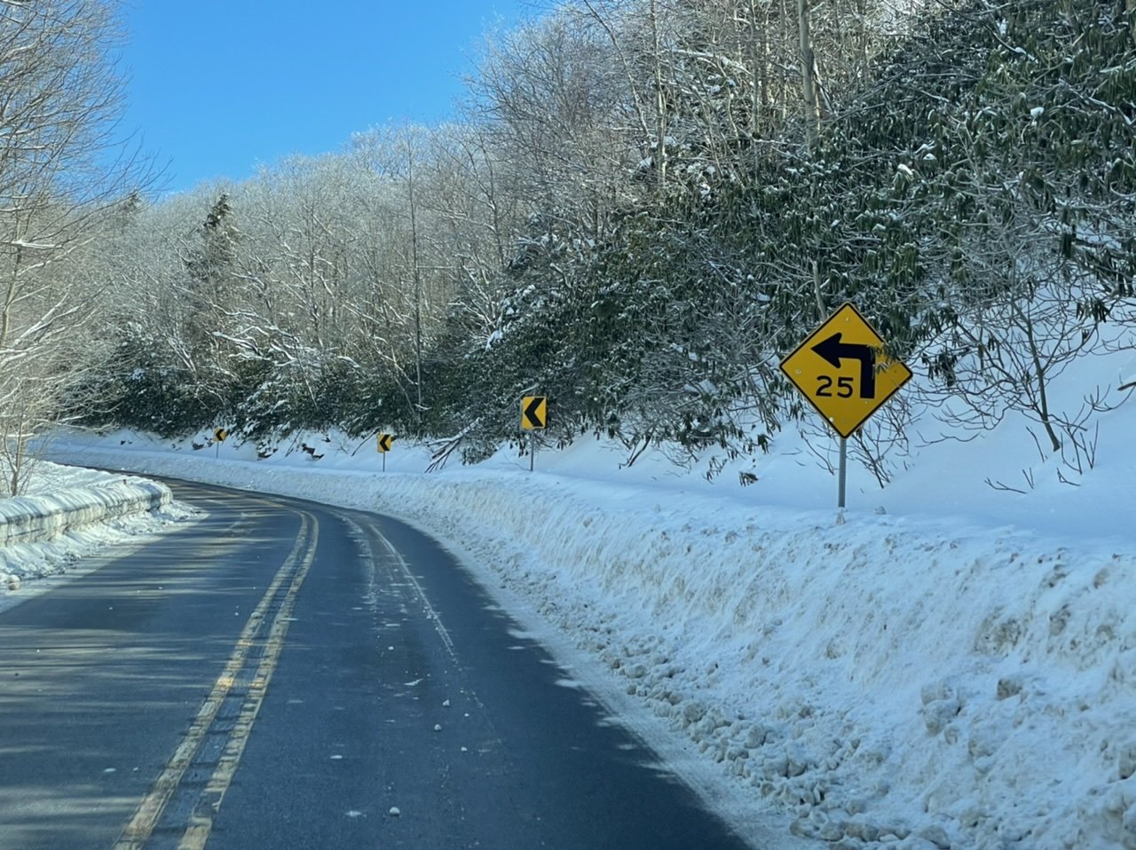
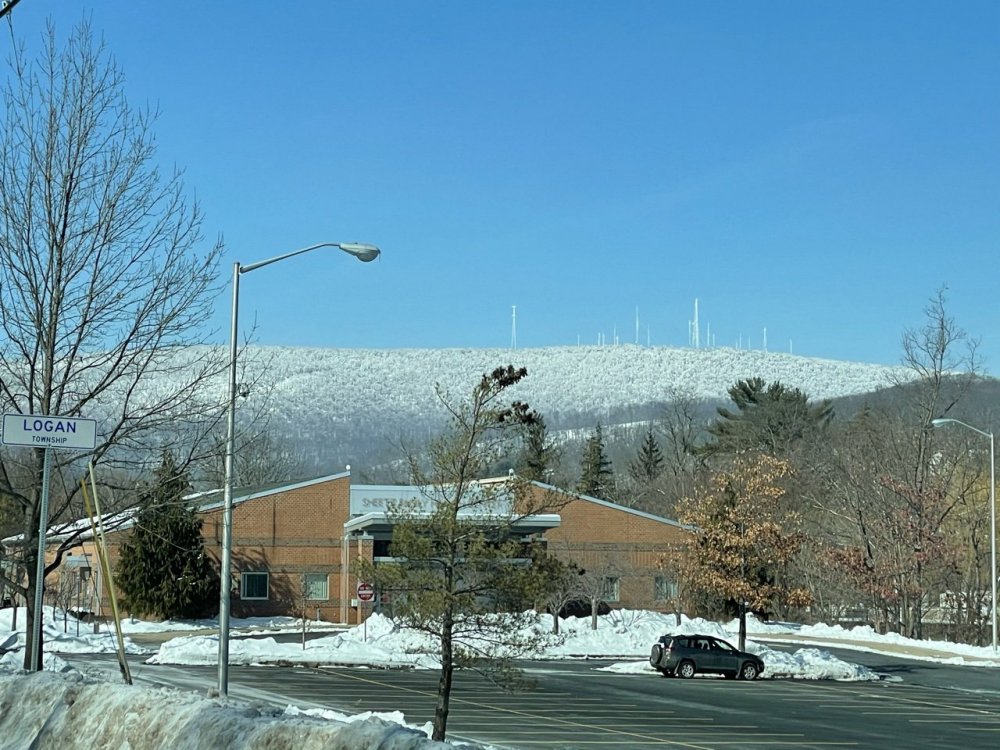
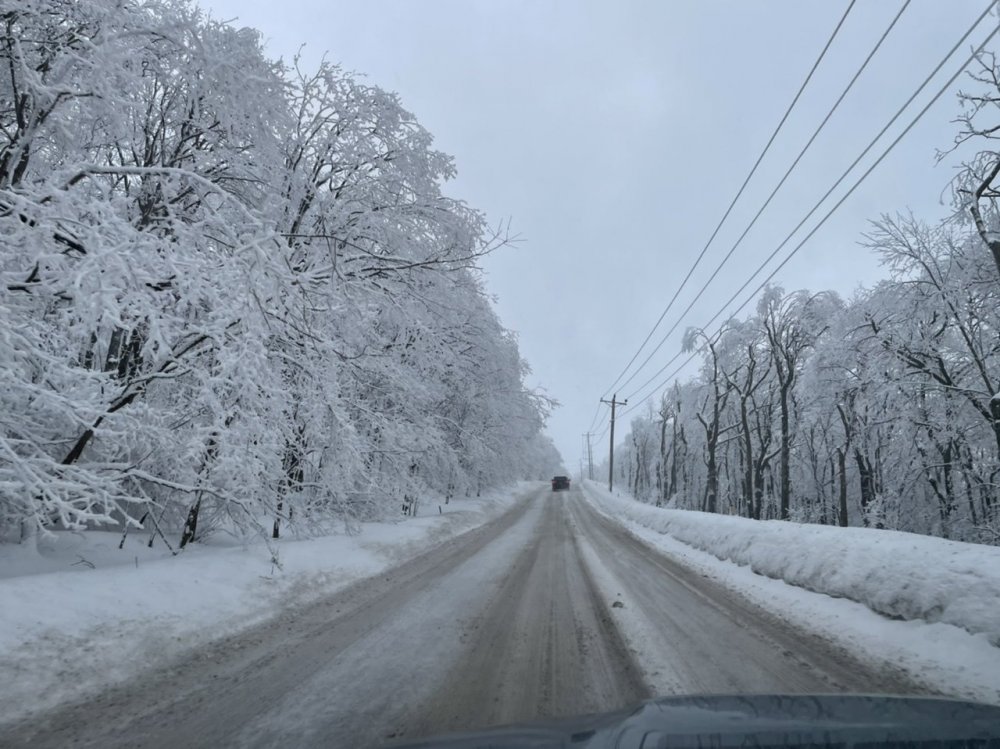
I did just that not too long ago, it definitely didn’t disappoint haha. It really sticks out with the clear skies today, I wish I could load the full quality pics on here. It’s always wild the difference 4 miles and 1100’ of elevation makes. Top of Wopsononock Mtn west of Altoona

-
Central PA - Winter 2020/2021 Part 2
MAG5035 replied to MAG5035's topic in Upstate New York/Pennsylvania
This looks like a quick hitting advisory type event, like a 2-3" scattered 4" type deal for most with perhaps more frequent higher amounts (4-6") a better possibility in the Laurels, I-80 corridor, and Poconos. Also need to consider the possibility of a weak spot in the south central counties between I-99 and I-81 (Bedford, Fulton, Franklin, maybe southern half of Huntingdon, etc.) where could only be a 1-2" type snowfall. Low stays NW of PA on a general westerly flow so that typically invites the probability of some downsloping in that aforementioned area, and it has been showing up on most model guidance. Could only be 1-2" in the LSV as well, and I'll explain that below. Timing and temps are another concern, esp LSV below the turnpike. This appears to be a late morning to late afternoon/early evening hit, so rates better be good there with marginal low level/surface temps. I often find that after about the 2nd week of February or so it's like flipping a switch with respect to solar input (ie the sun angle)...not yet with heavier and/or cold storms, but with clear days and light events with marginal temps (specifically ones in the middle of the day). NAM once again the warmest, bringing mixed up into the LSV. Showing ZR as primary p-type but I would imagine any icing would be limited in scope if it were in fact liquid precip. And considering how thermals have went in the other two events this past week (even though the M/D simultaneously got their 4-6" of snow and still had mixing all the way up through MDT with Thur), I'm inclined to seriously consider the NAM in that regard. So ideally, a good shot of heavy precip up front would at least secure getting a couple of inches. Ratios might be <10:1 as well. Kuchera maps have actually looked a bit worse than the 10:1 maps, and while Kuchera method applies a fairly simple algorithm for calculating the ratios it is generally picking up that the temps 850mb to surface are a bit marginal. -
Central PA - Winter 2020/2021 Part 2
MAG5035 replied to MAG5035's topic in Upstate New York/Pennsylvania
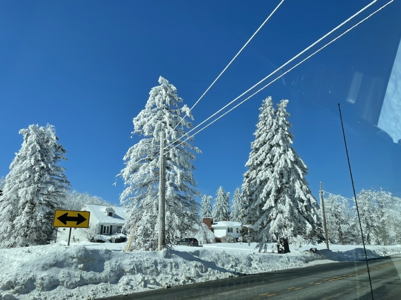
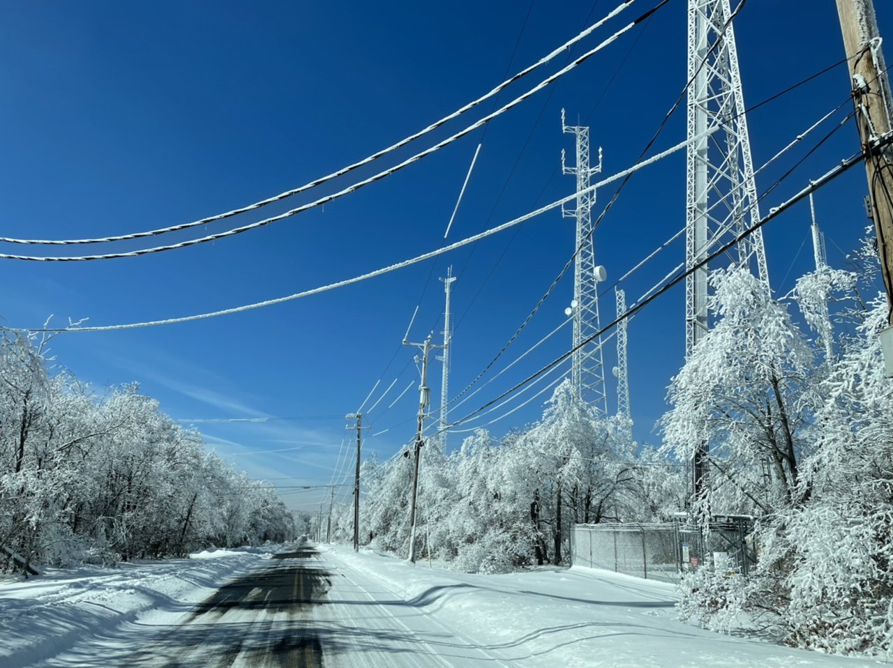
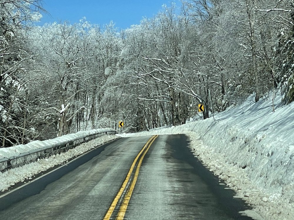
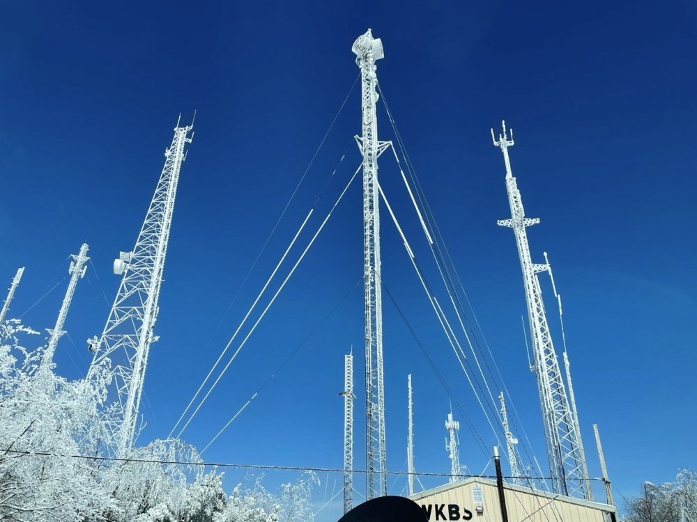
That looks like a lot of snow down there too at that elevation. Yea it was a combination of rime ice near the summit which is in clouds a good bit (over 3100' at the top) but alot of it was also the new snow sticking directly to the iced trees too. It looked like they had a significant amount of ice up there from that ice storm even for their standards, and since there was never any strong warm push at what is essentially the 925mb level at the top of the mountain there, most of it didn't melt. -
Central PA - Winter 2020/2021 Part 2
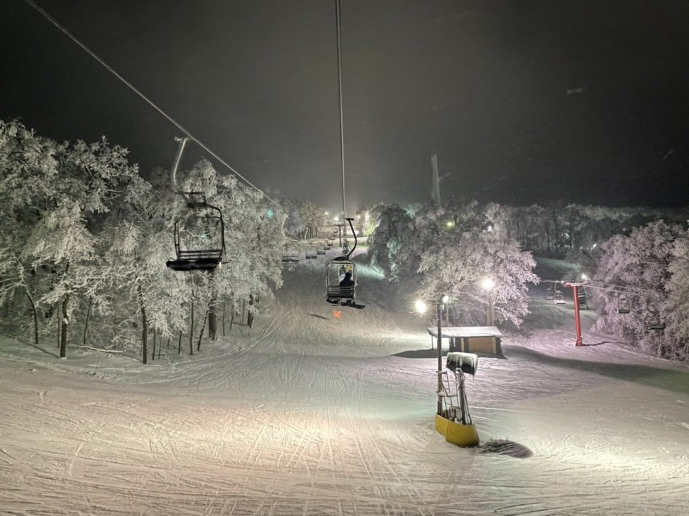
MAG5035 replied to MAG5035's topic in Upstate New York/Pennsylvania
I went up to Blue Knob in the afternoon/evening yesterday and it was quite a sight up there. Probably a general 2’+ natural snowpack around the mountain plus the 1/2”+ of freezing rain from the ice storm and rime ice (esp above ~2600ft) that never melted before it snowed again the last couple days.


-
Central PA - Winter 2020/2021 Part 2
MAG5035 replied to MAG5035's topic in Upstate New York/Pennsylvania
Decent burst of snow currently. Wouldn’t say it’s been piling up by any means but it has been snowing pretty much all night so far. Up to 1” additional now with round two, though that’s the running total all the way since mid afternoon. -
Central PA - Winter 2020/2021 Part 2
MAG5035 replied to MAG5035's topic in Upstate New York/Pennsylvania
It does seem like the stuff around is being somewhat under represented on the HRRR but it's still fairly patchy so I don't think we'll end up with as much as some of the models have tonight. I think for the most part an inch or less but perhaps we can get a band setup that drops some localized 1-2" amounts. The best action seems to be staying NW of I-81 for now as well, with it actually snowing half decently here currently. It's been snowing off and on enough this evening that it's got most of the streets and secondary rds icy again. Board was cleared this afternoon right after it started snowing off and on after 2pm. 2.9" fell before, and just measured 0.7" so far since for 3.6" on the event. That makes a 44.1" current season total on those measurements. I generally consider the 45-55" range as average-ish for this end of Altoona right against the Allegheny Front so looking pretty good for Feb 18th. -
Central PA - Winter 2020/2021 Part 2
MAG5035 replied to MAG5035's topic in Upstate New York/Pennsylvania
Some steady snow trying to get restarted back this way. While I was out clearing stuff off a bit ago I had a bout of freezing drizzle that promptly glazed the car right after I brushed it off. -
Central PA - Winter 2020/2021 Part 2
MAG5035 replied to MAG5035's topic in Upstate New York/Pennsylvania
2.8” and slotted out over here currently. Hopefully can get things started back up this afternoon. -
Central PA - Winter 2020/2021 Part 2
MAG5035 replied to MAG5035's topic in Upstate New York/Pennsylvania
2.1” for my last measurement til morning. Steady light snow, 23°F -
Central PA - Winter 2020/2021 Part 2
MAG5035 replied to MAG5035's topic in Upstate New York/Pennsylvania
Moderate snow and 24ºF. Midnight measurement is 1.3" of straight powder snow in a bit under 2 hrs since it got going. Not too bad considering the near term stuff late this afternoon and early evening didn't have this even starting here until about now or a bit later.