

MAG5035
-
Posts
5,884 -
Joined
-
Last visited
Content Type
Profiles
Blogs
Forums
American Weather
Media Demo
Store
Gallery
Posts posted by MAG5035
-
-
I'd sign up for the opening 10 days of that 18z GFS run coming in right now, good lord.
-
 2
2
-
 1
1
-
-
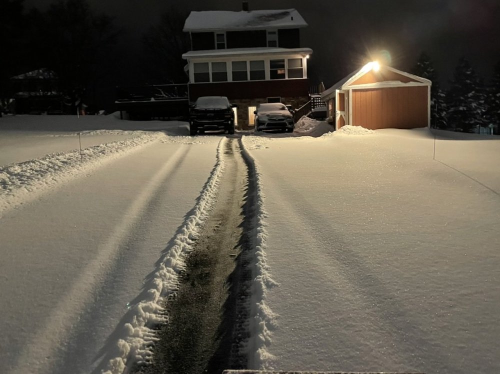
I thought about hitting the slopes today, glad I didn't.
-
I'll be curious to see the NESIS ranking of this storm. My guess is it's a solid/higher end 3, judging by the snow reports it had a pretty wide ranging 10-20" swath that got into the outer metro regions W and NW of all the big cities, with NYC/LI being the one big city metro that got into that 10-20. DC looked like it rode the edge of the 4-10" swath, while Philly was more into it but some suburbs there had big totals (. Same with Boston, there actually wasn't too much in the metro but a lot of mid-high teens reports in the suburbs. The 20-30" swath obviously located in a much more populated area than the December storm, which I think was a big reason it only ended up being a 2.
-
2 minutes ago, paweather said:
OH. My bad. Sorry. Someone had just twitter posted this so I thought it was for this Sunday.
I figured haha, that's how big storm rumors get spread. People on social media don't read details like the date of the map and share blindly.
-
1
-
-
1 minute ago, paweather said:
That's for the storm that just happened.
-
Lot of uncertainty in the models in the mid-range. Euro just went from plenty cold to straight up rainer between 0 to 12z runs with the wave it had out around D7. Actually it seems like all guidance really backed off the cold in this particular timeframe where there is that potential following wave after whatever materializes Sunday. It does look like this is going to be a gradient pattern setting up as guidance isn't completely dumping the PV into the east like it was a few days ago. Going to likely be some back and forth with where this gradient sets up.
-
1
-
-
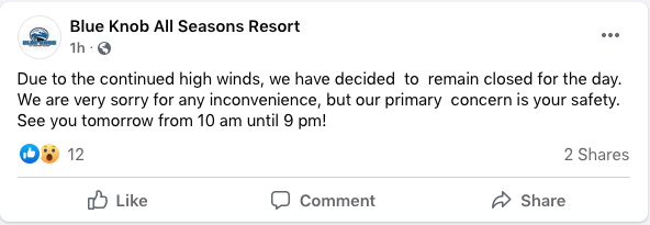
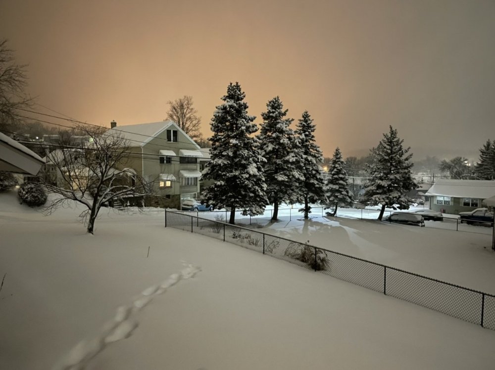
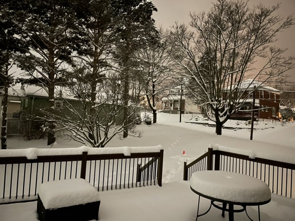
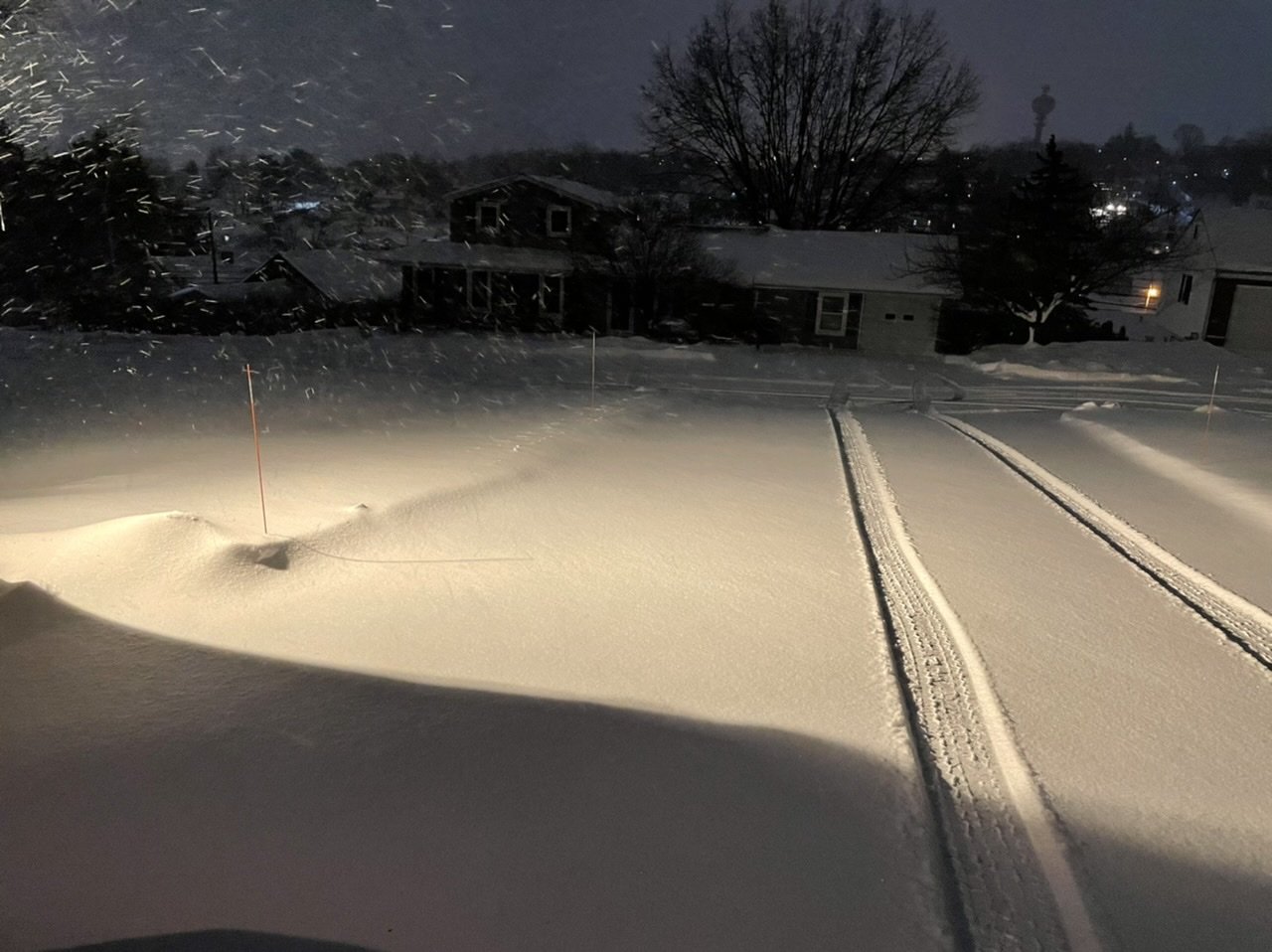
Snow has lightened up. An average of measurements is about 3.5" new. So the new storm total snowfall is 12.5" now.
Edit: Adding last pic of the night, driveway was bare late this afternoon when this band moved in.
-
5
-
-
7 minutes ago, pasnownut said:
This event was a forum wide crowd pleaser for most and 56 hours after it started, is still padding stats in central Pa.
Gonna be hard to top this winter IMO.
But let’s try...
Definitely the longest lasting nor’easter I can remember.
Got any cheap sleds for sale? Haha this looking like one of those rare good stretches for snowmobiling.
-
 1
1
-
-
8 minutes ago, Blizzard of 93 said:
Awesome, let us know your final tally!
I will, I did achieve double digits finally. Just call @2001kx and I the clean-up crew haha.
Think he said over in the storm thread he had 4.8” new. I’m prob getting close to at least 3” but it’s blowing and drifting like crazy.
-
2
-
-
At this rate the deform bands might leave C-PA just in time for Friday’s event lol.
At roughly 65 hrs off and on with this storm now, and I’m currently getting by far the worst conditions I’ve gotten the whole event.
-
2
-
1
-
-
Just got home after being out and about this evening. Best average I got is about 2” of new snow, but pretty variable as it’s wind driven and drifting. Took a drive to our camp in NW Huntingdon County before dark and roads are all a snow packed mess again after being clear this afternoon.


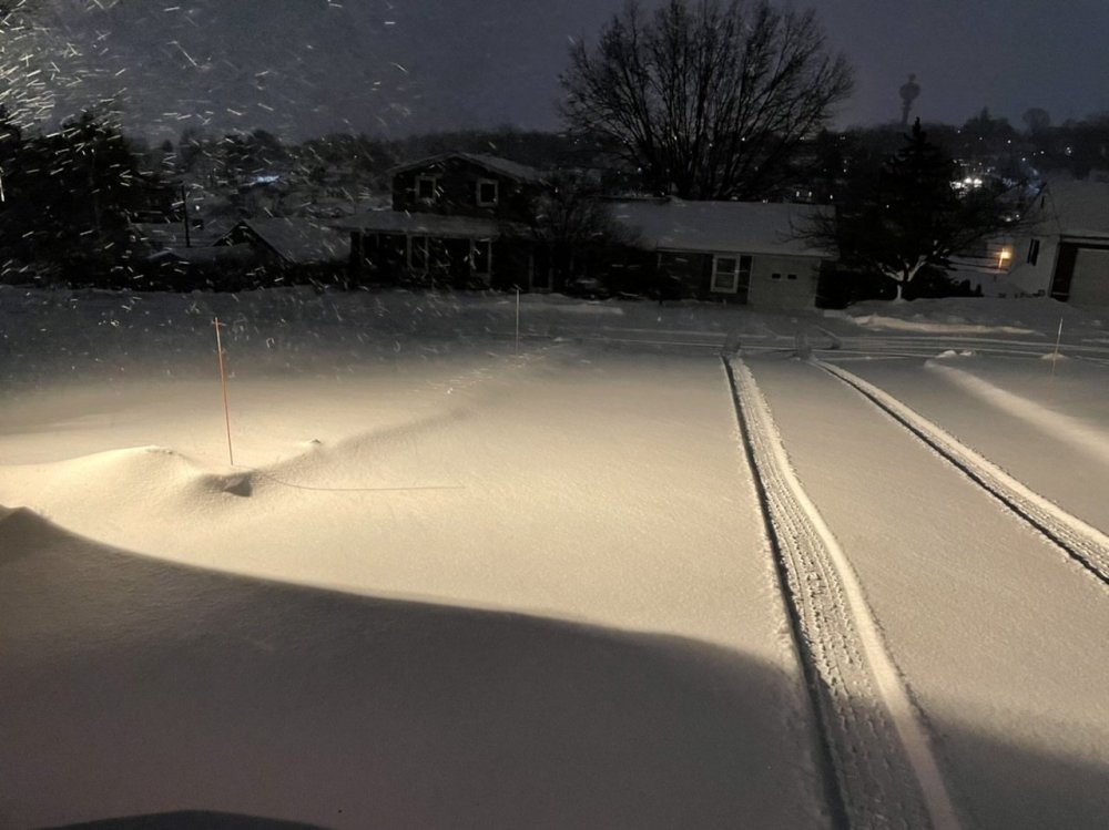
Getting crushed right now. This stuff is very fluffy and the stiff breeze is blowing it around.
-
2
-
-
16 minutes ago, 2001kx said:
It has been coming down at a good rate for the last hr or so.
Lol some of the best rates of the whole event here and not even in the heaviest echoes yet.
-
1
-
1
-
-
Some climo stuff from the AFD this afternoon. Check out the excerpt about State College.
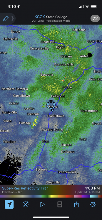
Quote.CLIMATE... 2-day storm total snowfall: Harrisburg: 4.6 Sun + 7.9 Mon = 12.5 Williamsport: 3.2 Sun + 11.2 Mon = 14.6 The State College COOP site reported a storm total of 12.5" ending 7AM Tuesday. This was the second 12"+ snowfall this season; only the 9th time on record with more than one 12"+ storm in a season. The last season with two 12"+ storms was 1995-1996. h/t @SteveSeman
-
1
-
 1
1
-
-
Moderate, wind driven snow now. The double digit total may be back in play now given the look of the radar.
-
1
-
-
Snow moving back in lol.
-
33 minutes ago, pasnownut said:
yep. Gfs still separated but ticked in right direction. Plenty of time for it to come around although suppressed is def a possibility as cold is fresh and deep.
I think even if the southern wave doesn't work out there's a northern branch shortwave and likely arctic frontal passage to be watched for there... and it would probably be a pretty potent one too given the arctic air on the table. Euro's the only one with this bigger storm attm, but it's been keeping this solution plus enjoying solid support from it's ensembles.. so def more than a fluky run or something like that. We'll see how things progress.
Did notice guidance isn't completely dumping the PV into the Great Lakes/NE today after whatever this system ends up being.. keeping the core of stupid cold -35 to -40ºC 850mb air just above over on the Canadian side of the North Central/Great Lakes. GFS drops it down more getting -20 to -25ºC 850mb air into the commonwealth. Euro cold but not quite as cold, which isn't too bad as that set up could be better in terms of getting a gradient pattern with some well tracked systems. Euro ran another system out around D8 or so.
-
1
-
-
42 minutes ago, Mshaffer526 said:
I actually grew up in Altoona --went to Keith/AAHS and lived in Sinking Valley for six years prior to leaving home. I definitely miss the snowfalls up in the valley--especially when it was raining in the city. My mom actually lived near the Campus until about five years ago, up at the top of N. 4th Street.
Really impressive how far west the heavy banding got.
Oh wow thats cool, yea I'm walking distance from the campus where I'm at.
Sinking Valley can def get some interesting weather.. especially on the mountain end. The wind's really kicked up this afternoon so there's likely to be some nice drifts over there.
-
The initial WAA phase of the storm with the primary is where I came up pretty short as better precip kind of split this area (going southern tier and up around UNV and N from there). I had under 2 inches all the way until later Sunday Evening. A few more inches from that and would've pretty much been on target with what I expected here. Otherwise, the 8-14" call with the imbedded area of heavier amounts ended up working out pretty good.
-
1
-
1
-
-
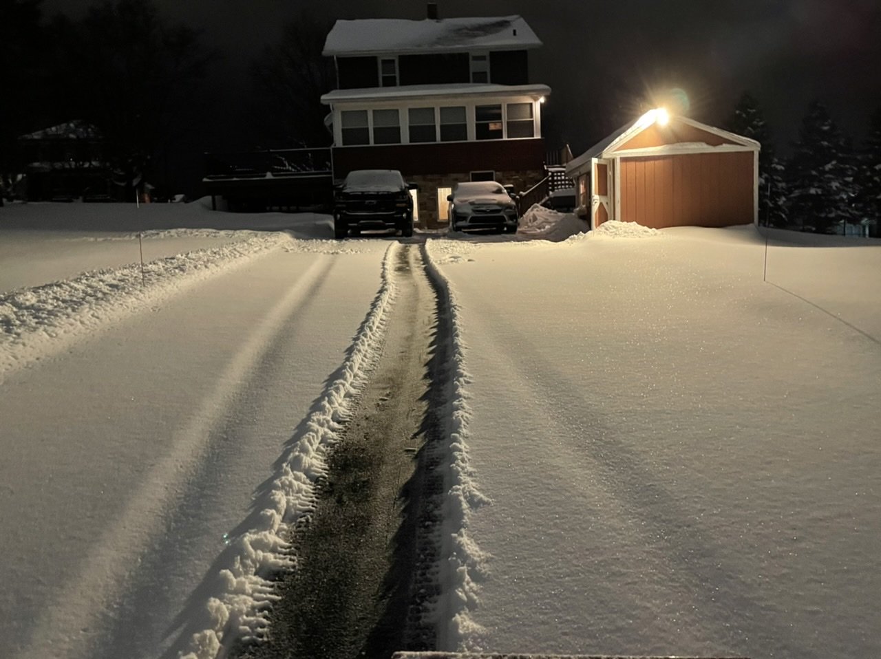
9" storm total is what I'm sending in (4.7" from 9am-9am Sun/Mon and 4.3" in the past 24 hrs with most of that falling last night).
May have been a little bit more with compaction but the way this storm had mostly slow accumulation for the most part I just did two 24 hour clears of my one snowboard. Depth on the untouched board measuring a bit over 8" so the 9" should be a pretty accurate number.
-
1
-
-
41 minutes ago, 2001kx said:
Not in Bellwood anymore?
Nah I bought a house a few years ago. I'm in Altoona now by the campus, only about 4 miles down the road.
-
Light to moderate snow, 8.4” now.
-
1
-
-
15 minutes ago, Rd9108 said:
Do you guys do the whole saving parking spots with chairs thing around your way??
Yea that's a thing here at least. I'm glad I have a driveway and don't have to worry about any street parking.
-
16 minutes ago, CoralRed said:
No joke. They just repeated before going to commercial: three people dead and snow. Story coming up. Amazing they didn't start with the deaths but with weather stories around the area.
It was a murder-suicide involving a couple and their neighbor. It happened about 9:00 this morning. The couple had a 15 year old special needs child. They mentioned shovelling but were not more specific.
I saw an article about that this afternoon from one of the local news stations here. DA quoted as saying there was some long running dispute between them but sounds like whatever they disagreed about with the snow was the tipping point. Still insane either way.
QuoteSalavantis said the preliminary investigation indicates that there was a long-running dispute among the parties involved, but “this morning, the dispute was exacerbated by a disagreement over snow disposal.”
-
1
-
-
3 minutes ago, CarlislePaWx said:
Looks like @MAG5035 is getting raked pretty good right now with some dark bands dropping down over him. The guy up in Wellsboro looks to be doing quite well now also.
Up to 7.5" total now with about 1.5" of that coming in the last couple hours. Moderate to heavy snow and nice flakes.
-
1
-


Central PA - Winter 2020/2021 Part 2
in Upstate New York/Pennsylvania
Posted
My take on this Sat night/Sunday system is the most likely area for accumulating snow in C-PA is probably going to run I-81 and esp SE of I-81 (could be an I-95 axis). This storm could sneak back a bit more but I don't see alot of amplification (much more progressive than our last system lol) and the northern and southern shortwaves stay separate. I think the best chance NW of I-81 is if there's a bit of interaction and enough amplification that we can generate an area of lighter snows between the two shortwaves. Some model runs were playing around with that a bit so we'll see. I personally think we'll see something like that but its not going to be anything heavy.
Good news is if we fizzle on this we're probably not waiting too long for the next one in what looks like a very active storm track. Obviously "potential" in the pattern is only realized if it actually comes to fruition but this 10-14 day period coming up is teeming with it, as evidenced by the 18z GFS run. We have legit arctic air on the playing field now unlike December and most of January and if it actually gets released into the eastern CONUS at some point in this period it's probably going to be something of a magnitude we haven't seen since the 2014-2015 winter.