

MAG5035
-
Posts
5,718 -
Joined
-
Last visited
Content Type
Profiles
Blogs
Forums
American Weather
Media Demo
Store
Gallery
Posts posted by MAG5035
-
-
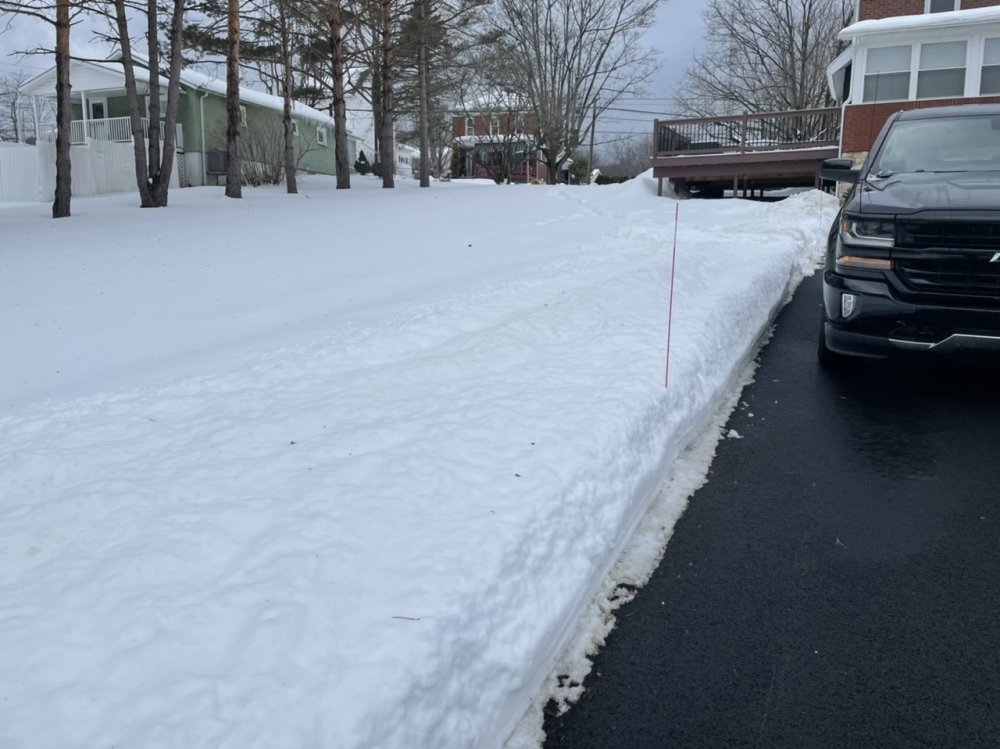
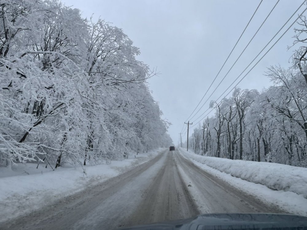
Catching the height of the snowpack. Temps are above freezing and winds have kicked up.
-
 1
1
-
-
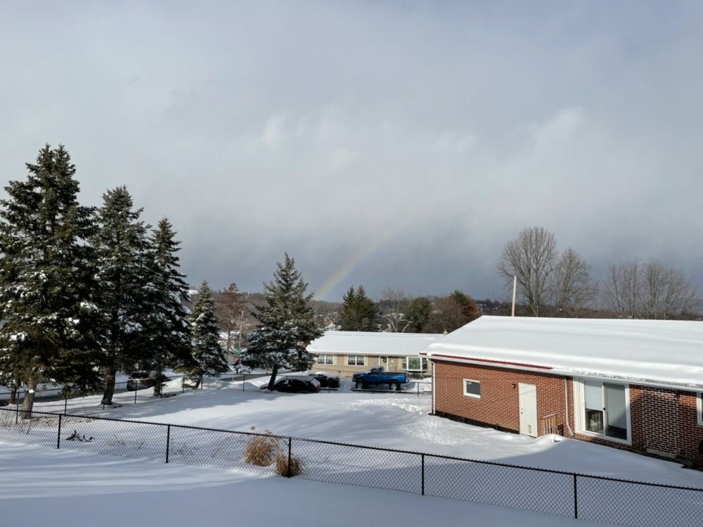
Well this is fun, a snow rainbow. Been quite a last few days with the picture taking haha.
-
5
-
-
3.6" is going to be my final. Checking the pack yielded mostly 10-15" depth measurements, roughly a 12" average. Season snow total to date is 48.5".
-
4
-
-
Was going to call a final a bit ago but still getting quick bursts of moderate to heavy snow with the lingering scattered precip.
1 hour ago, CarlislePaWx said:For the few of you who melt down your snow, such as @Cashtown_Coop, I'd love to hear from you. I think you'd all be interested to know that this storm had the highest SLR of any event this season. I measured 2.8" of pure snow and it melted down to 0.20" of liquid. This produced a ratio of exactly 14 : 1. I don't think any other event this winter had a ratio that high. Most of my other events were all around 10:1. So, another anomaly from this storm.
I was curious about this as well, as I did mention last night just a couple degrees colder on the low level temps might make a difference between 10:1 and <10:1 and higher amounts. There definitely must have been some good snow growth with at least the front part of the event and those colder low level temps meant the flakes didn't get rimed or anything like that. This thing arriving a bit early helped too.
-
3
-
-
3.3” and moderate snow. 3” was my expected target # for here so definitely a nice snowfall this morning.
Today’s likely to be the “crest” of the snowpack depth this winter here unless something wild happens down the stretch.
-
1
-
-
Just woke up and there's already over an inch of new snow. Moderate-heavy rates, 28ºF.
-
On 2/20/2021 at 5:05 PM, MAG5035 said:
This looks like a quick hitting advisory type event, like a 2-3" scattered 4" type deal for most with perhaps more frequent higher amounts (4-6") a better possibility in the Laurels, I-80 corridor, and Poconos. Also need to consider the possibility of a weak spot in the south central counties between I-99 and I-81 (Bedford, Fulton, Franklin, maybe southern half of Huntingdon, etc.) where could only be a 1-2" type snowfall. Low stays NW of PA on a general westerly flow so that typically invites the probability of some downsloping in that aforementioned area, and it has been showing up on most model guidance. Could only be 1-2" in the LSV as well, and I'll explain that below.
Timing and temps are another concern, esp LSV below the turnpike. This appears to be a late morning to late afternoon/early evening hit, so rates better be good there with marginal low level/surface temps. I often find that after about the 2nd week of February or so it's like flipping a switch with respect to solar input (ie the sun angle)...not yet with heavier and/or cold storms, but with clear days and light events with marginal temps (specifically ones in the middle of the day). NAM once again the warmest, bringing mixed up into the LSV. Showing ZR as primary p-type but I would imagine any icing would be limited in scope if it were in fact liquid precip. And considering how thermals have went in the other two events this past week (even though the M/D simultaneously got their 4-6" of snow and still had mixing all the way up through MDT with Thur), I'm inclined to seriously consider the NAM in that regard. So ideally, a good shot of heavy precip up front would at least secure getting a couple of inches. Ratios might be <10:1 as well. Kuchera maps have actually looked a bit worse than the 10:1 maps, and while Kuchera method applies a fairly simple algorithm for calculating the ratios it is generally picking up that the temps 850mb to surface are a bit marginal.
Bringing this post back up from yesterday as my thought's really haven't changed too much on it and neither has guidance. Still seeing the weak spot in the aformentioned part of the south-central between I-81 and I-99. Still should see at least a quick 1-2" up front there though.
Biggest thing is this does look to take the whole LSV as a period of snow up front and how aggressive the rates are is going to ultimately determine impacts and accumulations. Sped up a tad too, with this looking to get into the Sus Valley by mid-morning so if it comes in gangbusters it's obviously going to screw the roads up pretty good. A couple degrees colder in the low levels might be enough to realize 10:1 instead of <10:1 ratios so all of the Sus Valley looking pretty solid on that 2-3" scattered 4". The wave of snowfall is probably done in 4-6 hrs tops, with any lingering precip east of the mountains likely in the form of some scattered showers later in the afternoon.
-
2
-
-
19 hours ago, pirates21 said:
Great pics. You should take a ride up top of Wopsy. Looks similar to Blue Knob. Really beautiful with the snow on ice covering everything. The large pine trees covered with snow and ice are gorgeous
I did just that not too long ago, it definitely didn’t disappoint haha. It really sticks out with the clear skies today, I wish I could load the full quality pics on here. It’s always wild the difference 4 miles and 1100’ of elevation makes.
Top of Wopsononock Mtn west of Altoona


-
5
-
-
3 minutes ago, Blizzard of 93 said:
What do you think of the Monday snow potential?
This looks like a quick hitting advisory type event, like a 2-3" scattered 4" type deal for most with perhaps more frequent higher amounts (4-6") a better possibility in the Laurels, I-80 corridor, and Poconos. Also need to consider the possibility of a weak spot in the south central counties between I-99 and I-81 (Bedford, Fulton, Franklin, maybe southern half of Huntingdon, etc.) where could only be a 1-2" type snowfall. Low stays NW of PA on a general westerly flow so that typically invites the probability of some downsloping in that aforementioned area, and it has been showing up on most model guidance. Could only be 1-2" in the LSV as well, and I'll explain that below.
Timing and temps are another concern, esp LSV below the turnpike. This appears to be a late morning to late afternoon/early evening hit, so rates better be good there with marginal low level/surface temps. I often find that after about the 2nd week of February or so it's like flipping a switch with respect to solar input (ie the sun angle)...not yet with heavier and/or cold storms, but with clear days and light events with marginal temps (specifically ones in the middle of the day). NAM once again the warmest, bringing mixed up into the LSV. Showing ZR as primary p-type but I would imagine any icing would be limited in scope if it were in fact liquid precip. And considering how thermals have went in the other two events this past week (even though the M/D simultaneously got their 4-6" of snow and still had mixing all the way up through MDT with Thur), I'm inclined to seriously consider the NAM in that regard. So ideally, a good shot of heavy precip up front would at least secure getting a couple of inches. Ratios might be <10:1 as well. Kuchera maps have actually looked a bit worse than the 10:1 maps, and while Kuchera method applies a fairly simple algorithm for calculating the ratios it is generally picking up that the temps 850mb to surface are a bit marginal.
-
 1
1
-
-
2 minutes ago, Cashtown_Coop said:
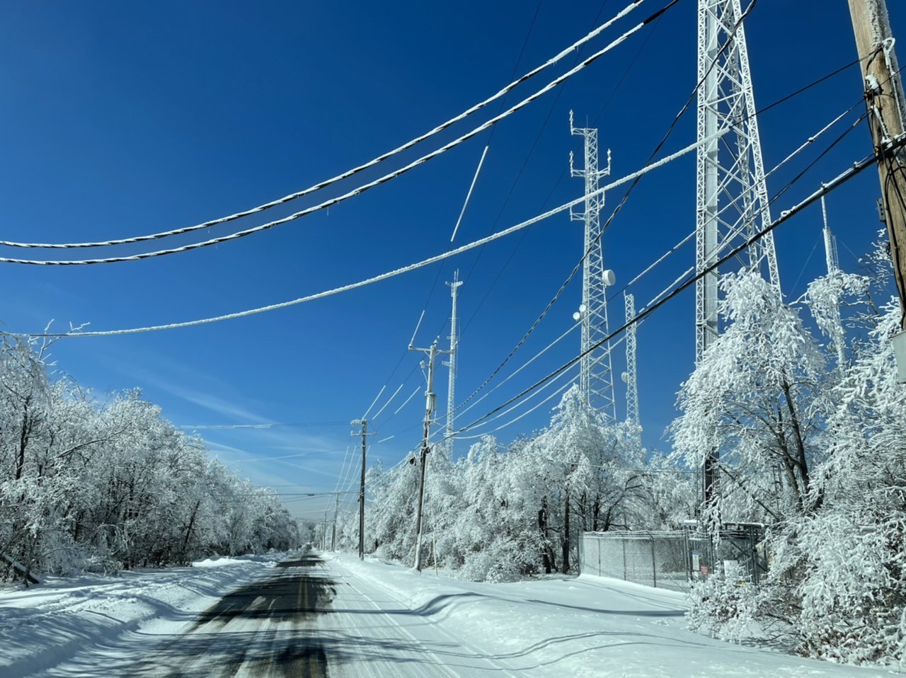
@MAG5035 Nice pics. I went for a drive yesterday and at 1600ft ran into what I know now after looking at your pics rime ice on the trees. It almost reminded me of hoar frost
That looks like a lot of snow down there too at that elevation. Yea it was a combination of rime ice near the summit which is in clouds a good bit (over 3100' at the top) but alot of it was also the new snow sticking directly to the iced trees too. It looked like they had a significant amount of ice up there from that ice storm even for their standards, and since there was never any strong warm push at what is essentially the 925mb level at the top of the mountain there, most of it didn't melt.
-
I went up to Blue Knob in the afternoon/evening yesterday and it was quite a sight up there. Probably a general 2’+ natural snowpack around the mountain plus the 1/2”+ of freezing rain from the ice storm and rime ice (esp above ~2600ft) that never melted before it snowed again the last couple days.


-
9
-
1
-
-
Decent burst of snow currently. Wouldn’t say it’s been piling up by any means but it has been snowing pretty much all night so far.
Up to 1” additional now with round two, though that’s the running total all the way since mid afternoon.
-
1
-
-
23 minutes ago, Blizzard of 93 said:
What are your thoughts on round 2 tonight into tomorrow?
It does seem like the stuff around is being somewhat under represented on the HRRR but it's still fairly patchy so I don't think we'll end up with as much as some of the models have tonight. I think for the most part an inch or less but perhaps we can get a band setup that drops some localized 1-2" amounts. The best action seems to be staying NW of I-81 for now as well, with it actually snowing half decently here currently. It's been snowing off and on enough this evening that it's got most of the streets and secondary rds icy again.
Board was cleared this afternoon right after it started snowing off and on after 2pm. 2.9" fell before, and just measured 0.7" so far since for 3.6" on the event. That makes a 44.1" current season total on those measurements. I generally consider the 45-55" range as average-ish for this end of Altoona right against the Allegheny Front so looking pretty good for Feb 18th.
-
1
-
-
Some steady snow trying to get restarted back this way. While I was out clearing stuff off a bit ago I had a bout of freezing drizzle that promptly glazed the car right after I brushed it off.
-
2.8” and slotted out over here currently. Hopefully can get things started back up this afternoon.
-
2.1” for my last measurement til morning. Steady light snow, 23°F
-
1
-
-
Moderate snow and 24ºF. Midnight measurement is 1.3" of straight powder snow in a bit under 2 hrs since it got going. Not too bad considering the near term stuff late this afternoon and early evening didn't have this even starting here until about now or a bit later.
-
1
-
-
Much better flakes now and moderate-heavy rate. Binocular check of the snowboard with the flood light on already looks like over a half inch.
-
1
-
-
51 minutes ago, pirates21 said:
Starting to pick up pretty good over on the other side of the city Mag. I’m near 99. Covering cars now
Yep same over here, a nice moderate pixie dust snow for now. Getting this early swath of snow to set over the area is gonna be a big part of hopefully getting pretty well into our forecast range of the advisory (3-7"). I think we're in pretty good shape. There's a patch of some more enhanced echoes on radar over JST that should try to shift this way here within the next hour or so.
-
2
-
-
Flurries starting here, 25ºF.
-
3
-
1
-
-
11 minutes ago, Cashtown_Coop said:
LWX 9pm update
00Z IAD sounding showed a warm nose of 1.8C at the 809 mb
level. This is around 1C warmer than what most of the 18Z models
initialized. The 18Z Canadian Regional had the best
initialization of the 18Z guidance with a warm nose around 1C
with the 00Z NAM now having caught up to the warmer air aloft.
Although, there is a lot of dry air at that level which would
result in wet-bulb cooling once precip arrives, the trend in the
models has been for a faster changeover to mixed precip Thu
morning. Will be incorporating more of the 00Z NAM and 18Z
Canadian Regional in our update tonight. These two models have
verified the best with temps aloft this winter, especially with
the mid December 2020 and Feb 10 mixed precip events.

There has also been a trend toward a faster exit of the
precipitation late Thu night across the region with precip only
lingering across southern MD and in the upslope areas.
Great catch. And the 0z sounding (weather balloon) is hard data too. This was my worry about the southern tier in terms of a getting a warm layer somewhere in between 850-700mb. Yea it will wet bulb down, but more robust WAA there is already being noted. Fortunately for our region I think this has been trending towards minimizing the threat for sleet/mixed (0z NAM didn't have it getting very far across the mason-dixon). But there's still a decent possibility of pingers at some point to consider in likely the bottom tier of LSV counties.
-
4 minutes ago, MAG5035 said:
Boy I bet the DC metro folks are loving seeing the 0z NAM and some of the differences between other models this close to game time (||GFS vs GFS and Euro). 3k gives them almost nothing snowy and 12k NAM isn't much better and the 0z HRRR hits them good. My only worry for this region is some sleet mixing in at some point for a little bit in the southern counties. At least none of us are riding THAT edge for this event.
To clarify a bit, holy crap the NAM is sleeting on DC. 2.5-3"+ on both the NAMs lol.
-
Boy I bet the DC metro folks are loving seeing the 0z NAM and some of the differences between other models this close to game time (||GFS vs GFS and Euro). 3k gives them almost nothing snowy and 12k NAM isn't much better and the 0z HRRR hits them good. My only worry for this region is some sleet mixing in at some point for a little bit in the southern counties. At least none of us are riding THAT edge for this event.
-
2
-
-
Got some echoes overhead, just waiting for it to hit the ground.
-
1
-


Central PA - Winter 2020/2021 Part 2
in Upstate New York/Pennsylvania
Posted
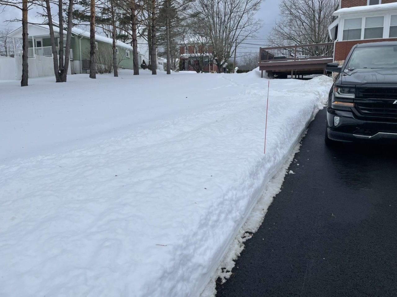
Some definite shrinkage in the pack today with the brisk winds, some sun, and temps gettin into the low-mid 40s.