

LibertyBell
-
Posts
39,305 -
Joined
Content Type
Profiles
Blogs
Forums
American Weather
Media Demo
Store
Gallery
Posts posted by LibertyBell
-
-
12 hours ago, uncle W said:
a warmer than normal April could be derailed if the ao/nao forecast is right...it could be coupled with a big pna rise...I would not be surprised if NYC ends up close to average for April with another possible near recold outbreak similar to last May but not to that extreme...
if that kind of cold outbreak happens in April instead of May it could be colder even if not as extreme
-
1 hour ago, uncle W said:
many Aprils ended up very warm after a cold beginning...1915 is the best example with 10" of snow on the 2nd and 91 degrees near the end of the month...yesterday was a great day although a little windy...today looks good too...
20 inches in Philly in April 1915 wow
-
15 hours ago, bluewave said:
Yeah, JFK can have some of the warmest area temperatures on dry offshore flow days. JFK and EWR both made it to 70°. Our area was far enough SW of the storm east of New England. Looks like the blocking ridge should keep most rain west of the area this week. Then it appears that the ridge eventually weakens by the weekend allowing better rain chances.


Think we can finally have a dry summer if we have a strong SE Ridge with downsloping winds like this? SST shouldnt matter if we get a 1995 or 2010 kind of SE Ridge that backs into the coast and gives us a downsloping wind, it will also hold back fronts and weaken them
-
1 hour ago, bluewave said:
The warm spots may make a run on 70° today as these dry and windy downslope days often beat guidance.
KEWR   GFS MOS GUIDANCE    4/05/2021  0000 UTC
 DT /APR   5            /APR   6                /APR   7          /
 HR   06 09 12 15 18 21 00 03 06 09 12 15 18 21 00 03 06 09 12 18 00
 X/N                    68          44          66          46    67
 TMP  50 47 49 58 64 67 61 55 49 46 50 57 62 64 60 55 50 48 51 64 61
 DPT  27 27 28 27 26 25 27 29 29 28 29 25 22 23 26 30 32 33 35 34 37
 CLD  CL CL FW FW FW CL SC BK CL CL CL CL FW FW FW FW CL CL FW SC BK
 WDR  31 27 31 32 31 30 30 31 31 28 31 32 31 32 32 33 30 36 35 34 11
 WSP  07 07 13 15 17 18 16 12 06 05 08 11 13 10 09 04 03 02 04 06 06

Maybe JFK will hit 70? These are my favorite kinds of days.
-
5 hours ago, sferic said:
There was an actual winter storm warning posted for NYC on that date
6 inches for parts of Long Island.
How is it Central Park didn't record anything?
-
6 hours ago, MJO812 said:

NYC edged out Boston
-
 1
1
-
-
1 hour ago, bluewave said:
It’s one of the quirks of our warming climate. The average first 80° day has moved one month earlier up at Newark from April 28th in 1970 to March 31st in 2021. But the average first 90° day has remained nearly unchanged from May 19th in 1970 to May 21st in 2020. So record early 90°+ heat like April 2002 remains rare. The fall is reversed. Later last 90° day while the last 80° day is mostly unchanged.


wow that is weird- any reason why this might be happening, maybe more precip is causing this?
-
1 hour ago, donsutherland1 said:
The latest freeze at Charleston occurred on April 20, 1983 when the temperature fell to 31°.
Same day when JFK had its latest accumulating snow- 1.5"?
-
16 hours ago, bluewave said:
Looks like another low dewpoint and low relative humidity special today. Dewpoints are forecast to drop to near 0 with temperatures getting back above 50°. We make a run on 60° tomorrow and get back into the 60s on Monday. So it’s tough to maintain the record cold of the last few days very long.
KEWR   GFS MOS GUIDANCE    4/03/2021  0600 UTC
 DT /APR   3      /APR   4                /APR   5             /
 HR   12 15 18 21 00 03 06 09 12 15 18 21 00 03 06 09 12 15 18 00 06
 X/N              55          38          58          40       65
 TMP  36 44 52 55 51 46 42 40 44 49 55 56 53 48 44 42 46 56 62 58 50
 DPT   9  3  3  5 11 17 21 25 29 31 31 29 29 30 29 28 29 28 27 30 32
the blue skies were gorgeous today
-
6 hours ago, donsutherland1 said:
The region started with readings at or below freezing for a second consecutive day. However, the strengthening April sun boosted temperatures into the 50s in much of the region during the afternoon.
Elsewhere, daily record low temperatures were set or tied. Daily records included:
Allentown: 20° (tied record set in 1954)
Charleston, SC: 31° (old record: 33°, 1962)
Charlotte: 26° (old record: 28°, 1972)
Columbia, SC: 28° (tied record set 1992)
Jacksonville: 36° (old record: 39°, 1962)
Savannah: 32° (old record: 33°, 1966)
Sherbrooke, QC: 9° (old record: 28°, 2008)
Wilmington, NC: 30° (old record: 31°, 1992)Meanwhile, in the Southwest, Phoenix reached a record-tying high temperature of 97° today.
That warming trend will tomorrow into early next week. Temperatures will likely return to the 60s in parts of the Middle Atlantic region tomorrow and then in much of the region on Monday.
Historic experience following a warm to very warm March suggests a probability that is skewed toward a warmer than normal April. That warmer scenario remains the base case despite the current strong cold shot.
The ENSO Region 1+2 anomaly was -0.9°C and the Region 3.4 anomaly was -0.6°C for the week centered around March 24. For the past six weeks, the ENSO Region 1+2 anomaly has averaged -0.15°C and the ENSO Region 3.4 anomaly has averaged -0.67°C. La Niña conditions will likely give way to neutral-cool ENSO conditions as the spring progresses.
The SOI was -0.46 today.
The preliminary Arctic Oscillation (AO) figure was +0.533 today.
On April 1 the MJO was in Phase 5 at an amplitude of 1.398 (RMM). The March 31-adjusted amplitude was 1.297 (RMM).
wow thats a very late freeze for Savannah- latest ever? and Jacksonville down in the mid 30s, there should be a frost advisory for North Florida!
-
12 hours ago, bluewave said:
It’s very challenging to get wall to wall warmth here during March, April, and May. The NYC average temperature in March is 42.5°...April 53.0°...May...62.4°. So the springs that everyone remembers as warm usually went 45°..55°...65°. So 3 consecutive +2 to +3 spring months. We had the 45°+ March and 80° record warmth. But the record cold to start April reversed the March pattern. The only 3 years I can find were 2012, 2010, and 1985.
NYC....45....55....65....springs since 1981
2012 50.9 54.8 65.1 2010 48.2 57.9 65.3
1985 45.8 55.5 65.2 why is it that these months were much warmer in the 90s and early 00s?
April 2002 is my benchmark for spring warmth.
-
14 hours ago, bluewave said:
Yeah, the low humidity season usually peaks in March and April here. Things should gradually moisten back up going into next week. Then it looks like our next chance of significant rain again in about a week. We saw this in March when we went from very dry to wet again. The main take away is that dry patterns don’t have much staying power in our new wetter climate.

arent dry patterns more common in the summer? I thought they would be with a nice blocking SE ridge holding fronts back to our north and west. By dry I mean least rainfall, not lowest humidity lol
-
15 hours ago, dave0176 said:
I really hope these dew points start rising, I have serious dry skin and then these cool days and I having scorched air heat makes it crazy dry.
Unfortunately the last 5-8 years April has become my least desirable month. I remember when April came around we seemed to always get at least one heat wave. My favorite being 1991 I was in 9th grade and I remember how hot it was coming out of school.
Seems to me the last couple years starting in April and it seems to always persist to about the last week of June then suddenly it’s like a switch flips to all out summer.
2002 was awesome too
-
17 hours ago, donsutherland1 said:
It is increasingly uncommon. The last time it happened was April 9, 2003. Since 1950, there have been only 9 such dates:
April 8, 1956
April 4, 1975
April 7, 1982
April 9, 1982
April 5, 1995
April 7, 2003
April 8, 2003
April 9, 2003
April 2, 2021
Three days in 2003 really stands out, almost as much as what happened in 1982.
People often mention the extreme cold in April 1982 but forget that April 2003 was also pretty extreme. Is 3 straight days the record for April, Don? Looks like we could've also done it in 1982 but barely missed with the day in between?
-
18 hours ago, bluewave said:
Walt, great post. It looks like we could see a slow moving cutoff with the blocking to the north. I have noticed that the new OP GFS v16 beyond 120 hrs has tried to cut storms to our west with blocking last winter. It seems to adjust south as we get closer to 96-120 hrs. Even the GEFS has a slow moving system going underneath to the Mid Atlantic coast.


what kind of temps are we talking about with these storms?
Mid April was mentioned....could we be talking about something like April 15, 2007, aka the Tax Day noreaster?
-
18 hours ago, wdrag said:
No thread on my part but three more opportunities for snow lurk in our subforum. later tonight ne PA/nw NJ, probably no big deal tho 1/2" possible higher terrain ne PA. Then the 9th-11th (next Fri-Sun), Potential for a pretty big long duration periodic rain event (1"+) with wind (40kt) for a part of the sub forum coast with high terrain wet snow possible. Ensembles don't favor snow, certainly nothing like the 00z/3 EC snow depth forecast (just nw NYC). There's even something during mid month? Keeping an eye on it. Figure future modeling will shrink the snow, not sure the sizable storm will disappear in what appears to me to be a favorable blocking pattern for a slow mover somewhere along the Mid Atlantic Coast.
snowing right now near and north of Allentown!
-
 1
1
-
-
19 hours ago, bluewave said:
This is only the 3rd April since 1990 with a NYC high temperature below 40°. The other 2 years were 2003 and 1995. It was also the first -14 daily temperature departure in NYC since November 18th.
Time Series Summary for NY CITY CENTRAL PARK, NY - Month of Apr
Click column heading to sort ascending, click again to sort descending.YearLowest Max TemperatureMissing Count2021 39 28 2020 46 0 2019 45 0 2018 43 0 2017 48 0 2016 43 0 2015 43 0 2014 47 0 2013 43 0 2012 52 0 2011 44 0 2010 52 0 2009 48 0 2008 50 0 2007 41 0 2006 47 0 2005 50 0 2004 43 0 2003 37 0 2002 45 0 2001 43 0 2000 43 0 1999 46 0 1998 48 0 1997 42 0 1996 40 0 1995 39 0 1994 53 0 1993 41 0 1992 45 0 1991 46 0 1990 46 0 Surprised we didn't say below 40 for a high that day in April 2018 when we had 6" of snow!
I remember April 1995 very well for some reason, that was a sunny and very cold day and it was weird to see it so cold in April without any snow lol.
Made up for it the following April and almost had back to back Aprils of below 40.
2003 had the all day snowstorm in April of course, one of my favorite snow seasons of all time.
-
18 hours ago, bluewave said:
This made the top 5 for greatest spring 7day temperature drops.

1967 was legendary for late season cold.
How does this compare with what happened in April 2014? I remember we had some very late season snow and cold then too.
-
20 hours ago, donsutherland1 said:
Morning thoughts...
Low temperatures in New York City, Newark, and Philadelphia were 28°, 28°, and 29° respectively. For Central Park, that as the coldest April temperature since April 5, 2016 when the temperature fell to 26°. For Newark, it was the coldest April temperature since April 6, 2016 when the temperature was 27°. For Philadelphia, it was the coldest April temperature since April 11, 2018 when the mercury dipped to 29°. At Binghamton, the temperature fell to 17°. That broke the daily record of 19°, which was set in 2003.
Today will be variably cloudy and unseasonably cold. A stray rain or snow shower cannot be ruled out during the afternoon, especially north and west of New York City. High temperatures will likely reach the upper 30s and lower 40s in most of the region. Likely high temperatures around the region include:
New York City (Central Park): 41°
Newark: 43°
Philadelphia: 45°
Tomorrow will start off with unseasonably cold temperatures, but a warmer afternoon is likely. The warming trend will continue through the weekend.
it stayed in the 30s! How often does that happen in April?
-
20 hours ago, uofmiami said:
Had some graupel fall overnight it seems, as awoke to this on my deck.
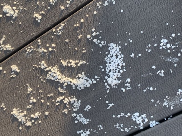
it formed some random patterns lol
-
2 minutes ago, Vice-Regent said:
In my mind this is a subtle form of climate denial because believe it or not the climate changes will take these creatures out in the long-run. The best thing we can do is stop the bleeding and prevent the things we have control over.
Having less humans on the planet would also certainly help. No one regulates the destruction on the planet better than nature does. So humans will also be one of the species that will be culled to reduce their negative impacts on the environment.
Climate change is also mentioned, it's all part of the same capitalist evil that humanity is addicted to.
-
 1
1
-
-
3 minutes ago, Vice-Regent said:
It will never happen as they produce the products that the American economy depends on and backtracking on offshoring would move the ecological costs of production back to the states. It is the main reason why they pulled out of all the stops to get Biden into the White House. Trump wanted to create an economy based on national autarky.
But they are being penalized for the illegal animal trade with this pandemic (which was also mentioned in the documentary as the primary cause for it) and so have started to shut down those animal markets. Humans expanding into regions they dont belong in was also explained as another reason for both this and the AIDS pandemic.
-
1
-
-
4 minutes ago, Vice-Regent said:
Good luck with that. This is starting to look like World War 2 all over again because the core causes of this war were never resolved in detail.
we need to embargo the hell out of them until they stop the illegal animal trade and shut down their coal factories. They are far more dangerous to the planet than Iran is, for example.
Shut down all trade with these nations and isolate them from the rest of the planet.
-
4 minutes ago, Vice-Regent said:
It's all meaningless but you have a point in the regard of you cannot have these activities without carbon overshoot. Remove either one and the problem is solved.
I know my stance on this issue is unpopular. I have become increasingly more Luddite-esque as the world pushes the futurist narrative but there is only one sure fire way to end over-exploitation of the land-base which is disrupt technology.
It's also mentioned that overconsumption tendencies of modern society need to be curbed so they agree with you. African nations are doing their part by giving poachers life sentences in jail, the main problem right now is China and Indochina.


April 2021
in New York City Metro
Posted
cold in the morning but hot by afternoon lol