psv88
-
Posts
17,309 -
Joined
-
Last visited
Content Type
Profiles
Blogs
Forums
American Weather
Media Demo
Store
Gallery
Everything posted by psv88
-
75 today. The pool is up to 80. Summa
-
Probably a sandstorm down on the beaches
-
73 today.
-
Sun finally breaking out. 63 and muggy
-
1.10” nice drink. Everything will stay nice and lush
-
Overperformer out here. Up to 0.93” with more to come. Wasn’t expecting an inch plus
-
Nice downpour. 0.86”
-
Got my son’s baseball game in just in time. Showers now and 0.16” so far.
-
0.32” from the event. Not bad
-
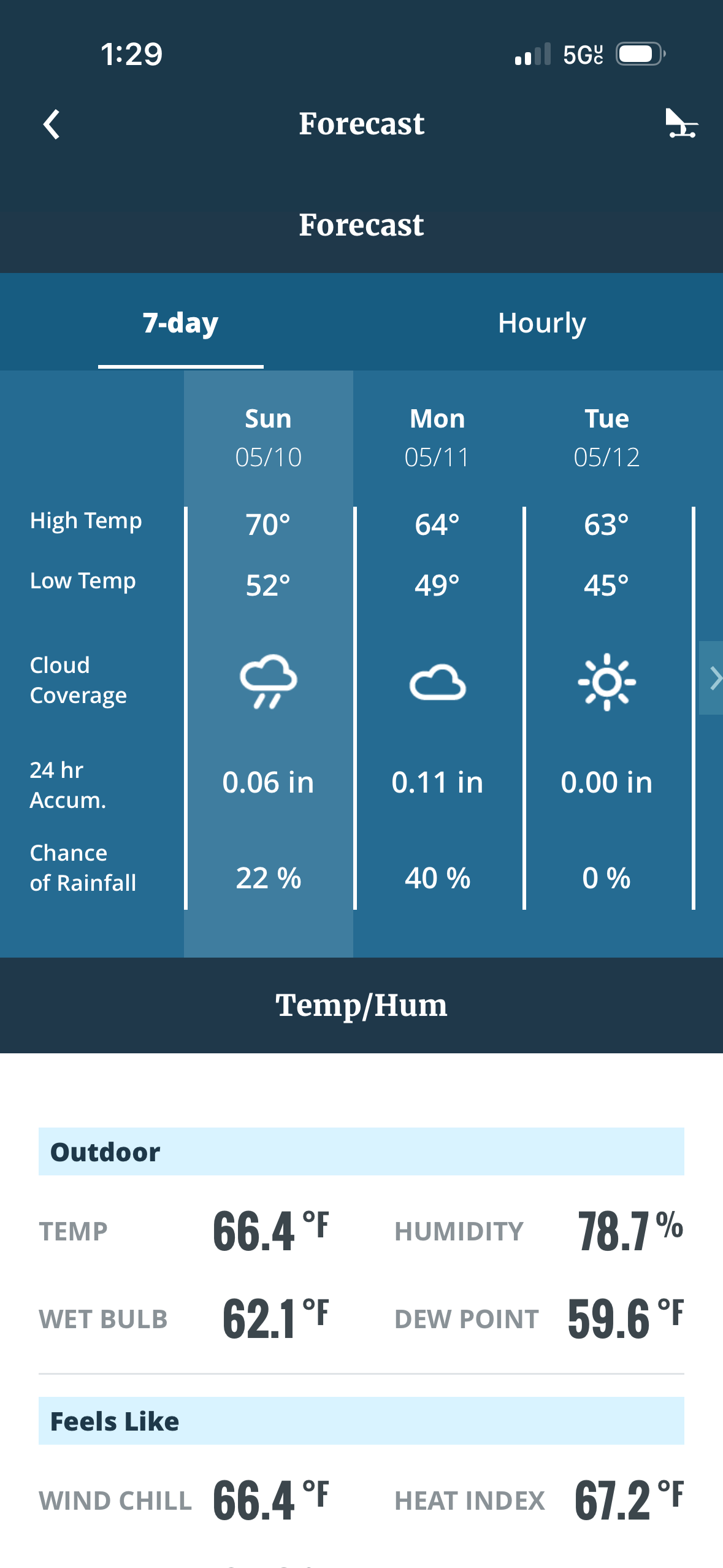
High of 70. Nice day
-
It’s 65 outside. Maybe see a doctor
-
69 today
-
Late day high of 60
-
Next 2 weeks don’t look great. May have to wait until mid June for summer weather
-
51 and windy. Don’t see us hitting 60 today
-
58.2” in Commack
-
0.25”
-
70 today. Gorgeous
- 970 replies
-
- 1
-

-
- april showers bring may..
- rain
- (and 2 more)
-
Gotta love April. 50s in Raleigh and 70 in Montreal
-
56 and some sun. At least its possible to be outside
- 970 replies
-
- 1
-

-
- april showers bring may..
- rain
- (and 2 more)
-
1.51”. Solid event
-
1.12”. Things will pop nice and green this week when we hit low 60s.
-
High today was 48, rain continues. 0.73”