TriPol
-
Posts
1,899 -
Joined
-
Last visited
Content Type
Profiles
Blogs
Forums
American Weather
Media Demo
Store
Gallery
Everything posted by TriPol
-
In a different thread.
-
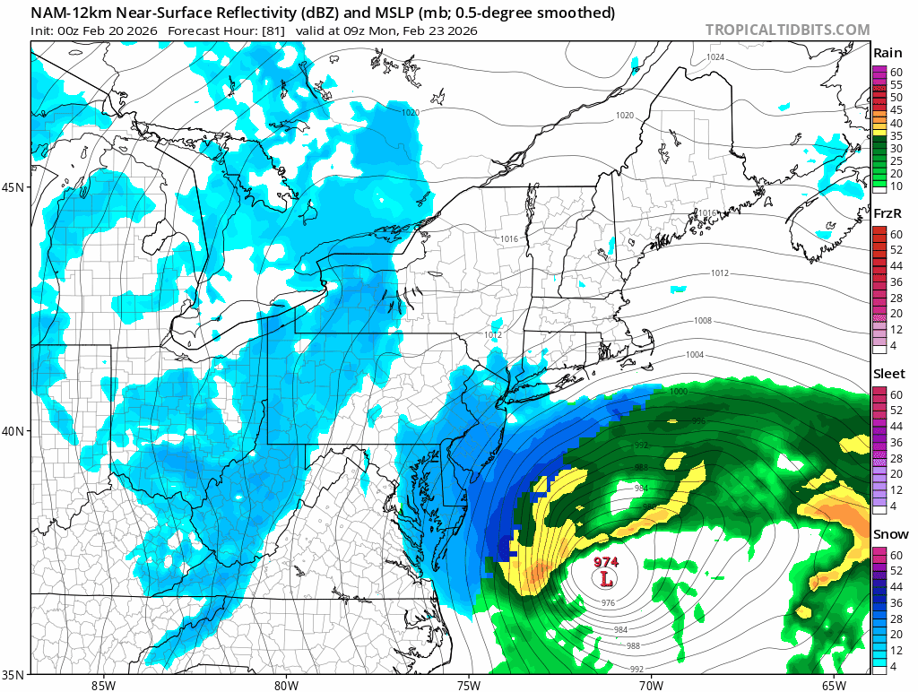
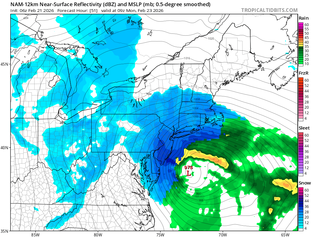
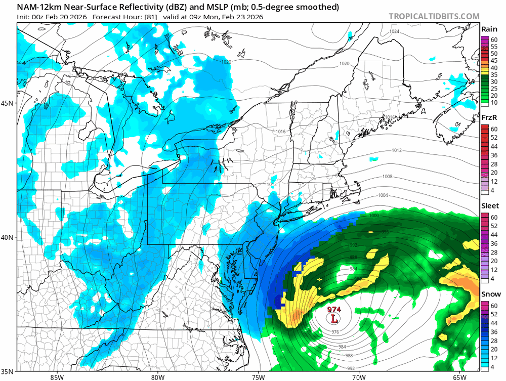
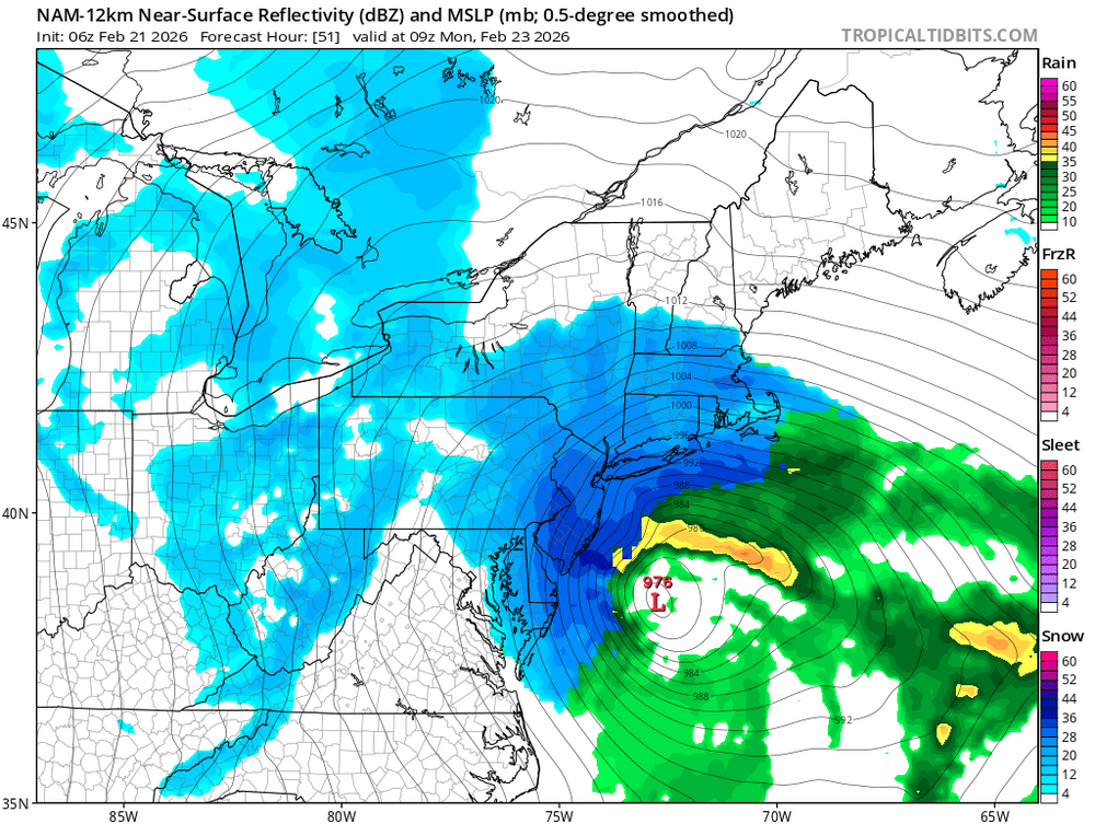
Bombogenesis. Once this thing goes offshore it explode.
-
There was talk of closing this thread earlier in the week because the chances were so small that anything would come of it. Now Atlantic City could get... 4 feet of snow.
-
Beautiful.
-
This is the most west the low has been over the past few runs.
-
Doubt there will be any school on Monday.
-
We shall see if the GFS can score a coup.
-
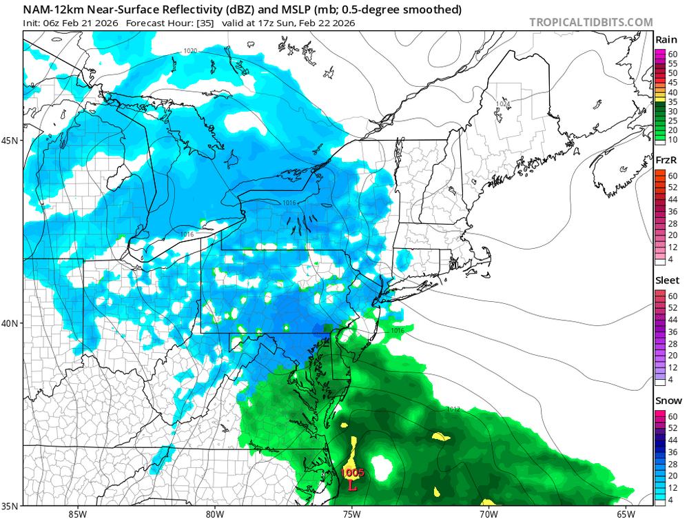
The NAM moves sooooo slow...
-
Is it me or is it much weaker?
-
I'm out to hour 35.
-
Life comes at you fast.
-
I cannot imagine what NYC is going to wake up to this morning. A blizzard warning will get people out of bed VERY QUICKLY.
-
-
Wow.
-
HOLY SHIT!!
-
That's so odd that they've knocked 2 inches off of the forecast when the models (except the EURO) have gotten better.
-
I think that’s exactly right, and it really does put forecasters in a no-win spot. As we get inside about 48 hours, higher-resolution, short-range guidance starts to carry more weight. Models like the NAM, HRRR, and other mesoscale systems can better resolve banding, localized deformation zones, and boundary-layer thermal structure. That’s where snowfall totals can swing dramatically over small distances.
-
The problem is, what if we get 18 - 24 inches of snow and the TV mets keep calling for 6-12 because one model refuses to budge?
-
Every single model keeps bumping west. The EURO holds serve. Either every single weather model is seeing something that the EURO isn't, or every single weather model is wrong and the EURO is right. We're 36 hours away.... something is up with the EURO imho.
-
I've seen the NAM overamp storms a million times, but the GFS is usually suppressed or warm. Plus the UKMET, CMC and GEM are all with the GFS and NAM.
-
This is a hot-hand fallacy. It refers to the tendency to believe that a person who has experienced a run of success, such as winning several games in a row, has a higher probability of continuing to win because they are “on a roll.” The classic example comes from basketball, where fans assume a player who has made several consecutive shots is more likely to make the next one. Just because the EURO has been right in the past, does not mean it will be right this time around. No, if all the other models were showing nothing and the Euro was showing a blizzard where we could up to 2 feet of snow, I would not go all in.
-
We all staying here for the 06z NAM??
-
Who's still up?
-
The EURO is not what it was 6 years ago.
-
LOL at Lee Goldberg calling for 8 - 12 inches.