

BGM Blizzard
-
Posts
1,676 -
Joined
-
Last visited
Content Type
Profiles
Blogs
Forums
American Weather
Media Demo
Store
Gallery
Posts posted by BGM Blizzard
-
-
1 minute ago, TugHillMatt said:
Interesting, as it's NOT 5+ days out. It is 3 to 4 days.
Yeah start time Thur evening, so 4-4.25 days. Thought they'd add this storm to the HWO with the afternoon update, but they left it out. Think they are focusing on the mid week storm moreso for now.
-
2 minutes ago, BGM Blizzard said:
BGM
12/18z NBM
.thumb.png.1dff7e5ade9aba2063254358b1dff005.png)
-
 1
1
-
-
-
Just now, TugHillMatt said:
Those look solid.
Indeed. Thruway, Capital District, southern ADK, eastern Catskills look like the consensus sweet spot right now.
-
-
-
35 minutes ago, TugHillMatt said:
I don't like that jut north on the Canadian. Looks too close to what the Euro had been showing the past few days. The GFS moved the low slightly north and look how much more mixing gets into Southern NY. It just seems if mixing makes it any past the border, it FLOODS in the whole way to the Lake Plain. The GFS had room for northward movement. The rest don't.
12z Geps and Gefs shifted a little north but not a lot. Still solid from the northern tier of PA north. I wouldnt worry about north central NY too much. The thruway corridor might be the jackpot for this one.

-
2
-
 2
2
-
-
11 minutes ago, tim123 said:
Canadian brings a mix into Southern tier but looks like a solid storm
Yeah just for a short time in the central southern tier. The 12z gfs did as well but both are mainly snow and around 6 along the PA border.
-
1
-
-
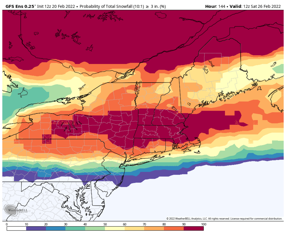
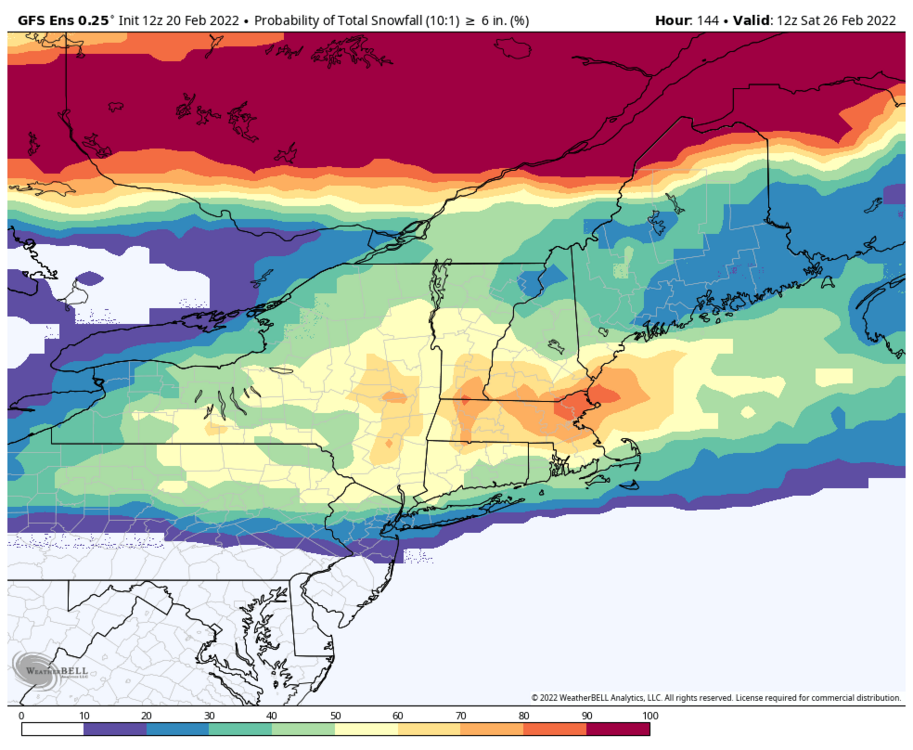
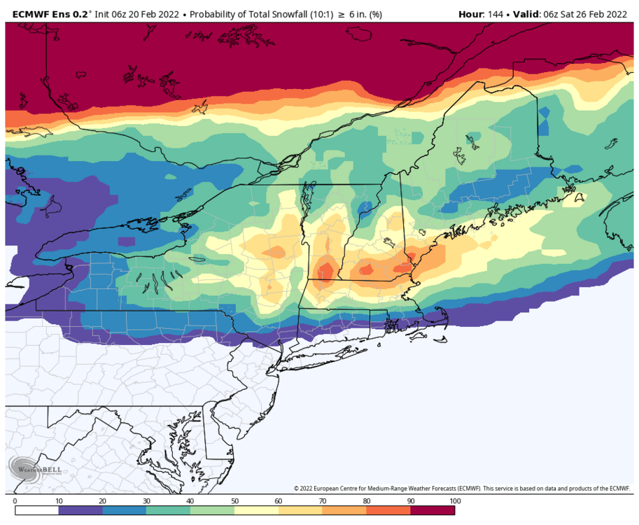
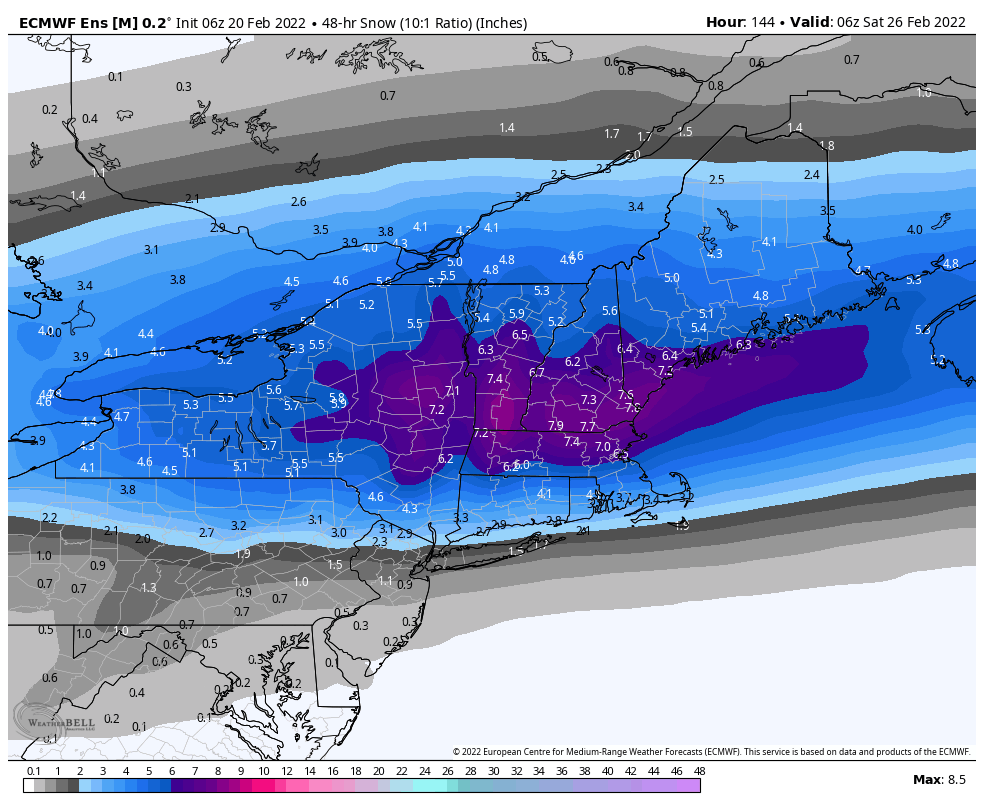
6z eps was even better than 0z. This is trending the right way folks. Widespread 6+ becoming more and more likely. Hopefully no more big shifts the rest of the way.

-
1
-
-
Big improvement in the Eps mean. Start locking it in.
.thumb.png.4bfbc157209b66a49e283368e14700de.png)
.thumb.png.a7d3137f240ca78a2d4be639f8cce2d0.png)
.thumb.png.58c2a190f7c4a2145e7afc1a22ecdd47.png)
.thumb.png.387fdb2f6bb4032a940b77451aa8a66e.png)
-
2
-
-
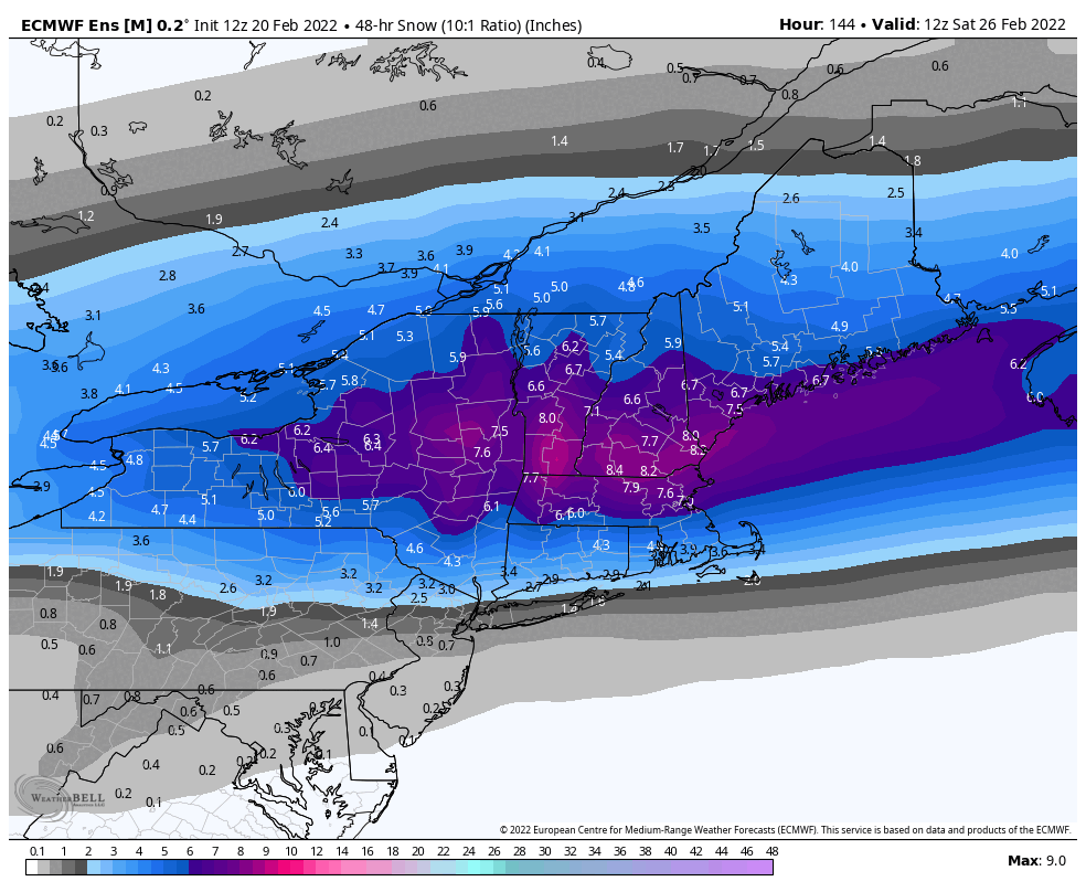
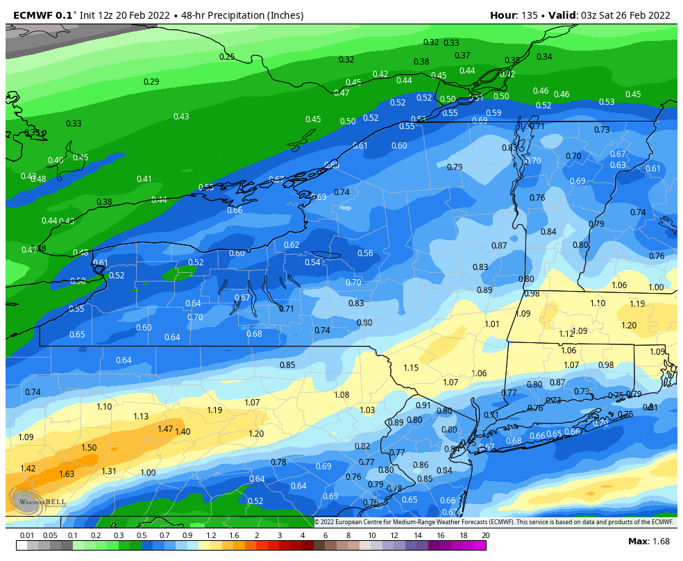
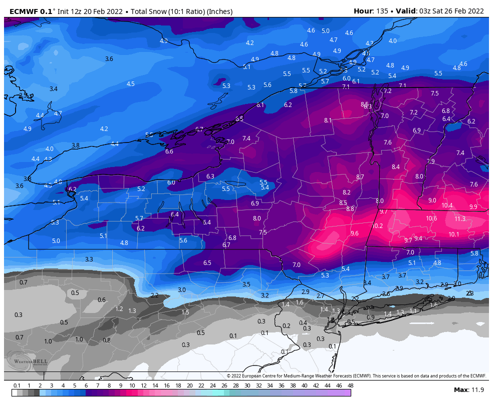
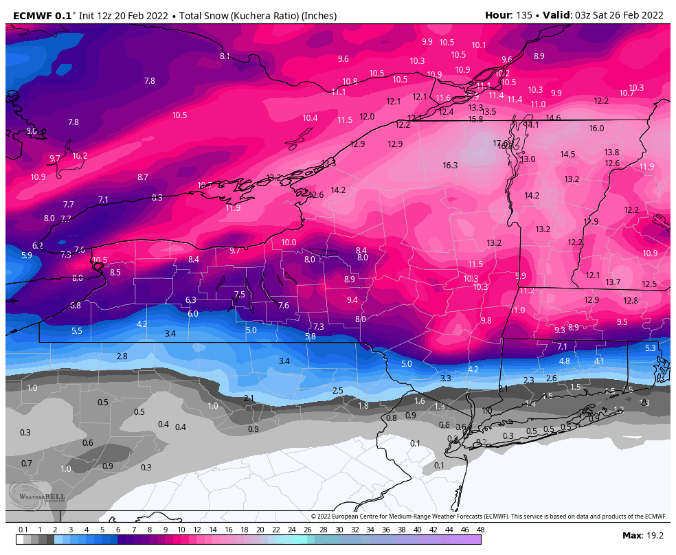
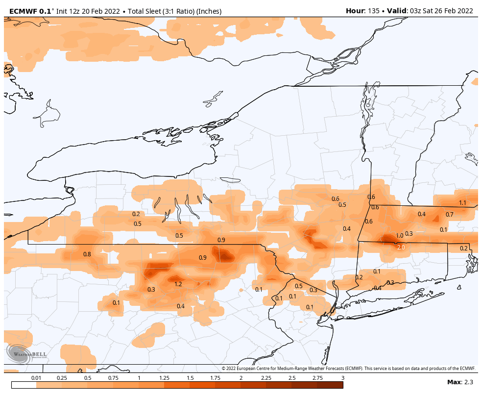
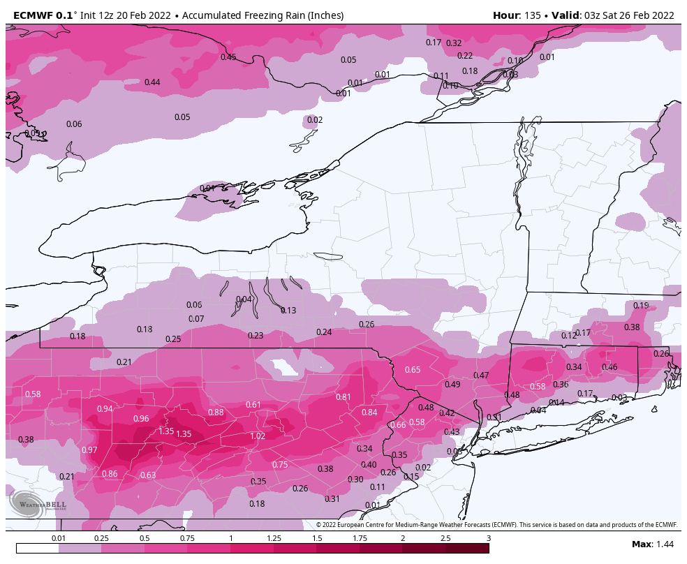
Thats a sizeable SE shift by the Euro. Mix line stays south of i90 except for Capital District area. Less dry slotting too.
-
1
-
-
UK still a widespread hit
.thumb.png.71e4dc760b28abf2f76edc1bb9e03bb9.png)
-
2
-
-
19 minutes ago, TugHillMatt said:
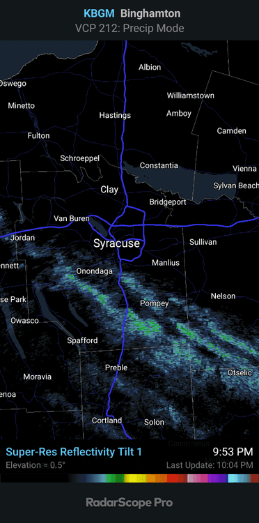
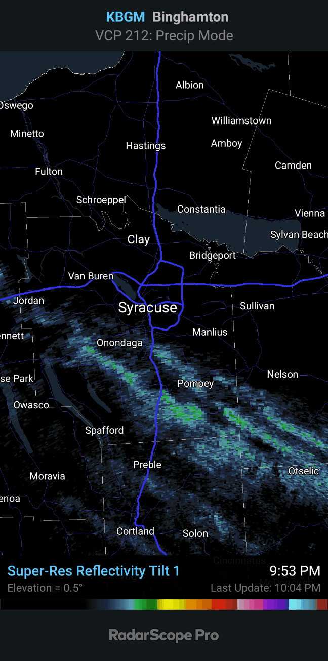
Ha. I was thinking the same thing. Another failed lake effect event on NW winds. These NW wind lake effect events behind cold fronts do diddly for Syracuse...or maybe it's just the new theme of snow dying here all the time. Looks like Syracuse city area did even worse, as has been the case, over the past 2 days. Looks like the lake effect has made its way over the new snowbelt of SW Onondaga county. Glad we got some moisture yesterday for a couple of inches because today's snowfall was waaaay less exciting than I thought it was going to be. I think we'll be mostly grass by Monday/Tuesday (Maybe even tomorrow pm).
Yeah, the WWA will probably still verify over the hills of S Onondaga and Madison. Kbgm radar probably overshooting some of the bands.

-
18z Gefs was another nice run. Now if can just get Euro/Eps trending better.
.thumb.png.beaf5374f2e0f63fa548826d4e61471e.png)
-
2
-
-
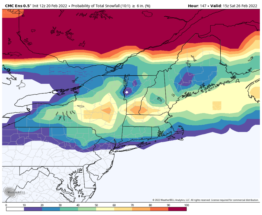
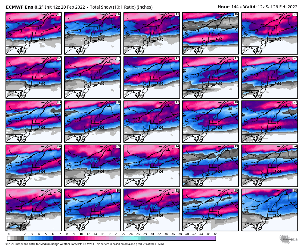
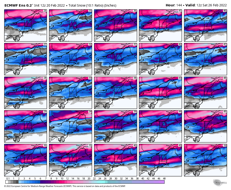
Euro/Eps continue to be a stubborn pos for late week. Until they get on board, cautious optimism only.
Pretty good look on most other models.
10:1 mean (Eps, Gefs, Geps)
.thumb.gif.d75a32e58636efebf7c6bda35fa131c6.gif)
Eps members
.thumb.png.c117428223418d0ec057d71b2379396e.png)
.thumb.png.00bd12c5d63d1874ec8cb05ab041fcb9.png)
Gefs members
.thumb.png.6909715e15a04f156a3e2345c1b0da33.png)
Geps members
.thumb.png.0534c3b6695c156347065402ae13ee2f.png)
-
1
-
-
-
-
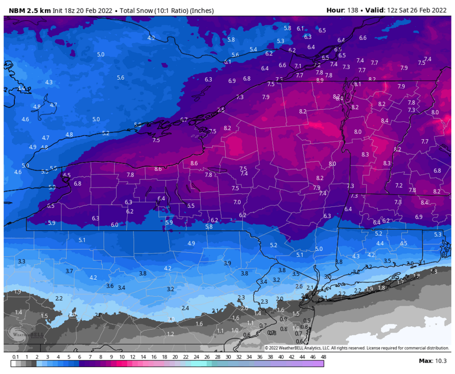
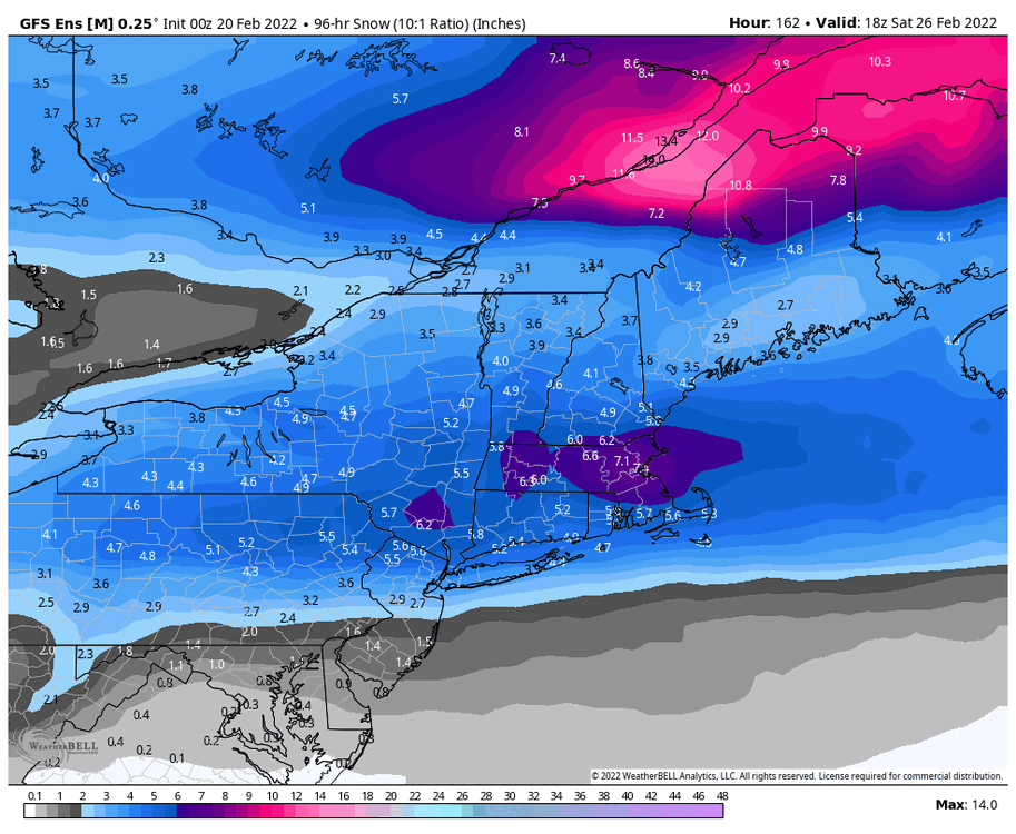
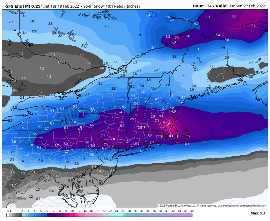
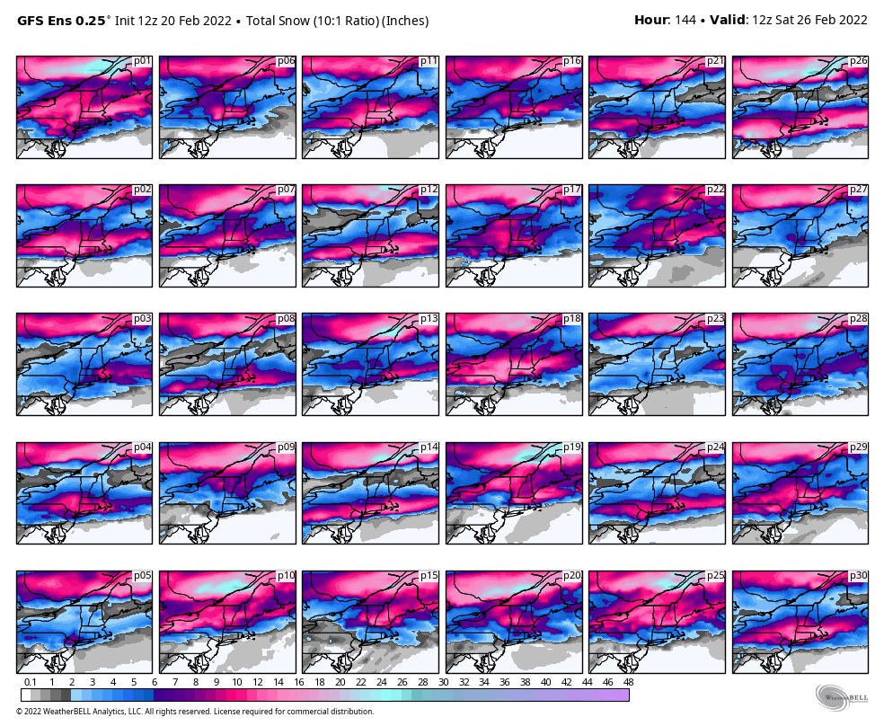
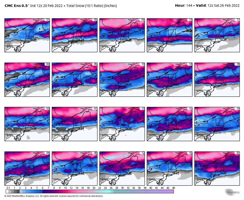
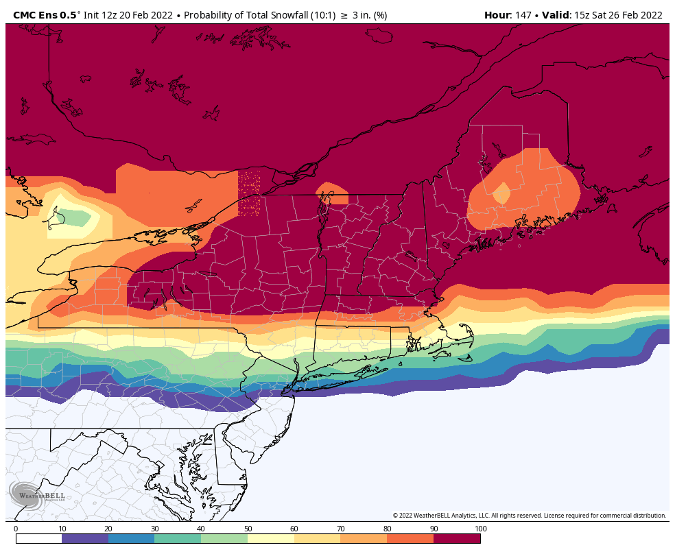
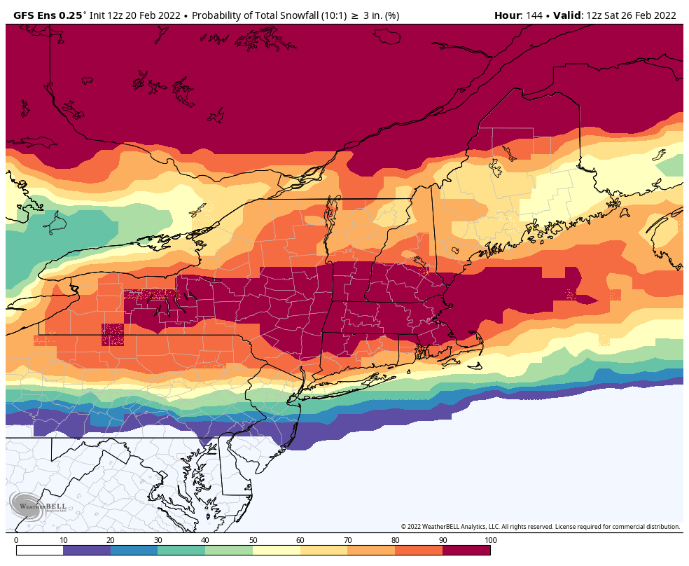
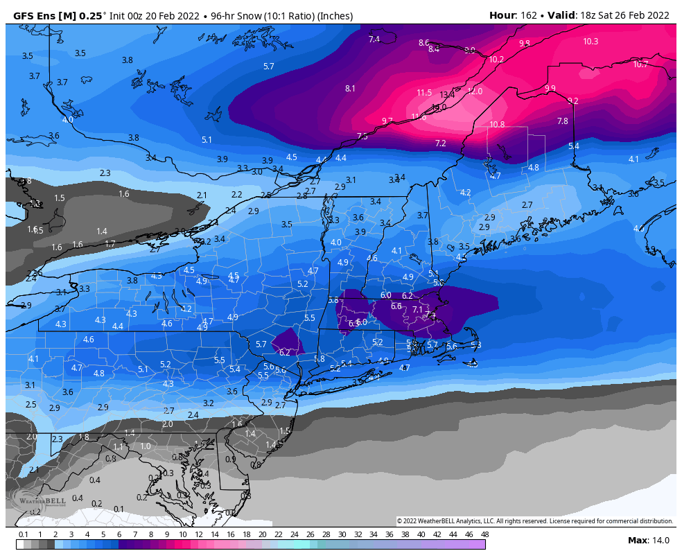
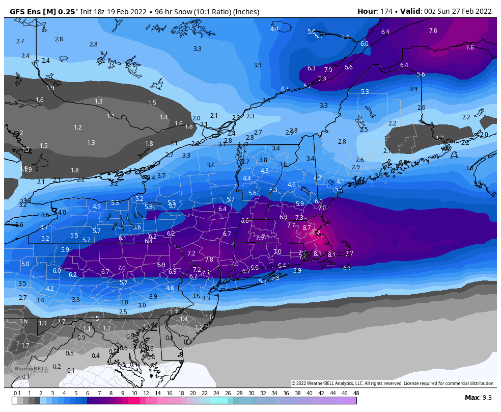
0z ensemble 10:1 mean from mid week to 18z Saturday 2/26. That's a pretty strong signal for a widespread heavy snowfall event at this range.
Just need the Euro/Eps to spread the love.

-
1
-
1
-
-
0z ensemble members
Eps


Gefs

Geps

-
2
-
-
Eps def has a North of 90 look for late next week. Would expect widespread mixing issues unless theres an early transfer to the coast before this gets to Jamestown.

.thumb.png.30e4230e302f2e0e4aac146c8c5fdb42.png)
.thumb.png.7a33bb74c4df24880118b139aff5466c.png)
-
1
-
-
-
Somehow held onto about 2" of snowpack in most spots. Total of 0.89" of rainfall. Wasn't even that icy this morning either. Think the winds help dry things out a bit.
Reached a high of 54.9° at 2:19am and dropped to 32.0° at 3:59am.
-
2
-
-
2 hours ago, BuffaloWeather said:
Surprised there isn't winter storm warning for Niagara county
...WINTER WEATHER ADVISORY IN EFFECT FROM 5 PM THIS AFTERNOON TO
9 AM EST FRIDAY...
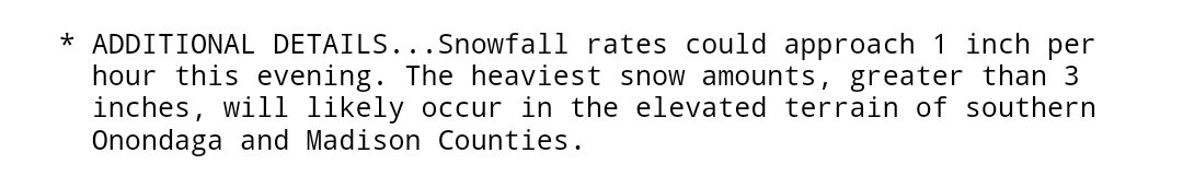
* WHAT...Mixed precipitation and snow expected. Total snow
accumulations of 4 to 7 inches and ice accumulations of one
tenth to two tenths of an inch. Winds gusting as high as 40 mph.
-
1
-
-

.png.37434e04a7650234d880884463624bb3.png)


.png.d08d1547e69b59f9caa7b2b29b9ed864.png)
.png.556d4d9e2f74e00020fa27c1978a05b8.png)
.png.82bac7cfb81edb695c398494e259a5db.png)
.png.da37b52780a99d5200e039bc116cfad3.png)
.png.34015a86d44ec571958fa1dc01742e94.png)
.png.96e7e933c8770e547a7ed8ad09c8fc70.png)
.gif.8f34779e0cea93a690006737124cffdb.gif)
.png.d822a641206f3e0402df5447a302a757.png)
.png.09abeae2019f9c53f3eae6c74466d31a.png)
.png.9793a2db2685637cb8a993bf4c8a71b3.png)
.png.2fd7c3e18452bc7c690fc20dd1d1b85f.png)


.png.91ba5c30032d4c43abda276803a02168.png)
.png.afa69775411b3834f7ffb21a809e0731.png)


Upstate/Eastern New York-Pattern Change Vs Tughill Curse?
in Upstate New York/Pennsylvania
Posted
Shifted south a decent bit from 12z but plenty of room to spare on that front. Keeps the mix line south of NYPA line.