

BGM Blizzard
-
Posts
1,676 -
Joined
-
Last visited
Content Type
Profiles
Blogs
Forums
American Weather
Media Demo
Store
Gallery
Posts posted by BGM Blizzard
-
-
6 minutes ago, TugHillMatt said:
The Syracuse microclimate - at the mercy of any change in wind direction. Winds shifted from East and temp dropped 8 degrees. A wind from the south hills and it jumps right back up.
22 15:54 S 14 10.00 Light Rain SCT040 BKN060 OVC080 54 47 77% NA NA 29.83 1010.0 0.02 0.08 22 14:54 E 7 5.00 Light Rain BKN060 OVC080 50 45 83% 47 NA 29.89 1012.1 0.03 22 13:54 NE 7 5.00 Light Rain BKN070 OVC085 50 43 77% 47 NA 29.92 1013.2 0.03 22 12:54 S 10 G 22 10.00 Light Rain BKN075 OVC090 58 43 59 41 58% NA NA 29.96 1014.5 38° in Watertown, 46° here, syr roasting at 54° in between lol
-
 1
1
-
-
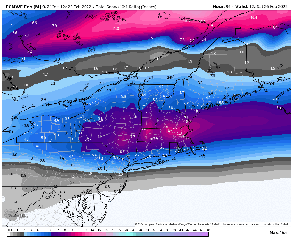
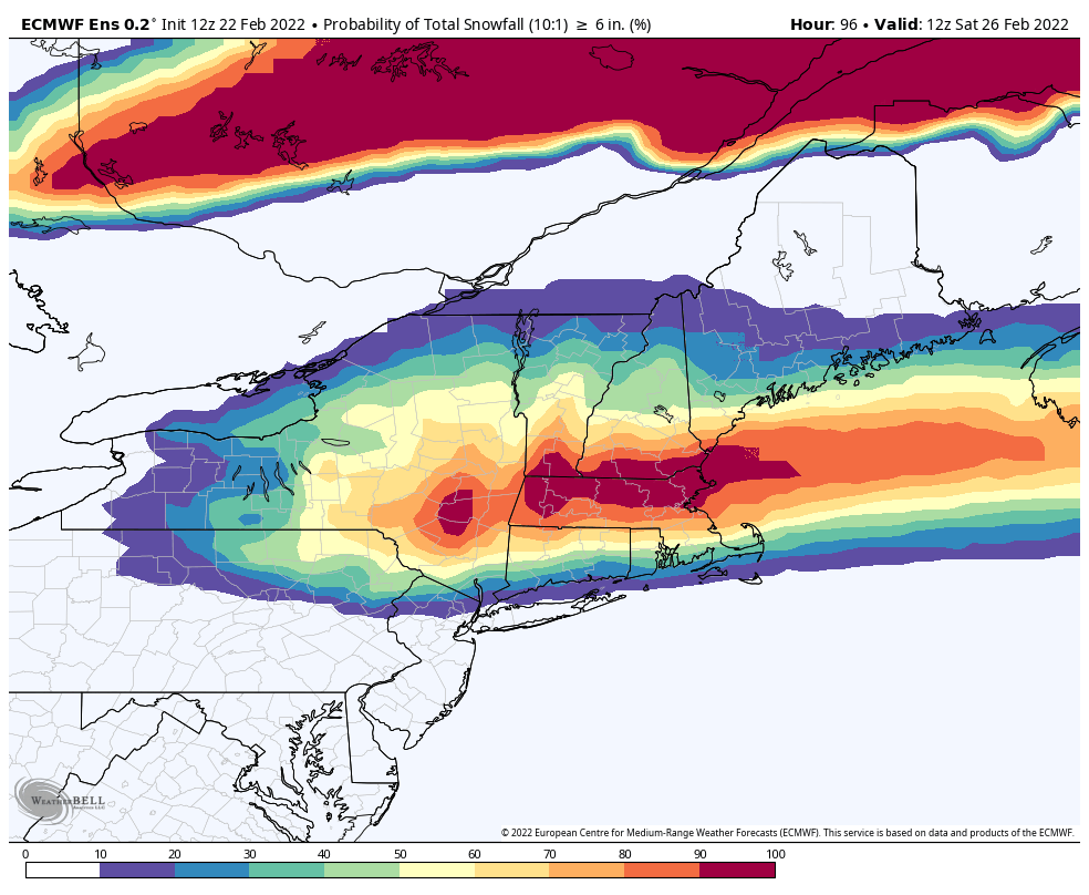
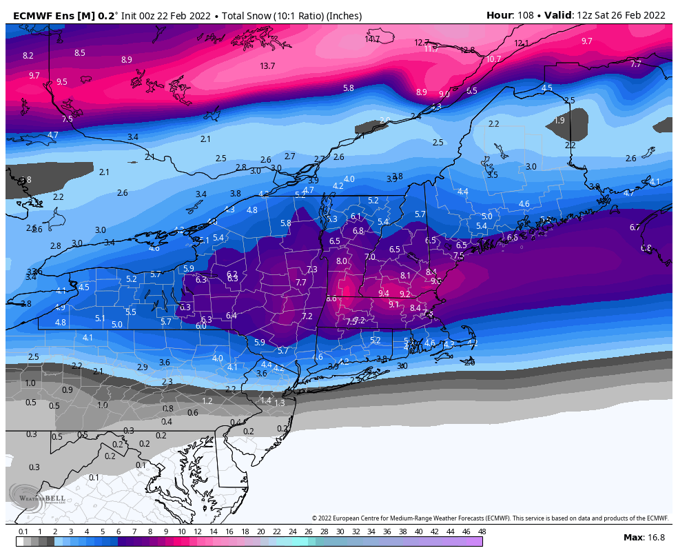
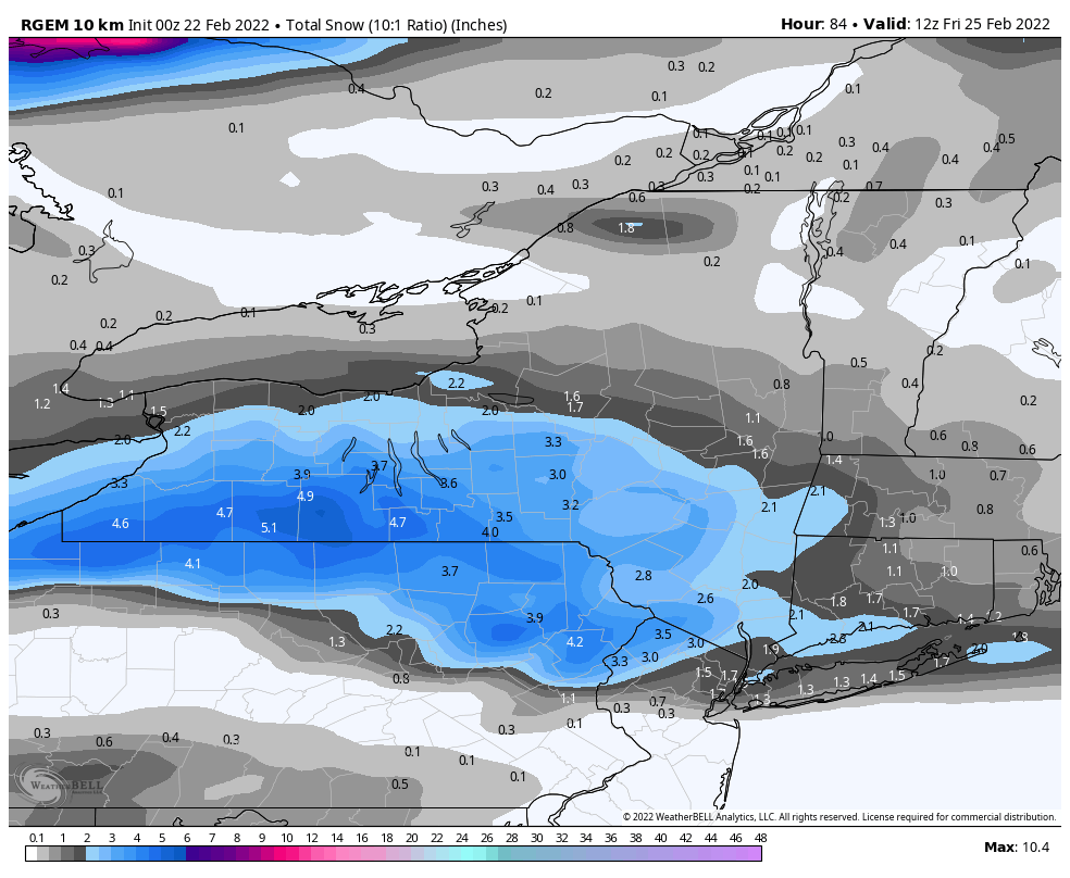
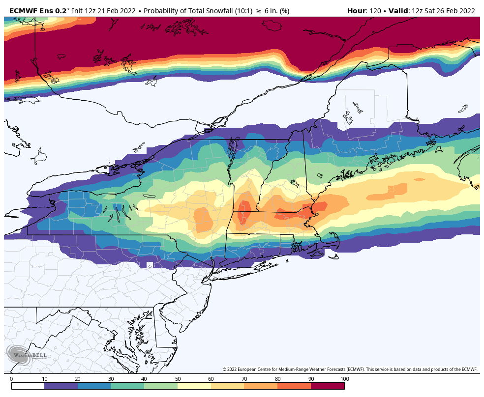
18z NBM... widespread 6-9 locally higher in ENY
.thumb.png.bad638e527e1aafc0abb69f52b0dad2b.png)
-
 1
1
-
-
-
48 minutes ago, Leelee said:
Don't these secondary coastal lows usually take more moisture from the primary than models suggest though? That seems like what KBUF discussion has been suggesting the last few days kind of downplaying what models are showing.
Yeah that can be an issue too with these handoffs. Plenty can go wrong for sure... primary too far north (mixing, dry slot)... or secondary forms and pulls the precip and energy toward the coast while robbing areas in between.
-
There'll be a north bump in the late innings. Always happens with these.
-
 3
3
-
 1
1
-
-
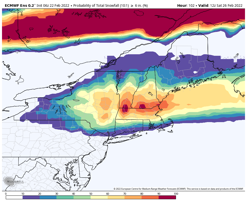
Current nws grids for snowfall thru 12z Friday. Easy to see the cwa border between Buf/Bgm and Ctp (the state line until Bradford county and Luzerne county Pa).
.thumb.png.c9e315806ea7b1aa0393c1220eada53f.png)
-
-
-
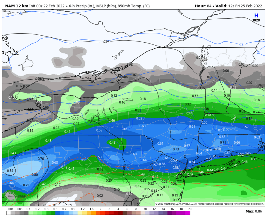
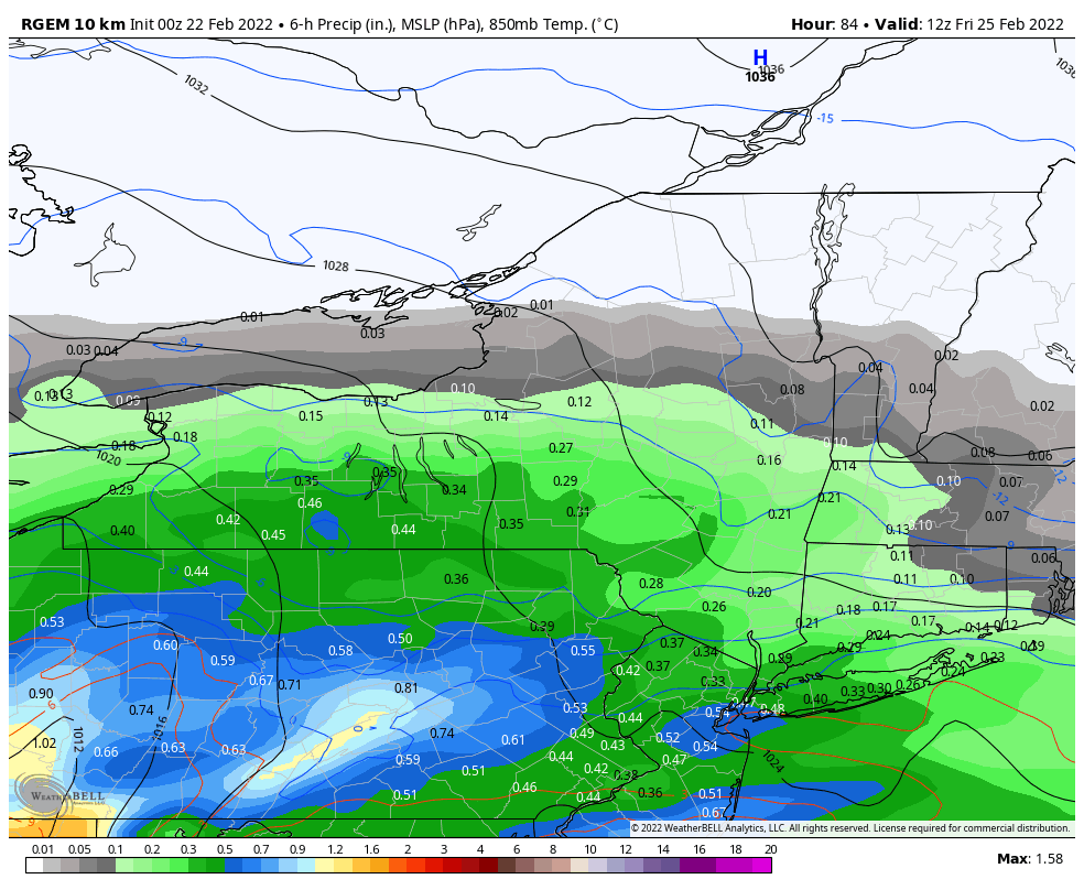
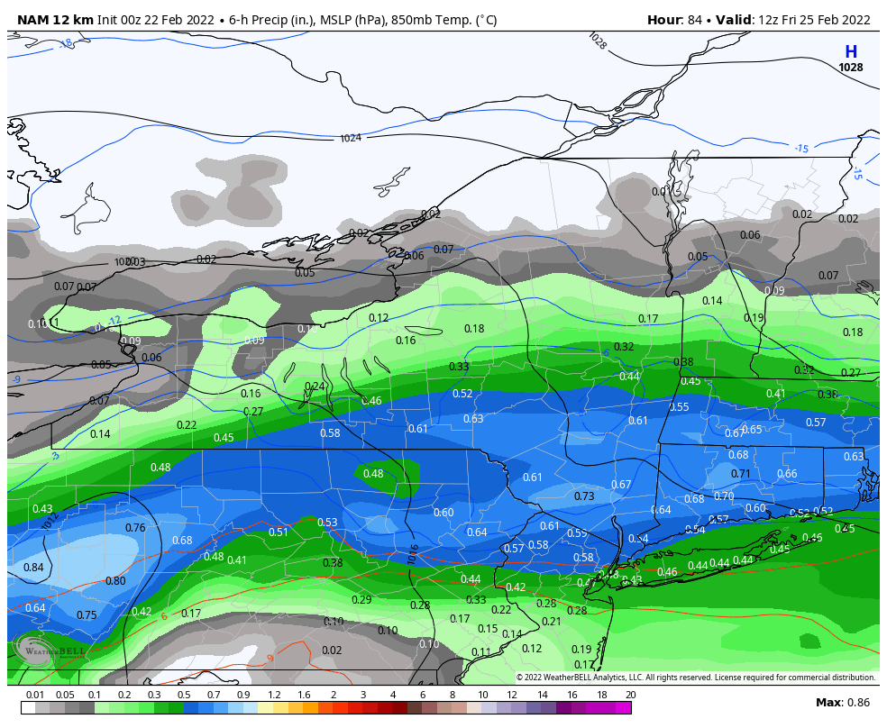
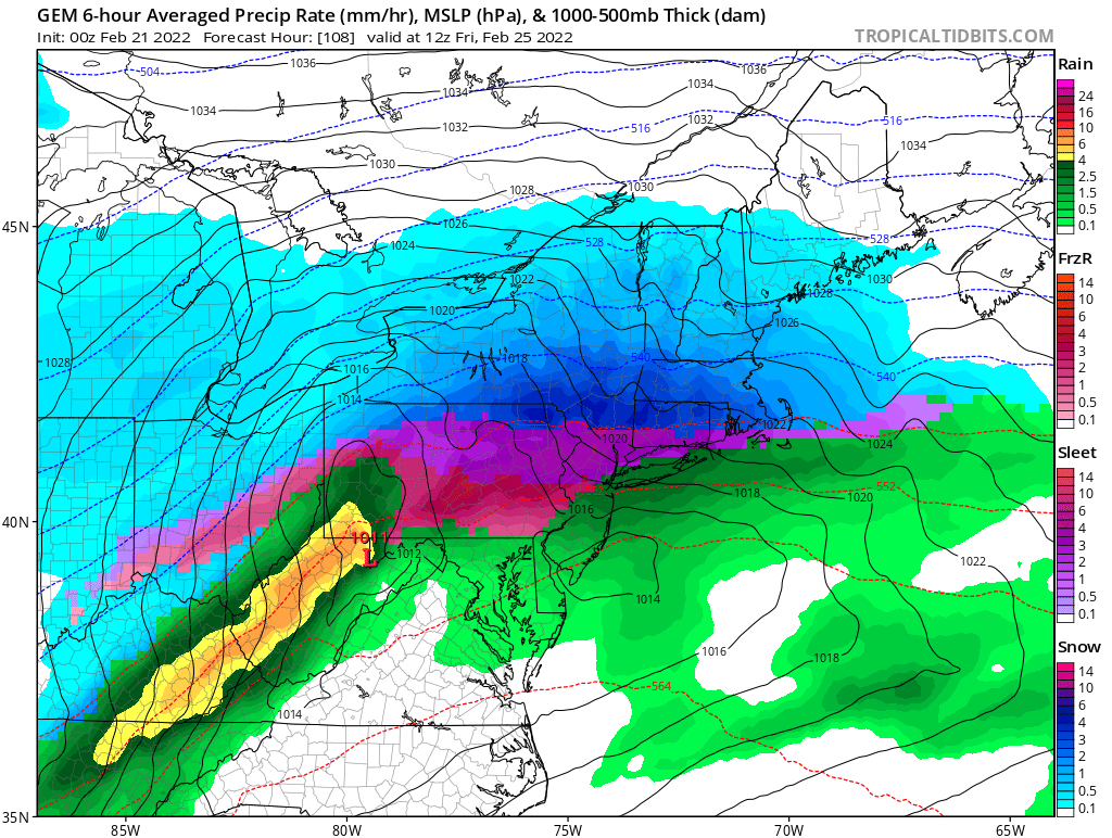
Wish I could sign for this waa dump in the LR Nam right now. Mix line is on the doorstep but sufficient damage already done verbatim. That said, being that close to the heavy mix zone at this range is no bueno. No margin for error for the inevitable late inning move N.

-
-
6 minutes ago, tombo82685 said:
Euro looks good, let’s get that about another 50-75 miles further north please
Gfy lol.
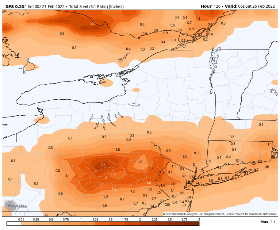
Itll probably happen though. It's been the trend with these systems. Atleast the sleet will be on top of the snow this time. Makes for easier cleanup.
-
1
-
1
-
-
51.4° under mostly sunny skies. Feels like Spring for sure. I'm half tempted to start cleaning up the yard.
-
-
-
-
Gefs and Geps still look solid. Will post together when Eps comes out.
-
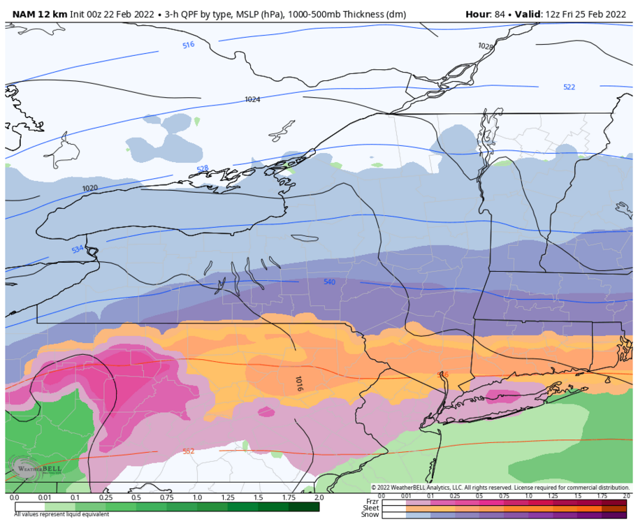
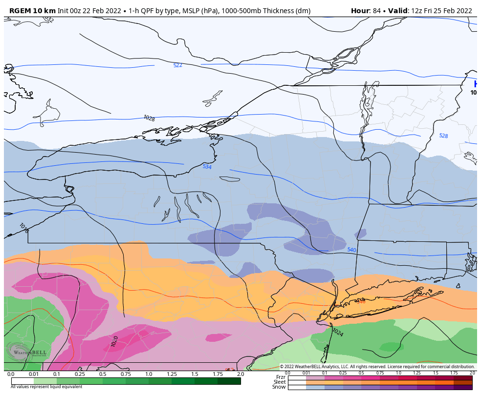
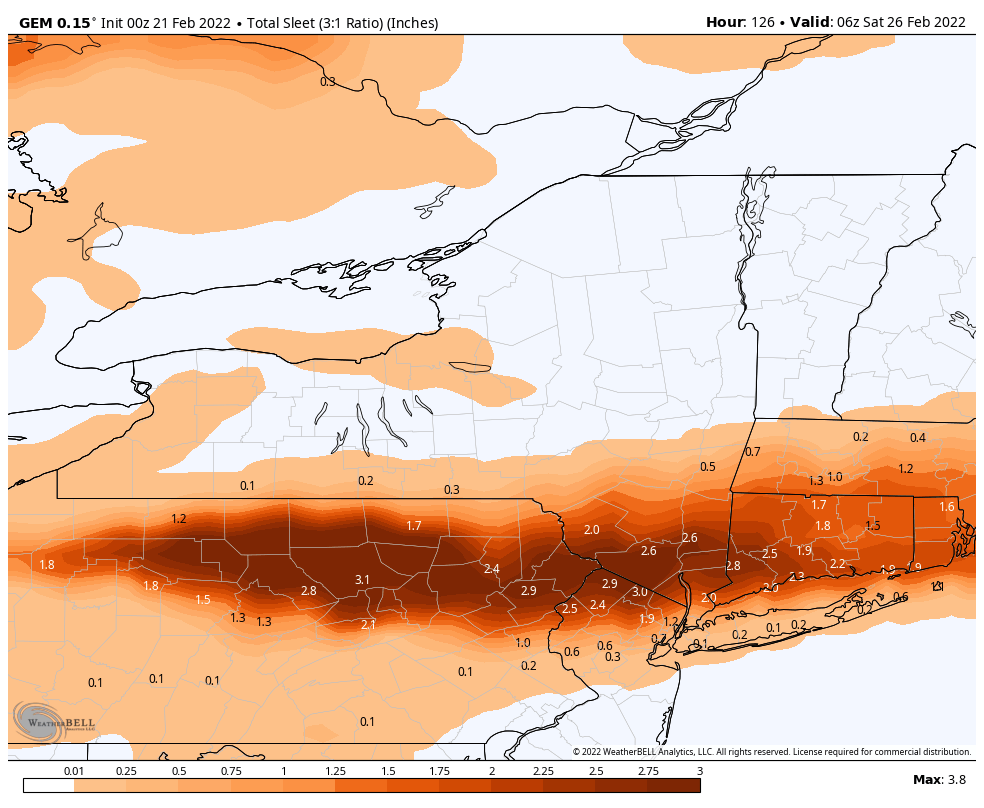
Gfs and Cmc sleet lines

-
1
-
-
-
32 minutes ago, tombo82685 said:
ggem, looks good, gets mixing to about bgm, bit colder than 12z
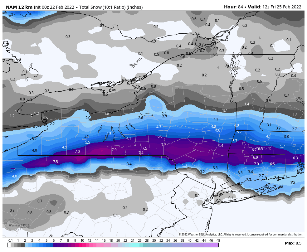
Pretty damn close. Might be few hours of mix. Idk why 12z and 0z runs won't load past 63 hours on weatherbell. These other sites are loading fine.
Edit: 0z run seems to be moving along now (87 hours)
.thumb.png.a279dbf47f9db241b0606325bbb6c848.png)
-
1
-
-
3 minutes ago, wolfie09 said:

Its definitely been shifty the last several runs. Gotta give the edge to the more consistent models right now and hope the Icon isn't right.
-
1
-
-
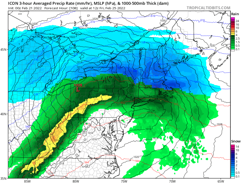
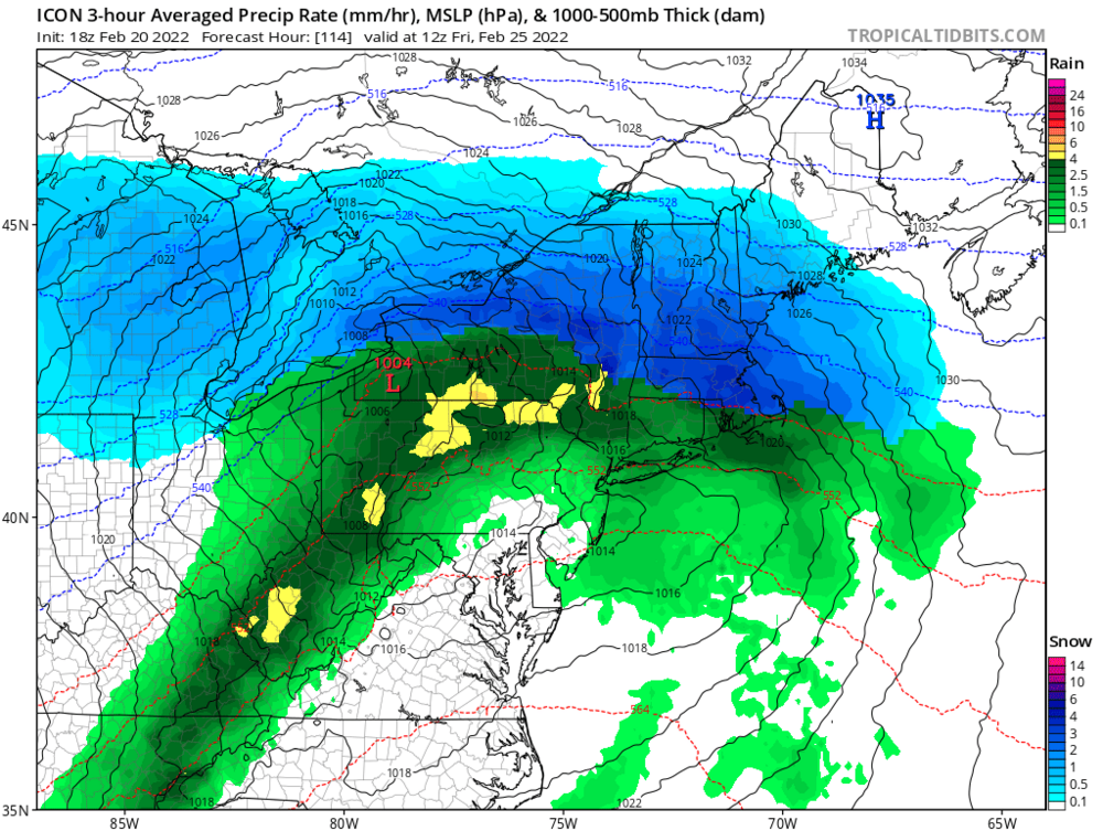
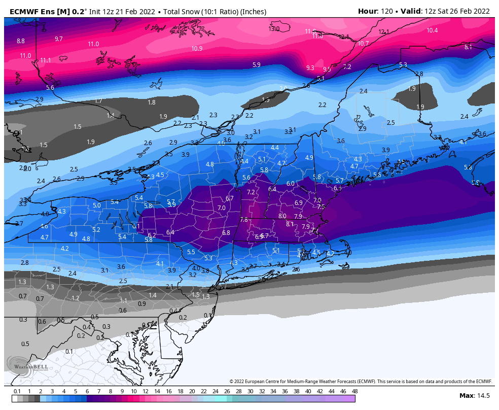
Icon gets an A for consistency with its Jamestown track
-
0z nbm to kick off
.thumb.png.396cf3f5ed1c0a82ce66fd7b601a8602.png)
-
1
-
2
-
 1
1
-
-
11 minutes ago, tombo82685 said:
Honestly, gfs probably still to far south imo given how gfs has been last to catch up. Ggem and euro have been locked in and get mixing to about cortland area. Icon could be close to final outcome with how these like to bump north inside of 3 days. Still tho k everyone gets a good thump regardless. That’s a beast of a high to the north
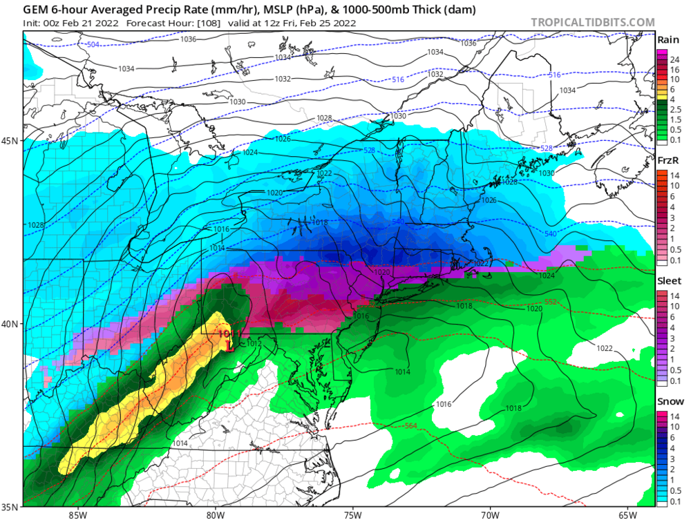
Probably right. I'm fully expecting the mix line to get atleast to the Southern Tier for a time... and yeah maybe even a bit north of there. I don't think the ICON solution comes to fruition though. This system looks too weak to get that far north. I think I90 is pretty safe for all snow.
-
Meanwhile the ICON keeps steaming for Jamestown
-
2
-
.png.3056cac73516fe4870e5e5805a9b6479.png)
.png.69d30e9278dd2a84a8a1ad4ee025e1e3.png)
.png.daa1f5650a618eebac5a1ea8731e2640.png)
.png.2664fef1be142ec847ca776dd5b646ca.png)
.png.99b1b2a8a89771e65fbc9cec925cf786.png)
.png.6aeb656ff431ba1dc45a17945e39ee39.png)
.png.2a2757e8e62ae0765e9b660a7666115d.png)
.png.fd5819bc2a7904083d4d2b82ec91afa0.png)
.png.dec86ef1b9096b24ff51d8330bfaece8.png)
.png.30eda7d3711a0f19c79b3284ef4c6549.png)

.png.2324b25d3a76bcb15fb450d57e9d3f1e.png)
.png.cf805ba973deea6f4a9c11df27447939.png)
.png.274023d1162f68bcb7ef252c6cf99c16.png)
.png.1c88dd04ff84edad9d4187e84d68283b.png)
.png.7558077428f1f55f0002ba750109b52c.png)
.png.7e004b46765d63603488f65ca0db6566.png)
.png.3164dd767a5d4efda65b7dea94aec5b2.png)
.png.6851fbd388f445a48e7c709bda6c6901.png)
.png.38048cfdcbbeb3b69cab1683fae1aba6.png)
.png.c7f06e9172046594ca5b5855b3b3a10c.png)
.png.8e93c3a2fcdbe53aef05ede0d4a44f42.png)
.png.c820815b3cd4761a4f5132c4039f09aa.png)
.png.6b8ceba53fdfdcd9d9cd5f31a9b0c085.png)
.png.490574eaf9332a1df5f4a65d3257bb7b.png)

.png.3eb45e14a46c709cf8fe5249742f0940.png)
.png.d55b4b6550fbf2d4dfac2f238af30c7c.png)

.png.41309b93234ed4eef1b475edb0619993.png)
Upstate/Eastern New York-Pattern Change Vs Tughill Curse?
in Upstate New York/Pennsylvania
Posted
I like your other idea too of just relocating to the high terrain in Southern Onondaga/Madison. Bet you see big differences there compared to the Lake Plain. Driven 81 many times when it was doing nothing or flurries in the Syracuse and Cortland city propers but in between around Lafayette, Tully, Preble it was whole different world. Driven NY 41 too plenty of times and seen big differences in the snow cover around Spafford area.