Wurbus
-
Posts
666 -
Joined
-
Last visited
Content Type
Profiles
Blogs
Forums
American Weather
Media Demo
Store
Gallery
Everything posted by Wurbus
-
Let's all agree to toss it.
-
Looks like some mixing issues or an energy transfer issue for the East.
-
How was the 18z Euro?
-
MRX posted this on Twitter about an hour ago.
-
Let's hope the ICON leads the charge into a Happy Hour to remember!

-
Still some lingering flurries in the east, but much beefier on that pass!
-
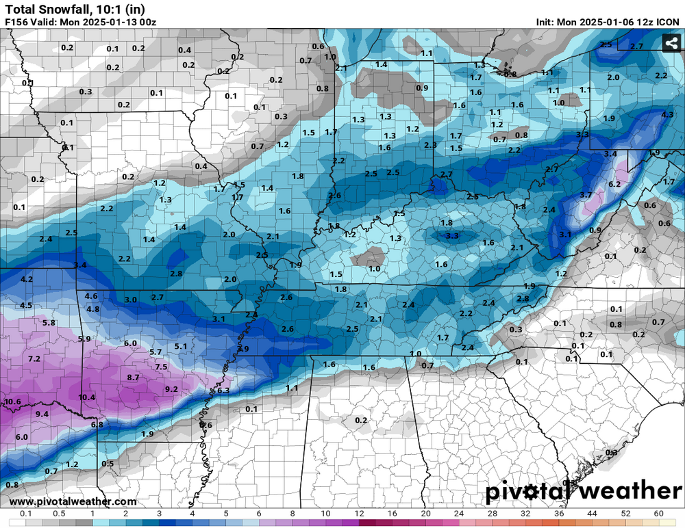
18z ICON looks much healthier across the state
-
The ECWF-AI had about .3-.4" of QPF for the whole state. Extreme southern counties were around .5".
-
Like John said, it kinda falls apart over our area, but that turns into a monster for parts of the NE. 2'-3' of snow for parts of New Jersey and NYC. 969 low sitting just off the coast before it goes to sea.
-
ICON has a light snow event across the state as it falls apart.
-
Waking up to 0z Euro finally getting on board and a beautiful 6z GFS run!

-
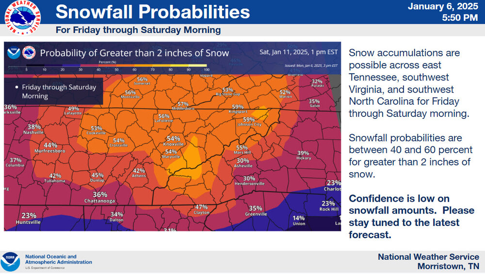
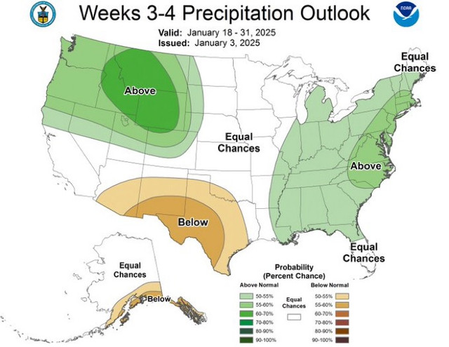
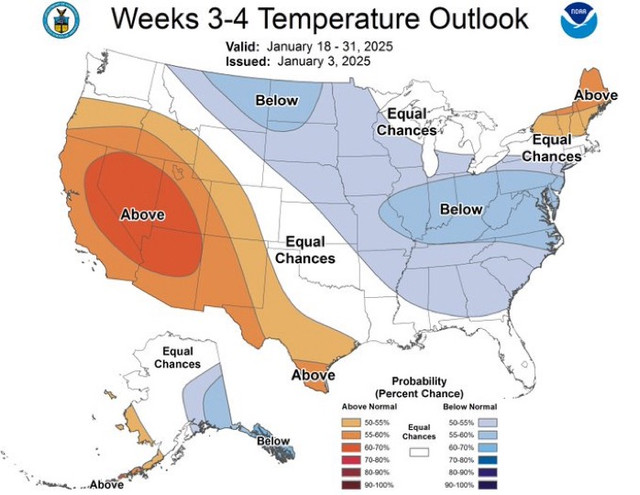
Someone in the Southeast forum posted the 3-4 week Outlook from the NWS and I thought it would be relevant to post here as well.
-
Just missed the phase on this run and energy is being held back in the SW on the system around the 10th
-
Let's just lock this look in for the next week.
-
The temp difference between the RGEM & NAM at 48 hours is massive. Just looking at Knoxville, the temp is 13 degrees on the RGEM and 30 degrees on the NAM.
-
Happy hour has arrived on the GFS for the Jan 10th-11th storm
-
Looked like it was amped and cut through TN. A little ice in East TN, but it warms up into the 40s as it cuts. I'll take that over the inch of ice.
-
Wild that we have 20 pages on the Jan thread before it even begins!
-
Might have to go buy that indoor propane heater I saw at Lowe's earlier today if this comes to fruition.
-
Holy smokes this is some really cold air. Widespread -10 to -15 temps with wind chills in the -30 to -40 range
-
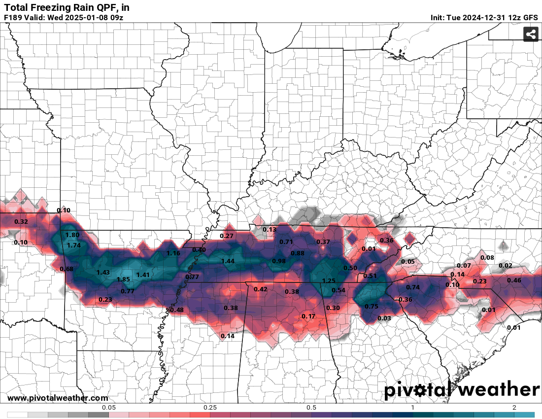
CMC is showing about .5" of ice for most of East TN as Carver mentioned
-
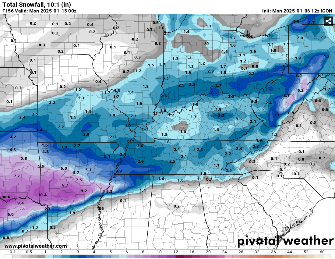
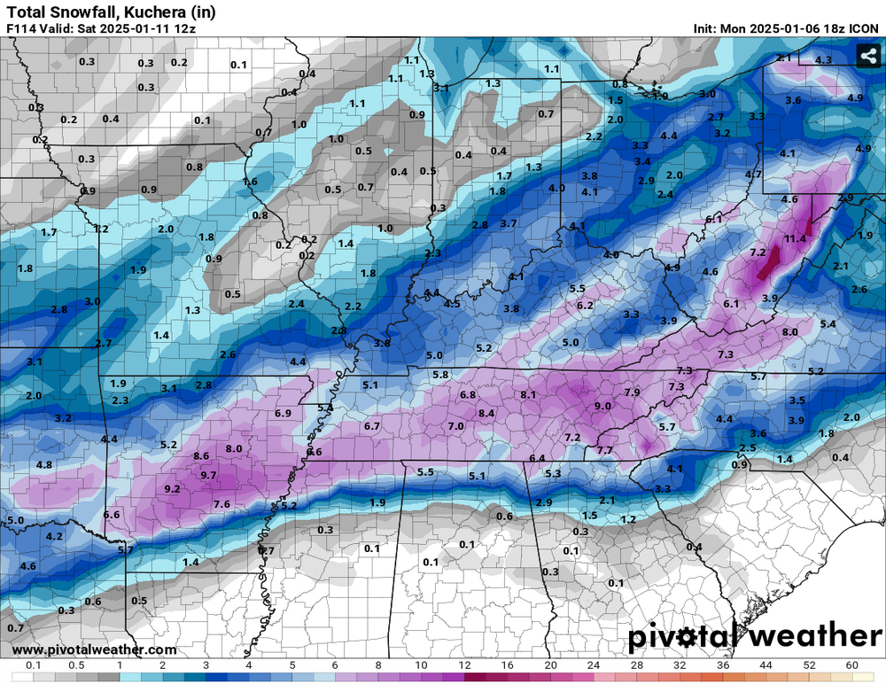
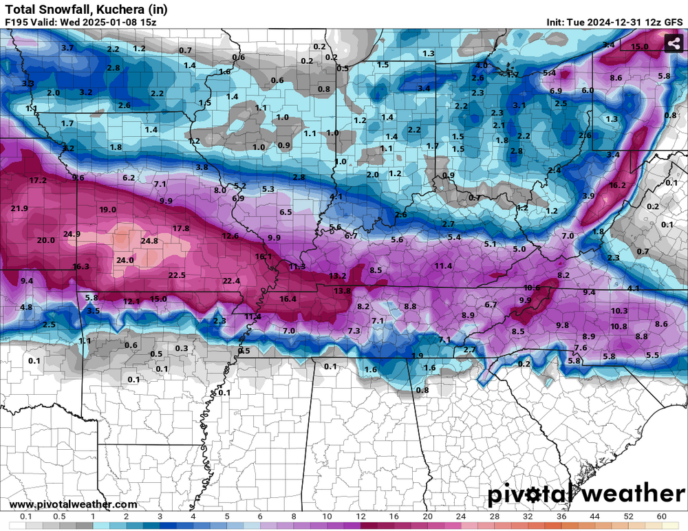
Ice and Kuchera maps for your viewing pleasure

-
So we basically have CMC/UKIE vs GFS/GEFS for the system around the 6th?
-
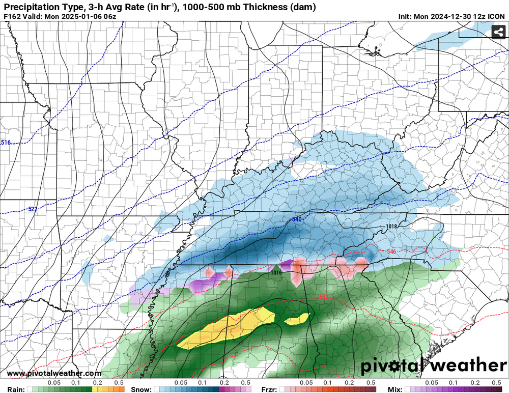
ICON blankets the whole state on the 1st system around the 6th. We'll see if GFS is still cutter city here shortly.
-
Wow.....This is the "warm" nose I can get behind!