-
Posts
399 -
Joined
-
Last visited
Content Type
Profiles
Blogs
Forums
American Weather
Media Demo
Store
Gallery
Everything posted by LaGrangewx
-
January 16 2021 - Inland runner Rain/Snow/Wind
LaGrangewx replied to Baroclinic Zone's topic in New England
Nws Albany claimed they reported 12” at noon and then 22” at 5pm. The initial 12” has to count 2-3 days? The 10” this afternoon seems a little high but maybe plausible they were getting hammered on radar. -
Was wondering what makes Cannon not great for snowfall? Shadowing to the east? Looks like they could get decent Nw upslope though
-
Awesome really appreciate the detail. Main goal would be to ski a safer and softer Ravine so will probably aim for that mid to late April time frame. I’ll keep an eye on the avalanche website and any detailed trip reports on the forum.
-

January 16 2021 - Inland runner Rain/Snow/Wind
LaGrangewx replied to Baroclinic Zone's topic in New England
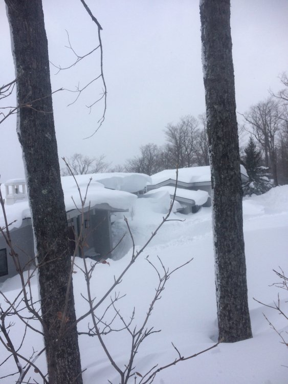
Yup I believe they had a few small events in between the big ones as well. Crazy stretch. I remember a picture I saw and found it again on twitter just now. Apparently it was near Stratton around that time. I don’t know if it was on the backside where I drove through or potentially on the opposite side of the mountain on that 2600’ ridge that’s been discussed in here. Either way that picture looks like it could fool me if someone said it was Mammoth Lakes. -
Wow. You have some incredible pics from the last few days. I was planning on making my first trip to Tuckerman this spring with a couple buddies. Was planning on left gully as well from what I have read. I was wondering when you would recommend the ideal spring conditions would be? Mid to late April? I guess I’m wondering if there is a time, where the most stable snowpack in the Ravine lines up with full coverage of the Sherburne Trail to the bottom.
-
27.1 inch depth reported at Lake Colden ~2800ft as of 2 days ago in the ADK High Peaks. Pretty impressive and on par with Hermit Lake on Mount Washington even though its 1000' lower. Widespread ~15-20+" depths basically across entire ADK now. They look like they will be cashing in well with upslope/lake effect the next 2 days as well. I know Whiteface had 6+ fluff yesterday caught a lake streamer I think. Had a friend there who said it was great. They were in pretty bad shape just a week ago.
-
Was looking at the MW avalanche site. The manual Obs site from Hermit lake Now has a 37 inch depth. That’s pretty sweet hopefully it keeps shooting up. I think the snotel says it’s at 3750 a little bit down the trail and has about 31-32”. Awesome pics looked like a great tour. As of Monday Chimney pond, Came in with 18” depth I believe. The Adirondack backcountry updates will come tomorrow I’m interested to see what Lake Colden is reporting. They had 11.5” before this significant storm cycle and have caught some lake effect. They’re also reporting depth from a few additional spots around the ADK This year which is cool. Old forge and snowmobile country has cashed in on lake effect all in all this system was generous to all the areas that desperately needed snow. Hopefully deep winter is here and rolls on in the mountains.
-

January 16 2021 - Inland runner Rain/Snow/Wind
LaGrangewx replied to Baroclinic Zone's topic in New England
Sweet conversation I always love learning more about that region as it one of the coolest micro-climates in the area. I mentioned a few weeks back about the Woodford snowmobile club Having some trails back into the higher Glastenbury terrain. I Remember I skied Stratton on March 14th 2018. It was a phenomenal day and snow depths were very impressive throughout the whole region. This day in particular I remember the Northwest flow upslope was supposed to be cranking in the area... but not at Stratton. Lighter snow all day but not significant accumulations. I took the weenie drive home to New York down through Woodford instead of Manchester. I came down the Southeast side of Stratton. Beautiful homes in there. I reached rt-100 and the 2400’ section before dipping down to mount snow base area and they had some crazy piles near that pass and excavators plowing driveways but their still wasn’t much upslope snow. The snow pack decreases as you head down towards mount snow and then Wilmington. Once I got to Rt-9, passing through Searsburg and reached woodford, no surprise the snow was cranking. It happened so suddenly. I remember my friend and I passed the empty prospect mountain parking lot and turned around to go have some fun and spin a few donuts lol. Half of it was plowed but the other half probably had 3+ft of snow just from the recent storm. We of course managed to beach the Jeep in it for a few minutes while it was almost a white out. Fun times. The snow pack in that area was awesome probably the most I’ve ever seen in a northeast residential area 5-6ft easy. Also you mentioned how mesos always jackpot that area and I would like to believe that as accurate as it is so consistent and shows the sharp eastern cutoff. So long story short I really don’t think it would be a stretch to say that the 3000-3800 area on Glastenbury averages significantly more snow than both Stratton and Mount Snow which seem to be just a few miles too Far East for the best snows based on what you see in Woodford. Others who live in that region have great input about the terrain and microclimates and I always appreciate their great input. That place truly has to be one of the snowiest live-able places in New England and definitely the snowiest that is fairly close to the coast. They’re positioned so well for monster storms and seem to get huge dumps more frequently than basically anywhere. A few 2 foot storms every year and a 3 foot+ storm or better every other year. Truly a weenie heaven that place is. -

January 16 2021 - Inland runner Rain/Snow/Wind
LaGrangewx replied to Baroclinic Zone's topic in New England
Was at the Cabin in Thurman at 1425’ for the last 3 days. There was about 4-5” of crusty pack when I arrived Thursday. Skied Gore Thursday and Friday with nice machine groomed conditions. Woke up today to some heavy snow. Drove all the way to Speculator to ski Oak mountain because Gore was sold out. It was interesting. On the way The highest point of Rt 8 around 1900’ near Eleventh Mountain, the snow became very grainy, hitting my windshield, but quickly turned back to big flakes as I went down a bit in elevation. It was dumping in speculator when I got to Oak they reported 10” and that was accurate for sure. Dense powder Skied very well. On the drive home the lighter precipitation showed just how marginal the setup was. It flipped between big flakes light snow and light rain a few times depending on elevation. Made it back to the cabin and I estimated about 8” all snow no mix. It was dense and wet. I’d say the town of Warrensburg about 7-10 miles away and lower elevation had half of what I had at the cabin up the hill. I was looking at the reports from Warren County Ny and they seem a bit misleading and underdone for the higher terrain as the highest report is 4”. The snow totals in the higher elevation hills seem to be a bit closer to the 10” reported at Gore and Oak. Overall beautiful scenery in the mountains today. It was an awesome drive and day to ski. -
Heading up to Gore for Thursday, Friday but they’re sold out for the weekend. Thinking of trying to hit Oak Mountain for some runs on Saturday. Agreed forecast looks great as of now for Saturday. Looking more and more like 6+ really hoping it holds.
-
I know Whiteface can do extremely well with certain lake effect connections. Gore on the other hand almost never gets In on it as it seems to have trouble getting past the mountains west of Indian lake. I think the high peaks region actually gets a lot of lake effect and snow in general it’s just not documented well. So I don’t think the greens necessarily steal the adk snow rather than its impressive that they still cash in while the Adk’s are getting some as well. Also from that map it’s so evident how the northern greens have incredible topography for NW upslope. It must be like every nor’easter Has to be treated as a 2 part storm up there
-
-
Drove home from skiing that night and the car thermometer was jumping all over the place I was confused. When I was in Columbia county I noticed It would fluctuate like 10 degrees within a few miles. Pretty neat.
-
McCauley has to get some crazy lake effect dumps. I’m hopefully planning a trip to Tuckerman’s Ravine this spring. Hiked up Mount Washington this summer and realized I need to go back for the skiing experience
-
Cool map. I’ve seen his maps before. He does some pretty accurate post event analysis. Shows my areas max of about 2 feet pretty well.
-
Me too. There and Pico Mountain are both great alternatives to the corporate resorts and offer that traditional skiing experience for an affordable price.
-
skied Magic Mountain up in Vermont yesterday, it was opening day for the upper mountain and by noon they had dropped the ropes on everything. The snowfall increased a bit as I drove up through columbia county but by the time I got to Manchester Vt the depths were very impressive. It was beautiful up there after the fresh snowfall and cold temps since. Settled powder depth on the hill was around 24-30" and I had waist deep first tracks on a few runs. Overall Incredible day
-
That report of 48” must of came from near ragged mountain. Regardless of the accuracy at 2000ft there they must have been crushed
-
I just looked at 2 different reports from Ludlow. 44”at 930am was at 1800ft and 41” at 10am. I checked the radar loop and snowed till At least 2pm in that area. You’d expect even higher storm totals then the final measurements If those were accurate. Were those reports tossed for some reason?
-
You’re definitely right that the window of snowfall was perfect to get high reports with the clearing. This reminds me of an intense lake effect snowfall just Incredible in a short window. What are the rules regarding clearing? I thought it was ok to clear every 6 hours but has that changed now? Does it vary for Nws, Coop, or CoCoRaHS?
-
Went to Magic today and the snow on the drive up from NY was incredible once you hit Manchester. Do you think a favorable location probably had 50” if they cleared?
-
Skied Magic mountain today. Untouched since they opened upper mountain today. Settle powder was at least 2 feet id guess. Incredible skiing for basically one storm this season
-
I saw a 1.61 in Poughkeepsie. If I had 9 or 10 to 1 ratio that adds up to about what I measured
-
Did the kuchera maps even underestimate this lol
-
Outside of lake effect I don’t know If something like that has happened. Valentine’s Day 2007 potentially? That was a bit longer duration tho wasn’t it?


