
LaGrangewx
-
Posts
399 -
Joined
-
Last visited
Content Type
Profiles
Blogs
Forums
American Weather
Media Demo
Store
Gallery
Everything posted by LaGrangewx
-
Actually down in Bel Air MD for this go figure when my home town in NY is getting crushed. About 6” here with lots of icy crust. Back home family was reporting around 15” several hours ago with a lot of snow to go.
-
Mahopac area looks like it’s been in that small intense band over northern westchester for hours
-
Also late for models but the 18z hrdps was a thing of beauty
-
Seems like widespread 12-18” in hv already gonna be some 30” totals
-
20” report by you just now in Monsey
-
Reminds me of how in 2017 we were supposed to jackpot but got dryslotted. A lot of models had the city jackpotting but are getting dryslot rn. Seems common these systems have a stationary band to the northern extent of the storm that models have trouble picking up on
-
I'm marveling at that radar, looks to me like it could easily over-perform up there
-
That’s awesome. I remember the snow growth was poor after the initial band in December. Was a Dense and fine sugar consistency.
-
Down in Maryland rn visiting family. Bit of a dud here probably 4-5” with a lot of ice crust. Had 15 in the December Storm in Lagrange
-
Hopefully it rivals the December storm up there had about 15”. Looks like you guys are in a great spot right now. Jealous
-
Rates look insane on radar up there. What are people seeing?
-
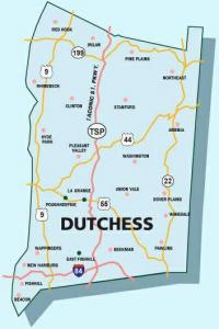
Not in NY for this one. Grandfather was saying about 6” in Red oaks mill Area not too long ago
-
Can there be some significant differences in weather/snow up the road at Crawford Notch from Bretton Woods or is it generally fairly similar? I drove through there this summer after hiking Washington and checked out the hotel and then went for a swim at Ammonoosuc Falls. Was a beautiful swimming hole and area.
-
Nice 150” this week in the high Sierra. They need it. Looks like another big one there next week as well.
-
Thanks Great explanation as always. I think it may struggle a bit truly modeling the highest of elevations in the mountain areas without a lot of obs like you said. Especially later season when the surrounding area is melted out. Outside of the infrequent reports from the Lake Colden Ranger there are no obs in the main high peaks area. Whiteface is quite removed from that area and has its own weather to an extent. Hiked Marcy early June 2018 and there was a solid snow pack from 4000’ up. Right now I just looked nohrsc has 20-30 in the high peaks when the Colden Ranger reported 4 feet in the high elevations. NOHRSC does seem to have the Presidentials modeled a lot better most likely because of the better obs
-
Been looking a lot at NOHRSC data. Is it modeled depth and then also takes into account reports? If you look several years back it seems to be a lot less accurate than it is now a days. Like for example it will show the high depths on Mansfield at elevation but then it didn’t show the same in the ADK high peaks when I’ve personally hiked there with snow pack into early June
-
January 16 2021 - Inland runner Rain/Snow/Wind
LaGrangewx replied to Baroclinic Zone's topic in New England
Sounds like an awesome week. How does searsburg pass usually do for snowfall in that area? Does it still cash in when Mount snow is missing out? I realize it’s up at 2500’ must have great retention I’m guessing. I’ve never driven it, would you say it gets even more snow than that stretch of 9 in woodford? -
Horrible news. Agreed that today is a day you shouldn't venture in there, you’re not just putting your own life at risk. Has news been posted online?
-
Yep ny ski blog. Gore is awesome terrain wise. If they got a bit more snow it’d be one of the top places In the east for sure. I was there last week before the snow and was still impressed with the conditions and snowmaking.
-
Presidential’s have an avalanche warning with gusts forecast to 140+ and wind chills to -60 tonight. Sounds like a good place for a picnic.
-
January 16 2021 - Inland runner Rain/Snow/Wind
LaGrangewx replied to Baroclinic Zone's topic in New England
Yea I would think somewhere near the crest of rt-9 just past the lake area around 2400’ in woodford probably does the best. There are actually a couple homes there around 2500’ it seems. Prospect base is at like 2150’ a bit before the crest. Also, the snow pack retention might get a little better as you drive further East is my guess. -
I know we discussed it before about ski areas reporting snowfall. I think My theory that Gore’s marketing doesn’t emphasize snowfall reporting has some merit today. They make generalized remarks about snowfall over a lengthy time period and do not have the best website setup to show totals it’s just a 24 hour report or 7 days. Anyways I know they got some fairly substantial snow yesterday (my guess 2-4+”) based on radar, photos, and trip reports I read on the ny ski forum. From what I can see they didn’t mention anything about yesterday’s snow on the report this morning which really surprised me. I just think places like Killington or Jay Peak don’t miss the chance at reporting every inch of snow that falls and for the most part that is how it should be done, barring any turn to rain that washes the fallen snow away. That should be mentioned in an ethical conditions report in my opinion.
-
Yup I saw on the avalanche site they were foreshadowing a bad forecast the next few days in today’s discussion
-
Saw there was a Slide reported on Left Gully today and a skier got carried down. Ok though thankfully
-
January 16 2021 - Inland runner Rain/Snow/Wind
LaGrangewx replied to Baroclinic Zone's topic in New England
I like to check the prospect mountain report as a comparison. They seem to report each morning fairly consistently and said they had 3” this morning. I’d like to see what they say tomorrow. They are on the western part of the ridge and the woodford observer is on the eastern side. I think they’re like 3-4 miles apart. I do think based on mesos that area has some extreme micro variations tho. Woodford snobusters also has some generalized reports on Facebook.
