mckinnonwg
-
Posts
150 -
Joined
-
Last visited
About mckinnonwg

Recent Profile Visitors
1,480 profile views


-
Thanks, can’t seem to find one decent for georgia .
-
That’s a good map-mind asking where you found? .
-
NAM decided to back off for the west georgia region on the 18z. .
-
Praying for some shifting for west Georgia chances LOL
-
This was the 10z analysis so I definitely expect slight variations but that is solid.
-
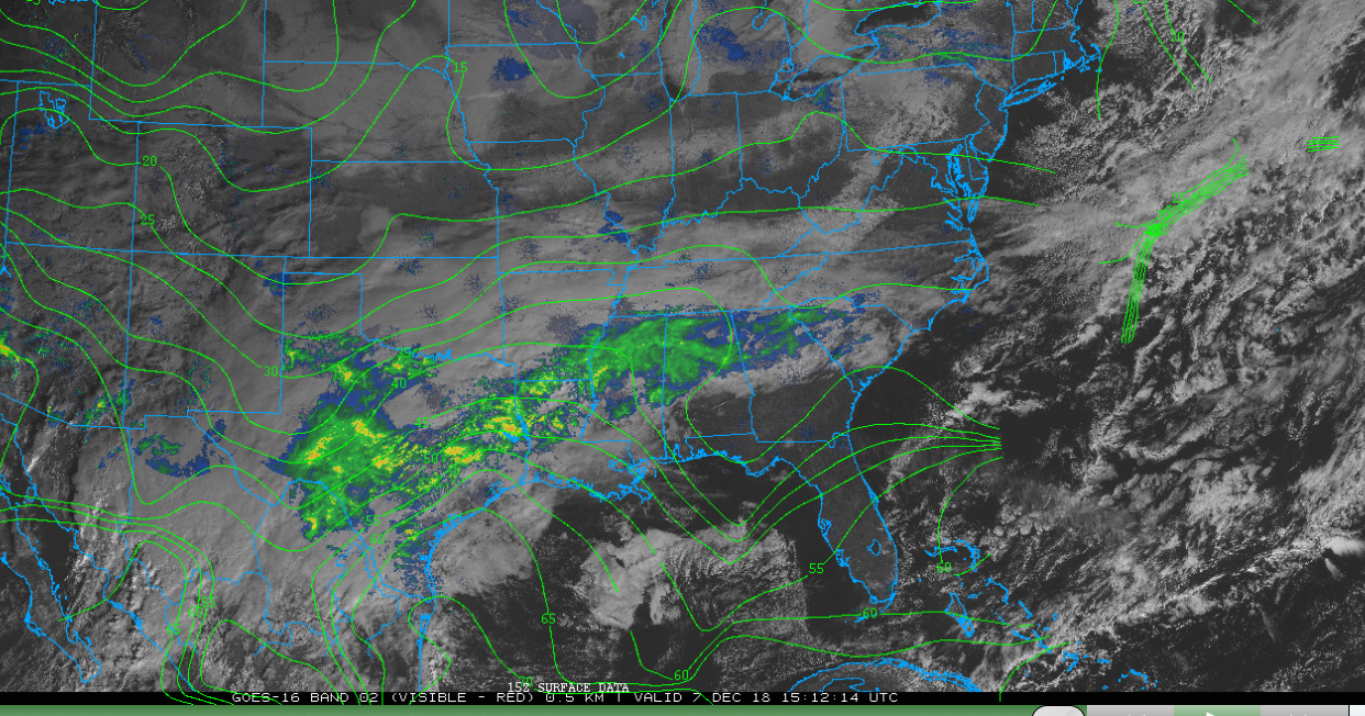
The dew point analysis map is digging much deeper than the HRRR model is showing. The HRRR model showed the 35 line a bit further back into Georgia but the analysis shows it stretched all the way down into the panhandle. That is strong wedge IMO.

-
I think they are expecting more of the 850 temps to cancel out. We are still a good bit away from the actual event so the model observations occurring can still play a major role. We just need to be mindful we are on the borderline and certain placements ahead of time to the north or south can shift something greatly in the longterm.
-
Not 100% sure honestly...but the forward lean might lead to more cold getting out in front of the main rain. Which is why folks are already reporting certain conditions. The high is going to pull it down into the moisture. Also, vorticity has increased in the 500 level where the cold is coming from more than what was forecasted. The low will continue to push in...its' the cold air we all need.
-
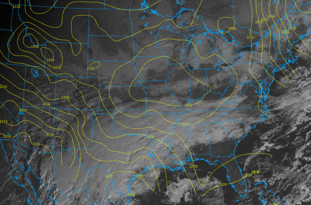
Looking at analysis data, it looks like the current HP is not as stretched out and has a forward lean (east) than what the 12z NAM forecasted.
.png.1bae1230ed0478ce9e17b67713e6135e.png)
-
Busted as in not as much precip totals....more south, more north...etc.
-
Also, long range HRRR is coming into play and showing A LOT OF RAIN. How is the performance of this outside the 18 hour window?
-
Is it my eyes or is the 12z NAM exiting the low a bit quicker? Not as much suppression and time for heavy accumulation?
-
personally, I focus on the short term at this point.
-
It's possible based on the algorithms used to define the contours. The soundings will give you the exact dew temp at climbing levels and may show you something different. But maybe not. Just one method of verification.
-
Have you viewed the soundings?