Normandy Ho
-
Posts
3,295 -
Joined
-
Last visited
Content Type
Profiles
Blogs
Forums
American Weather
Media Demo
Store
Gallery
Everything posted by Normandy Ho
-
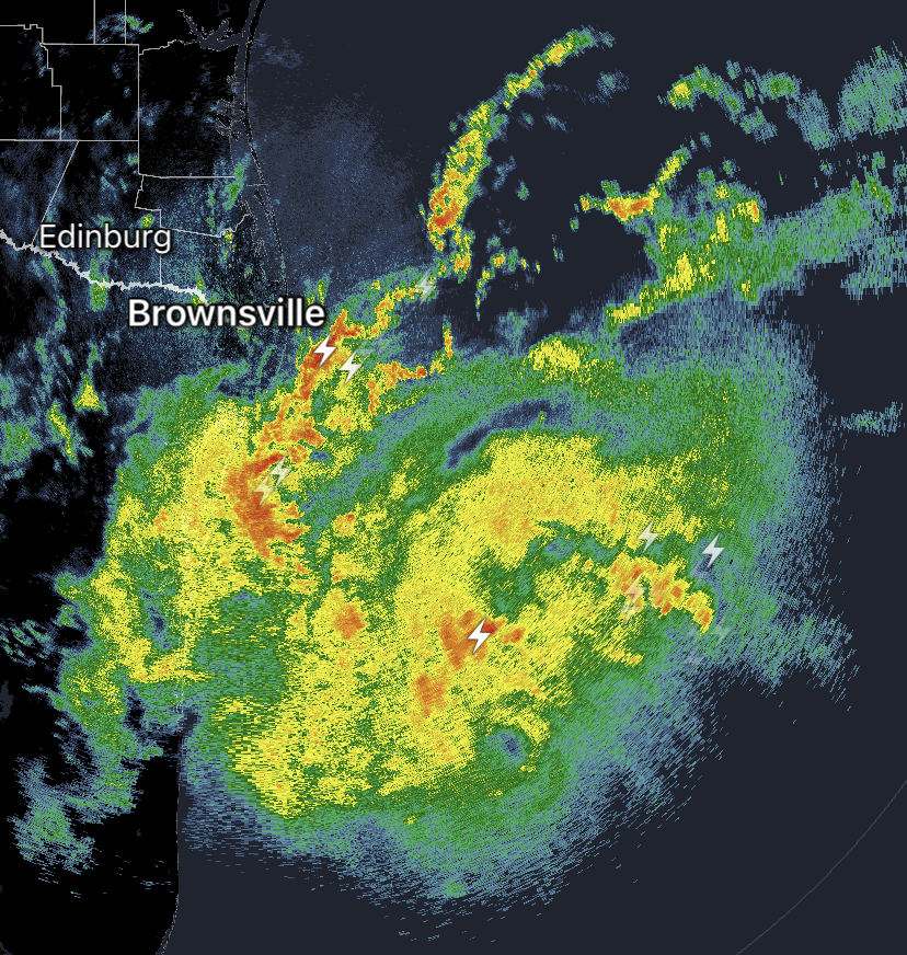
No question this is the center. Very clear eye like feature

-
2024 Atlantic Hurricane Season
Normandy Ho replied to Stormchaserchuck1's topic in Tropical Headquarters
Was just about to call that feature out. Very obvious developing wave there passing through the windwards. Would be interesting to see obs and radar out of there -
The explosive convection is telling. Ceiling is high for this one. If it can catch a positive trough interaction (and let’s be honest the more convection produces the better chance that happens) this could go nuclear. Look at the outflow in all quads. Upper level support is great. in terms of track im also east. I think this gets very strong and thus I think it gets yanked NE fairly briskly and feels that weakness. New Orleans would be at risk if this plays out
-
Very strong inflow coming into this new burst. Still have multiple centers though but the windfield on the west side is already stout. Very WPAC like look
-
I don’t have the charts to prove this, but this feels a hell of a lot like the setup of hurricane opal (but further west). Cyclone forms deep in the BOC and gets pulled north/northeast. I’m bullish on this one. I actually like the chances of a major out of this. The quality train continues
-
^not sure about the inhibiting factors. The models are showing the deepening fast as it accelerates NE. The fast NE motion might yield a more positive interaction with the jet streak to its north (less shear)
-
If I’m a betting man I’m thinking eastern LA. I like the idea of a sharper hook east
-
Think they need to pull the trigger on this one. Very evident circ with deep convection now.
-
^appreciate the post and sentiment but part of me feels like that’s a cultural thing. I’ve seen several videos of Asian folks out and about during typhoons over the years. I think they have a different relationship with typhoons than we do with hurricanes in America. Not saying it’s right or wrong just an observation of mine
-
2024 Atlantic Hurricane Season
Normandy Ho replied to Stormchaserchuck1's topic in Tropical Headquarters
Agree I think we get a name out of this gulf system. Very clear low on radar and satellite just offshore -
2024 Atlantic Hurricane Season
Normandy Ho replied to Stormchaserchuck1's topic in Tropical Headquarters
Alright let’s bRIng in some positive energy and focus on the now. Our wave in the Caribbean is at least firing convection and showing signs of life. If we get a good d max, maybe we can finally get something to pop. It’s got a small window before the Yucatán but let’s see if it can take advantage -
2024 Atlantic Hurricane Season
Normandy Ho replied to Stormchaserchuck1's topic in Tropical Headquarters
The all hell breaking loose will come. But numbers into the 20s is gone. The season can’t produce enough quantity. However I’m very nervous as there still is a lot of energy I’m the tropics that have yet to be evacuated, and eventually the storms will have to form to take care of that. Once they form they could be absolutely explosive. Got to wait and see but this is hella interesting -
2024 Atlantic Hurricane Season
Normandy Ho replied to Stormchaserchuck1's topic in Tropical Headquarters
Yea this season is going to humble many many a meterologist. Something’s wrong (or the climate models busted substantially) -
2024 Atlantic Hurricane Season
Normandy Ho replied to Stormchaserchuck1's topic in Tropical Headquarters
New GFS crushes Texas. Might be times for a thread -
2024 Atlantic Hurricane Season
Normandy Ho replied to Stormchaserchuck1's topic in Tropical Headquarters
GFS starting to show the lid coming off now. The bears are going home soon -
2024 Atlantic Hurricane Season
Normandy Ho replied to Stormchaserchuck1's topic in Tropical Headquarters
To be fair it is august 20th. The bears have a reason to howl right now. My fear is when the lid comes off, it will be frightening (multiple major hurricanes threats at once) -
2024 Atlantic Hurricane Season
Normandy Ho replied to Stormchaserchuck1's topic in Tropical Headquarters
The lack of numbers still doesn’t ease my concern. The ones that have formed have all found land. And one (beryl) was quite punishing. The models are showing a transition to more ridging as we get into peak season. The writing is still on the wall for a very damaging season. Season cancel at your own risk -
Motherfucker that made me laugh so hard kudos
-
If by some luck this strikes Bermuda as a major, then the season this far would be incredibly surgical with respect to landfalls (beryl already smashing grenada as a five)
-
Disagree. This storm has a very odd presentation on radar and satellite. It’s almost as if there are two centers (one about To exit the carribean moving WNW, and another further south still moving west). Interesting to watch unfold on radar this mess of a storm is.
-
Something weird going on with this on radar out of San Juan. It looks as if it is mid level shear (echoes are being sheared SW as if there are NE winds blowing) . Now I feel like that’s not shear, but either way recon obs (horrendous SW windfield with little to no winds) and radar (see above) suggests a broad disorganized storm.
-
Still lots of work to do. Recon showing a giant gyre like structure with no coherent right LLC
-
The caymans have redic strong concrete construction too. Regarding PTC 5, still A long ways to go.
-
Still got some genesis issues today. Tons easterly shear, broad vortex, and lack of focused and concentrated convection. Got to watch to see how long this genesis takes. Until that happens I’m not totally confident in where this turn north occurs
-
The SNE threats always bring out the bangers in terms of shitposting lol. I wouldn’t say there is zero reason to be concerned about a US threat tho. A signal is there for a close approach. Got to wait and see but I’m thinking a coastal scraper right now if I had to pick. Intensity will be a wildcard because of land interaction with the Antilles