eyewall
-
Posts
13,370 -
Joined
-
Last visited
Content Type
Profiles
Blogs
Forums
American Weather
Media Demo
Store
Gallery
Everything posted by eyewall
-
Potential 1/28-1/30 2022 winter storm
eyewall replied to Prismshine Productions's topic in Southeastern States
Doesn't make any sense and I checked the upper levels for moisture and that isn't lacking. I would think there would be more banding for sure for the eastern half of NC with a 996 low starting to bomb out. The takeaway from this run is the improvement in position etc as NorthHillsWx mentioned. -
Potential 1/28-1/30 2022 winter storm
eyewall replied to Prismshine Productions's topic in Southeastern States
The QPF is crap on this run but not sure if I am fully buying that. -
Potential 1/28-1/30 2022 winter storm
eyewall replied to Prismshine Productions's topic in Southeastern States
Well it definitely looks better in the end on this run: -
Potential 1/28-1/30 2022 winter storm
eyewall replied to Prismshine Productions's topic in Southeastern States
yeah the phase has been too late and more partial in recent runs. -
Potential 1/28-1/30 2022 winter storm
eyewall replied to Prismshine Productions's topic in Southeastern States
I don't think it will get the job done for us be we shall see: -
Potential 1/28-1/30 2022 winter storm
eyewall replied to Prismshine Productions's topic in Southeastern States
12z GFS rolling: Wave 1 over the 4 corners: -
Potential 1/28-1/30 2022 winter storm
eyewall replied to Prismshine Productions's topic in Southeastern States
If anyone in NC gets this one I think it will end up being the coast. Unfortunately I am not thinking it will be a 2010 redux at this stage. -
Rooting for you all up there and hoping we can all cash in from RDU to Maine. I would say the southwest s/w if farther west when it dives into the 4 corners region by almost misses the phase with the northern stream until it is nearly too late. It is those two players that are resulting in the run to run variability. The ridge in the southwest is a factor as well in the position of the southern stream piece of energy.
-
Potential 1/28-1/30 2022 winter storm
eyewall replied to Prismshine Productions's topic in Southeastern States
The 18z GFS is a backslide in the wrong direction for sure. The primary wave in the southwest starts off in good position but the phase is more partial and late. Almost a miss by the northern stream wave. Hopefully a blip but not reassuring of course. Even most of the New England forum won't like this one. -
Potential 1/28-1/30 2022 winter storm
eyewall replied to Prismshine Productions's topic in Southeastern States
No complaints here. That dumped 10 inches in this area. -
Potential 1/28-1/30 2022 winter storm
eyewall replied to Prismshine Productions's topic in Southeastern States
GFS: Euro: Note the subtle differences between the two regarding the main piece of energy near the 4 corners. Note the stronger SW Ridge on the Euro as well. That is the difference maker. -
Potential 1/28-1/30 2022 winter storm
eyewall replied to Prismshine Productions's topic in Southeastern States
The Euro has a much stronger ridge in the Southwest than the GFS so the phase again happens farther east and New England gets a superbomb. -
Hell I would be more than thrilled with a post Christmas 2010 scenario:
-
The mean is definitely better than the op. Definitely a step in the right direction.
-
We need it to wait a little longer before going neutral to get the phase farther southwest.
-
Not huge amounts but respectable even if the low cranks a bit late. Definitely an improvement.
-
And as I said the comma head delivers after the rain. This is what you want. A solid Miller A:
-
Much better spot for the phase. The thumb ridge in the SW collapses a bit more this run allowing more of a dig. The downside is more in the way of rain for central NC but those details come later. Everyone forgets there was a lot of rain first in the Carolina Crusher before the epic comma head.
-
Looks like our wave is over the 4 corners on Thursday (similar to the 84hr NAM):
-
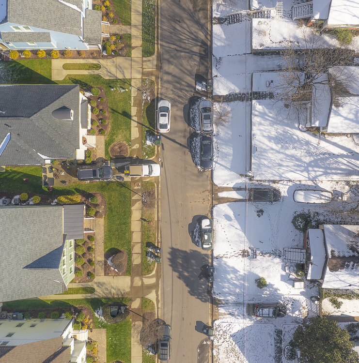
The grass is always greener:
-
One thing we know is this likely not going to be a Murphy to Manteo event. There will be winners and losers if there any land impacts in NC at all.
-
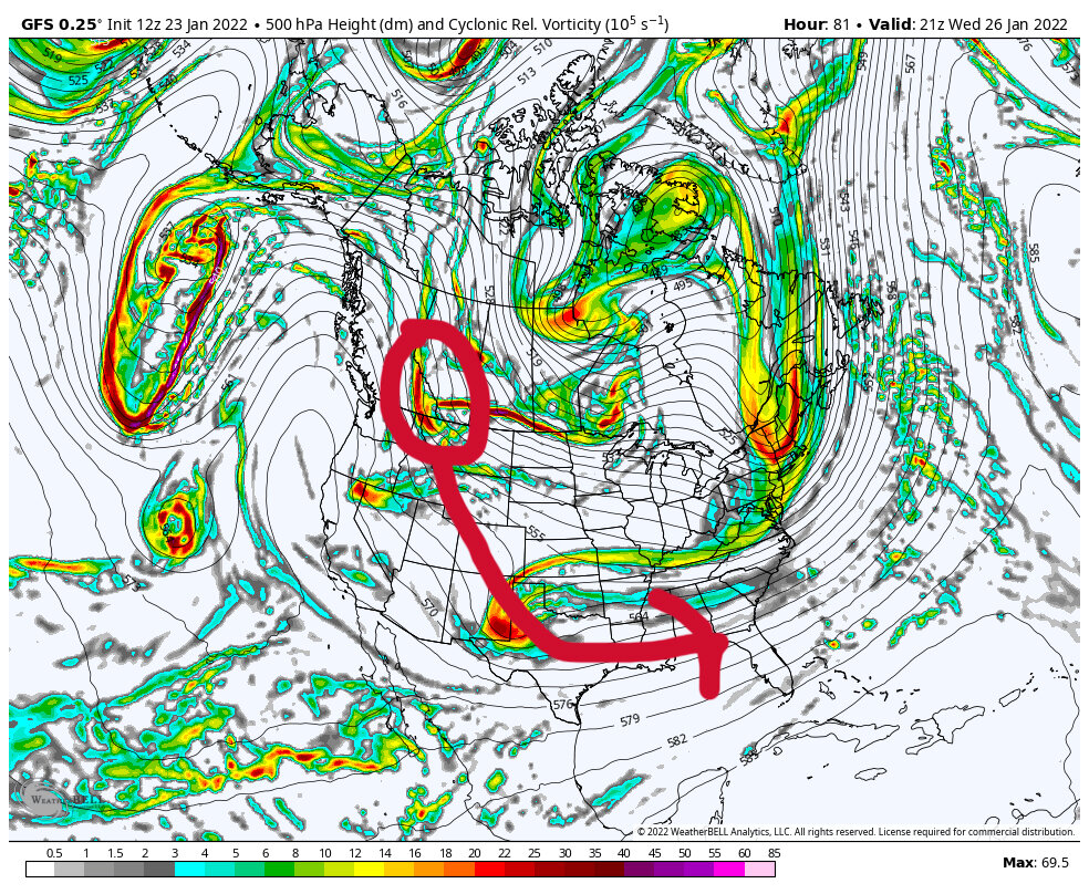
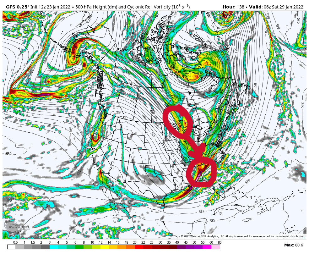
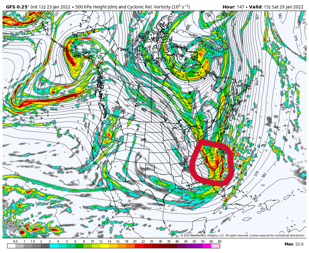
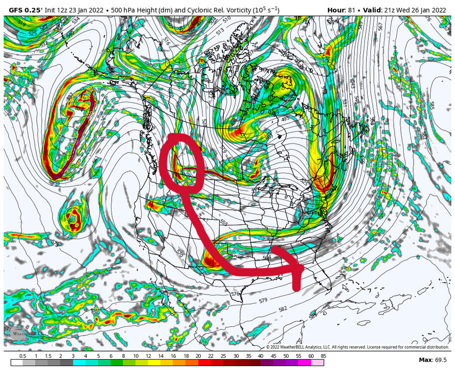
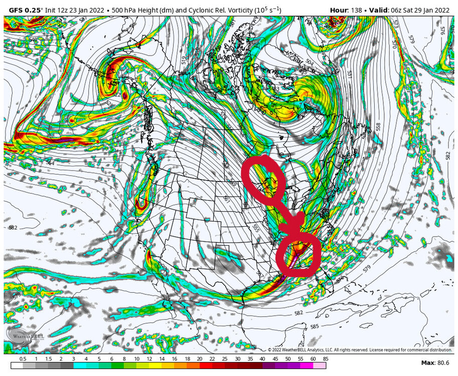
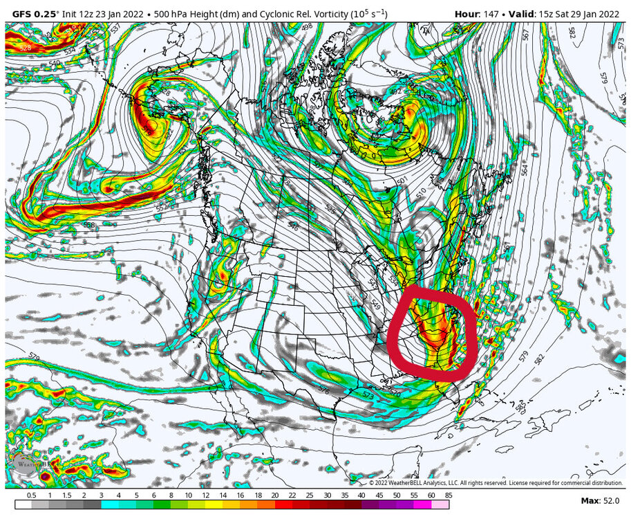
The first image shows the GFS modeling of the fist vortmax. The second image shows the first wave moving east through the Gulf region as the next piece of energy comes in quickly through the lakes. The final image shows the phasing occurring. Shift this a bit west and we are in business.
-
The signal continues. We will see if we reel it in this week. The timing seems a bit faster lately. The first key piece of energy comes out of western Canada early this week around Tuesday or so. That piece will drop into the southwest than move east. The second piece drops south later in the week through the Great Lakes. It will be interesting to see when they start being sampled in the real world this week. I would argue we need that Great Lakes piece to get there a little quicker to start the phase earlier and farther west.
-
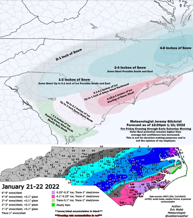
My forecast vs what fell for NC:
-
NC mets are sweating in December 2000 with this one. Anyway, obviously the last 2 GFS runs didn't have a hit for the region but we will see how this settles out over the next few days.