eyewall
-
Posts
13,365 -
Joined
-
Last visited
Content Type
Profiles
Blogs
Forums
American Weather
Media Demo
Store
Gallery
Everything posted by eyewall
-
Yeah the water restrictions will likely come back.
-
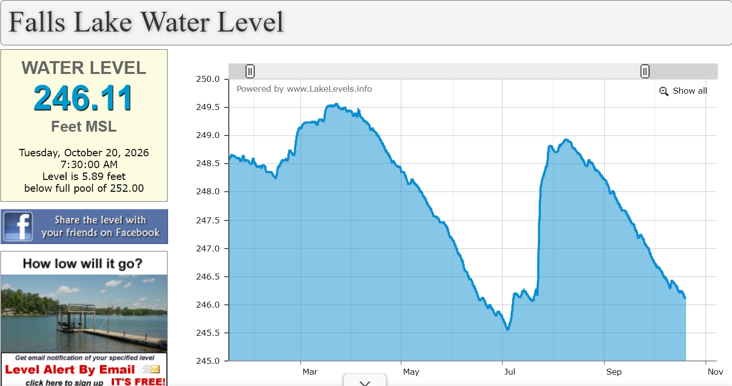
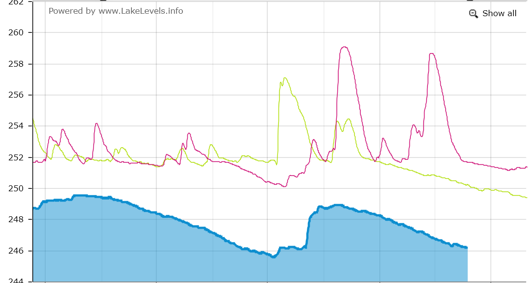
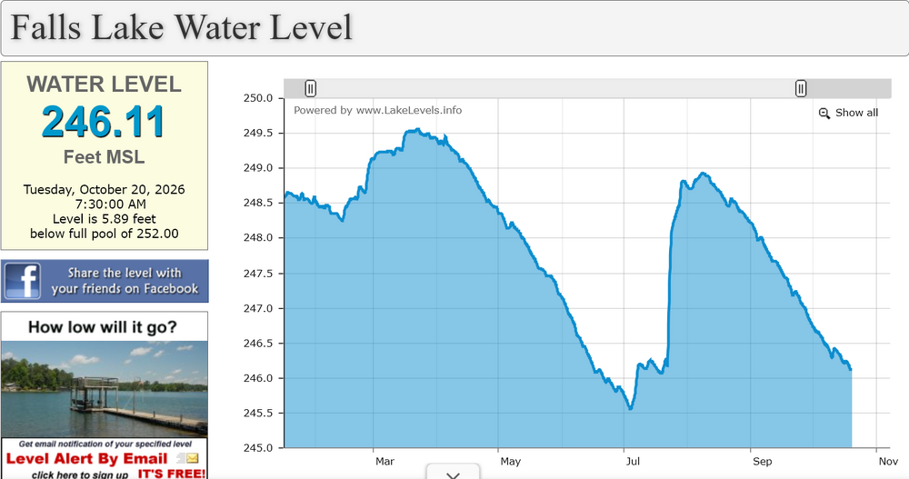
This is a better depiction of the lake level without previous years shown. It is on the way to the lows we saw over the summer once again and this week at least looks completely dry.
-
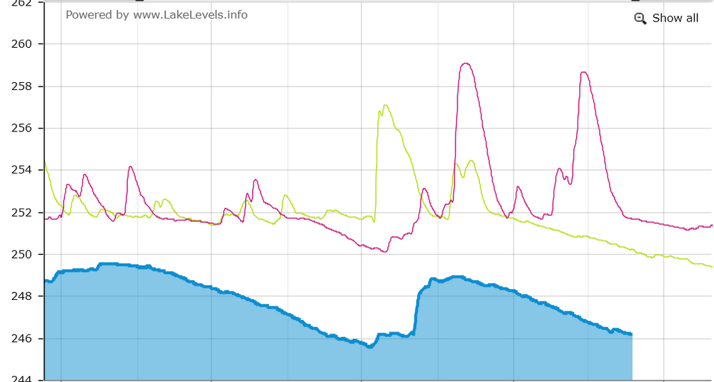
Falls Lake is becoming an issue again for sure:
-
Well it looks to be dry as a bone this week. So much for any rain from that coastal.
-
I got a shot of the funnel which was rainwrapped on this storm. It was on the ground at one point as seen here in the NWS damage survey. I had to dehaze in lightroom to really bring it out. I was just west of where the touchdown occurred
-
Got this near Morrisville (Had to dehaze in post to really see it due to it being rainwrapped. After there was some tree debris on I-40 between 283 and 284
-
Cloud tops warmed pretty quick. This system is definitely struggling right now.
-
They updated it not long ago and cut back central NC from this:
-
The 12z Euro shreds it and keeps it very weak.
-
2026 Atlantic Hurricane Season
eyewall replied to Stormchaserchuck1's topic in Tropical Headquarters
Good! I do not want to have to work this system lol. -
This entire summer except for late July was horrible and now the start of fall sucks too. Even worse is the models have backed off a bit on the extent of the cool down. The leaf change is expected to suck as well due to the drought.
-
Lock it in!
-
Halloween snow in the Triad?
-
Same here. We have seen so many modeled hits fizzle out.
-
Yep wash, rinse, repeat. Well we cannot do that because there is not enough water for it lol.
-
It just cannot rain in Raleigh anymore lol.
-
Yes! Lets light this candle!
-
@NorthHillsWxyou may be lucky to get another 0.01 today. That ended up being a disaster.
-
Run ahead outflow is killing us again in Raleigh
-
This was the light show in the clouds before I got that shot: https://www.facebook.com/reel/1085227447341802
-
thank you!
-
Well done lol.
-
Nailed this one tonight:
-
At some point the readout should just say fuck this!
-
They have not accounted for the Wake County dry slot.