eyewall
-
Posts
13,302 -
Joined
-
Last visited
Content Type
Profiles
Blogs
Forums
American Weather
Media Demo
Store
Gallery
Everything posted by eyewall
-
Ouch it sure did.
-
It is way too early for this shit.
-
A few showers skirted just north of Raleigh this morning.
-
I definitely worry about getting this pattern in July. We will be 110F LOL.
-

-
Sunset in Dix Park in Raleigh:
-
This week is going to be brutal for sure. It is painful to see so many 90's F in the forecast this early ugh.
-
In Wake County you need a miracle no matter the setup.
-
You may get a glimpse of it down there if you get a clear view to the S and SE.
-
This is giving me 2007 worries.
-
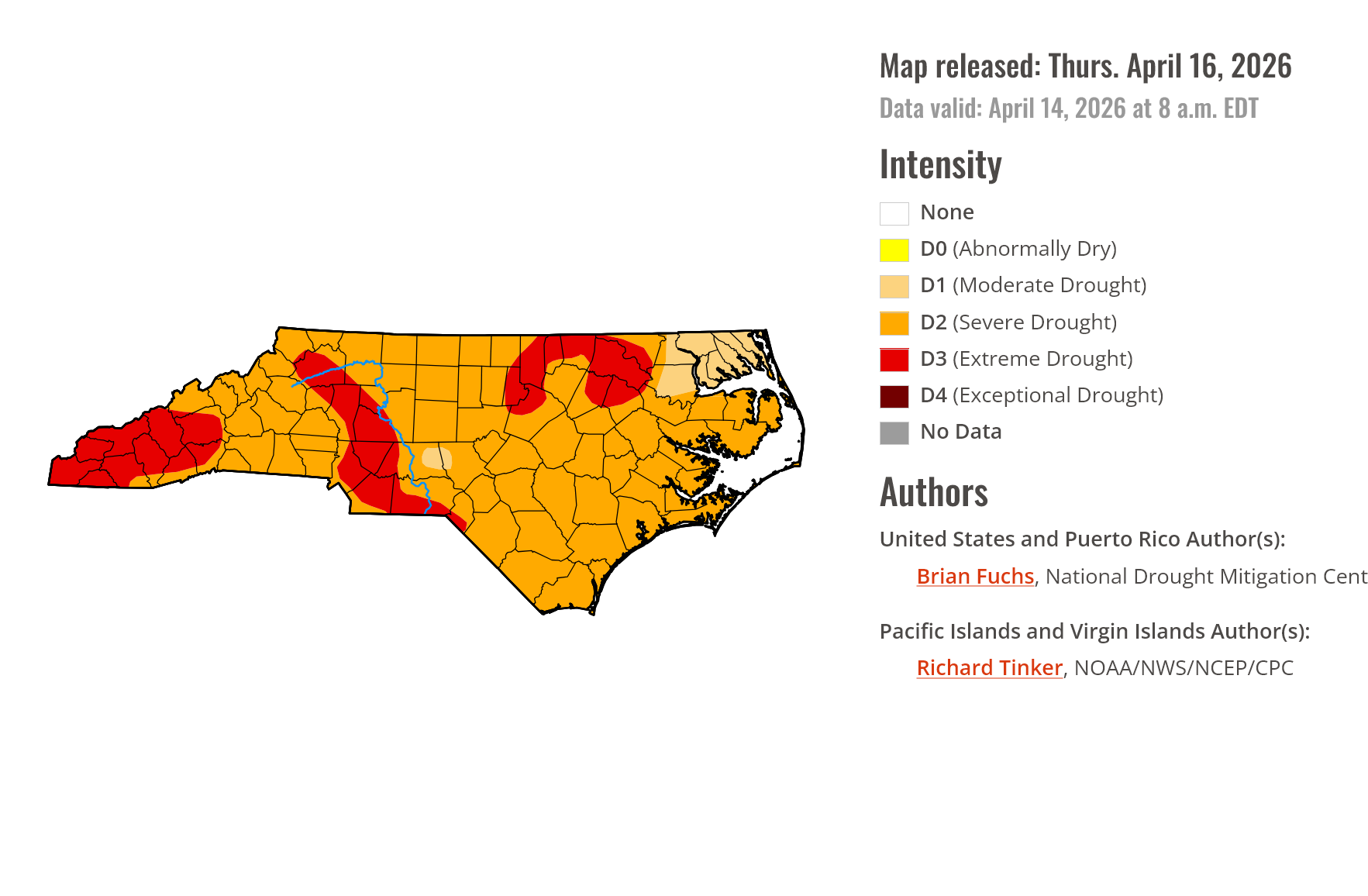
I have a feeling we will start to see that extreme drought cover more real estate in the next few weeks and some exceptional areas pop up.
-
It isn't just us. Much of the West is in real trouble with all time record low snowpack.
-
My concern for you all is the snowpack being at all time record lows in many spots across the West and what that will mean for water supply and fires.
-
The death ridge in early April won't help either.
-
The pollen count is not as high as Georgia here yet but the haze is starting to show up and there is a brush fire south of Raleigh:
-
Day 1 of the real pollening. The haze is likely to get quite a bit worse with no rain in sight.
-
That should make Wake County people feel a little better lol.
-
You can exceed 300kA with positive strikes for sure.
-
Lock it in:
-
Definitely impressive for this point in March!
-
Yeah I knew it when the air didn't have the feel of an outbreak day like it did on 4/16/2011. On top of that as you stated the winds were calm and that is definitely not how it goes around here on most high end days.
-
Yeah overall it truly was a bust yesterday and even on air meteorologists are basically saying the same. They are taking a beating today.
-
Those were not 65+ knots. Those would be marked in black.
-
Most of those came with the NCFR last evening more than likely.
-
I am getting more wind now than at any point during the storms.