sbnwx85
-
Posts
1,954 -
Joined
-
Last visited
Content Type
Profiles
Blogs
Forums
American Weather
Media Demo
Store
Gallery
Everything posted by sbnwx85
-
Wind screaming in at Wrigley at like 30 mph looks chilly
-
Flood Watch up for IWX’s Indiana counties.
-
The dog days of summer. Starting with a Saturday soaking for many of us.
-
I’m going to cosplay this cut off low as a weak tropical storm.
-
Would be nice to get an inch of rain out of this cutoff low this weekend.
-
https://x.com/Real_Wookie/status/2081800492649206062/video/1
-
Associated Press reporting major tornado damage near Appleton, WI
-
Monster storm complex. Already getting lightning strikes near here in Indiana
-
Maybe a quick drop near Glen Ellyn. Indiana and SW MI shoreline gonna get rocked.
-
I was gonna say, which office is holding out?
-
They can suck for multiple reasons
-
5 SVR Warnings and a TOR Warning in SE WI but no watch yet.
-
Here’s this
-
Might change thread title to Potential Convection Crapfest.
-
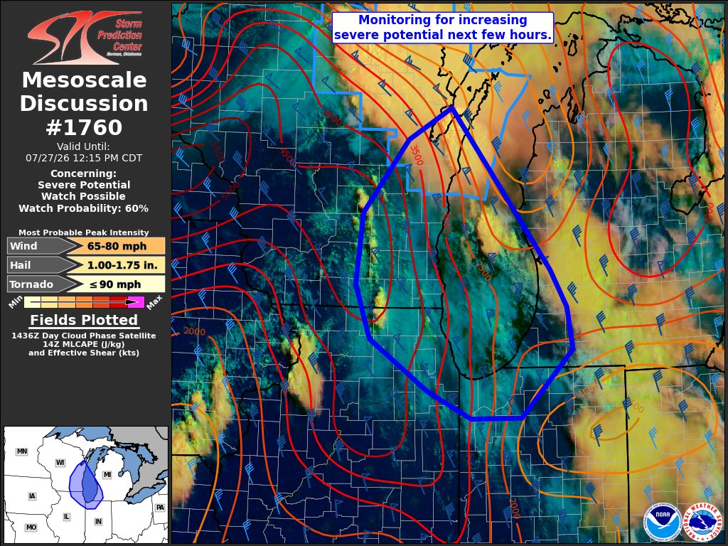
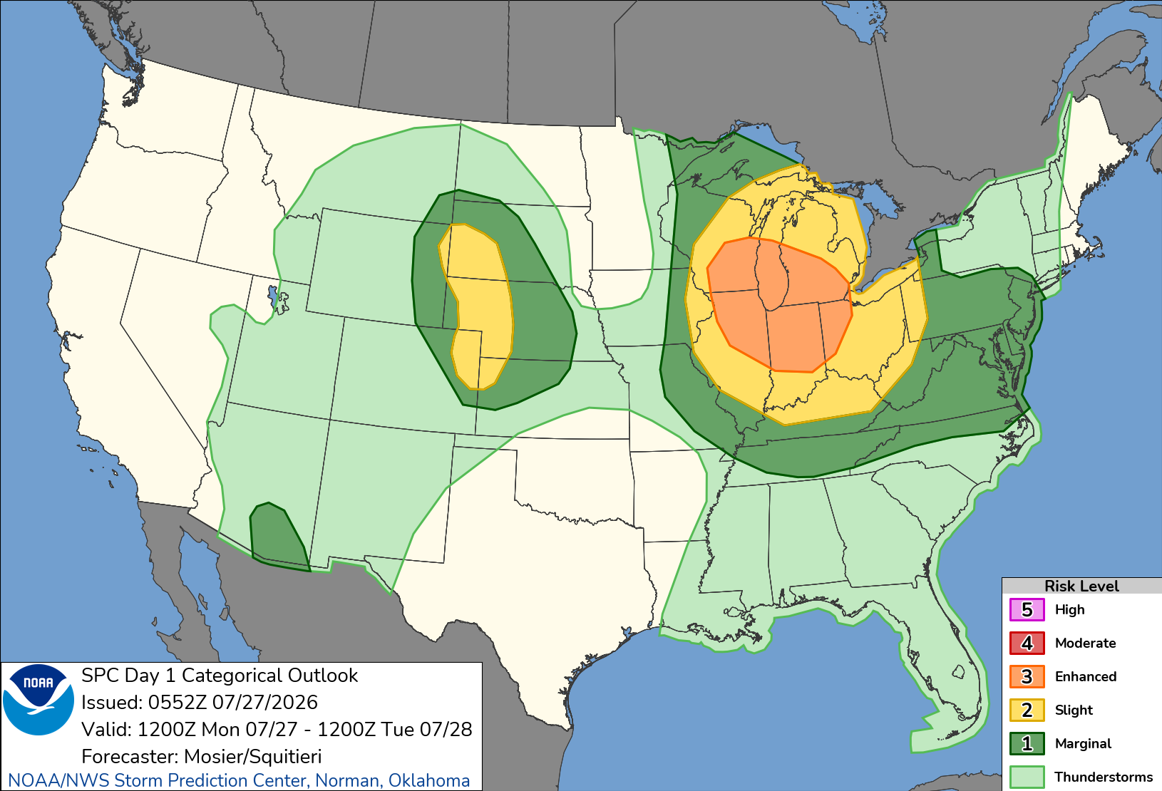
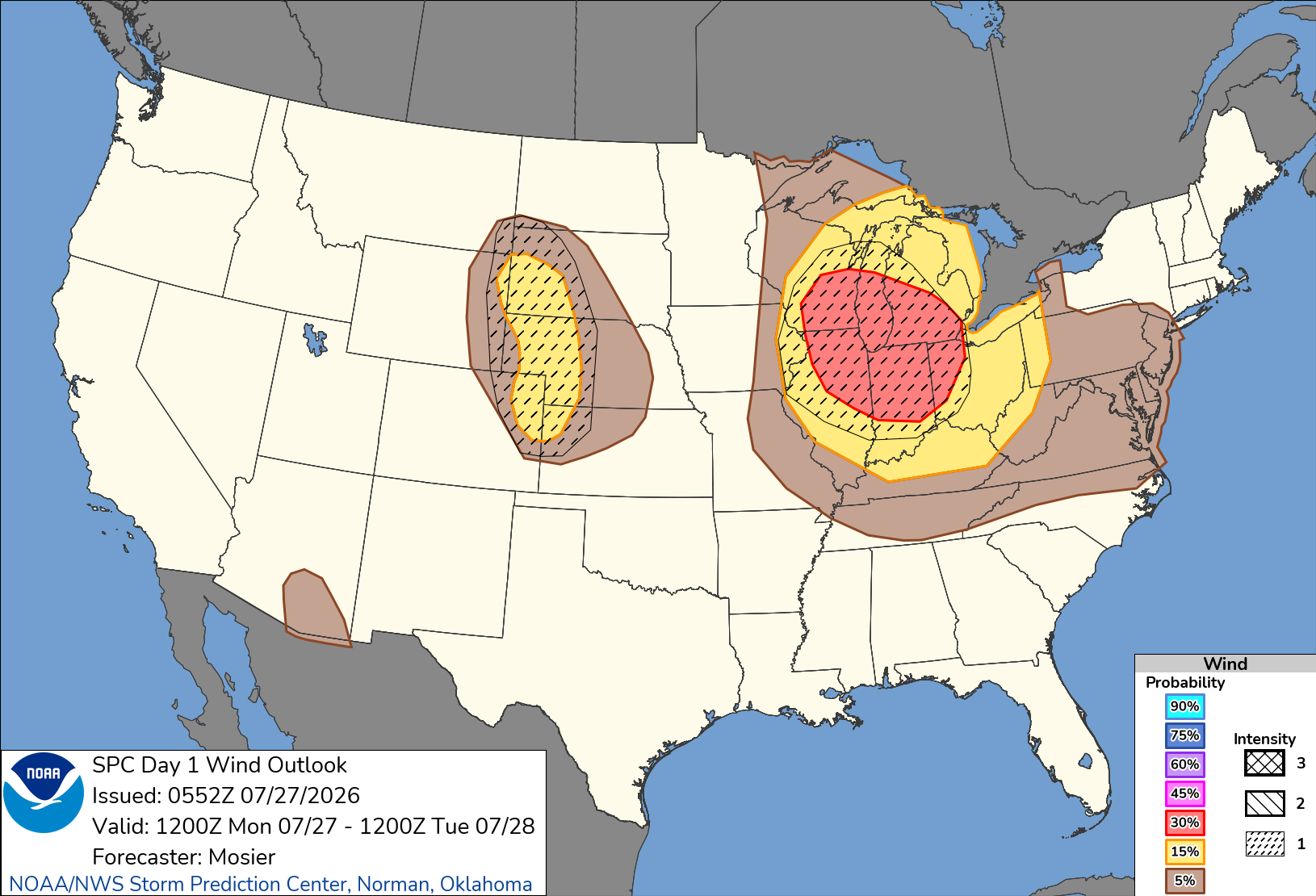
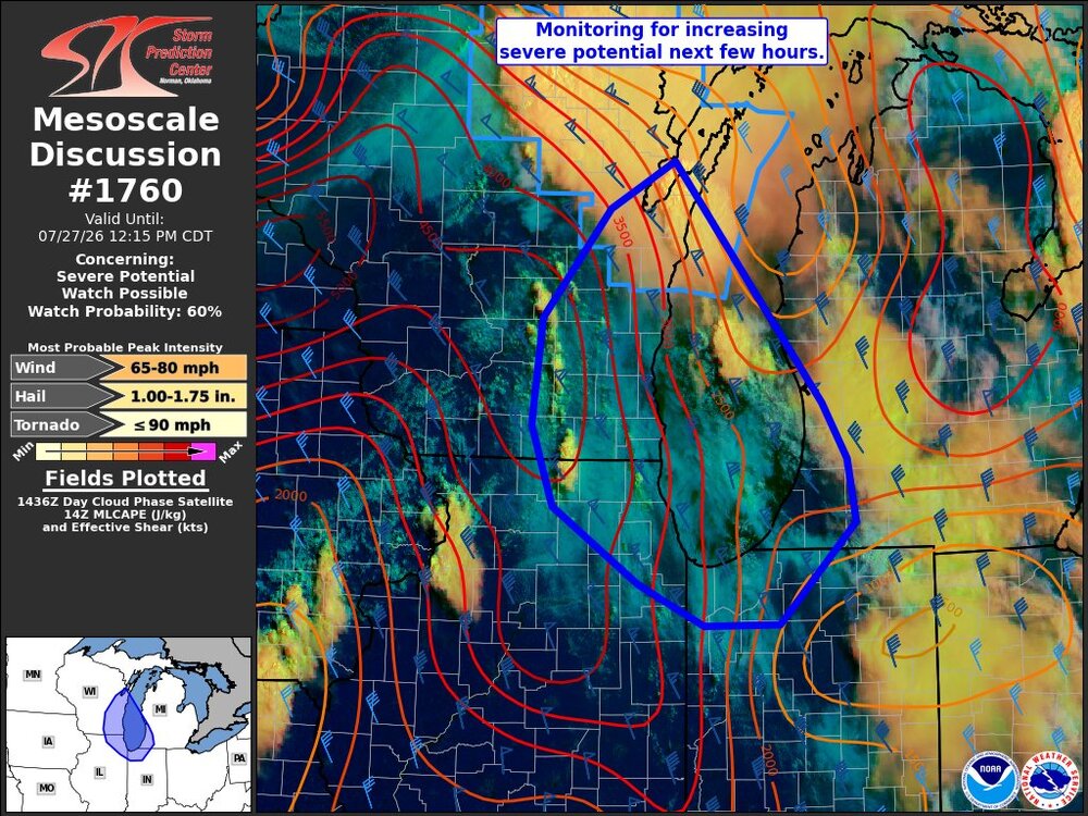
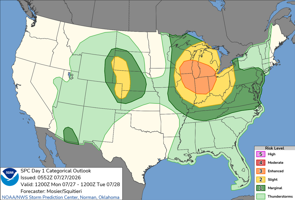
Going all in. If it happens I’ll start the first winter storm thread of the season. Potential for a destructive windbag/derecho Monday. SPC outlining a large Enhanced Risk area with SIG1 hatching. Potential upgrade to CIG2. Day 1 Convective Outlook NWS Storm Prediction Center Norman OK 1252 AM CDT Mon Jul 27 2026 Valid 271200Z - 281200Z ...THERE IS AN ENHANCED RISK OF SEVERE THUNDERSTORMS FROM PORTIONS OF THE UPPER MIDWEST/UPPER GREAT LAKES INTO THE OHIO VALLEY... ...THERE IS A SLIGHT RISK OF SEVERE THUNDERSTORMS ACROSS PORTIONS OF SOUTHWEST SOUTH DAKOTA...WESTERN NEBRASKA...NORTHEAST COLORADO...AND FAR NORTHWEST KANSAS... ...SUMMARY... Severe storms capable of strong to severe wind gusts and large hail are possible across the Great Lakes into the Ohio Valley Monday into Monday night. More sporadic occurrences of damaging wind appear possible in the Mid-Atlantic, Tennessee Valley, central High Plains, and southeast Arizona. ...Upper Midwest/Great Lakes into the OH/TN Valleys... A very moist airmass is in place from the Upper Midwest into the OH and TN Valley. This airmass is exists south of a diffuse cold front that extends from a surface low over far southeast Manitoba southeastward to far eastern Upper MI. One thunderstorm is currently ongoing near this boundary over eastern Upper MI. Most of the thunderstorms are ongoing just northeast another surface boundary demarcating the very moist (i.e. 70+ dewpoints) to it southwest. How this warm-air advection activity evolves early this morning will have a large impact on the severe potential farther downstream from the Mid MS Valley into the OH and TN Valleys through the late morning into the afternoon and evening. Much of the guidance is beginning to suggest the warm-air advection activity clusters early this morning over the MN Arrowhead vicinity before then tracking southeastward within the moisture/buoyancy gradient and organizing/intensifying significantly. Synoptically, the overall setup matches many characteristics of scenarios with strong, forward-propagating MCSs, including a surface boundary parallel to the deep-layer shear, at least modest mid-level warm advection, and very strong to extreme buoyancy. Given the trend within the guidance and favorable synoptics, confidence in the development of a strong forward-propagating MCS is high enough to adjust the 30% wind probabilities westward while also introducing a CIG1 area. There is a chance that both higher wind probabilities and a CIG2 may be needed, but predictability regarding convective evolution is too low at this time.

-
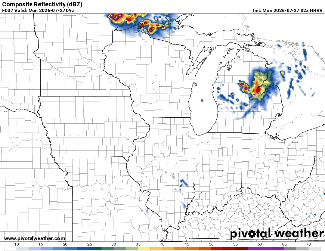
HRRR selling a derecho late morning to early afternoon tomorrow
-
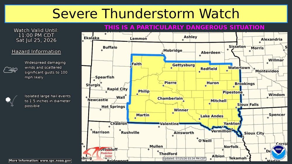
The rare PDS Severe Thunderstorm Watch up in SD.
-
Getting intrigued for Monday.
-

If you could re-experience ONE winter event....
sbnwx85 replied to cyclone77's topic in Lakes/Ohio Valley
I remember my mom telling me about water skiing and barbecuing at the lake on Christmas of ‘82. -
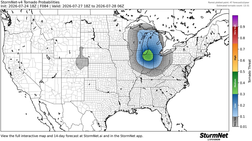
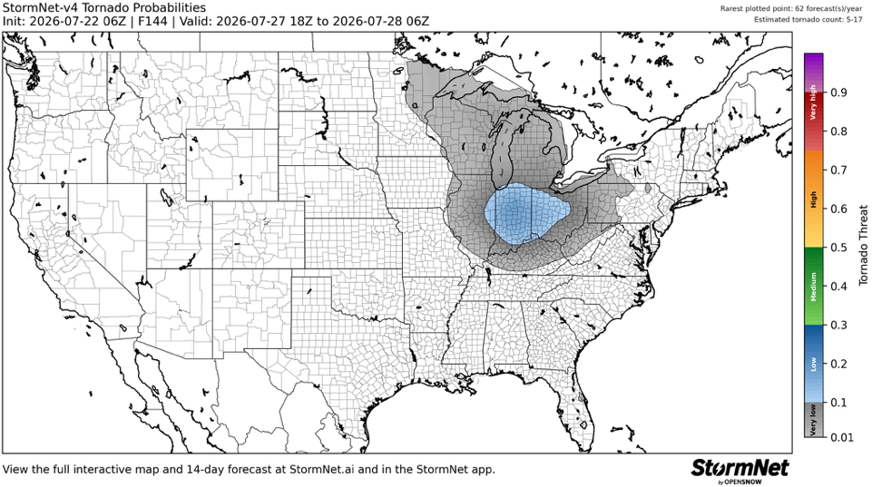
Was skeptical of StormNet at first because it’s very AI driven but it’s done a damn good job. Something to watch for Monday.
-
71/48 winds gusting to 20. Brilliant day. Might the best of the summer.
-
Not quite yearning for winter yet (who yearns?) but this pleases me.
-
Saw a post on FB about three Tornado Warnings in the UP at the same time. A rarity for sure
-
GFS and NAM keep me in the 60's on Wednesday. Would be v refreshing
-