KingJWx
-
Posts
247 -
Joined
-
Last visited
Content Type
Profiles
Blogs
Forums
American Weather
Media Demo
Store
Gallery
Everything posted by KingJWx
-
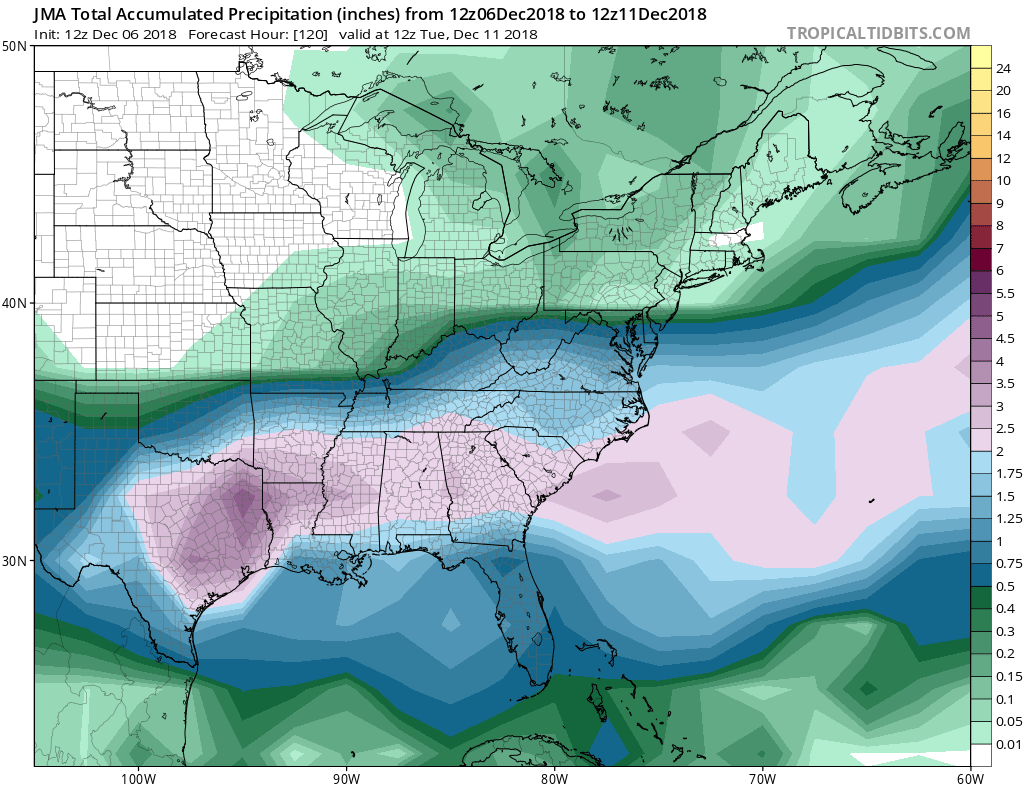
FV3 a tick north too. Precip up to extreme SE Fairfax County. 0.5" through RIC.
-
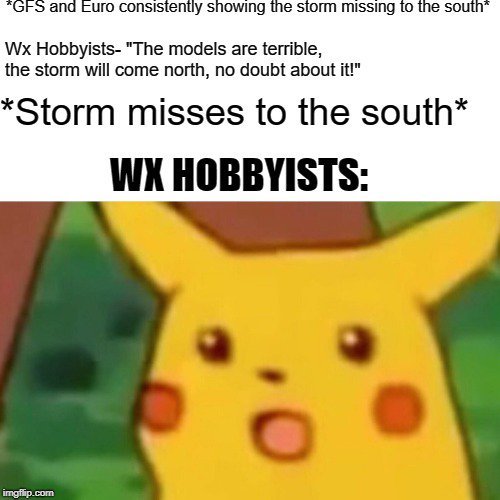
We aren't the only ones to lose out
-
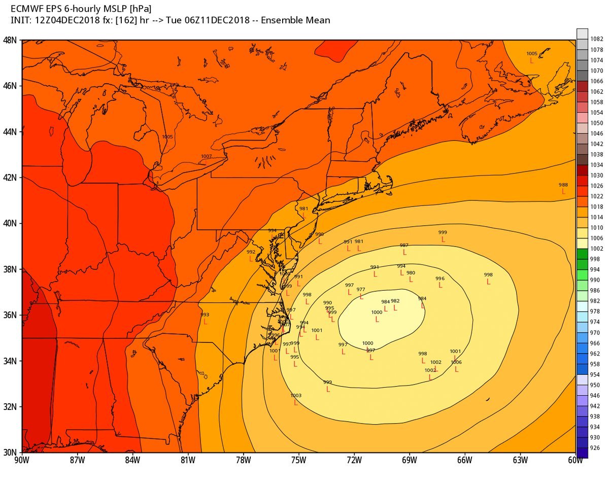
GFS holds with the whiff
-
Well, it's time.
.png.80f5df1e524702ea92afc8eb78717616.png)
-
Bullseye looks to be between Blacksburg VA and Greensboro NC. Think that region has done relatively well the past 2 winters too.
-
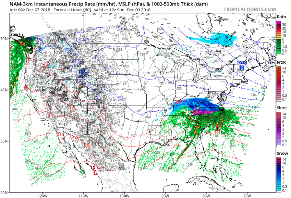
End of the NAM 3k, heavy snow in SW VA
-
18z GEFS cut back further. Mean QPF down to: IAD, 0.04" BWI, 0.02" CHO, 0.20" RIC, 0.58"
-
On the 12z ICON, precip makes it up to CHO and EZF
-
Well, it's over isn't it.
-
From Eric Fisher:
-
A lot of close lightning to complement the heavy rain.
-
Yeah, had a really close lightning strike several minutes ago. Shook the entire house.
- 1,302 replies
-
- 1
-

-
- severe
- thunderstorms
- (and 3 more)
-
Worst of it has passed. Power flickered twice and went out for a bit. Had pretty heavy rain and some gusts, but nothing extreme.
-
The 2012 derecho is easily the most impressive non-winter event for MBY, but this year's March windstorm was more impactful than I thought it was going to be.
-
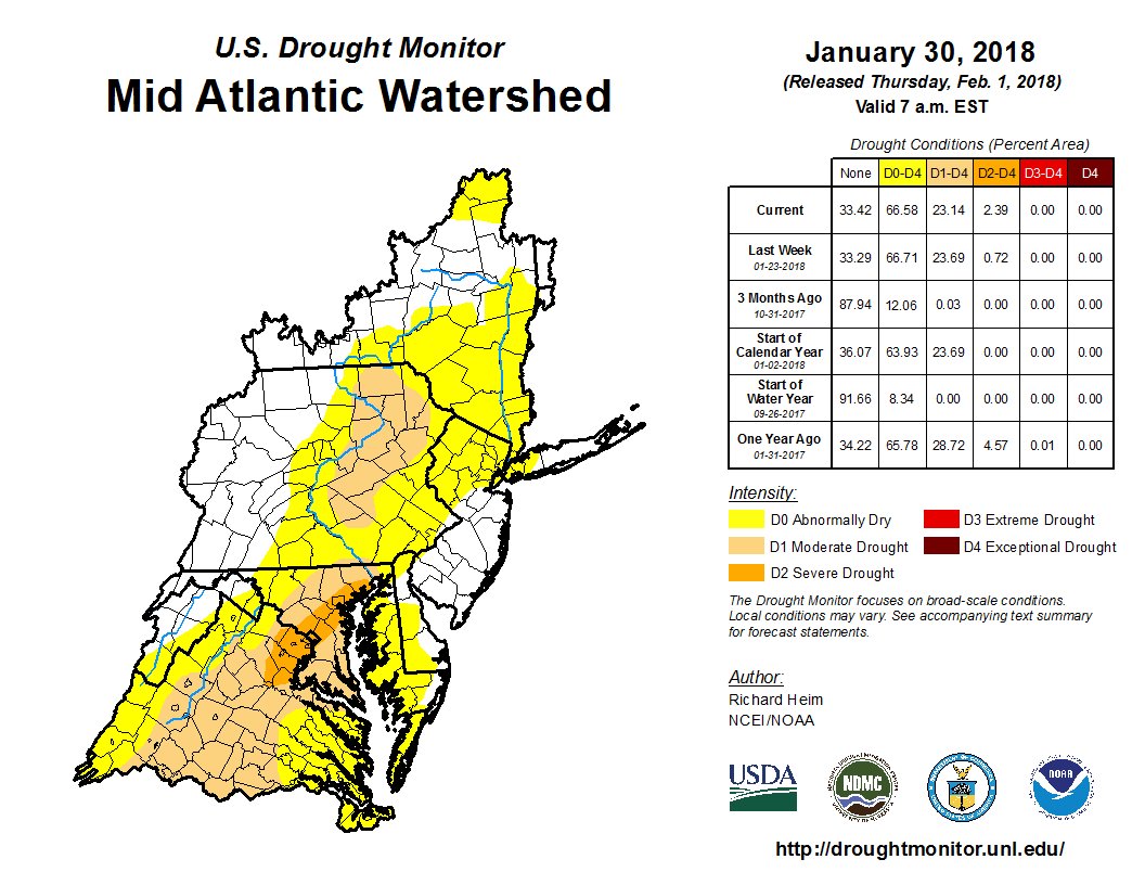
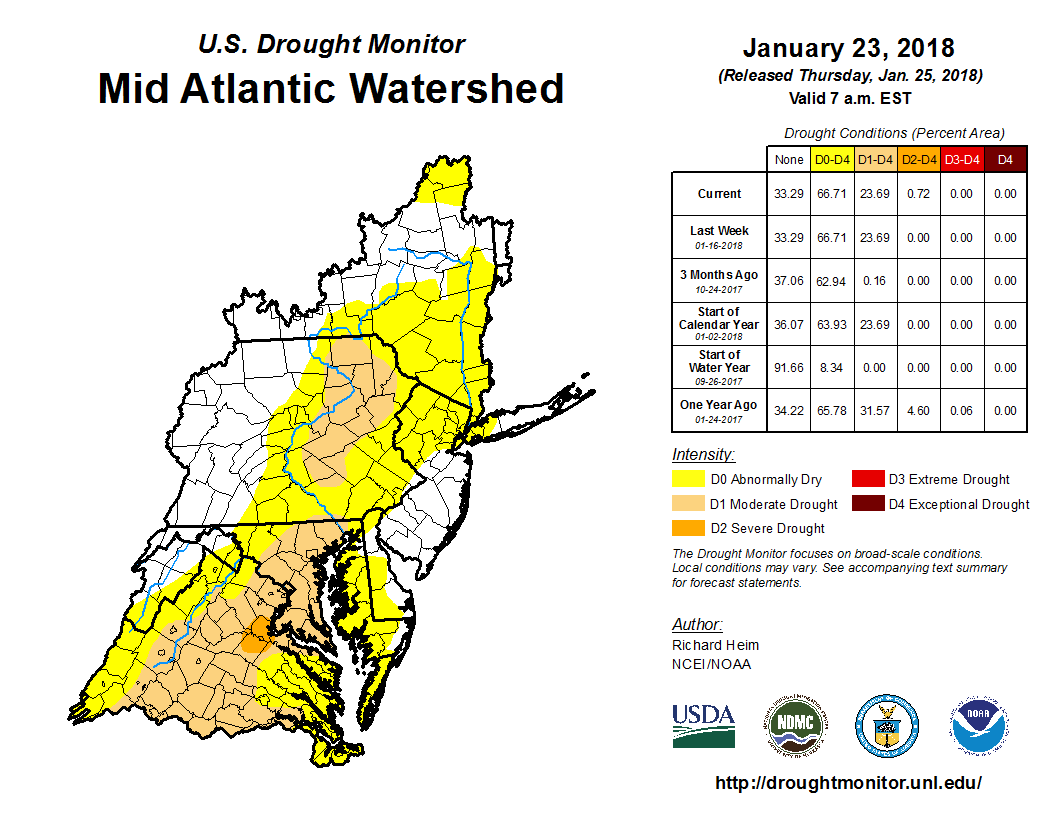
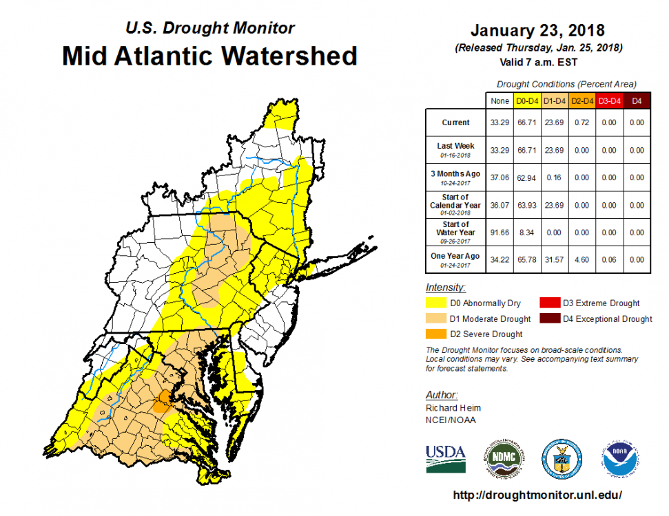
Severe drought for DC!
-
There's a small patch near Fredericksburg in severe drought:
-
DCA and IAD have not received any measurable snow for 3 Decembers in a row. I believe this a record for both airports.
-
IAD has 1.0" on the season.